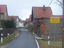
Hut courtyard
|
Hut courtyard
City of Bad Salzungen
Coordinates: 50 ° 51 ′ 32 ″ N , 10 ° 13 ′ 7 ″ E
|
|
|---|---|
| Height : | 300 m above sea level NN |
| Incorporation : | March 8, 1994 |
| Incorporated into: | Depth location |
| Postal code : | 36469 |
| Area code : | 03695 |
|
Location of Hüttenhof in Bad Salzungen
|
|
Hüttenhof is a district of Bad Salzungen in the Wartburg district in Thuringia .
location
Hüttenhof is located about 5 kilometers as the crow flies northeast of the main town, on the edge of the moorland near Oberrohn . The track of the Werra Railway runs east of the village . The geographic height of the place is 300 m above sea level. NN .
history
When the Möhra area received additional income opportunities through copper mining, the small settlement Hüttenhof is said to have emerged. Previously, a Günthersbach farm is said to have existed next to this district . The Hüttenhof consisted of five houses in the middle of the 19th century and had 24 inhabitants. He was administratively connected to Graefendorf and parish in Möhra.
The majority of the residents now work in the nearby district town and in the industrial areas of Marksuhl and Eisenach .
literature
- Peter Drescher : Tiefenort on the Werra from then until now . Geiger Verlag, Horb am Neckar 1999, ISBN 3-89570-549-7 , p. 156 .
- Ludwig Hertel: Oberrohn, Unterrohn . In: Georg Voss (Hrsg.): Architectural and art monuments of Thuringia. Duchy of Saxony-Meiningen, Meiningen district. District court district Salzungen . Booklet XXXV. Gustav Fischer Verlag, Jena 1911, p. 102 ff .
Web links
- Tiefenort, Oberrohn and its districts
- Private website with picture gallery and detailed local history
Individual evidence
- ↑ Official topographic maps of Thuringia 1: 10,000. Wartburgkreis, district of Gotha, district-free city of Eisenach . In: Thuringian Land Survey Office (Hrsg.): CD-ROM series Top10 . CD 2. Erfurt 1999.

