Hochrhöner
| Hochrhöner | |
|---|---|

|
|
| Data | |
| length | 175 km |
| location | Bavaria , Hesse and Thuringia |
| Supervised by | Rhön Club |
| Markers |
|
| Starting point | Bad Kissingen 50 ° 11 ′ 29.9 ″ N , 10 ° 4 ′ 44.9 ″ E |
| Target point | Bad Salzungen 50 ° 48 ′ 52.9 ″ N , 10 ° 13 ′ 52.2 ″ E |
The Hochrhöner is a long-distance hiking trail that stretches 175 km through the heart of Germany across the borders of Bavaria, Hesse and Thuringia. It leads from Bad Kissingen to Bad Salzungen. 150 km of this run in the Rhön Biosphere Reserve. The German Hiking Institute has recognized the Hochrhöner as a premium hiking trail . The path has been part of the Top Trails of Germany marketing cooperative since 2009 .
The Hochrhöner leads over the highest peaks of the Rhön , such as Wasserkuppe , Kreuzberg , Heidelstein and Ellenbogen . He touches highlights of a cultural nature such as the world-famous spa town of Bad Kissingen , the Franciscan monastery on the Kreuzberg with its old brewing tradition, the center of gliding on the Wasserkuppe, the rocky ridge of the Milseburg and Bad Salzungen with its half-timbered graduation buildings.
Course of the Hochrhöner
Main way
Bad Kissingen - Saaleauen - Kaskadental - Klaushof Wildlife Park - Stralsbach - Frauenroth - Premich - Langenleiten - Kreuzberg Monastery - Arnsberg - Oberweißbrunn - Himmeldunkberg - Schwedenwall - Red Moor
There the Hochrhöner divides into the eastern route Lange Rhön and the western route Kuppenrhön . The two routes meet again in Andenhausen. From there, the Hochrhöner continues via Glassesberg , Ibengarten , Bernshaeuser Kutte , Pleß , Kleine Pleßspitze, Langenfeld to Bad Salzungen .
Kuppenrhön route
Red Moor - Fulda Spring - Wasserkuppe - Aviator Monument - Abtsroda - Enzianhütte - Milseburg - Langenberg - Gotthards - Habel - Tann - Horbel - Andenhausen
Lange Rhön route
Rotes Moor - Heidelstein - Black Moor - Frankenheim / Rhön - Ellenbogen (Rhön) - Eisenacher House - Kaltenwestheim - Mitteldorf - Above the Rhön town of Kaltennordheim - Hexenlinde near Klings - Horbel - Andenhausen
In Andenhausen, the Lange Rhön route and the Kuppenrhön route meet again and become the main Hochrhöner route again.
Extra tours
In addition, 24 extra tours have now been created, all of which meet the Hochrhöner's quality criteria.
- Basalt path
- Gebaweg
- Guckaisee
- Hood tour
- Hilders he
- Hochrhöntour
- Hut tour
- Skittles
- Celtic path
- Royal road
- Kreuzberg tour
- Kuppenweg
- Meininger
- Michelsberg
- Milseburg
- Moths
- Mill tour
- Museum tour
- Tour de nature
- Ostheim he
- Point alpha way
- Rotes Moor - The Red Moor extra tour is marked with a red "R" on a white background.
- Thulbatal
- Vorderrhönweg
Labelling
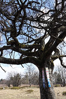
The Hochrhöner is represented by an orange Ö on a white background. Feeders from the neighboring communities to the Hochrhöner are marked with a green Ö on a white background.
literature
- Hiking map - Leporello Der Hochrhöner, 1: 25,000, Geseke, 2010, ISBN 978-3-89920-584-8
Web links
- Hochrhöner from the Rhönklub supervisor : Directions
- Hochrhöner at OpenStreetMap : Map with GPX / KML download
- Hochrhöner at the Rhön-Touristikgesellschaft: stage suggestions, route planner, accommodations


