
Red Moor (Rhön)

Coordinates: 50 ° 28 ′ 0 ″ N , 9 ° 58 ′ 50 ″ E

The Rote Moor is a raised bog in the Hessian Rhön . It is part of the nature reserve of the same name in the Rhön Biosphere Reserve and part of the Europe-wide Natura 2000 system of protected areas . After the Black Moor (66.4 hectares ) with 50 hectares in the Bavarian Rhön, the Rote Moor is the second largest raised moor in the Rhön. For 175 years, from 1809 to 1984, peat was extracted. The inner area of the raised bog is badly damaged due to the long peat excavation. Only its peripheral areas are still largely undisturbed areas, which are also better and more typically developed than in the Black Moor, eight kilometers away . Extensive renaturation measures began in 1979 .
geography


The Rote Moor is the largest raised bog in Hesse , followed by the four-hectare moor in the Breungeshainer Heide on the Hohen Vogelsberg . In the Rhön it is the second largest moor after the Black Moor, ahead of the Large (eight hectares) and Small Moor (two hectares) on the Stirnberg , as well as the Moorlein on the Rasenberg. Due to the peat extraction until the 1980s, there is only an area of around five hectares as the core zone. The Red Moor is divided into two sub-areas: the Great Red Moor (formerly 32 hectares of high moor area - today almost eleven hectares) and the Small Red Moor (formerly seven hectares of high moor area - today 1.7 hectares). It is located about five kilometers southeast of the Wasserkuppe on the federal highway 278 between the municipality of Ehrenberg (district Wüstensachsen) on the Hessian side and the town of Bischofsheim an der Rhön on the Bavarian side.
The moor stretches about one kilometer in a north-south direction and 600 meters in a west-east direction. The deepest point at the southern end of the bog is 804 meters above sea level and rises to around 830 meters in the north. The moor is bounded by the surrounding mountains - starting clockwise - in the north by Mathesberg (831.8 meters), by Ottilienstein in the northeast (846.4 meters), by Heidelstein in the east (925.7 meters), and by Kesselstein in the south (799.2 meters), from Mostberg (807.4 meters) in the west and from Feldberg in the northwest (815.2 meters).

The Rote Moor is located in the southern part of the 314.7 hectare nature reserve Rotes Moor . The nature reserve designated in 1979, the name of which goes back to the raised bog, is mostly over 800 meters above sea level , with deviations of 720 to 835 meters above sea level. It is one of the oldest and largest nature reserves in Hesse and extends between the Wasserkuppe and the Heidelstein on the flat, undulating saddle of the Hohen Rhön, with a north-south extension of 3.5 kilometers and a width of 0.6 to 1.2 Kilometre. In the nature reserve there are other smaller bogs with little peat thickness, it is determined by three spring hollows. The runoff at the deepest point of the bog is called bog water . The river flows south to the Black brook, which at Bischofsheim in the Brend flows and the Franconian Saale in the river system of the Rhine reached. Within the moor, the moor water separates the small red moor to the southeast from the large red moor to the northwest . In front of the outflow at the artificial dam, which was built in 1973, a small reservoir extends today. Another source river, the Feldbach , flows west into the Fulda . A third stream, the Grumbach , flows north into the Ulster , a tributary of the Werra . Werra and Fulda together later form the Weser . Thus the nature reserve lies on the watershed between the Rhine and Weser.
Emergence
Like the other high moors in the Rhön, the Rote Moor was formed after the last Ice Age around 12,000 years ago. In the Tertiary , clayey sediments were deposited . 25 to 18 million years ago volcanoes produced extensive lava flows that solidified to form weather-resistant basalt . During the last ice age, the Rhön was in the periglacial area , so it was not covered by glaciers . Large slope hollows were created by firing erosion and floor tiles . In areas where water-retaining sediments such as clays or loamy weathering residues of the basalts sealed the hollows, rain bogs could form over low bog stages. The climatic conditions with high amounts of precipitation and low soil temperatures favored the growth of the bog. Through pollen analyzes , the development could be traced back to the La Tène period .
Original condition

A central, tree-free plateau and a wooded edge slope is characteristic of a raised bog. The edge hanging is surrounded by a low and transition bog strip (edge swamp). The water coming from the raised bog accumulates in the marginal swamp and then flows away. The extent of the peripheral swamp is determined by the angle of incline of the adjacent terrain and by the inflow of water from outside. This structure can still be seen in the Red Moor, despite the peat being removed.

The Red Moor consists of two separate high moor parts, namely the Great Red Moor and the Small Red Moor . Between them lies a low moor strip through which the stream of moor water flows. This is seen as the common edge swamp of both parts of the bog. In the north and especially in the northeast of the Great Moor, i.e. north of the Small Moor, the marginal swamp is particularly wide. This strip has a characteristic plant cover with the rare purple riding grass , ear-willow bushes and groups of Carpathian birch trees distributed like islands . The Carpathian birch (Betula pubescens ssp. Carpatica) is a subspecies of the downy birch . It is one of the most distinctive tree species in the moor landscape and is noticeable for its bizarre growth. The edge forest is particularly beautiful on the eastern edge of the Great Red Moor, the extent of which can be seen from the lookout tower . This area consists almost exclusively of gnarled Carpathian birch trees, which are of great value for nature conservation.
The character and extent of the marginal forest depends on the width and gradient of the marginal slope. It was least developed on the northern and western edges of the moor, where it was only narrow and less steep. This is no longer clearly visible due to the peeling. Where there used to be a tree-free plateau, Carpathian birches have settled as a result of drainage. Only small drained remains of the former plateau are preserved today. Originally, this plateau, following the slope of the subsoil, sloped gently from north to south. The height difference was 15 meters over the distance of about 800 meters.
In the Red Moor it seems more fluid retention ( scours have never been in the Black Moor). This can be seen both from the oldest descriptions of the bog from the 1920s and from the character of the peat layers, as there are no traces of such bog waters in them.
climate
The climate in the Rote Moor and in the adjacent high altitude areas is rough and cold. The Rhön foreland, which is about 400 meters lower in the Hessian part, had annual mean temperatures of seven to eight degrees Celsius from 1961 to 1990 . The Hochrhön forms a cold island and has annual mean temperatures of 4.8 degrees Celsius ( Wasserkuppe ). Frankenheim , about ten kilometers to the northeast, had an annual mean temperature of 5.3 degrees Celsius with an annual precipitation of 938 millimeters at a slightly lower altitude (754 meters above sea level) than the Rote Moor . On the Wasserkuppe, four kilometers to the north-west, the average annual precipitation is 1084 millimeters.
The Hochrhön is characterized by a snow cover of up to 110 days and a short summer vegetation period from May to October. The temperature conditions limit the plant growth considerably. The main growing season only lasts from July to mid-September. In addition, there are up to 200 foggy days and a high number of days with hoarfrost formation . At night, cold air and frost can form on the open spaces at this altitude at any time of the year .
Flora and vegetation


Depending on the shape of the surface, the moor is divided into different vegetation zones, each of which has special nutrient and water conditions and has its own typical plant communities . Carpathian birch forest grows on the slopes of the Red Moors. The undergrowth consists of common heather , bilberry and bogberry .
The low moor, which surrounds the moor in varying widths as a swamp belt, is followed by characteristic grass vegetation as the next vegetation zone. Typical plant communities of fen zone are small sedge vineyard ( vaginal cotton grass , Eriophorum angustifolium , Carex canescens , Agrostis canina , comarum palustre , marsh bedstraw , marsh thistle , Bogbean ) Trollblumen wetlands and bristle grass lawn , the endangered cranberry , the crowberry , the cotton-grass and the purple riding- grass . The Kleinseggenriede grow here because the water running down from the moor mixes with the surface water and the high groundwater of the mineral soils in the area, thus increasing the supply of nutrients compared to the central moor area.
The moor-edge slope follows further inwards. Small trees and bushes thrive there (bog birch, pine , bogberry , bilberry , common heather , black crowberry , common cranberry ). Due to the clear slope, this area is the driest area within the moor compared to the almost flat plateau.
The high moor is in the center. Peat mosses such as the red magellan peat moss (Sphagnum magellanicum) with its reddish color and the strikingly large leaves and the spit peat moss (Sphagnum cuspidatum) with a greenish color, which thrive on strongly acidic, nutrient-poor and water-saturated soil, only exist in this core zone of the Preserved raised bogs. This area contains only nutrient-poor rainwater and groundwater, so that only a few poorly developed pine trees can be found there. Round-leaved sundew and butterwort (both are insect-catching plants ) as well as rosemary heather , bell heather and gray heather grow here . In the Red Moor there are other rare plants such as seven-star , swamp fern and ostrich-flowered loosestrife .
fauna
.jpg)
From the circular hiking trail that leads over the old Reichsstraße and the Bohlensteg, as well as from the observation tower, animals living in the moor can be observed all year round, some of them more during the day, others more in the morning or in the evening. In addition to the typical animals of the Hohe Rhön, there are the endangered snipe and meadow pipit . Mallard ducks and common rush dams live in the area of the moor reservoir .

There are 36 species of mammals in the nature reserve . These include pine marten , polecat and swamp shrew . The swamp shrew lives very hidden, polecats and pine marten can be found in the late afternoon in summer. Other representatives of the carnivores such as ermine (large weasel), mouse weasel (small weasel) and in particular the fox can also be observed during the day. This has been very numerous since the rabies immunization . Beech marten , badger and raccoon become active at night . The raccoon has only been native to the Rhön region since around 1970 and can usually only be detected through leftover food and excrement (solution). Of the domestic ungulates , roe deer can be found in the area all year round, they have enough cover and food. The wild boar population has been increasing for several years and can the clutches of ground-nesting birds are dangerous. Native are hare , squirrel , dormouse , dwarf , forest and yellow-necked mouse on voles the earth , field and bank voles , the Vole and the muskrat . The insectivores include the aforementioned swamp shrew, wood shrew, dwarf shrew, water shrew and alpine shrew as well as moles and hedgehogs .

There are six species of bat in the nature reserve: the great mouse- eared bat , the brown long-eared bat , fringed bat , aquatic bat , small bearded bat and Bechstein's bat . These have been wintering in a former clay mining tunnel on the western slope of the Mathesberg since winter 1988/1989. Those who hunt at dusk can be seen from the moor lake, which attracts numerous species, and from the observation tower. Here regularly breed Stock- and teal and grebes . Pond and Blessrale breed here only sporadically. Occasionally, on the migration Tableware , spit , whistling , herons and marsh ducks to observe, further Sandpiper , breakage and green sandpiper , green and redshank and the reed bunting .
.jpg)
Most noticeable to visitors are the larger birds of prey when circling and hunting in the open areas. The most common are the red kite , kestrel and buzzard . There is also the honey buzzard and the not regular winter guest buzzard . Corn harriers , marsh harriers and Montagu's harriers that pass through or rest there every year can be made out, as can the black kite and the osprey . The tree falcon often breeds and hunts in the area . The sparrowhawk is rarely seen hunting, which also applies to the larger hawk . However, this does not breed in the region.
In the domestic owls are tawny owl and long-eared owl regularly heard and seen occasionally at dusk. The short-eared owl sporadically roams the area and can only be spotted by chance. In the area hunting owls and Raufußkauze become noticeable by its distinctive call. The wood pigeon breeds regularly in and around the area , the smaller turtledove only rarely. The woodpeckers are represented by the gray , great spotted and black woodpecker . As a result of the forest damage in the spruce stands in the area, they have no feeding problems. The common pine jays and crossbills often fly into the area from these spruce stands . A typical summer bird is the cuckoo , which is common in both the Rhön and the Red Moor.

The woodcock , which is represented in large numbers in the Hochrhön, feels particularly at home in the Red Moor . This finds plenty of food in the many wet spots, which enables it to endure even in mild winters. The same applies to the smaller relatives such as the common snipe and the miniature snipe . These, however, inhabit open wet meadows, spring swamps and fen areas. The snipe breeds here every year and, like the woodcock, is noticeable when it flies . The miniature snipe is rarely seen on the train. The showy lapwing prefers short grassed, moist meadows. The corncrake broods as the lapwing only very irregularly in the area and in the area. The partridge , which only breeds irregularly and with varying success, is rare in the Red Moor and the Hochrhön . During the migration time, the little quail reveals itself with its call.
.jpg)
122 species of birds can be detected in the area of the red moor, half of them are songbirds. The blue warbler has a very good habitat in the Carpathian birch forest , as does the willow tit . Marsh warbler , field owl and black warbler can be found in the bushy areas . In the loose scrub and bushes in individual living Shrike and Red-backed Shrike . Fallow areas with thistles and perennials are perennials for the colt , thistle fin and whinchat . The meadow pipit and the skylark are native to structurally poor grassland. The carrion crow and the jay have increased significantly in the area since 1987 as a result of the hunting exemption. The magpie is now breeding close to the area and is increasingly appearing here. In the past these were more likely to be found in lower elevations and floodplains. The common raven has been populating the region again for several years .
.jpg)
The mountain lizard is often found and the fire salamander and the mountain newt can be found in the catchment area of running waters . The rewetting outside the bog area promoted the population of common toad and common frog , while the adder has not been found in the area since the 1980s. 31 butterfly species have so far been found in the area. In the meantime, the raised bog yellowfling and some other species that rely on bog and wetland plants have returned to their home. These include, for example, brown-spotted , meadowsweet , raised bog , rim ring and great mother-of-pearl butterflies .
27 dragonfly species are restricted to the moorland. These include the arctic emerald dragonfly , large and small moss damsel and peat damsel . The 137 cicada and 100 bed bug species in the area have been well researched, although only a few prefer the bog area as their habitat. The locusts are an important indicator of the biotope quality of the grassland and the moisture status of the raised bog. 14 species have been identified so far. Around 1960 the raised bog area was still populated by moisture-loving species. Due to the progressive peat removal, the raised bog area shrank, was drained and fenced off, so that in 1983, shortly before mining ceased, all areas were populated only by drought-loving locust species.
history

The area around the Rote Moor used to be forested and only interrupted by a few, narrow, forest-free areas. The first settlement of the Hochrhön began around 744, the year the Fulda monastery was founded. In the higher elevations, new cultivated land was created through forest clearing. The extraction of charcoal and potash for the glassworks and the common forest pasture decimated the forest more and more. The agricultural use of the high region also began in part. Without fertilization and with a considerable amount of work, cultivation was carried out, which grew due to the local conditions. However, the moorland itself remained uncultivated. The moors and their immediate surroundings were considered wasteland and were hardly usable.
A first description of the Red Moors comes from the year 1803 by the local researcher Franz Anton Jäger, who lives in Simmershausen:
“Fog rises from this swamp almost every day, and on sultry summer nights inflammations of flammable matter, which wander around on the surface of the bog like beautiful burning lights, are not uncommon. If you now ask me about the cause of this great bog, I must confess to you that it is a riddle for me, and that nothing but guesswork will take place when it is unraveled. "
Another report by this local researcher about the condition of the moor comes from 1803:
“This swamp, which is called the red moor because of the red moss as its main component, […] seemed a little raised above the other mountain range, and I really saw that the moss was piled up almost two shoes higher; which, however, did not surprise me, since it, like every plant, grows annually, changes its lower particles into roots, and must thereby increase in height. As I dug deep, I found nothing but the roots of this moss, which form the peat at an even greater depth. I cannot say whether the depth is immeasurable here […] but it is reliable that one dug over twenty feet deep and noticed nothing but moss and water or peat. The depth of these swamps must therefore be very considerable. "
Peat extraction

The rulers of the Rhön and aristocratic landowners tried to get more benefit from their possessions than the farmers' taxes. At the end of the 18th century there was a shortage of firewood for the population. In the search for alternative fuels for domestic fires as well as for glass and ironworks and pottery and for economic considerations, peat cutting had already begun in other places. In 1799, the mining of peat as fuel also began in the Kleiner Roten Moor ; the clayey subsoil was used for brick burning. The pitted areas should be used for agriculture by creating meadows, fields and a pond, as can be seen from a draft contract from 1799. But there was never a contract. Nevertheless, the owner of the Red Moor, Count von Frohberg from Gersfeld, had the peat excavation started.
The first attempts at dismantling were only made after the construction of a small peat drying hut in August 1809. However, the workers lacked experience, so that they made very poor progress and the dismantling had to be stopped again soon. From 1820, the extraction of peat began in the Kleiner Roten Moor . After the end of winter until the end of July, the peat diggers dug peat sod with a size of about 10 × 15 × 36 centimeters and put them on top of one another to pre-dry them on site. The sod was later brought to the peat house to dry. The rulers covered their own needs for the furnace lighting of the offices and the greenhouses of the nursery. Starting in 1856, a Batten brewery and schnapps distiller bought large quantities of peat . The peat dry house was rebuilt in 1856, enlarged on a sandstone substructure. This was necessary because the peat dried too slowly for the increased demand. The peat dry house was located between the large and the small red moor in the marginal swamp. Six trenches drained the peat drying area, which was partly located next to the drying house in the area of the Little Red Moor. From 1861, peat was also delivered to a factory in Gersfeld, which produced oil for lamps by smoldering lignite.

From 1837 the deliveries of peat for mud baths to Bad Bocklet and later to around ten baths in Hesse and Bavaria, including Bad Brückenau , Bad Kissingen , Bad Neustadt , Bad Salzschlirf , Bad Salzungen , Bad Orb and as far as Würzburg and Wiesbaden, began . The peat mud is said to have helped with various ailments, especially rheumatism . From 1879 Bad Homburg vor der Höhe was also one of the buyers of peat mud from the Red Moor. Nevertheless, the proportion of fuel peat was significantly higher. Towards the end of the 19th century, there was a fertilizer peat factory with a house for the workers and a canteen on the Roten Moor. Two thirds of the Little Red Moor was peated off on the surface towards the end of the 19th century. The borders of the peeled area can still be seen today. However, the raised bog peat had not been removed in its entire thickness, but only to a depth of 1.7 to 2 meters.
At the beginning of the 20th century, a second potting started in the Little Red Moor. This was in the southernmost part of the raised bog under today's reservoir. On the northern edge of this moorland, potting also proceeded. In the early 1930s, peat cutting came to a standstill in the Kleiner Moor . By then 90,000 cubic meters of fresh peat, equivalent to around 13,000 tons of burned peat, would have been extracted. The peat was only 1.7 hectares of the approximately seven hectares of moorland.
After the peat was stopped in the small red moor, the marginal hanging forest spread to the formerly open plateau and thus covered about half of the remaining moor area. The rest of the moorland is covered with a plant cover and groups of birch and pine trees. The partially scoured areas were heavily wetted over a longer period of time. Cranberries, peat moss and cotton grass settled on the remaining peat. In the last 100 years or so, about ten centimeters of new moss peat has been deposited on an area of slightly less than half a hectare.
In 1886 a Rhöntorfwerk leased the rights to extract peat in the Great Red Moor . However, this lease contained restrictions on the sale of bath peat and burning peat. From 1886 on, experienced peat cutters came from Northern Germany, who drained the Great Red Moor through a system of ditches that is still visible today . They dug parallel drainage ditches running from west to east at intervals of 20.7 meters on the entire plateau of the Great Red Moor. Then one in five of these trenches was enlarged in the same year and in the following years to a ten to 30 meter wide and 1.3 to 3.6 meter deep peat dig. The peat cuttings were connected to a single one by two north-south ditches. This enabled large-scale dismantling.

The water balance of the Great Red Moor, which was completely intact up to that point, was seriously affected. In the following decades this led to the predominance of dwarf shrubs such as common heather and bogus berries, the settlement of trees such as Carpathian birch, pine and later also spruce and the death of the peat moss. In large parts of the bog growth came to a standstill. Today the eastern part of the drainage system with a north-south running longitudinal ditch and the remains of four transverse ditches opening into it is still present in the unspoiled raised bog area.
The mining in the Great Red Moor took place from the southern edge area and probably also from the western edge. The dried peat sod, crushed with shredders, was sold as litter peat and peat litter. The company had to be auctioned, however, as sales of the expensive products stagnated due to the cheaper peat from Holland. The construction of a light railroad with the appropriate tracks made it easier in 1930 to remove the excavated peat. Up until 1951, raised bog peat was cut on an area of 11.6 hectares, about a third of the area of the Great Red Moor. This peat cut was carried out up to the transitional bog layer rich in birch stumps. You only went deeper in the southernmost part and in a narrow peat cut leading north towards the center of the moor. The amount of peat was around 220,000 cubic meters.

From 1960 onwards, potting increased significantly. A grapple excavator was used for the dismantling - up until then a spade had been used for digging - and up until 1970 an area of 8.8 hectares was dredged. Diesel locomotives transported the trucks to the edge of the moor. There the peat was loaded onto trucks. The bog was excavated to the clay in a single operation. The uppermost, deeply rooted and heavily weathered position of the bog with the vegetation consisting mainly of heather and bog berries was left behind as overburden. This towered up to form walls along the light rail tracks.
In 1978 the State of Hesse declared the entire area a nature reserve in order to preserve the rest of the raised bog, especially the small red bog to the east. After this decision, dismantling was initially tolerated and then restricted more and more. In September 1984 peat extraction finally ended after 175 years because a contractually agreed limit had been reached with regard to the designation of the nature reserve. In the last few decades the peat that was extracted was used exclusively for bathing purposes. The end of the dismantling was set for the end of 1985. Due to the tight deadlines, the peat extraction was increased in the 1980s to up to 18,000 tons of peat annually, which corresponded to more than 20,000 cubic meters. Leased meadows next to the moor served as temporary storage for a large amount of peat. Since 1960, around 350,000 cubic meters of peat had been excavated over an area of 8.8 hectares. The total peat extraction in the Great Red Moor is estimated at around 700,000 cubic meters. After the cessation of operations, the state of Hesse took over the moorland by swapping land.
The Great Red Moor decreased after 99 years of peat exploitation from 32 hectares to just under eleven hectares. Of this, seven hectares are wooded slopes. The remaining plateau is only four hectares. However, this had sunk considerably and no growing bog could be found anywhere, which was due to the draining effect of the high peat cut edge and the old drainage ditches.
Renaturation

In 1979, designated as a nature reserve, renaturation measures began immediately. The pitted areas and the remaining raised bog were rewetted by an artificial dam in the south of the bog and 140 hectares of spruce forest were removed, thus initiating the conversion of the area to extensive grassland or natural deciduous forest.
Since the bog was placed under protection from 1981 to 1986, measures were carried out to renaturate it in three directions with the aim of restarting the growth of the bog. Federal funds and the Hessian Nature Conservation Foundation, which was also the sponsor of this project, helped secure the funding. At the same time, a scientific support program ran, which was essentially completed in 1990. Employees of the then Federal Research Institute for Nature Conservation and Landscape Ecology ( Bonn ) as well as other specialists from institutes at the universities of Frankfurt am Main , Darmstadt and Marburg were involved. Dams were put in place on the remaining plateau of the Great Red Moor. In the central part of the Small Red Moor and on the remaining plateau of the Large Red Moor and partly in the northern part of the paved moor, which is called Leegmoor , bushes and trees were removed. This measure is also known as decussing (debushing). The third measure is the redesign of the Leegmoor part; more waterlogging is to be achieved through dams.

In 1983 and 1984, it required extensive construction work to set up storage areas in the old drainage ditches of the remaining plateau. Because of the gradient, water levels of up to 1.5 meters were necessary. This was ensured by thick sheet piles rammed up to six meters into the clay subsoil and mechanically secured with supporting dams made of peat. A total of 2000 cubic meters of peat was taken from suitable areas of the remaining plateau. Thereupon a good plant development started in the area of influence of the damming. In 1987/88, several thousand larvae of nine dragonfly species , including characteristic raised bog species , had already found their way into the newly created bog waters .

By removing trees and bushes, the character of a tree-free moor plateau is to be restored. In order to preserve the habitat for the black grouse population, pine trees, which serve to camouflage the animals, were left standing. A few years after the de-bushing, the birch branches could be seen again. A second clearing of bushes followed. This measure will also be necessary approximately every five years in the future.
The redesign of the northern parts of the Leegmoor should lead to increased waterlogging. After the birch bushes had been removed, the existing overburden and the lower layers of peat, some of which still existed, were used to fill a total of 28 three to six meter high dams. These run parallel to the contour lines, so that there were also small impoundments in between, in which flora and fauna in need of moisture have settled.
Moor nature trail

The Rote Moor is accessible to tourists by a three-kilometer circular path. 1.2 kilometers run along the screed path, which was renovated to be wheelchair accessible in 2007. The plank path is also part of the Hochrhöner premium path . The path begins at the information pavilion next to the moor lake and leads in a south-north direction to the observation tower in the northern part of the Great Red Moor . From there the former peat extraction area can be seen in which fen vegetation has returned. The remaining raised bog is located to the north of the abrading edge as an inaccessible protected core zone. The boundaries of the surrounding slopes (Carpathian birch forests) are just as recognizable as the edge of the spruce forest planted around 1900. To the east of this area rises the Heidelstein (925.7 meters) with its 211 meter high television broadcast mast. Along the plank path there are information boards that provide information about the animals and plants in the bog, the history of the bog, peat extraction and its renaturation. From there the path leads west on a forest path. After 200 meters, the circular route meets the Alte Reichsstraße ( Ortweg ), which comes from the Wasserkuppe. It leads about a kilometer south to the moor lake and then turns back to the starting point.
In 1972 and 1973 the moor water was dammed on the southern edge in order to supply the moor with sufficient water again. The resulting moor lake, with its backdrop, is one of the most beautiful waters in the Rhön. A barrier gate that prevents access to the plateau has been guiding visitors since 1980. The moor nature trail, initially laid out in 1972 from oak planks over a length of 800 meters, had to be renewed in 1981 and 1988. An eight-meter-high observation tower had stood at its northern end since 1983, and an information pavilion was built at the southern end in 1986. From October 2003 to spring 2004 the boardwalk was renewed from 100 cubic meters of oak. The Hessian state government financed the 90,000 euro project. Along the new, wider and straightened boardwalk, new information boards provide information to visitors. In 2007 the old lookout tower was replaced by a new eleven meter high tower. The tower cost around 30,000 euros, of which the nature park contributed 15,000 euros. The Rhön Biosphere Reserve provided EUR 5,500 and ÜWAG, as a domestic supply company, provided EUR 10,000 from the ÜWAG Nature Fund .

Information board for the use of the moor on the Red Moor
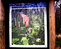
A bird's eye view of the Rotes Moor information board

Information board for the use of the moor on the Red Moor


Myths and legends
For a long time, the moors were regarded as sites of disaster. There are various legends and legends about the Rote Moor. Horror tales of godless villains and sunken villages made the rounds. There are also adventurous reports of life-threatening moor crossings. It used to be quite dangerous to cross the Red Moor in bad weather, which is why only brave people dared to go inside. However, nothing of the many reports of sunken people or villages has ever been confirmed. In the sources there is no report of a bog body find, and a human body was never found while cutting peat.
Some stories have survived to the present day.
In the area of today's deserted Mohrdorf there used to be a stately linden tree, called a moor linden tree . The legend goes about it:
“Once upon a time, a group of nuns rested under the bog linden, who carried a shrine with relics and monastery treasures on a cart. Suddenly the residents of the neighboring village of Poppenrode rushed out of hiding, robbed the nuns and mocked them and their belief in God and drowned them in the village pond. But now the wild waters broke up from the depths, filled the pond, covered the whole corridor and tore the place with all its inhabitants down into the abyss. Since then, Poppenrode has only lived in the memory of posterity and in legend. "
Another story deals with the formation of the two great Rhön moors:
“It is said about the formation of the Rhön moors that the devil led water veins from the sea through the underground rocky fissures into the Rhön Mountains, which turned the plateaus of the Rhön into moors. Originally the devil intended to use the drained and dammed water to flood the valleys. But in their need the residents prayed to God to avert the impending danger; and when the devil had to see that all his labor was in vain, he angrily abandoned the work he had begun to do, and so the moors remained. His clan, which he had now settled on the Hohe Rhön, sank in the Red Moor. "
Another legend is about the sunken village of Poppenrode:
The village of Poppenrode has sunk because of the vicious life of its residents. Two or three virtuous virgins should be left. They often came to desert Saxony , mingled with the dancers and sang wonderful songs. At about the twelfth hour they were always called off by a pigeon they followed. They were late one night returning and then disappeared forever. The young men of the village looked for them in vain for a long time, until a light-gray man appeared to them who said: “Your search is all in vain; but take a rod, hit the red moor with it and then examine it ”. When the young men did so, they saw that blood was flowing off the rod as a sign that they would never see the beautiful dancers again.
Pollen analysis

The development stages of the bog can be reconstructed using characteristic plant remains in the peat. The red moor is an archive of its own development history thanks to the plants enclosed in the layers of peat in their historical succession.
In addition to the remains of the bog plants, there is also some preserved in the peat that was blown or fell into the bog from outside. In this regard, the pollen ( pollen ), which not only comes from the bog plants, but has also been blown in from the near or further area, is of great importance. A microscopic examination of the pollen content of the layers, the pollen analysis, provides a fairly precise idea of the vegetation cover in the bog area . It is also possible to use physical methods to determine the origin of the individual peat layers. The red moor provides quite precise information about the history of the development of the plant cover. Already 80 years ago, pollen analyzes were carried out in the Red Moor . This makes the moor one of the places in Germany with the oldest research on vegetation history.
Based on these investigations, the development of the plant cover in the Rhön over the last 10,000 years can be reconstructed. With the help of the Pollan analysis, it is also possible to understand the change in landscape caused by human impact. An overview of this is provided by an analysis of the past 1200 years, starting with the foundation of the Fulda monastery. The clearing of the beech forests is documented by a noticeable decrease in the proportion of beech pollen. Increased grass pollen indicates the clearing of the forests as a result of forest pasture. Large amounts of grain, especially rye, pollen result from arable land. In addition, there are also pollen finds of characteristic wild herbs. These pollen-analytical findings fall around 1000 AD during the time of the Rhön settlement.
The pollen analysis also reveals the desertification period in the late Middle Ages, when numerous settlements were abandoned in the 14th and 15th centuries. Extensive arable land fell fallow and forest developed again. This led to an increase in pollen precipitation from the rapidly settling birch trees. This was followed by an increase in beech pollen as this deciduous tree slowly returned. A similar trend can be observed in the Thirty Years War. At that time the Swedes were only five kilometers southwest of the Red Moor. They maintained a fortified camp and destroyed the village of Rotenmoor east of the moor .
Since the beginning of the 20th century, the use of the low-yield grassland in the high areas has decreased more and more, and woody plants such as the Carpathian birch and ear willow have expanded. There was also the first extensive reforestation with conifers, such as the spruce, which is only found in the Hochrhön. This is all clearly reflected in the uppermost parts of the pollen diagrams. The peat also contains pollen from heather and sundew and spores from peat moss .
Peat profiles
In addition to the pollen, the plant tissue residues contained in the peat give clear indications of the bog vegetation and its development. They allow the peat to be assigned to a low bog, transition bog and raised bog stage. Reed and pond horsetail are characteristic of fens. In transitional moorland there are remains of fever clover and rushes as well as birch trees. Raised bog peat is characterized by peat moss, cottongrass and heather.
One or more such peat profiles can be used to reconstruct the history of the development of the entire bog. A peat profile from the Great Red Moor is exhibited in the Vonderau Museum in Fulda. The top layers of the profile are already weathered earthy and crumbly to a depth of ten centimeters due to the ventilation. The layers are criss-crossed by the roots of common heather and bogus. The raised bog peat extends with clearly recognizable parts of plants to a depth of 2.06 meters. This area is largely made up of blood-forming peat moss, such as the reddish peat moss ( Sphagnum rubellum ) and the brown peat moss ( Sphagnum fuscum ) and predominantly the magellan's peat moss ( Sphagnum magellanicum ). The upper, younger layers up to 1.5 meters deep consist of peat moss. In between there are thin layers of sphagnum peat moss ( Sphagnum cuspidatum ) that grows in water-filled gullies .
There are also small proportions of vaginal cottongrass and heather plants. They are more abundant in layers with greater decomposition due to reduced moisture penetration. There are no tree roots in the peat, which means that the raised bog was free of trees. Up to two millimeters of peat was deposited in the raised bog peat per year, which corresponds to a height of around 0.6 millimeters in the profile due to the drying-related shrinkage. The 2.06 meter thick profile layer is dated back to 60 years before the birth of Christ.
The transition bog ranges from 2.06 to 2.36 meters deep. It contains cotton grass and a lot of birch roots, some larger birch stumps, plus plenty of dwarf shrub remains, especially heather, and a few peat mosses. The bubble rush is also located in the lower section of the peat profile. This peat profile ranges from 60 to around 800 years before the birth of Christ. Below 2.36 meters, the section of rush peat begins, which extends to around 3.9 meters. There are plenty of remains of bladder rush, plus fruits of sedges and blood-eye, in some cases also smaller birch roots, above mud-sedge and some vaginal cottongrass, and below, increasingly, remains of pond horsetail and fever clover, also fever clover seeds. This layer covers the period from 800 to about 5000 years before the birth of Christ.
The area of the peat bog ranges from about 3.9 to 4.42 meters deep. It contains strongly decomposed peat with remains of reeds and pond horsetail, small birch roots and a lot of birch bark in layers. The age range covers the period from about 5000 to 8000 years before the birth of Christ. From 4.42 meters to about 4.5 meters deep, the reed and horsetail peat is mixed with the relocated Laacher pumice, which is 4.5 to 4.58 meters deep. The Lacher volcano in the Eifel erupted in 9080 before the birth of Christ. The yellowish volcanic ash has partially flooded together and loosely traversed by roots and rhizomes of sour grasses.
Then in the profile is the mineral-free Ried-Moostorf . This area ranges from approximately 4.58 to 4.9 meters in depth. There are deciduous moss and fine roots of sour grasses in it, but no birch roots. The dating goes back to about 10,000 years before the birth of Christ. Underneath is the mineral subsoil from Tertiary deposits. This area starts at a depth of 4.9 meters and consists of gray, impermeable clay with many smaller and individual larger basalt lumps.
colonization
In the immediate vicinity of the Red Moor, two settlements emerged in the 16th century: Mohrdorf and Hasenhof . In the wider area in the higher elevations, people settled further areas. With this settlement policy, the diocese of Fulda wanted to put a stop to the expansion efforts in Würzburg.
Desert Mohrdorf

From 1545 there was a village called Rotenmohr , or Mohrdorf , in the immediate vicinity of the moor . It was on the western slope of the Ottilienstein. In the very dry and hot summer of 1540 the moor burned for weeks. The landlord of this area, Ulrich von Weihers zu Haselbach, knew no other use for this area than to make farmers resident there. The village, which initially comprised four houses, was continuously enlarged. It belonged to the Gersfeld estate and in 1634 comprised 36 houses. The residents led a very modest and hard life there. The owners of the farms often changed, because “there is never anything good on the moor, and nothing to be gained from it” , as a former resident explained. The residents grew barley and oats , which did not always ripen, and ran cattle.

In the middle of the Thirty Years' War , Sweden and their Hessian allies settled in the Rhön after the battle of Nördlingen . In 1634 Croatian troops destroyed the village and burned it down. It was not rebuilt, the last mayor of Mohr was Lorenz Laudenbach. The farmers who had not fallen victim to epidemics moved to Lower Franconian villages. From there they managed their properties extensively . Their rule tried unsuccessfully to persuade the peasants to rebuild their farms after the end of the war. They preferred to stay in a climatically more favorable area and only mow the Rhön grass in the summer.
In 1811 the ruins of 31 former farms were found; the village linden tree was still standing in 1816. In 1969 some house floor plans were successfully uncovered and the village fountain was given a new version. Today there is an information board by the fountain in the forest near the federal highway 278, which indicates the desert .
Deserted Hasenhof
The Hasen- or Haselhof on the western edge of the moor belonged to the Gersfeld rulership and, like Mohrdorf, was destroyed in the Thirty Years' War . It was on the busy road to Bischofsheim , where all the war armies passed. Soon after the end of the war it was rebuilt as a square four-sided farm with a side length of about 30 meters and was used as a sheep farm until the 18th century. The farm was then leased and sold to Bischofsheim for demolition in 1817. The fields and meadows that were otherwise leased were reforested after the Second World War . Today only a few remains of the foundations and the former pond of the Hasenhof can be seen.
tourism
The Rote Moor is well developed for tourism and a popular excursion destination in the Rhön. It is freely accessible and the boardwalk from the information pavilion to the observation tower is wheelchair accessible. Guided hikes through the moor are offered several times a week. About 500 meters east of the information pavilion of the red moor, on the road from Wüstensachsen to Bischofsheim an der Rhön (B 278), there is a large parking lot and the house on the red moor , with sanitary facilities, kiosk and information boards. The house was built in timber frame construction with an area of about 150 square meters and opened on September 3, 2004. This parking lot leads to the main entrance to the Rotes Moor cross-country ski center .
literature
- Hessian Nature Conservation Foundation (publisher): Red Moor nature reserve in the Rhön biosphere reserve. 1997, ISBN 3-89051-172-4 .
- Willy Kiefer: The Moors of the Rhön. Parzeller publishing house, Fulda 1996, ISBN 3-7900-0269-0 .
- Joachim S. Hohmann: Country folk under the swastika. Agricultural and race policy in the Rhön. A contribution to the regional history of Bavaria, Hesse and Thuringia. Frankfurt am Main u. a. 1992, ISBN 3-631-45093-1 .
- Max Mölter: The Hochrhönstrasse. 5th edition. Verlag Parzeller, Fulda 1986, ISBN 3-7900-0149-X .
- Heribert Kramm: The Hochrhön. Verlag Parzeller, Fulda 2006, ISBN 3-7900-0305-0 .
- U. Bohn: The vegetation of the Hohe Rhön - society inventory, assessment, current threats, conservation measures. In: Nature and Landscape. Volume 56, No. 10, Bonn-Bad Godesberg 1981, pp. 350-359.
- G. Große-Brauckmann : Moors in the Rhön as examples for the origin, development and formation of moors and their problems today. In: Naturkunde Osthessen. Volume 32, Fulda 1996, pp. 73-99.
- LIFE project Rhön of the EU (Ed.): Natural treasures of the Rhön: Hochmoore. Kaltensundheim 1997, DNB 1075777194 .
- Jürgen Holzhausen, Ernst Hettche: Raised moors in the Rhön Biosphere Reserve. Richard Mack Verlag, Mellrichstadt 1996, ISBN 3-9802436-2-1 .
- S. Reimann, G. Grosse Brauckmann, B. Streitz: The plant cover of the red moor in the Rhön. In: Naturkunde Osthessen. Fulda 1985.
Web links
- Literature on Rotes Moor in the Hessian Bibliography
- Rhön Lexikon - Rotes Moor
- Rotes Moor trail park
- Red Moor nature reserve. A film for the hearing and the non-hearing on YouTube
- Photos from the Red Moor
Individual evidence
- ↑ Natura 2000 Hessen - Hessische Rhön. ( Memento from August 31, 2007 in the Internet Archive )
- ^ Stiftung Hessischer Naturschutz (Hrsg.): Red Moor nature reserve in the Rhön biosphere reserve. P. 6.
- ↑ Willy Kiefer: The Moore der Rhön. P. 8.
- ↑ a b c d e Hessian Nature Conservation Foundation (ed.): Rotes Moor nature reserve in the Rhön Biosphere Reserve. P. 21.
- ↑ Hessisches Landesvermessungsamt (Ed.): Topographische Karte 1: 25,000 - 5525 Gersfeld (Rhön).
- ^ Stiftung Hessischer Naturschutz (Hrsg.): Red Moor nature reserve in the Rhön biosphere reserve. P. 5.
- ^ A b Foundation Hessischer Naturschutz (Hrsg.): Nature reserve Rotes Moor in the Biosphere Reserve Rhön. P. 13.
- ↑ a b Horst Bayer: The current climate development of the Rhön with compare to the Thuringian Forest.
- ^ Stiftung Hessischer Naturschutz (Hrsg.): Red Moor nature reserve in the Rhön biosphere reserve. P. 46.
- ↑ Joachim Jenrich: The Wasserkuppe - A mountain with a history. P. 67.
- ^ A b Foundation Hessischer Naturschutz (Hrsg.): Nature reserve Rotes Moor in the Biosphere Reserve Rhön. P. 48.
- ↑ a b c Foundation Hessischer Naturschutz (Hrsg.): Nature reserve Rotes Moor in the Biosphere Reserve Rhön. P. 49.
- ↑ Natural treasures of the Rhön: high moors. P. 3.
- ↑ Natural treasures of the Rhön: high moors. P. 8.
- ↑ a b c Foundation Hessischer Naturschutz (Hrsg.): Nature reserve Rotes Moor in the Biosphere Reserve Rhön. P. 20.
- ^ Stiftung Hessischer Naturschutz (Hrsg.): Red Moor nature reserve in the Rhön biosphere reserve. Pp. 21-22.
- ^ A b Foundation Hessischer Naturschutz (Hrsg.): Nature reserve Rotes Moor in the Biosphere Reserve Rhön. P. 23.
- ^ A b Foundation Hessischer Naturschutz (Hrsg.): Nature reserve Rotes Moor in the Biosphere Reserve Rhön. P. 24.
- ^ Stiftung Hessischer Naturschutz (Hrsg.): Red Moor nature reserve in the Rhön biosphere reserve. P. 25.
- ^ A b Foundation Hessischer Naturschutz (Hrsg.): Nature reserve Rotes Moor in the Biosphere Reserve Rhön. P. 28.
- ^ A b Foundation Hessischer Naturschutz (Hrsg.): Nature reserve Rotes Moor in the Biosphere Reserve Rhön. P. 29.
- ^ Saale newspaper. May 6, 2004, p. 28.
- ↑ New observation tower inaugurated in the Red Moor nature reserve. In: Fulda news. November 5, 2007.
- ↑ Willy Kiefer: The Moore der Rhön. Pp. 5-6.
- ↑ Willy Kiefer: The Moore der Rhön. P. 30.
- ↑ Willy Kiefer: The Moore der Rhön. P. 28.
- ↑ The Moor Maiden. on: www.sagen.at
- ^ Stiftung Hessischer Naturschutz (Hrsg.): Red Moor nature reserve in the Rhön biosphere reserve. Pp. 14-17.
- ↑ a b c d e f Foundation Hessischer Naturschutz (Hrsg.): Red Moor nature reserve in the Rhön biosphere reserve. P. 18.
- ↑ a b Willy Kiefer: The moors of the Rhön. P. 14.
- ↑ Willy Kiefer: The Moore der Rhön. Pp. 15-16.
- ↑ The house on the Roten Moor - an attractive new contact point in the Rhön! ( Memento from September 28, 2008 in the Internet Archive ) NABU Landesverband Hessen.