
Kreuzberg (Rhoen)
| Kreuzberg | ||
|---|---|---|
.jpg) View from the southwest, near the Kissinger hut |
||
| height | 927.8 m above sea level NHN | |
| location | near Haselbach ; District of Rhön-Grabfeld , District of Lower Franconia , Bavaria ( Germany ) | |
| Mountains | Rhön ( High Rhön ) | |
| Dominance | 8.9 km → Dammersfeldkuppe | |
| Notch height | 273 m ↓ SW Oberweißbrunn | |
| Coordinates | 50 ° 22 '12 " N , 9 ° 58' 48" E | |
|
||
| Development | Road to the hilltop | |
| Normal way | Stairs from Kreuzberg Abbey or Franz-Zierof-Weg | |
| particularities | - Third highest mountain in the Rhön - Sinn quelle (among others) - Kreuzberg monastery - Kreuzbergschanze - Kreuzberg transmitter |
|


The Kreuzberg (previously called Aschberg ) is 927.8 m above sea level. NHN high mountain of the Rhön ; After the Wasserkuppe ( 950 m ; highest mountain in Hesse ) and the Bavarian-Hessian Dammersfeldkuppe ( 927.9 m ; summit location in Bavaria) it is the third highest Rhönberg and after the 0.1 m higher Dammersfeldkuppe the second highest in the Bavarian Rhön. However, its summit is the highest among the mountains that are entirely in Lower Franconia . It is located near Haselbach in the Bavarian district of Rhön-Grabfeld ( administrative district of Lower Franconia ).
The mountain is the location of the Kreuzberg monastery , the Kreuzbergschanze and the Kreuzberg transmitter . The sense rises on its northwest slope . With 500,000 to 600,000 visitors annually, the Kreuzberg is the highest and most visited destination in the Bavarian part of the Rhön.
geography
location
The Kreuzberg rises in the Hohe Rhön in the Bavarian Rhön Nature Park and in the Rhön Biosphere Reserve . It is located between the town of Bischofsheim in the Rhön in the north-northeast, the municipality of Sandberg in the southeast in the Rhön-Grabfeld district and the Wildflecken market in the neighboring Bad Kissingen district in the west. The Kreuzberg monastery ( 864 m ) is located on the western flank of the summit near the summit .
The north-north-western neighboring mountain of the Kreuzberg is the Arnsberg ( 843.1 m ), the eastern branch is the Käulingberg (also called Käuling ; 754.3 m ). The Arnsberg is passed north near the Bischofsheimer district Oberweißbrunn running roughly in a west-east direction from the upper reaches of the Brend , a tributary of the Franconian Saale , whose water flows through the Main and Rhine into the North Sea . The brooks that arise at Kreuzberg (Vorderer Haselbach) and Käulingberg (Hinterer Haselbach) and flow to the northeast flow into the Brend. On the southern flank of the Käulingberg, Dürrgraben and Dreikahrbach, both source streams of the Schmalwasserbach , which flows south-southeast and which also flows into the Franconian Saale via the Premich, arise . West-southwest of the Kreuzberg rises - near the Guckaspass ( 662.4 m ; state road St 2267), which leads to the Feuerberg ( 832 m ) - with the Kellersbach the left-hand source stream of the Premich.
To the west of the woodless mountain saddle, which leads from Kreuzberg to Arnsberg, near the Weihersbrunnen lies the source of the southwest flowing Sinn , which in Gemünden flows into the Franconian Saale shortly before its confluence with the Main.
Natural allocation
The Kreuzberg belongs to the natural spatial main unit group Osthessisches Bergland (No. 35), in the main unit Hohe Rhön (354) and in the subunit Südliche Hochrhön (354.0) to the natural area Kreuzberg-Gruppe (354.02). The landscape leads north to northwest into the natural area of Dammersfeldrücke (354.00) and to the south-west into the natural area of Black Mountains (354.01). To the northeast through east to south-east it leads into the natural area Schönau plateau (140.20 ) belonging to the subunit Eastern South Rhön (140.2) and to the south into the natural area Adelsberger Wald (140.101) belonging to the subunit Hammelburger Südrhön (140.1), which belongs to the main unit group South Rhön (14) are parts of the main unit Südrhön (140).
nature
flora
The flanks of the Kreuzberg are wooded; however, from the north in the direction of the saddle leading to the Arnsberg, a woodless strip stretches to the summit region, which is used as a ski slope in winter. There are groups of trees on the summit plateau.

The summit cross (2016)
Basalt block sea "St. John's Fire"

Turkish lily below the transmitter system
_-_Gipfelkreuz_-_2016.jpg)


Protected areas and geotopes
Parts of the nature reserve Sinnquellgebiet and Arnsbergsüdhang extend to the northwest flank of the Kreuzberg ( CDDA -Nr. 165580; designated 1989; 1.6124 km² in size). Parts of the landscape protection area Bayerische Rhön (CDDA no. 396113; 959.8027 km²), the fauna-flora-habitat area Bayerische Hohe Rhön (FFH-Nr. 5526-371; 192.6059 km²) and the bird sanctuary are located on the mountain Bavarian High Rhön (VSG no. 5526-471; 190.2908 km²).
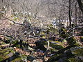
There are two geotopes on the mountain that have been identified by the Bavarian State Office for the Environment (LfU): The former basalt quarry on the northern slope of the Kreuzberg is a small, very overgrown basalt quarry with numerous basalt columns. East of the transmitter mast is the basalt blockmeer Johannisfeuer am Kreuzberg , which consists of massive basalt.
Summit cross
The mighty wooden summit cross of the Kreuzberg has stood near the three crosses of the Way of the Cross for centuries . It has to be renewed from time to time because it is heavily exposed to the weather. For example, such a cross was erected in 1997 and had to be removed in 2012 for safety reasons. The design of this cross comes from the architect Uwe Kröckel from Bad Neustadt an der Saale. On April 12, 2014, a new cross made from a larch trunk was erected, which was consecrated on May 3, 2014.
Religious meaning
Mountain names and Holy Mountain of the Franks
It is possible that there was a pagan cult site on the Kreuzberg in pre-Christian times. The Celtic and Germanic settlement in the Rhön and the former name Asenberg (after the Germanic gods of the Asen ) suggest cultic and religious activities on the mountain. In addition, a holy ash is said to have been on the mountain (see: Yggdrasil and tree cult ), which the name Aschberg , used from the 12th to the middle of the 17th century, reminded of. The name Kreuzberg came into being after the establishment of the Golgota Group (also known as the Crucifixion Group) in 1582 by the Würzburg Prince-Bishop Julius Echter . Since the missionary mission of the Franks by the Iro Scots St. Kilian and his companions Kolonat and Totnan in 686 and its tradition as a place of pilgrimage , the Kreuzberg has been considered the "Holy Mountain of the Franks".
Kreuzberg Monastery, Way of the Cross and pilgrimages
West-northwest below the summit plateau is the Kreuzberg monastery, founded by Franciscans in 1644, with the monastery brewery, the only brewery operated by the Franciscan order in Germany.
_-_Golgota-Kreuze_-_2016.jpg)
From the Kreuzberg monastery, a way of the cross with picture chapels, modeled on the path of Jesus in Jerusalem to his execution on Golgotha, leads to the three Golgotha crosses, which can also be reached via the stairs above the monastery. There are also the 13th and 14th stations of the Cross (Holy Sepulcher).
Every year there are 70 to 80 pilgrimages to the Kreuzberg , especially in late summer and early autumn .

Procession from Kreuzberg Monastery to Kreuzberg

9th to 12th stations of the cross with the mast of the Kreuzberg transmitter in the background

Front view of the three Golgotha crosses
_02.jpg)

_9596.jpg)
Transmitter Kreuzberg

The Kreuzberg transmitter of the Bavarian Broadcasting Corporation has been located on the Kreuzberg since 1951 . Its guyed tubular steel mast was erected in 1985 and raised in 2016 from 207.5 m to 227 m in height. Broadcast FM radio and various TV programs; In addition, the mast is used by numerous radio network operators.
leisure

Opportunities for viewing
From the Kreuzberg there are good views: From its northern slope there is a view of the Black Mountains , the Dammersfeldkuppe (second highest mountain in the Rhön; with restricted area of the Wildflecken military training area), the upper Sinntal, the Wasserkuppe , the Langen Rhön, the Thuringian Forest and the Brend valley. When visibility is very good, the Taunus with the Großer Feldberg can be seen in the west . Then there is an impressive view of the southern foreland of the Hohe Rhön and all the way to Schweinfurt from the Blockmeer located east to south-east below the summit plateau .
hike
All year round, the Kreuzberg is popular with hikers as a destination or transit station. Its summit plateau can be reached in about 10 minutes via the stairs above the Kreuzberg monastery in the hamlet of Kreuzberg, which are about 300 m long, or on the Franz-Zierof-Weg in about 30 minutes. The Franconian Marienweg leads over the Kreuzberg .
On June 28, 2008, Federal President Horst Köhler hiked from Oberweißbrunn to Kreuzberg as part of the German Hiking Day. There he then entered himself in the city of Bischofsheim's Golden Book.
Kreuzberg ski area
The Kreuzberg ski area is located on the Kreuzberg . The mountain is part of a 70 km long network of trails. There are four ski lifts available: the Three Fir lift , the view elevator , the Rothanglift and fish farming lift . There is a toboggan run on the Klosterwiese, and another is located below the Roth inn. On the northern slope of the mountain, west of the Bischofsheimer district Haselbach, stands the Kreuzbergschanze.
Transport links
The Kreuzberg can be reached from Bischofsheim on the district road NES 10 or from Wildflecken on the state road 2289 and, branching off from the St 2289, on the merging district roads KG 22 and NES 25. The latter meets the NES 10 on its northern flank at a weekend house area, which leads south from there to the hikers' car park north of the summit region .
panorama

View from Kreuzberg in northerly directions over Wildflecken , Oberwildflecken and Neuwildflecken , etc. a. to Dammersfeldkuppe , Eierhauckberg , Arnsberg , Himmeldunkberg , Wasserkuppe and Heidelstein

See also
literature
- Reinhold Albert : One of the oldest crossroads in Germany is on the Kreuzberg. In: Heimat-Jahrbuch of the Rhön-Grabfeld district. Volume 30. Mellrichstadt 2008, ISBN 978-3-9811225-2-7 , pp. 26-29.
- Reinhold Albert: Soli Deo Gloria. Kreuzberg, pilgrimage and monastery. Kreuzberg Monastery, Bischofsheim an der Rhön 2005, ISBN 3-00-015719-0 .
- Wolfgang Brückner : The pilgrimage to the Kreuzberg in the Rhön. (= Church, Art and Culture in Franconia, Volume 7). Echter Verlag, Würzburg 1997, ISBN 3-429-01939-7 .
- Christa Enders: The Kreuzberg - the birthplace of alpine winter sports in the Rhön. In: Heimat-Jahrbuch of the Rhön-Grabfeld district. Volume 29. Mellrichstadt 2007, pp. 84-91.
- Heribert Kramm: The Kreuzberg. Parzeller, Fulda 1990, ISBN 978-3-7900-0201-0 .
- Andreas Pampuch: The Kreuzberg and its surroundings. District Office Bad Neustadt / Saale, Bischofsheim 1970.
- Irene Reif : Free as a cat's eye. From Fulda to Kreuzberg. In: Irene Reif: Franconia - my love. Oberfränkische Verlagsanstalt, Hof 1989, ISBN 3-921615-91-7 , p. 117 f.
- Regina Rinke: The Kreuzberg in the Rhön - "Lived Faith". Printing house R. Mack GmbH, Mellrichstadt 2017, ISBN 978-3-942112-32-1 .
- Justus Schneider : Guide through the Rhön. In addition to an attachment for the spa guests in the Rhön baths Bocklet, Brückenau, Kissingen, Neuhaus and a travel and route map. Stahel, Würzburg 1877. (Gustav Schneider, Gerhilde Kramm: Schneiders Rhönführer. Official Guide of the Rhön Club. 26th edition. Parzeller, Fulda 2008, ISBN 978-3-7900-0404-5 , pp. 296-297, 483).
- Anton Schumm: History of the town of Bischofsheim, its compatriots and all friends of the Rhön. Würzburg 1875, pp. 105–109 ( digitized version in the Bavarian State Library ).
Web links
- Kreuzberg (Rhön) . In: Website of the Rhön Biosphere Reserve
- Information brochure about the Kreuzberg (PDF)
Individual evidence
- ↑ Dominances and celebrities according to Highrisepages.de ( Memento of the original from October 19, 2014 in the Internet Archive ) Info: The archive link was inserted automatically and has not yet been checked. Please check the original and archive link according to the instructions and then remove this notice.
- ↑ a b Map services of the Federal Agency for Nature Conservation ( information )
- ↑ Former basalt quarry on the northern slope of the Kreuzberg. In: uok.bayern.de (Geotop no. 672A015), accessed on October 30, 2015
- ↑ Basalt Boulder Sea Midsummer Fire on Kreuzberg. In: lfu.bayern.de (Geotop no. 673R002), accessed on October 30, 2015 (PDF; 1.6 MB)
- ↑ Thomas Pfeuffer: Flexen for the summit cross - New cross for the Kreuzberg. In: Mainpost.de. March 31, 2014, accessed November 28, 2017 .
- ↑ Consecration of the new summit cross ( Memento from May 12, 2014 in the Internet Archive ). In: BR.de. Retrieved November 28, 2017.
- ^ History of the Rhön. In: Rhoenentdecker.de. Retrieved March 26, 2017 .
- ↑ Kreuzberg / Rhön. In: Biosphaerenreservat-rhoen.de. Retrieved March 26, 2017 .
- ↑ Kreuzberg (mountain). Rhön Lexicon, accessed on March 26, 2017 .
- ↑ Kreuzberg . In: Heinrich August Pierer , Julius Löbe (Hrsg.): Universal Lexicon of the Present and the Past . 4th edition. tape 9 . Altenburg 1860, p. 801 ( zeno.org ). Retrieved March 26, 2017
- ↑ The crucifixion group on the Kreuzberg is renovated. In: inFranken.de. April 29, 2015. Retrieved November 26, 2017 .
- ↑ The Kreuzberg - the holy mountain of the Franks. Tourist-Information Bischofsheim an der Rhön, accessed on March 26, 2017 .
- ↑ Kreuzberg in the Rhön - place of pilgrimage and monastery inn. In: Franziskaner.net. Retrieved November 28, 2017 .
- ↑ Kreuzberg - The Holy Mountain of the Franks. In: Tann-Rhoen.de. Retrieved November 28, 2017 .