
Linum (Fehrbellin)
|
Linum
Fehrbellin parish
|
|
|---|---|
 |
|
| Height : | 33 m |
| Area : | 26.65 km² |
| Residents : | 750 |
| Population density : | 28 inhabitants / km² |
| Incorporation : | October 26, 2003 |
| Postal code : | 16833 |
| Area code : | 033922 |


Linum is a district of the municipality of Fehrbellin in the Ostprignitz-Ruppin district in Brandenburg (Germany), also known as Linum stork village .
geography
Linum is a street village that today meanders along Nauener Straße - the old Berlin-Hamburg Poststraße - parallel to the A24. It is located between Fehrbellin and Kremmen , about 45 km northwest of Berlin and about 19 km south of Neuruppin in the Rhinluch , a wetland.
.JPG)
history
Linum was first mentioned in 1294 as a property of the diocese of Havelberg . It is located on the Berlin – Wilsnack pilgrimage route , which has been committed since the end of the 14th century.
From 1571 to 1872 it belonged to the Fehrbellin office. The landmark of the village is the neo-Gothic brick church (1867/68); There is also a memorial plaque for Luise Hensel (1798–1876), who was born here and who became famous above all for the night prayer “ I'm tired, go to rest ”. The past of the place is mainly characterized by the peat extraction. At the time of the peat cut, Linum had 2500 inhabitants. There were two brick factories, two windmills and several shipping companies that shipped the peat from the Linum harbor via the Amtmann Canal with their boats to Berlin. The Linumer Rasthof was the transformer station for the stagecoach line Berlin – Hamburg with a 24-hour service. The king had a hunting lodge in Linum and went hunting for great bustards in the moor .
In the village of Linum near Fehrbellin are the remains of a Slavic and later an early German rampart . It is located on the “Straße der Jugend”, north of the village church. It was built by Slavic settlers in the 11th century on a small river. On the other side there were very damp meadows and also smaller ponds. The castle was thus very well protected against unexpected attacks. The castle had an approximately round floor plan with a diameter of approx. 130 m. There was probably only one wall on the land side. A wooden palisade wall was probably sufficient on the north side. Certainly there was a local ruler with his craftsmen and servants in the fortified castle. There was also a Slavic settlement in the immediate vicinity, whose residents fled to the castle in times of need. After Christianization, the Wallburg was taken over by the Germans and certainly expanded. So it existed until the 14th century. About 400 m south of the A 24, southeast of Linum, there was another Slavic rampart. Today it lies in the middle of the field and is used for agriculture. It can be seen very clearly from the air. It had a round main castle about 135 m in diameter. You can no longer tell whether a fortified outer bailey was part of the complex. At that time the castle was in a damp valley. It was created in the 9th century and existed until the 10th century. The castle site is popularly known as the "castle wall".
Linum meteorite
On September 5, 1854, a meteorite fell in Linum . Its main mass is kept in the Berlin Museum of Natural History .
Incorporation
Linum was incorporated into Fehrbellin on October 26, 2003.
Attractions
The neo-Gothic church from 1867/68 contains large parts of a previous Gothic building made of field stones. Since the middle of the 19th century, this was no longer sufficient for holding church services, as the number of residents had grown significantly due to the mining of peat, which served as heating material for Berliners. The roof and gable of the church also serve as stork quarters.
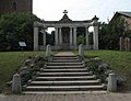
War memorial

Rectory

Former school


politics
coat of arms
Blazon : "In blue, two diagonally crossed silver peat spades, angled at the top by a golden royal crown."
The coat of arms was designed by the heraldist Frank Diemar .
flag
The flag is striped blue - white - blue in a ratio of 1: 8: 1 with the local coat of arms in the middle.
tourism

.JPG)
The Linum pond area with 240 hectares of water is an experience. The ponds were created from pitted areas. Above all, the large number of pairs of storks that breed here every year is known, which has earned the place the nickname "stork village". The storks arrive in Linum from March to May and move south again in the second half of August.
In the autumn months, the area around the small village hosts hundreds of thousands of cranes and geese , who gather here before they start their onward flight to the south. The ponds, with their mostly knee-deep water, offer safe sleeping places, and the large fields of the Rhinluchs are a set table for the birds. A small group of cranes is here all year round. From September to November the big birds migrate south and rest for a while. In the weekly counts, the animals are counted at all rest areas at the same time. With annual increases in numbers, Linum is now the largest inland rest area in Europe. In 2006, 72,000 cranes and 60,000 geese were counted in one day in mid-October.
Since 1991, visitors to the NABU nature conservation center “Storchenschmiede” have been able to find out more about nature and conservation in the region in a small exhibition and experience nature on a nature trail near the Linumer ponds and at events.
Transport links
Linum can be reached via the Bundesautobahn 24 Berlin – Hamburg. It lies between the Kremmen (from the south) and Fehrbellin (from the north) exits.
Personalities
- Joachim Betke (1601–1663), theologian and spiritualist
- Luise Hensel (1798–1876), religious poet
Web links
- Website of NABU, Berlin regional association for Linum
- Contribution to the RBB program Landschleicher on May 4, 2008
Individual evidence
- ↑ Details on the Linum meteorite .
- ^ StBA: Changes in the municipalities in Germany, see 2003
- ↑ Anna Klöpper: Largest crane resting place in Europe: both a curse and a blessing . In: The daily newspaper: taz . November 3, 2018, ISSN 0931-9085 ( taz.de [accessed November 26, 2018]).
Betzin | Well | Dechtow | Deutschhof | Hakenberg | Karwesee | Königshorst | Long | Lentzke | Linum | Manker | Splurge | City of Fehrbellin | Tarmow | Walchow | Wall | Wustrau old frieze sack