
Rudnitz
| coat of arms | Germany map | |
|---|---|---|

|
Coordinates: 52 ° 43 ' N , 13 ° 37' E |
|
| Basic data | ||
| State : | Brandenburg | |
| County : | Barnim | |
| Office : | Biesenthal-Barnim | |
| Height : | 61 m above sea level NHN | |
| Area : | 13.92 km 2 | |
| Residents: | 1989 (Dec. 31, 2019) | |
| Population density : | 143 inhabitants per km 2 | |
| Postal code : | 16321 | |
| Area code : | 03338 | |
| License plate : | BAR, BER, EW | |
| Community key : | 12 0 60 192 | |
| Address of the municipal administration: |
Bahnhofstr. 5 16321 Rüdnitz |
|
| Website : | ||
| Mayor : | Andreas Hoffmann | |
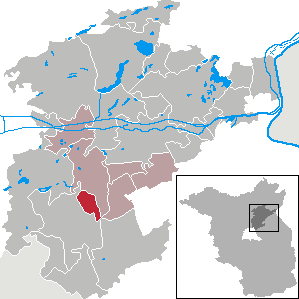
| Location of the municipality of Rüdnitz in the Barnim district | ||
  |
||

Rüdnitz ( Slavic rudnica : place where there is Raseneisenstein ) is a municipality in the Barnim district in Brandenburg . It is administered by the Biesenthal-Barnim office and is located northeast of the city of Bernau near Berlin .
Community structure
The Albertshof, Bahnhofssiedlung, Kühle Kaveln, Langerönner Mühle and Schulzenaue residential areas belong to the Rüdnitz community .
history
The area around Rüdnitz was settled in the early days . This is indicated by numerous finds from the Stone Age , the Bronze Age and the Early Iron Age . In addition to weapons, tools, utensils and jewelry, a number of urns were also discovered.
The place was mentioned for the first time in 1367, a Pecze Rudenicz appears as a witness in a Strausberg document. The place name probably goes back to the Slavic word Ruda , which means something like "red lawn iron stone", "red earth" or "earth mud". In the land book of Charles IV the place is mentioned in 1375 as Rydentz by Bernowe (Bernau).
From 1935 to 1941 there was a Hachschara training camp in Rüdnitz on the "Hof Wecker" .
Rüdnitz had belonged to the Oberbarnim district in the Brandenburg province since 1817 and to the Bernau district in the GDR district of Frankfurt (Oder) from 1952 . The community has been located in the Brandenburg district of Barnim since 1993.
Population development
|
|
|
|
|
Territory of the respective year, number of inhabitants: as of December 31 (from 1991), from 2011 based on the 2011 census
politics
Community representation
The community council of Rüdnitz consists of 12 members in addition to the honorary mayor:
| Voter group | Seats |
|---|---|
| Active for Rüdnitz | 7th |
| Free voters list Rüdnitz | 5 |
(As of: local election on May 26, 2019)
mayor
- 1990–2010: Hubertus Ritter
- 2010–2019: Christina Straube (Free Voter List Rüdnitz)
- since 2019: Andreas Hoffmann (active for Rüdnitz)
Hoffmann was elected in the mayoral election on May 26, 2019 with 58.8% of the valid votes for a term of five years.
Attractions

In the list of architectural monuments in Rüdnitz and in the list of ground monuments in Rüdnitz are the cultural monuments entered in the list of monuments of the State of Brandenburg.
Natural monuments
See the list of natural monuments in Rüdnitz
To the northeast of the church cemetery is the Friedenseiche zu Rüdnitz . It was planted in 1871 after the end of the Franco-Prussian War .
traffic
The state road L 200 (until 2003 B2 ) between Bernau and Eberswalde runs through the community.
The Rüdnitz station has existed since 1912 ( stopping point since 2006 ) on the Berlin – Szczecin railway line . Trains of the regional train line RB 24 Eberswalde - Berlin-Lichtenberg - Senftenberg of the DB Regio stop here . The Rüdnitz stop is part of the Berlin C tariff area of the VBB .
Personalities
- Friedrich von Bodelschwingh 1905 (1831-1910), clergyman laid that first home Hoffnungstal in Rüdnitz
- Kurt Kretschmann (1914–2007), conservationist, lived temporarily in Rüdnitz
- Hubertus Ritter (1938–2015), long-time mayor, honorary citizen of the community
Individual evidence
- ↑ Population in the State of Brandenburg according to municipalities, offices and municipalities not subject to official registration on December 31, 2019 (XLSX file; 223 KB) (updated official population figures) ( help on this ).
- ^ Service portal of the state administration Brandenburg. Rüdnitz community
- ^ Rainer Horn: Fates in Bad Times. In: Märkische Onlinezeitung, November 19, 2014. Accessed July 28, 2016.
- ↑ Historical municipality register of the state of Brandenburg 1875 to 2005. District Barnim . Pp. 18-21
- ↑ Population in the state of Brandenburg from 1991 to 2015 according to independent cities, districts and municipalities , Table 7
- ^ Office for Statistics Berlin-Brandenburg (Ed.): Statistical report AI 7, A II 3, A III 3. Population development and population status in the state of Brandenburg (respective editions of the month of December)
- ^ Result of the local election on May 26, 2019
- ↑ a b Hubertus Ritter obituary. In: Biesenthaler Anzeiger, November 24, 2015
- ↑ New election of the honorary mayor on www.amt-biesenthal-barnim.de
- ^ Law on local elections in the state of Brandenburg (Brandenburg Local Election Act - BbgKWahlG). Retrieved January 21, 2019 .
- ^ Result of the mayoral election on May 26, 2019. Accessed on August 11, 2019 .
Web links
Ahrensfelde | Althüttendorf | Bernau near Berlin | Biesenthal | Breydin | Britz | Chorin | Eberswalde | Friedrichswalde | Hohenfinow | Joachimsthal | Liepe | Lunow-Stolzenhagen | Marienwerder | Melchow | Niederfinow | Oderberg | Panketal | Parsteinsee | Rüdnitz | Schorfheide | Sydower Fliess | Wandlitz | Werneuchen | Ziethen