
Liepe (Barnim)
| coat of arms | Germany map | |
|---|---|---|

|
Coordinates: 52 ° 52 ' N , 13 ° 58' E |
|
| Basic data | ||
| State : | Brandenburg | |
| County : | Barnim | |
| Office : | Britz-Chorin-Oderberg | |
| Height : | 10 m above sea level NHN | |
| Area : | 10.85 km 2 | |
| Residents: | 653 (Dec. 31, 2019) | |
| Population density : | 60 inhabitants per km 2 | |
| Postal code : | 16248 | |
| Area code : | 033362 | |
| License plate : | BAR, BER, EW | |
| Community key : | 12 0 60 128 | |
| Office administration address: | Eisenwerkstrasse 11 16230 Britz |
|
| Website : | ||
| Mayor : | Klaus Marschner | |
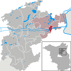
| Location of the municipality of Liepe in the district of Barnim | ||
  |
||


Liepe is a municipality in the northeast of the Barnim district in the state of Brandenburg . It is administered by the Britz-Chorin-Oderberg Office.
geography
Geographical location
Liepe forms the eastern end of the Finowtal agglomeration . The core village lies on the northwestern edge of the Oderbruch . It is squeezed between two landscape elements: the Uckermark basin and hill country in the north and the Oder-Havel Canal in the south. The waterway widens here to Lieper See as the western branch of the Oderberger See .
Community structure
The Lieper Vorwerk residential area belongs to the municipality of Liepe .
Neighboring communities
| Chorin | ||
.svg)
|
Oderberg | |
| Niederfinow | Falkenberg | Bad Freienwalde (Oder) |
history
Origin of the place name
The place name is derived from the old Polabian lipa , German ' lime tree '. It means 'place where linden trees grow'. Numerous Brandenburg settlements owe their name to the tree . That showed its widespread use.
From the stone age to modern times
People lived in the area since the late Neolithic . To the east of the village, a valley cut deep into the plateau hid a burial ground for the Oder cord ceramic culture . As adjuncts Excavations ceramics (vessels with cord and rafter ornaments, Zapf cup) and some arrowheads from flint to light. On the Pfingstberg, a terminal moraine to the northeast , there was a stool grave under a stone packing . It contained a flat stone hoe as an addition . The perforated leg of the bone from the second burial probably served as a shaft or socket for a stone implement. The funnel cup and Havelland cultures reached the area from the Oder valley to the Parstein basin. Cremation graves were discovered from the Bronze Age .
During the Slavic period , the area belonged to a settlement area that stretched from the Oderbruch via Oderberg to the Uckermark . To the south-east of the present-day town there was an Old Slavic and a Yugoslav settlement. An iron sword from the 9th century, probably a burial object, had strong silver inlaid on the pommel and quillons . The top of the pole showed the name Hiltipreth in Latin letters . This referred to the origin from the Franconian area . The so-called Wendenfriedhof was located between the south bank of the Großer Plagesee and the medieval Chorin –Liepe road . The burial ground of the 11th / 12th Century consisted of typical late Slavic cremation burials . In addition, it comprised rectangular barrows set over with stones and buried in bodies. This only happened in East Holstein , Rügen and East Pomerania at the same time . The grave goods from the 11th to 13th centuries occurred mainly on the western Baltic coast. Up until the 13th century, Danes and Western Slavs were in close contact.
In the 12th century the tribal area of fell ukrani for expansion goal of more powerful neighbors. From the middle of the century, the griffins and the Duchy of Pomerania gained the upper hand. Ultimately, the Askanians and the Mark Brandenburg emerged as winners . Albrecht II fortified the Finow line as a new border around 1212/1213 . Around 1230, the margrave brothers Johann I. and Otto III. move them up to the catfish . Most of the remaining Slavic and all emerging villages received a hoof constitution . After the country was built , the Slavs were assimilated within a few generations. Neither did Liepe.
In a document from 1233, the Slavic settlement chamber between Lake Parstein and Finow terra was called… Slavice Lipana . In 1258 the village of Lipe was mentioned. In 1261/1266 the Margraves of Brandenburg set the boundaries of the fields of Hohenliepe and Niederliepe. In 1267, her successor confirmed this. The first village was on the plateau near the Liepe forestry department. Originally it functioned as the center of the country. During excavations, u. a. Hearth and plastering found. The latter village was grouped around today's village church .
Anno 1308, the leaving rulers the convent Chorin the two Slavic Liepe including fishing prerogatives , the Frondienste , the upper and lower court and an angle of the heath . A document from 1335 included both of them in the possession of the Cistercians . The land register of Emperor Karl IV. From 1375 recorded (Hohen-) Liepe as a single pitcher settlement . (Nieder-) Liepe was the only one to describe the Urbar as a Slavic village. Each of the 23 fishermen's houses paid 4 shillings , 8 pfennigs as a tax , the jug 36 shillings. There was also a vineyard . In the lap register of 1450, the village still belonged to the monastery .
Administrative affiliation
Liepe belonged in the early modern period to Stolp Irish county of Brandenburg ; he was one of the two historical districts of the Uckermark province . In the district reform of 1816/1817 the village became part of the Angermünde district of the province of Brandenburg . With the district reform of 1952 in the GDR , it came to the Eberswalde district in the Frankfurt (Oder) district . The districts of Bernau and Eberswalde were united in the district reform of 1993 with small shifts in the border to form the district of Barnim .
Population development
|
|
|
|
|
It is mostly the territorial status of the respective year, 1817 with Charlottenthal, 1840 with Breitenfenn, Grenzhaus and Lieper Schleuse, 1858 without block house, Charlottenthal and Friedrich-Wilhelmsmühle; Population figures from 1991 as of December 31, from 2011 based on the 2011 census . The numbers given by the values of the German homeland and the historical local lexicon Uckermark partly differ from those in the table.
politics
Community representation
The municipal council of Liepe consists of eight members and the honorary mayor .
| Voter group | Seats |
|---|---|
| Together for Liepe | 8th |
(As of: local election on May 26, 2019)
mayor
- since 1998: Klaus Marschner
Marschner was elected unopposed in the mayoral election on May 26, 2019 with 65.2% of the valid votes for a further term of five years.
Sights and culture

The list of architectural monuments in Liepe and the list of ground monuments in Liepe contain the cultural monuments entered in the monuments list of the State of Brandenburg.
Economy and Infrastructure
Companies
Niederliepe was already a fishing village in Slavic times . The Deutsche Ostsiedlung did not fundamentally change that. As one of the few unspoilt villages in the Mark Brandenburg, it continued to feed on fishing in the Lieper See , the Finow and Oder . The land register of Emperor Charles IV of 1375 specified two other medieval economic branches - viticulture and jug .
The vines thrived on the southern slopes near the village. The extension was carried out on behalf of the Chorin monastery as the village landlord . In the first third of the 18th century, a master wine maker was still in charge of the vineyard 300 m west of the village church , and in 1734 it closed. The restaurant had certainly lost its importance with the redevelopment of the trade routes (see the chapter on traffic ). What remained was the use of inland navigation on the Finow, which was not canalised at the time, and the fishermen . The latter took over in socially similar Kietzen the brewing hate themselves. In High Liepe gave, according to the land register is also a pitcher. The namesake of the Krugsee was the only thing left of the settlement in 1375. Archaeological finds provided evidence of iron smelting that had previously operated here . The remains of the fields were tilled by the Niederlieper. They enabled flood-free summer hay to harvest between the Finowschlingen up to the Oder estuary.
traffic

In the Middle Ages , two trade routes from the south met in the local part of the Eberswalde glacial valley and moved together to the Baltic Sea : Leipzig - Frankfurt an der Oder - Stettin and Magdeburg - Berlin - Stettin . Originally the route ran via Niederfinow and Oderberg . In 1317 it was moved to Eberswalde and thus away from Liepe.
The village is on the L 29 state road between Oderberg and Hohenfinow .
In the district , the Finow Canal joins the Oder-Havel Canal .
Personalities

- Wilhelm Bando (1819–1899), chief forester in Liepe
literature
- alphabetically ascending
- Richard Dietrich: Liepe (district of Angermünde / Eberswalde) . In: Gerd Heinrich (Ed.): Handbook of historical sites. Berlin and Brandenburg. With Neumark and Grenzmark Posen-West Prussia (= manual of historical sites . 10th volume). 3rd, revised and supplemented edition, Alfred Kröner Verlag, Stuttgart 1995, ISBN 3-520-31103-8 , p. 264.
- Lieselott Enders (adaptation): Historical local dictionary for Brandenburg. Uckermark. With an overview map in the appendix (= Friedrich Beck [Hrsg.]: Historisches Ortslexikon für Brandenburg . Part VIII; Publications of the Potsdam State Archives . Volume 21). Hermann Böhlaus successor, Weimar 1986, ISBN 3-7400-0042-2 (gives a reprint from 2012).
- Lieselott Enders: The Uckermark. History of a Kurmark landscape from the 12th to the 18th century (= Klaus Neitmann [Hrsg.]: Publications of the Brandenburg State Main Archives . Volume 28). 2nd, unchanged edition, Berliner Wissenschafts-Verlag, Berlin 2008, ISBN 978-3-8305-1490-9 .
- Roland Fröhlich: The Cistercians and their in vineyards in Brandenburg (= studies on the history, art and culture of the Cistercians . Volume 30). 1st edition, Lukas Verlag für Kunst und Geistesgeschichte, Berlin 2010, ISBN 978-3-86732-070-2 , Part II: The Cistercians and their vineyards in Brandenburg. Chorin and viticulture near Liepe and Oderberg, pp. 134–154.
- Frauke Gränitz, Luise Grundmann on behalf of the Leibniz Institute for Regional Geography Leipzig and Saxon Academy of Sciences in Leipzig (ed.): Around Eberswalde, Chorin and the Werbellinsee. A geographical inventory in the area of Eberswalde, Hohenfinow and Joachimsthal (= landscapes in Germany. Values of the German homeland . Volume 64). Böhlau Verlag, Cologne / Weimar / Vienna 2002, ISBN 3-412-02401-5 .
- Kerstin Kirsch: Slavs and Germans in the Uckermark. Comparative studies on the development of settlements from the 11th to the 14th century (= Spiritual Science Center for the History and Culture of East Central Europe eV at the University of Leipzig (ed.): Research on the history and culture of eastern Central Europe . Volume 21). Franz Steiner Verlag, Stuttgart 2004, ISBN 3-515-08604-8 .
- Adolph Friedrich Riedel : Novus Codex diplomaticus Brandenburgensis. 1. main part. 13th volume . In: Codex diplomaticus Brandenburgensis . Collection of documents, chronicles and other sources for the history of the Mark Brandenburg and its rulers . 41 volumes, G. Reimer, Berlin 1857, V. Chorin Monastery. Pp. 202-309.
- Rudolf Schmidt : Liepe on the Finow Canal . In: Communications from the Uckermark Museum and History Association in Prenzlau. Volume 3 . Prenzlau 1907, DNB 012953903 , pp. 173-208.
- Johannes Schultze (Hrsg.): The land book of the Mark Brandenburg of 1375 (= Brandenburg land books . Volume 2; publications of the historical commission for the province of Brandenburg and the imperial capital Berlin . Volume VIII, 2). Commission publisher von Gsellius, Berlin 1940 ( digitized in Potsdam University Library ).
Web links
Individual evidence
- ↑ Population in the State of Brandenburg according to municipalities, offices and municipalities not subject to official registration on December 31, 2019 (XLSX file; 223 KB) (updated official population figures) ( help on this ).
- ↑ a b c d Gebhard Falk: To Eberswalde, Chorin and the Werbellinsee . Böhlau Verlag, Cologne 2002, ISBN 3-412-02401-5 , history and area structure. Historical development from the 12th century to 1945, pp. 52–59.
- ↑ State Office for Mining, Geology and Raw Materials Brandenburg (Ed.): Geological overview map 1: 100,000. Barnim district (= geological overview map 1: 100,000. Map of the formations on the surface with the representation of selected geotopes and geological objects . Map 6). Land surveying and geographic base information Brandenburg , Potsdam 2014, ISBN 978-3-7490-4187-9 .
- ↑ a b c d e f g h i j k l Frauke Gränitz, Luise Grundmann (ed.): Around Eberswalde, Chorin and the Werbellinsee. Böhlau Verlag, Cologne 2002, ISBN 3-412-02401-5 , Liepe, Barnim district, pp. 278-281.
- ↑ Gerd W. Lutze (author), Lars Albrecht, Joachim Kiesel, Martin Trippmacher (landscape visualization): Natural spaces and landscapes in Brandenburg and Berlin. Structure, genesis and use . Be.Bra Wissenschaft Verlag, Berlin 2014, ISBN 978-3-95410-030-9 , Uckermark, Eberswalder Urstromtal and Unteres Odertal. Breakdown. Uckermärkisches Becken- und Hügelland, pp. 129–134.
- ↑ a b Land surveying and geographic base information Brandenburg (ed.): From Niederfinow to the Oder. Topographic leisure map 1: 30,000 . In: Barnimer Land. Topographic leisure map 1: 30,000. Card 3 (= LGB leisure cards. Card 26). 3 maps and 1 booklet, 2nd edition, Potsdam 2008, ISBN 978-3-7490-4158-9 .
- ^ Service portal of the state administration Brandenburg. Liepe municipality .
- ↑ Reinhard E. Fischer : The place names of the states of Brandenburg and Berlin. Age - origin - meaning . Be.Bra Wissenschaft Verlag, Berlin 2005, ISBN 978-3-937233-30-7 , name book. Liepe (a), (b), (c), p. 105.
- ^ Kurt Adamy (author), Kristina Hübener (collaboration): The Prussian Province of Brandenburg in the German Empire (1871 to 1918) . In: Ingo Materna , Wolfgang Ribbe (Ed.): Brandenburg history . Akademie Verlag, Berlin 1995, ISBN 3-05-002508-5 , Agriculture, Industry, Transportation, pp. 524–539, here pp. 526–527.
- ^ Rainer Schulz: To Eberswalde, Chorin and the Werbellinsee . Böhlau Verlag, Cologne 2002, ISBN 3-412-02401-5 , history and area structure. Prehistory and Early History, pp. 47–52.
- ↑ a b c Lieselott Enders: The Uckermark . 2nd edition, Berliner Wissenschafts-Verlag, Berlin 2008, ISBN 978-3-8305-1490-9 , 1st chapter. Becoming the historical landscape and first heyday (from the beginning of the 12th to the beginning of the 14th century). I. The formation of rule of feudal princes in the land between the Elbe and Oder. 3. The formation of rule in the second half of the 12th century and in the 13th century, pp. 34–43.
- ↑ Johannes Schultze : The Mark Brandenburg. First volume. Origin and development under the Ascanian margraves (until 1319) . In: The Mark Brandenburg . 4th edition, Duncker & Humblot, Berlin 2011, ISBN 978-3-428-13480-9 , 12. Albrecht II. (1205-1220), pp. 112-117.
- ↑ Felix Escher : The Havelland in the Middle Ages . Duncker & Humblot, Berlin 1987, ISBN 3-428-06236-1 , The rural social structure of the Havelland with special consideration of the Slavic population. Village structure and individual social groups according to the Landbuch Kaiser Karls IV. From 1375, pp. 314–336.
- ↑ Helmut Assing: The sovereignty of the Ascanians, Wittelsbachers and Luxembourgers (mid-12th to early 15th century) . In: Ingo Materna , Wolfgang Ribbe (Ed.): Brandenburg history . Akademie Verlag, Berlin 1995, ISBN 3-05-002508-5 , The restructuring of the agricultural constitution and the changes in rural social relations in the 12th / 13th centuries. Century, pp. 102–109, here pp. 102–103, 105.
- ↑ a b Lieselott Enders: The Uckermark . 2nd edition, Berliner Wissenschafts-Verlag, Berlin 2008, ISBN 978-3-8305-1490-9 , 1st chapter. Becoming the historical landscape and first heyday (from the beginning of the 12th to the beginning of the 14th century). II. The development of the state in the Uckermark. 2. The economic and social conditions in the village. Fishing villages, p. 62.
- ^ Adolph Friedrich Riedel: Novus Codex diplomaticus Brandenburgensis. 1. main part. 13th volume . G. Reimer, Berlin 1857, V. Chorin Monastery. II. Bishop Conrad von Camin transfers the, in the place named Wendisch Barszdin, built monastery Gottestadt a hundred Hufen Landes in the country Liepe, in the year 1233, p. 203.
- ↑ Lieselott Enders: Historical local dictionary for Brandenburg. Uckermark. Hermann Böhlaus successor, Weimar 1986, ISBN 3-7400-0042-2 , Liepe w Oderberg. 4. First written mention, p. 582.
- ↑ a b c d Lieselott Enders: Historical local dictionary for Brandenburg. Uckermark. Hermann Böhlaus successor, Weimar 1986, ISBN 3-7400-0042-2 , Liepe w Oderberg. 7. Economic and social structure, pp. 582–585.
- ^ Lieselott Enders: The Uckermark . 2nd edition, Berliner Wissenschafts-Verlag, Berlin 2008, ISBN 978-3-8305-1490-9 , 1st chapter. Becoming the historical landscape and first heyday (from the beginning of the 12th to the beginning of the 14th century). III. The church conditions. 1. The monasteries and monasteries. Effectiveness and Radiance, pp. 88–90, here p. 88, including footnotes 423–424.
- ^ Adolph Friedrich Riedel : Novus Codex diplomaticus Brandenburgensis. 1. main part. 13th volume . G. Reimer, Berlin 1857, V. Chorin Monastery. XLIV. The margraves Otto and Woldemar left the two Slavic villages of Ober- and Nieder-Liepe with the corner of the heath, which still belonged to them, to the Chorin monastery, on March 12, 1308, pp. 232-233.
- ↑ a b Johannes Schultze (ed.): The land book of the Mark Brandenburg from 1375 . Commission publisher von Gsellius, Berlin 1940, Barnym. Barnym dἱstrictus Strutzberg. Lypa, p. 158.
- ^ Friedrich Wilhelm August Bratring : Statistical-topographical description of the entire Mark Brandenburg. Second volume. Containing the Mittelmark and Ukermark (= statistical-topographical description of the whole of Brandenburg. For statisticians, businessmen, especially for cameramen . 3 volumes). Friedrich Maurer, Berlin 1805, section 6. Uckermark, pp. 467-578, Liepe: p. 554 ( digitized version ).
- ↑ Lieselott Enders: Historical local dictionary for Brandenburg. Uckermark. Hermann Böhlaus successor, Weimar 1986, ISBN 3-7400-0042-2 , Liepe w Oderberg, pp. 581-585.
- ↑ Marlies Schulz: To Eberswalde, Chorin and the Werbellinsee . Böhlau Verlag, Cologne 2002, ISBN 3-412-02401-5 , Current Territory Structure, pp. 63–68 (including Fig. 14, p. 60).
- ↑ Historical municipality register of the state of Brandenburg 1875 to 2005. District Barnim . Pp. 14-17.
- ↑ Population in the state of Brandenburg from 1991 to 2015 according to independent cities, districts and municipalities , Table 7.
- ^ Office for Statistics Berlin-Brandenburg (Ed.): Statistical Report AI 7, A II 3, A III 3. Population development and population status in the state of Brandenburg (respective editions of the month of December).
- ↑ Frauke Gränitz, Luise Grundmann (ed.): To Eberswalde, Chorin and the Werbellinsee . Böhlau Verlag, Cologne 2002, ISBN 3-412-02401-5 , appendix. A. Population development from the 18th to the 20th century, pp. 339–341.
- ↑ Lieselott Enders: Historical local dictionary for Brandenburg. Uckermark. Hermann Böhlaus successor, Weimar 1986, ISBN 3-7400-0042-2 , Liepe w Oderberg. 10. Population figures, p. 585.
- ^ Result of the local election on May 26, 2019 .
- ↑ Results of the municipal elections in 1998 (mayoral elections) for the district of Barnim ( Memento of the original from March 30, 2018 in the Internet Archive ) Info: The archive link was automatically inserted and not yet checked. Please check the original and archive link according to the instructions and then remove this notice. .
- ↑ Brandenburg Local Election Act, Section 73 (1) .
- ^ Result of the mayoral election on May 26, 2019 .
- ↑ a b Frauke Gränitz, Luise Grundmann (ed.): To Eberswalde, Chorin and the Werbellinsee . Böhlau Verlag, Cologne 2002, ISBN 3-412-02401-5 , Eberswalde, Landkreis Barnim, Prehistory and City Foundation, pp. 210-213, Handelsstraßen: p. 212.
- ↑ Joachim Stephan: The rural population in the late medieval Mark Brandenburg . In: Clemens Bergstedt, Heinz-Dieter Heimann , Knut Kiesant, Peter Knüvener, Mario Müller, Kurt Winkler (eds.): In dialogue with robber barons and beautiful Madonnas. The Mark Brandenburg in the late Middle Ages . Accompanying volume for the exhibition association Raubritter and Schöne Madonnen (= Heinz-Dieter Heimann, Klaus Neitmann on behalf of the Brandenburg Historical Commission and Brandenburg State Main Archives [ed.]: Studies on Brandenburg and Comparative State History . Volume 6). 1st edition, Lukas Verlag für Kunst- und Geistesgeschichte, Berlin 2011, ISBN 978-3-86732-118-1 , Das Dorf in der Mark Brandenburg, p. 284.
- ^ Sascha Bütow: Streets in the river. Shipping, river use and the long changes in the transport infrastructure in the Mark Brandenburg and Niederlausitz from the 13th to the 16th century . Dissertation University of Potsdam 2014 (= Heinz-Dieter Heimann , Klaus Neitmann on behalf of the Brandenburg Historical Commission and Brandenburg State Main Archives [ed.]: Studies on Brandenburg and Comparative State History . Volume 18). 1st edition, Lukas Verlag für Kunst- und Geistesgeschichte, Berlin 2015, ISBN 978-3-86732-214-0 , Between Elbe and Oder: Shipping, river use and water-related infrastructure in medieval Brandenburg and Niederlausitz. The Havel-Spree waterway. The travelers on the Havel-Spree waterway. From Werder to Hamburg: The Lehnin Monastery as a carrier of shipping, pp. 173–178.
- ↑ Herbert Ludat : The East German Kietze . Publishing house Gustav Kunze, Bernburg 1936, III. Investigation of the Kietz problem. 5. The old Slavic neighborhood. g) The economic character. Other branches of business of the Kietzer. Brewing Beer, pp. 148-150.
- ↑ Gerd Heinrich (adaptation), J. Bollmann, K. Bremer, W. Scharfe (design and cartography): Medieval trading routes 1300 - 1375 - 1600 . Scale 1: 500,000. Supplements, Issue 5, In: Historical Commission to Berlin at the Friedrich-Meinecke-Institut of the Free University of Berlin (ed.): Historical hand atlas of Brandenburg and Berlin . Walter de Gruyter & Co., Berlin 1978.
- ^ Lieselott Enders: The Uckermark . 2nd edition, Berliner Wissenschafts-Verlag, Berlin 2008, ISBN 978-3-8305-1490-9 , 1st chapter. Becoming the historical landscape and first heyday (from the beginning of the 12th to the beginning of the 14th century). II. The development of the state in the Uckermark. 4. The high medieval urban system. Requirements, pp. 67–68.
Ahrensfelde | Althüttendorf | Bernau near Berlin | Biesenthal | Breydin | Britz | Chorin | Eberswalde | Friedrichswalde | Hohenfinow | Joachimsthal | Liepe | Lunow-Stolzenhagen | Marienwerder | Melchow | Niederfinow | Oderberg | Panketal | Parsteinsee | Rüdnitz | Schorfheide | Sydower Fliess | Wandlitz | Werneuchen | Ziethen