
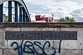
Charlottenbrücke
Coordinates: 52 ° 32 ′ 6 ″ N , 13 ° 12 ′ 22 ″ E
| Charlottenbrücke | ||
|---|---|---|
 |
||
| use | Road traffic, tram (until 1967) | |
| Crossing of |
Havel ( Lower Havel Waterway ) |
|
| place | Berlin , district Berlin-Spandau | |
| construction | Tied arch bridge without wind bracing | |
| overall length | 76 m | |
| width | 21 m | |
| Longest span | 60 m | |
| Clear width | 63 m | |
| Construction height | 10 m | |
| Clear height | 5.80 m | |
| start of building | 1926 | |
| completion | 1928 | |
| opening | 1929 | |
| location | ||
|
||

The Charlottenbrücke is a steel tied arch bridge without wind bracing in the Berlin district of Spandau over the Havel . It is entered in the list of cultural monuments in Berlin-Spandau with the object documentation no.09085524 .
location
The Charlottenbrücke leads the street Charlottenstrasse / Stresowstrasse over the Untere Havel waterway . It is connected on both sides by stairs to the Havel promenade. The promenade on the Lindenufer leads under the bridge and along the Havel. The listed bridge with its bridgehead and lights is located around 150 meters south of the Spree estuary on the eastern edge of the old town of Spandau . The span of today's bridge is 60 meters, the arch height 10 meters. The fairway of the federal waterway UHW is 55 meters wide under the bridge. The bridge has two lanes and two parking lanes. The width of the carriageway is 11 meters, the sidewalks each 5 meters. In 2000, the roadway was sealed for around 215,000 marks .
history
The Havel crossing from Stresow was of strategic importance in earlier times and was initially secured by a ferry. From 1319 a gate protected by a tower is mentioned on the Spandau side and from 1433 a wooden bridge is mentioned here. The structure, initially called the Stresow Bridge, was rebuilt in 1633. The bridge was later given the name Charlottenbrücke after the Charlottenstrasse crossing the bridge, which in turn is named after Queen Sophie Charlotte . In 1819 a two-flap bridge was built for shipping. From 1864 to 1866 the wooden bridge was renewed and a cast-iron elevator was installed for the passage of the ship. In 1886 the wooden structure was replaced by a multi-part bridge. The two edge fields were designed as a steel arch bridge, between which there was a hinged girder bridge . The sidewalks were jammed. From 1892, the Spandau tram used the bridge. In mid-January 1916, the central section collapsed after colliding with a ship. Since a new building was planned anyway due to the increased loads, the old Charlottenbrücke was subsequently torn down. To the south of it, the Pioneer Battalion 3 Rauch built a makeshift bridge by June 1916.
The current bridge was built between 1926 and 1928 instead of the bascule bridge from 1886. The pioneer bridge was demolished after it was cleared. Around 1930, a public toilet facility was built on the promenade on the west bank of the Havel. At its northern end in the direction of the Spandau Citadel there was a statue of Emperor Friedrich III until around 1926 . by Albert Manthe from 1892.

Charlottenbrücke, around 1896

Charlottenbrücke, around 1900
Name tag


See also
Web links
- Charlottenbrücke. In: structurae.de. Retrieved March 3, 2018 .
Individual evidence
- ^ A b Eckhard Thiemann, Dieter Deszyk, Horstpeter Metzing: Berlin and its bridges . Jaron Verlag, Berlin 2003, ISBN 3-89773-073-1 , p. 122 .
- ↑ Hans-Jürgen Kämpf: The tram in Spandau and around Spandau . Ed .: Heimatkundliche Vereinigung Spandau 1954 eV Berlin 2008, ISBN 978-3-938648-05-6 , p. 256-257 .
- ↑ a b Hans-Jürgen Kämpf: The tram in Spandau and around Spandau . Ed .: Heimatkundliche Vereinigung Spandau 1954 eV Berlin 2008, ISBN 978-3-938648-05-6 , p. 258 .
- ↑ Hans-Jürgen Kämpf: The tram in Spandau and around Spandau . Ed .: Heimatkundliche Vereinigung Spandau 1954 eV Berlin 2008, ISBN 978-3-938648-05-6 , p. 259-260 .