Bundesstrasse 122
| Bundesstrasse 122 in Germany | ||||||||||||||||||||||||||||||||||||||||||||||||||||||||||

|
||||||||||||||||||||||||||||||||||||||||||||||||||||||||||
| map | ||||||||||||||||||||||||||||||||||||||||||||||||||||||||||
| Basic data | ||||||||||||||||||||||||||||||||||||||||||||||||||||||||||
| Operator: |
|
|||||||||||||||||||||||||||||||||||||||||||||||||||||||||
| Start of the street: |
Wesenberg ( 53 ° 17 ′ N , 12 ° 58 ′ E ) |
|||||||||||||||||||||||||||||||||||||||||||||||||||||||||
| End of street: |
Neuruppin ( 52 ° 57 ′ N , 12 ° 51 ′ E ) |
|||||||||||||||||||||||||||||||||||||||||||||||||||||||||
| Overall length: | 48.5 km | |||||||||||||||||||||||||||||||||||||||||||||||||||||||||
|
State : |
||||||||||||||||||||||||||||||||||||||||||||||||||||||||||
| Development condition: | two-lane | |||||||||||||||||||||||||||||||||||||||||||||||||||||||||
|
Course of the road
|
||||||||||||||||||||||||||||||||||||||||||||||||||||||||||
The federal road 122 (abbreviation: B 122 ) is a federal road newly created in 2005 between Wesenberg in Mecklenburg-Western Pomerania and Alt Ruppin in Brandenburg and thus (based on the route) the youngest federal road with a 100 number. It leads through the Mecklenburg Lake District and the Rheinsberg Lake District . The route from Wesenberg to Rheinsberg is also part of the Deutsche Alleenstrasse .
course
- Mecklenburg-Western Pomerania
- Brandenburg
- Prebelow (14.5 km)
- Zechlinerhütte (18.5 km)
- Rheinsberg (26.5 km)
- Köpernitz b. Rheinsberg (30.5 km)
- Dierberg (35.5 km)
- Zippelsförde (41.5 km)
- Alt Ruppin , B 167 (48.5 km)
history
The former trunk road 122 (FVS 122), renamed Reichsstrasse 122 in 1934, ran from Cottbus via Glogau to the then Polish border near Fraustadt . Since 1945, most of the road has been on Polish territory.
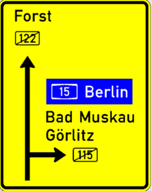
The B 122 was the remainder of the road that remained with Germany , designated as Fernverkehrsstrasse 122 (F 122) in the GDR from 1949 to 1990 , then the federal road . It began near Cottbus on the B 115 and ended in Klein Bademeusel on the A 15 . This old B 122 was rededicated as Landesstraße 49 in 2005 due to the nearby A 15. In the same year, the former state road L 192 was upgraded to federal road 122.

