Bundesstrasse 223
| Bundesstrasse 223 in Germany | ||||||||||||||||||||||||||||||||||||||||||||||||||||

|
||||||||||||||||||||||||||||||||||||||||||||||||||||
| map | ||||||||||||||||||||||||||||||||||||||||||||||||||||
| Basic data | ||||||||||||||||||||||||||||||||||||||||||||||||||||
| Operator: |
|
|||||||||||||||||||||||||||||||||||||||||||||||||||
| Start of the street: | 51 ° 30 ' N , 6 ° 52' E | |||||||||||||||||||||||||||||||||||||||||||||||||||
| End of street: | 51 ° 24 ' N , 6 ° 53' E | |||||||||||||||||||||||||||||||||||||||||||||||||||
| Overall length: | 15 km | |||||||||||||||||||||||||||||||||||||||||||||||||||
|
State : |
||||||||||||||||||||||||||||||||||||||||||||||||||||
| Development condition: | City street | |||||||||||||||||||||||||||||||||||||||||||||||||||
|
Course of the road
|
||||||||||||||||||||||||||||||||||||||||||||||||||||
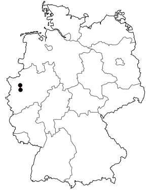
The Federal Highway 223 (abbreviation: B 223 ) is a trunk road in North Rhine-Westphalia . It begins at the end of the A 516 at the OB-Eisenheim junction, crosses the A 42 and continues through Alt-Oberhausen, crosses the A 40 in Mülheim an der Ruhr - Styrum and joins the B 1 in Mülheim- Saarn .
history
By January 1, 2007, the B 223 already began in Dorsten and ran via Bottrop-Kirchhellen and Oberhausen-Sterkrade to Oberhausen. This section was downgraded (AS Kirchhellen Nord (A 31) - Oberhausen) and the B 225 (Dorsten - AS Kirchhellen Nord) added.
Shared use by trams
The tram route Mülheim - Oberhausen-Sterkrade (line 112) from Mülheimer VerkehrsGesellschaft and Stadtwerke Oberhausen runs flush with the B 223 between Mülheim and Oberhausen city center .
Web links
Commons : Bundesstrasse 223 - Collection of pictures, videos and audio files
