Bundesstrasse 315
| Bundesstrasse 315 in Germany | ||||||||||||||||||||||||||||||||||||||||||||||||||||||||||||||||

|
||||||||||||||||||||||||||||||||||||||||||||||||||||||||||||||||
| map | ||||||||||||||||||||||||||||||||||||||||||||||||||||||||||||||||
| Basic data | ||||||||||||||||||||||||||||||||||||||||||||||||||||||||||||||||
| Operator: |
|
|||||||||||||||||||||||||||||||||||||||||||||||||||||||||||||||
| Overall length: | approx. 38 km | |||||||||||||||||||||||||||||||||||||||||||||||||||||||||||||||
|
State : |
||||||||||||||||||||||||||||||||||||||||||||||||||||||||||||||||
|
Course of the road
|
||||||||||||||||||||||||||||||||||||||||||||||||||||||||||||||||
The federal highway 315 (abbreviation: B 315 ) represents the connection between eastern Switzerland and the Titisee in the Baden-Württemberg Black Forest .
course
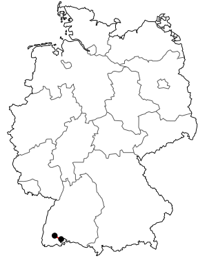
The B 315 begins at the German- Swiss border crossing between Stühlingen and Schleitheim , then runs together with the B 314 to the Weizen train station ( Waldshut district ). There it branches off from the B 314 and leads via Bonndorf and Lenzkirch to the Titisee. The length of the federal highway 315 is around 38 kilometers. It ends when it joins the B 317 at the southeastern end of Lake Titisee in the Breisgau-Hochschwarzwald district . From there it is about two kilometers to the B 31 and the B 500 .
The difference in height between the beginning and the end of the road is around 400 meters. The Ehrenbach runs parallel to the road from its origin in Bonndorf until shortly before its confluence in Weizen.
history
Road construction in the Upper Black Forest began around 1755 near Saig and Stühlingen. The western section from Saig to Lenzkirch was built around 1786. The subsequent section from Lenzkirch to Bonndorf was built between 1795 and 1798. Shortly before the secularization of the St. Blasien monastery , the "Wellendinger Steige" was also completed in 1803.
This road was designated in 1901 as part of the Baden State Road No. 53 between Freiburg im Breisgau and Stühlingen. From around 1937 until after the Second World War it was known as Reichsstraße 315 .
