
Nieplitz
| Nieplitz | ||
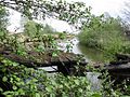
 The Nieplitz near Zauchwitz with the characteristic rows of poplar trees |
||
| Data | ||
| Water code | EN : 5848 | |
| location | Brandenburg , Germany | |
| River system | Elbe | |
| Drain over | Nuthe → Havel → Elbe → North Sea | |
| source | At Frohnsdorf in Fläming 52 ° 2 ′ 30 ″ N , 12 ° 53 ′ 48 ″ E |
|
| Source height | 85 m above sea level NN | |
| muzzle | At Gröben-Kietz in the Nuthe coordinates: 52 ° 16 '32 " N , 13 ° 9' 32" E 52 ° 16 '32 " N , 13 ° 9' 32" E |
|
| Mouth height | 33.1 m above sea level NN | |
| Height difference | 51.9 m | |
| Bottom slope | 1 ‰ | |
| length | 49.7 km | |
| Left tributaries | Mühlenbach, Neuer Graben , Königsgraben | |
| Right tributaries | Sernowfliess , Friedrichsgraben, Pfefferfliess | |
| Flowing lakes | Blankensee , Grössinsee , Schiasser See | |
| Small towns | Treuenbrietzen , Beelitz | |
The Nieplitz is a left tributary of the Nuthe in Brandenburg .
The river rises in Fläming near Frohnsdorf, takes the path through Treuenbrietzen then between the villages of Niebel and Niebelhorst , as well as Buchholz and Lühsdorf , crosses federal highway 2 at Buchholzer Mühle and then flows near Salzbrunn and Reesdorf towards Beelitz . The river crosses Bundesstraße 2 again in an arc that runs east, then flows parallel to Bundesstraße 246 past Schönefeld , Zauchwitz and Körzin to Stangenhagen . Shortly before the Blankensee , the Nieplitz picks up the Pfefferfließ that brings the water from the floodplains and the rift systems at Stangenhagen and Körzin. The mouth of the river is exactly opposite the point where the relatively wide Königsgraben joins the Nieplitz. The ditch was named after Frederick the Great , who had it built between 1772 and 1782, so that the then considerable amount of water from the Pfeffer River and the marshland diverted more quickly past the Nieplitz chain of lakes to the Nuthe and the land into that of Friedrich required usable stand could be moved.
The Nieplitz connects the Blankensee with the Grössinsee and the small tube-like Schiaßer See and flows into the Nuthe after approx. 50 kilometers between the Gröbener Kietz and Jütchendorf . The Nuthe-Nieplitz nature park was set up around both rivers , with moist, green meadows, former floodplains and smaller Elsbruchen .
At Blankensee Castle , the Nieplitz branches out into several small side arms that flow through the remarkable Sudermann Park with its peculiar Italian-Brandenburg note and are spanned by several curved bridges.
From Treuenbrietzen onwards, the course was straightened, deepened and diked in places so that the Nieplitz looks more like a canal than a river in many places.
The name Nieplitz comes from the Slavic and roughly means the non- navigable - in contrast to the Nuthe, which was up to 40 m wide around 1880 and was partially navigable before its various regulations.
In his wanderings through the Mark Brandenburg , the writer Theodor Fontane scoffed at the Nuthe and the even smaller sister Nieplitz, compared to these rivers the Havel looked as if the Volga were passing by.

Source near Frohnsdorf
Connection Grössinsee - Schiaßer See

Nieplitz estuary, in the foreground the Nuthe

The Neue Graben, a left tributary of the Nieplitz
.jpg)


2_Urstromtal.JPG)
Web links
- TMB Tourismus Marketing Brandenburg GmbH
- State Institute for Large Protected Areas Brandenburg
- Nature watch in Brandenburg
Individual evidence
- ↑ River directory gewnet25 (Version 4.0, April 24, 2014) from the Ministry for Rural Development, Environment and Agriculture of the State of Brandenburg, accessed on May 4, 2015.