Westuffeln
|
Westuffeln
Calden parish
Coordinates: 51 ° 26 ′ 4 ″ N , 9 ° 19 ′ 26 ″ E
|
|
|---|---|
| Height : | 197 (193-217) m above sea level NHN |
| Area : | 11.84 km² |
| Residents : | 1494 (Dec. 31, 2015) |
| Population density : | 126 inhabitants / km² |
| Incorporation : | 1st February 1971 |
| Postal code : | 34379 |
| Area code : | 05677 |
|
View of Westuffeln
|
|
Westuffeln is a district of the municipality of Calden in the northern Hessian district of Kassel .
Geographical location
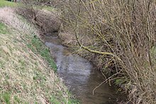
Westuffeln is located between wooded hills in the Westuffeln depression . It is located northwest of the main town at the confluence of the small Lohbeeke in the Nebelbeeke , which flows into the warmth near the western neighboring village of Obermeiser . South of the village passes the Federal Highway 7 , of these branching national road 3233 traverses the site. Westuffeln is the source of the Calden mineral water. It is pumped from the Wilhelmsthal mineral fountain. Some Westufflers are annoyed that the water is still called "Caldener".
history
The first documentary mention comes from the year 965. The donation from Emperor Otto I to the Church of St. Mauritius in Magdeburg is recorded in a document. On the Westuffeln cemetery there is a rare preacher's house from 1694. The village church has a church tower built in Romanesque style and a Gothic nave.
On February 1, 1971 Westuffeln was incorporated into the municipality of Calden.
Sports
The gymnastics club Westuffeln 1909 with six branches and around 700 members is based in the village. Westuffeln has two sports fields at the Struthkampfbahn and the club's own gym, which was largely built and financed in-house between 1952 and 1957. The soccer team has a game community with the neighboring town of Obermeiser .
traffic
The federal road 7 (B7) passes Westuffeln in the south, which provides a connection to the large cities of Kassel in the southeast and Warburg in the northwest. The state road 3233 , starting with the exit on the B7, leads through the village and leaves it in a north-easterly direction to Grebenstein and Immenhausen . The county road 30 crosses Westuffeln direction Obermeiser and records in this area the old course of the B7.
Bus route 130 connects Westuffeln with Volkmarsen , Obermeiser, Calden, Burguffeln and Grebenstein . There are other bus connections to the surrounding villages.
Web links
- Westuffeln (and the other Calden districts), on www.calden.de (municipality website)
- The story of Westuffeln ( memento from June 17, 2013 in the web archive archive.today ) Private website .
- Westuffeln, Kassel district. Historical local dictionary for Hessen. In: Landesgeschichtliches Informationssystem Hessen (LAGIS).
- Literature on Westuffeln in the Hessian Bibliography
Individual evidence
- ↑ a b Municipality of Calden: facts and figures ( memento of June 30, 2016 in the Internet Archive ), accessed in June 2016.
- ^ Federal Statistical Office (ed.): Historical municipality directory for the Federal Republic of Germany. Name, border and key number changes in municipalities, counties and administrative districts from May 27, 1970 to December 31, 1982 . W. Kohlhammer GmbH, Stuttgart and Mainz 1983, ISBN 3-17-003263-1 , p. 398 .
- ^ Turnverein Westuffeln 1909 eV


