Nebelbeeke
| Nebelbeeke | ||
|
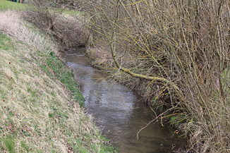
The Nebelbeeke at Westuffeln |
||
| Data | ||
| Water code | EN : 4464 | |
| location |
District of Kassel , Hesse , Germany |
|
| River system | Weser | |
| Drain over | Warm → Diemel → Weser → North Sea | |
| source | in the Habichtswald Nature Park at Hohen Dörnberg 51 ° 22 ′ 13 ″ N , 9 ° 20 ′ 49 ″ E |
|
| Source height | approx. 350 m above sea level NHN | |
| muzzle | at Obermeiser in the Warm Coordinates: 51 ° 26 '34 " N , 9 ° 18' 24" E 51 ° 26 '34 " N , 9 ° 18' 24" E |
|
| Mouth height | approx. 175 m above sea level NHN | |
| Height difference | approx. 175 m | |
| Bottom slope | approx. 16 ‰ | |
| length | 10.8 km | |
| Catchment area | 34.051 km² | |
| Left tributaries | Heimbach, Lohbeeke, Ufflerbeeke | |
| Right tributaries | Mühlengraben | |
The Nebelbeeke ("Nebel-Bach"; cf. Mnd. Beke ) is an approximately 10.8 km long, right or eastern inflow of heat in the district of Kassel , North Hesse ( Germany ).
course
The Nebelbeeke rises on the Hohe Dörnberg massif . Its source is located a little below the former Dörnberg youth farm north of the “Helfenstein” ( 509.8 m above sea level ) (today including the Habichtswald nature park center ) on the Schwarzer Berg mountainside .
Initially, the stream flows northwards and past Fürstenwald about 750 m away to the west . Then it passes Ehrsten in the Westuffelner Senke directly to the east and then crosses Meimbressen . From now on, flowing in a north-westerly direction, it runs roughly along federal highway 7 through Westuffeln , where the water of the 4 km long Lohbeeke flows into it.
Then the Nebelbeeke reaches Obermeiser , where it flows west of the Mäckelsberg at the bridge of the side road “Zum Sportplatz” at a height of about 175 m into the Diemel tributary, Warme , coming from the south .
Catchment area and tributaries
The catchment area of the Nebelbeeke is 34.051 km². Its tributaries include Heimbach, Lohbeeke and Ufflerbeeke.
history
In the 19th and 20th centuries the Nebelbeeke was deepened and straightened in places in the locality and district of Meimbressen, and in Obermeiser its course was relocated to drive mills.
Individual evidence
- ↑ a b Topographic map 1: 25,000
- ↑ a b c d Water map service of the Hessian Ministry for the Environment, Climate Protection, Agriculture and Consumer Protection ( information )
