Ringgau
| Ringgau | ||
|---|---|---|
| Highest peak | Rabenkuppe ( 514.8 m above sea level ) | |
| location | Werra-Meißner district , Wartburg district ; Hessen , Thuringia ( Germany ) | |
| Part of the main unit | Ringgau – Hainich – Obereichsfeld – Dün – Hainleite , Thuringian Basin (with edge plates) | |
| Classification according to | Handbook of the natural spatial structure of Germany | |
|
|
||
| Coordinates | 51 ° 5 ' N , 10 ° 8' E | |
| Type | Layered mountain range | |
| rock | Shell limestone , red sandstone | |
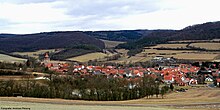
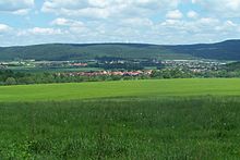
The Ringgau is a by Hercynian shared Talung medium mountain-like limestone - plateau in Hessen Werra-Meissner and Thuringian Wartburgkreis ( Germany ). It lies to the left or northwest of the Werra near Creuzburg and is surrounded to the north, west and south by the red sandstone landscapes of the Fulda-Werra mountainous region .
The central municipality of the Ringgau is also called Ringgau .
geography
location
The Ringgau is not far west of the center of Germany in the Hessian Werra-Meißner district and, to a somewhat smaller extent in the northeast, in the Thuringian Wartburg district. It is located west of the Werra and east of the ( Ulfe and the) Sontra between the Richelsdorf mountains in the southwest, the Hosbach-Sontra-Bergland in the west, the foothills of the Hohe Meißner in the northwest and the Schlierbachswald in the north.
Beyond the Werra lie the Hainich upstream ridges Wanfrieder Werra heights and Falkener plate in the north east of Creuzburg-Eisenacher ditch in southern East and the Thuringian Forest in the southeast.
Natural structure
The Muschelkalk plateau of the Ringgau is cut in west-northwest-east-southeast direction by the Netra-Ifta valley , in which the Netra flows to the Sontra in the west and the Ifta to the Werra in the east . The part of the Ringgau to the north of this valley is referred to as the Northern , the more southern as the Southern Ringgau , the narrow red sandstone southern roofing of the southern as the Southern Ringgau foothills .
The Ringgau belongs to the edge plates of the Thuringian Basin and is often referred to as the "island of the Thuringian Triassic in the Hessian mountainous region" .
Specifically, the Ringgau is structured according to the handbook of the natural spatial structure of Germany as follows:
-
(to 483 Ringgau – Hainich – Obereichsfeld – Dün – Hainleite )
- 483.4 The Ringgau
- 483.40 Southern Ringgau foothills
- 483.41 Southern Ringgau
- 483.42 Netra-Ifta Valley
- 483.43 Northern Ringgau
-
(483.44–47 south-eastern continuation of the Ringgau)
- 483.44 Creuzburg Werra breakthrough
-
483.45–47 Creuzburg – Eisenacher Graben
- 483.45 Stedtfelder plate
- 483.46 Creuzburg-Eisenacher Senke
- 483.47 Mihla plateau
- 483.4 The Ringgau
Usually only the units 483.40–483.43 are referred to as “Ringgau”. The Creuzburg – Eisenacher Graben (483.45–47) was originally assigned to the main unit of West Thuringian mountain and hill country (481) and is still counted there by the BfN today.
geology
From a geological point of view, the plateau of the Ringgau , which runs in a north-west-south-east direction, consists of shell limestone , which emerges from the red sandstone of the main block of the Fulda-Werra mountains between Fulda and Werra . The plateau slopes down in sharp-edged layers towards the outside and towards the central ditch . Upper Muschelkalk now only emerges on the Scherbdaer Platte , a muschelkalk slab in the northeastern Ringgau cut off by the Schnellmannhäuser Bach .
The geological Netra – Creuzburger Graben runs in the center of the Ringgau with the trough-like basin of the Netra-Ifta valley, which is drained to the south-east via the Ifta to the Werra and to the north-west via the Netra to the Sontra . In the valleys of these rivers there are marls of the Keuper .
The southern Ringgau breaks off to the south in a layered step to the red sandstone, on which the narrow border of the southern Ringgau foothills lies, which reach a maximum of 380 m (occasionally a little more) height. These break off to the south in a layer to the Zechstein or to the sediments of the Werraaue.
mountains


The mountains of the Ringgau include - sorted by height in meters (m) above sea level (NHN; if not otherwise named according to):
("S" = Southern Ringgau, "N" = Northern Ringgau; with mention of possible Ringgau peripheral locations)
- Rabenkuppe (N, 514.8 m), part of the Graburg mountain plateau, between Röhrda and Weißenborn , Hesse
- Boyneburg (S, 513.0 m), on the western edge, near Wichmannshausen , with Boyneburg ruins (approx. 500 m), Hesse
- Heldrastein (N, 503.8 m), on the northeastern edge, between Rambach , Heldra and Schnellmannshausen , Thuringia
- Schickeberg (S, 500.2 m), on the western edge, between Grandenborn and Krauthausen , Hesse
- Schieferstein (N, 488.2 m), between Röhrda and Weißenborn, Hesse
- Schloßberg (S, southeastern crest, 452.3 m; northwest crest, 451.8 m), on the southern edge, near Holzhausen and Markershausen , with ruins of Brandenfels , Hesse
- Stöckigtsberg (N, 450.2 m), between Scherbda and Schnellmannshausen, Thuringia
- Breitenberg (N, 447.3 m), between Scherbda and Schnellmannshausen, Thuringia
- Kielforst (S, 446 m), on the southeastern edge, between Herleshausen and Pferdsdorf , Hesse and Thuringia
- Erbelberg (S, 440.0 m), in the southwest part, between Breitau and Renda , Hesse
- Ringelberg (S, 436.4 m), in the center, near Renda and Röhrda, Hesse
- Iberg (S, 434.6 m), on the southern edge, near Archfeld and Markershausen, Hesse
- Spitzenberg (N, 422.8 m), between Datterode and Oetmannshausen , Hesse
- Kehrberg (N, 416.7 m), north of Ifta , Thuringia
- Eichenberg (N, 388.9 m), southwest of Rittmannshausen , Hesse
- Wide mountain ( Fischersberg ; N, 323.2 m), between Falken and Scherbda, Thuringia
- Sandberg (N, 290.2 m), between Schnellmannshausen and Treffurt , Thuringia
Waters
The rivers of the Ringgau include:
- Ifta - east-south-east part of the central depression, tributary of the Werra
- Nesse - rises in the central south of the southern Ringgau, tributary of the Werra
- Netra - west-northwest part of the central depression, tributary of the Sontra
- Renda - rises in the center of the southern Ringgau, tributary of the Ulfe
- Sontra - flanked the southern Ringgau to the northwest, tributary of the weirs
- Ulfe - flanked the southern Ringgau to the west, tributary of the Sontra
- Werra - flanks the Ringgau from south-east, a source river of the Weser
- Schnellmannshausen Bach - separates the Northern Ringgau near Schnellmannshausen
- further small brooks cut especially the southern edge of the Schich stage
Localities
Within the Ringgau , in particular, is the municipality of Ringgau with its districts Datterode , Grandenborn , Lüderbach , Netra (municipal administration), Renda , Rittmannshausen and Röhrda . The landscape is surrounded by these communities, some of which are located on the outskirts of the Ringgau: Wehretal , Weißenborn , Ifta , Creuzburg , Herleshausen , Nentershausen and Sontra .
history
East past the Ringgau ran between 1945 and 1989 the former inner-German border to the GDR or to Thuringia, where border systems and patrol routes can still be seen, including the former border station "India" at the one during the Cold War a US radar station was operated.
The inner-German border only marginally hit the almost entirely Hessian southern Ringgau, but divided the northern part centrally. The small Thuringian community Großburschla on the left bank of the Werra, which was almost completely enclosed by "border security systems", was only connected to the rest of the GDR by the serpentine road to Schnellmannshausen in the southeast, which crosses the edge of the plateau and climbs to a maximum of 350 m .
After August 13, 1961, the Kornblume campaign began , as the GDR authorities cynically called the forced resettlement of over 10,000 people in the border region. Großburschla, which is a stone's throw from the Hessian towns of Altenburschla and Heldra , was only allowed to be entered by residents and people with special permission. The former border strip from the Heldrastein to the southwest has been cleared to this day.
flora
The partially steeply sloping peripheral areas of the Ringgau, the plateau of which is predominantly unforested and used for agriculture, consist in particular of deciduous and coniferous forest with beech , spruce and pine .
Transport links
The Ringgau can be reached via the section of Bundesstraße 7 , which, as a former army road as the main link between east and west, connects the B 27 in the west with the B 250 in the east. A section of the federal motorway 4 runs south past the Ringgau , from which a section of the A 44 will branch off in the future , in order to pass southwest of the Ringgau.
The nearest train stations are Herleshausen on the Halle – Bebra line and the Wehretal-Reichensachsen stop on the Göttingen – Bebra line .
Hiking / sights
The Ringgau is accessed by numerous hiking trails, including the Barbarossaweg and European long-distance hiking trail E6 ("Baltic Sea-Wachau-Adria"). The sights of the Ringgau include, in addition to its scenic plateau, the forest areas on its edges and villages with a medieval character, the ruins of the Boyneburg , which are located on the Boyneburg ( 513 m ), the highest mountain in the southern Ringgau, and the ruins of Brandenfels , which stands on the southeast summit ( 452.3 m ) of the Schloßberg on the southern edge of the Ringgau.
See also
References and comments
- ^ A b c Emil Meynen , Josef Schmithüsen (editor): Handbook of the natural spatial structure of Germany . Federal Institute for Regional Studies, Remagen / Bad Godesberg 1953–1962 (9 deliveries in 8 books, updated map 1: 1,000,000 with main units 1960).
- ^ Hans-Jürgen Klink: Geographical land survey: The natural space units on sheet 112 Kassel. Federal Institute for Regional Studies, Bad Godesberg 1969. → Online map (PDF; 6.9 MB)
- ↑ Map and legend of the natural areas of Hesse (online copy of Die Naturraum Hessens , Otto Klausing 1988) in the Hessen Environmental Atlas of the Hessian State Office for Environment and Geology
- ↑ a b Map services of the Federal Agency for Nature Conservation ( information )
- ↑ When the newspaper Kassel appeared, the Federal Institute for Regional Studies had just come to terms with the fact that, due to the low probability of an imminent reunification of the two parts of Germany, cross-border mapping no longer seemed appropriate, which is why the main unit “West Thuringian mountain and hill country”, which is otherwise entirely in Thuringia “Appeared obsolete. This could have been a reason for subordinating the south-eastern continuation of the Ringgau to the Ringgau itself.
- ↑ Geological Map of Hesse (RTC 300) , Hessian Agency for Environment and Geology (PDF; 28 KB)
- ↑ a b Official topographic maps of Thuringia 1: 10,000. Wartburgkreis, district of Gotha, district-free city of Eisenach . In: Thuringian Land Survey Office (Hrsg.): CD-ROM series Top10 . CD 2. Erfurt 1999.
- ↑ There was no man's land , documentation from Hessischer Rundfunk , programm.ard.de
Web links
- Geology at Heldrastein , on heldrastein.de
- Aerial photo and map of the Ringgau with rivers, natural boundaries and the most important peaks
- Historical and geographical information about the Ringgau , on heimatverein-datterode.de

