Netra (river)
| Netra | ||
|
|
||
| Data | ||
| location | Hessen , Germany | |
| River system | Weser | |
| Drain over | Sontra → Weirs → Werra → Weser | |
| source | At Rittmannshausen 51 ° 5 ′ 14 ″ N , 10 ° 7 ′ 8 ″ E |
|
| Source height | 332 m above sea level NN | |
| muzzle | At Wichmannshausen in the Sontra coordinates: 51 ° 7 ′ 1 ″ N , 9 ° 58 ′ 30 ″ E 51 ° 7 ′ 1 ″ N , 9 ° 58 ′ 30 ″ E |
|
| Mouth height | 195 m above sea level NN | |
| Height difference | 137 m | |
| Bottom slope | 10 ‰ | |
| length | 13.2 km | |
| Catchment area | 34.5 km² | |
| Left tributaries | Renderothsgraben, Zielecksgraben, Harmuthsbach | |
| Right tributaries | Leimbach, Lautenbach, Hasselbach | |
| Communities | Ringgau , Sontra | |
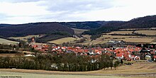
The Netra is a 13.2 km long, eastern, orographically right tributary of the Sontra in the Ringgau ( natural area 483.4) in the Werra-Meißner district in eastern North Hesse . With the exception of the last 1.5 km, it runs exclusively within the municipality of Ringgau .
Hydrology and geology
The Netra is a watercourse of type 7 : coarse material rich, carbonate agents mountain .
It runs in the center of the Ringgau in the Netra-Creuzburger Graben or within it in the trough-like hollow of the Netra-Ifta Valley (natural area 483.42, also called Netra-Ifta-Graben ), which crosses to the southeast over the Ifta to the Werra and to the northwest the Netra is drained to Sontra. Therefore, together with the Ifta, it divides the Muschelkalk plateau of the Ringgau in a west-northwest-east-southeast direction into the northern and southern Ringgau .
course
The Netra rises about 1.5 km west of the Hessian border with Thuringia, about 600 m west-southwest of Rittmannshausen and 200 m south of the federal highway 7 at 332 m above sea level. NN at the foot of the northern slope of the Eichenberg ( 388.9 m ). Only about 800 m further east is the source of the 2.9 km long Sommerbach, one of the source brooks of the Ifta, which flows eastwards.
The Netra then flows in a generally west-northwest direction to Netra , which it passes on the southern outskirts. On the western outskirts, directly at the Netra moated castle , it takes on the small Leimbach coming from the north. In its further course in a west-north-westerly direction to Röhrda , the Renderothsgraben flows directly to the west of the Wiesenmühle from the south, then the Zielecksgraben on the eastern outskirts of Röhrda, also from the south. The village of Röhrda bypasses the Netra on the northern edge of the village, before it takes in the Lautenbach coming from the north at the western end of the village. It then flows through the village of Datterode , where the Hasselbach flows from the north and the Harmuthsbach from the south.
About 1 km further west, the Netra takes up another stream coming from the Spitzenberg ( 423 m ) in the north and then turns slightly west. Shortly afterwards it enters the district of Wichmannshausen , a district of Sontra , and finally flows, after crossing under the federal road 7, north of Wichmannshausen and immediately south of the house at Heuberg at 195 m above sea level. NN in the Sontra.
traffic
The entire length of the Netra valley is used by federal highway 7 ( Kassel - Eisenach ), which runs along the north bank of the small river.
Individual evidence
- ↑ Profile of the river type 7 on wasserblick.net (PDF file; 167 kB)
Web links
- Map of the Ringgau with rivers, natural boundaries and the most important mountains
