
Hero stone
| Hero stone | ||
|---|---|---|
 The hero stone from the north |
||
| height | 503.8 m above sea level NHN | |
| location | Thuringia , Germany | |
| Coordinates | 51 ° 6 '37 " N , 10 ° 11' 18" E | |
|
||
| rock | Upper red sandstone (red) and shell limestone | |
| particularities |
|
|

.jpg)
The Heldrastein (pronounced Heldra stone ) is 503.8 m above sea level. NHN high mountain southwest of Treffurt in Thuringia near the border with Hesse . To the north, the Heldrastein breaks off with a striking rock face to the Werra valley . There, across the river, lies the eponymous North Hessian village of Heldra .
location
The Heldrastein is the eastern part of an approximately eight kilometer long and steeply sloping north to the Werra , reaching over the forest village Dreiherrenstein , the Schäfersburg ( 489.6 m above sea level ) to the Graburg ( 514.8 m above sea level ) Shell limestone rock demolition. The erosion of the plateau was the valleys Mertelstal , Märtal , Schöddel , Heldratal and wooded valley formed.
The highest point is the Heldrastein with the pulpit ( 503.8 m above sea level ). The wooded knolls and spur-like slopes (position and height) also belong to the ridge:
- Dreiherrenstein ( ⊙ 488.5 m above sea level )
- Hüneburgberg ( ⊙ 495.4 m above sea level )
- Eschenberg ( ⊙ 459.4 m above sea level )
- Mertelsköpfe ( ⊙ 485.3 m above sea level )
- Spießenkopf ( ⊙ 412.8 m above sea level )
- Winter rent ( ⊙ 329.6 m above sea level )
- Lindenberg ( ⊙ 292.5 m above sea level )
The neighboring communities of Heldrastein on the Thuringian side are the town of Treffurt with the districts of Großburschla , Schnellmannshausen with the districts of Volteroda, Hattengehau and Schrapfendorf and the community of Ifta with the district of Wolfmannsgehau ; on the Hessian side, the municipality of Rittmannshausen - Ringgau , Weißenborn with the Rambach district and the Heldra district of the city of Wanfried should be noted.
view
The edge of the Heldrastein is a natural vantage point. The view extends from the Hoher Meißner and the Gobert in the northwest over Hülfensberg and Plesse in the north to Adolfsburg and Burg Normannstein in the northeast. On very clear days, the Brocken can also be seen 82 km away. The deep view includes the Werra valley from Treffurt to Wanfried . The 30 m high tower of the unit enables a full all-round view .

history
Hueneburg

The first traces of settlement in the area of the Hüneburg come from the pre-Roman Iron Age, in the late 1930s settlement pits and small finds were examined during construction work. In the High Middle Ages there was a fortification of the Knights of Treffurt in the area of the Hüneburg. An old road ran over the mountain from Treffurt in the direction of Gerstungen and Burg Brandenfels Castle , which the Treffurt helped to build.
Robber Hennings Cave
Just below the demolition edge was a cleft cave that was accessible until the 1960s, known as Henningshöhle and which later collapsed as a result of weathering. According to tradition, it was the hideout of the robber captain Henning, a gang leader feared in the region, who could be caught by a ruse.
Observation towers

From 1890 on there was a lookout tower and a forester's house on the Heldrastein , which served as an inn in the summer months. In 1927 an innkeeper from nearby Lüderbach built a new restaurant with overnight accommodation. After the Second World War and during the time of German division, the mountain was in the GDR border area and was therefore no longer accessible to the population from 1952 onwards. The observation tower and the restaurant were demolished.
Military installations
From 1962 a radio reconnaissance station for the State Security under the code name KONDOR was built on the Hüneburg site, which was secured by guards and additional fencing. The team, housed in a wooden barracks, was provided by the Erfurt district administration and comprised a head radio operator as station manager and main clerk (rank of captain), six radio operators as clerk (rank of first lieutenant) and a driver, also trained as a substitute radio operator (rank of lieutenant). The station had 10 radio receivers of the type 2070 and 10 tape recorders. Mobile VHF and directional radio antennas were initially set up on the open space of the Hüneburg, later (around 1980) a lattice mast with a dome was built as an antenna carrier.
From 1973, the radio reconnaissance unit of the GDR border regiment in Mühlhausen / Thuringia was assigned a base on the Heldrastein, which had the cover name FICHTENNADEL 4. The task of the radio reconnaissance squad 4 (FuaT4) Schnellmannshausen / Heldrastein consisted of the working group and division of labor with the listening station KONDOR for seamless monitoring of radio traffic on the opposing side (VHF radio networks of the Federal Border Guard, the border customs service and the federal state police) in the border area. Both units were networked with each other through secure telephone and telex systems. The continued existence of the Stasi reconnaissance base on the Heldrastein was to remain hidden from even the conscript border soldiers in the Ifta-Treffurt border section. From 1975 KONDOR had 16 radio-technically improved receivers of the type 2070 and 12 tape recorders.
From 1980, the radio engineering post 713 (FuTP-713) of the radio engineering company in Steinheid was built on the Heldrastein as a radar station for the GDR air force / air defense. The unit observed the airspace in the assigned area "Thuringian Gate / Thuringian Basin" - especially below 500 m altitude and forwarded the reconnaissance results on the air situation via secure wire connections to the command post of the Radio Technical Battalion 51 (FuTB 51) in Sprötau near Erfurt. The unit consisted of an officer as station leader, the group leader Funkorter (rank non-commissioned officer) as well as three soldiers with training as electrical mechanics, military drivers and radio operators. The radio measuring station P15-M was housed in a mobile SIL 157 K truck, which was positioned with a unit trailer near the edge of the rock. The station was set up from April 1st to October 31st and was housed in military tents. The service was carried out in the uniform of the GDR air force.
Tourist redevelopment
Immediately after the opening of the border in 1989, the Stasi monitoring station KONDOR was abandoned and the technical systems were dismantled or made unusable. The lattice mast and the accommodation were not destroyed; this area was reopened to the public in March 1990. At the beginning of 1990 a community of interests was founded, which immediately began to redevelop the Heldrastein for tourism. Hiking trails were restored and in 1996 the monitoring tower was converted into an observation tower, the tower of unity . Connected to this is a refuge and an exhibition about the border fortifications, which can be visited all year round. The Premiumweg 6 hiking trail leads over the Heldrastein.
Nature reserve
vegetation
The Heldrastein is almost completely forested again. These are dry beech forest on the edge of the slope and natural ash-maple shatthang forest on the rocky eruptions and on debris in the north slope area. Spruce forests have also been planted at the northern foot of the Heldrastein. The rock front itself, which is about 70 m deep, is largely free of vegetation.
Bat and bird protection
The rocks and crevices are a natural breeding area and feeding habitat for bats and the peregrine falcon . The area is largely secured as a nature conservation and FFH area , and because of the border location, rare owl species have also survived.
Green band
The former border barriers have largely been removed and the border strip has become part of the Green Belt .

View to the Heldrastein (lithograph, ca.1840)

View from the Werra valley to the rock face at the edge of the break

On the nature trail.

The hero stone.
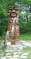
Robber captain Florian Henning has asked.
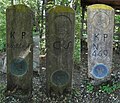
Dreiherrenstein west of the Heldrastein.


Web links
literature
- Interest group Heldrastein (ed.): The Heldrastein. Ringgau-Datterode 1997, ISBN 3-930342-06-5 , p. 35.
- Else Krapf: Ifta, a small village in the Wartburgland. Eisenach 1996.
- Festschrift 1125 years Schnellmannshausen. Date of meeting 2001.
- Wilhelm Pippart: The hero stone for young and old. Eschwege 1907.
- IG Heldrastein eV (Ed.): Forest, learning and adventure trail in the nature reserve "Auf dem Heldrastein" . S. 12 (flyer, no place or year information).
Individual evidence
- ↑ a b Map services of the Federal Agency for Nature Conservation ( information )
- ^ Geyer, Jahne, Storch: Geological sights of the Wartburg district and the independent city of Eisenach . In: District Office Wartburgkreis, Lower Nature Conservation Authority (Hrsg.): Nature conservation in the Wartburgkreis . Booklet 8. Printing and publishing house Frisch, Eisenach and Bad Salzungen 1999, ISBN 3-9806811-1-4 , p. 26–27 and cover picture .
- ↑ Thuringian Land Survey Office TK25 - sheet 4927 Creuzburg. Erfurt 1992, ISBN 3-86140-202-5 .
- ↑ Official topographic maps of Thuringia 1: 10,000. Wartburgkreis, district of Gotha, district-free city of Eisenach . In: Thuringian Land Survey Office (Hrsg.): CD-ROM series Top10 . CD 2. Erfurt 1999.
- ↑ Dreiherrenstein am Heldrastein ( Memento from October 12, 2013 in the Internet Archive )
- ↑ NN The hill fort on the Heldrastein - a prehistoric settlement? In: Eisenacher Tagespost. January 10, 1940.
- ↑ The Mihla local chronicler Rainer Lämmerhirt researched Henning: “Henning is said to have been born in Heldra in 1738. Growing up in the poor house, he didn't know what to do with life and joined the military. As a mercenary he learned the craft of war during the Seven Years' War. When he returned to Heldra, he was drawn to the solitude of the Heldrastein. He spent his days in the famous Henning Cave there. Raids as far as Eschwege and Mühlhausen are attributed to him. In Mihla there is an old tradition according to which Henning personally judged a crony who had become a traitor by hanging him. That should have happened Am Bach . Eventually hussars and farmers stormed the cave and captured Henning. He is said to have been executed in Mühlhausen. ”- Rainer Lämmerhirt: Robber Henning and other robber stories. In: Werratalnachrichten, newsletter of the Mihla municipality…. Year 1998, No. 6, p. 15.
- ↑ Gerhard Kühn: From the history of the hero stone. (Part 11) In: Werratalbote. 4th july 2016.
- ↑ Gerhard Kühn: From the history of the hero stone. (Part 12) In: Werratalbote. July 11, 2016.
- ↑ Birgit Schellbach: Interest group has made Heldrastein known again. In: Thuringian General. 3rd August 2015.
- ^ German Wanderinstitut eV: P6 Heldrastein.