
Sprötau
| coat of arms | Germany map | |
|---|---|---|

|
Coordinates: 51 ° 8 ′ N , 11 ° 12 ′ E |
|
| Basic data | ||
| State : | Thuringia | |
| County : | Sömmerda | |
| Management Community : | Gramme-Vippach | |
| Height : | 196 m above sea level NHN | |
| Area : | 8.01 km 2 | |
| Residents: | 801 (Dec. 31, 2019) | |
| Population density : | 100 inhabitants per km 2 | |
| Postal code : | 99610 | |
| Area code : | 036371 | |
| License plate : | SÖM | |
| Community key : | 16 0 68 052 | |
| Association administration address: | Erfurter Str. 6 99195 Schloßvippach |
|
| Website : | ||
| Mayoress : | Sabine Redam (WG) | |
| Location of the municipality of Sprötau in the district of Sömmerda | ||
  |
||

Sprötau is a municipality in the Sömmerda district in Thuringia . It belongs to the administrative community Gramme-Vippach , which has its administrative seat in the municipality of Schloßvippach .
geography
The Sprötau district is located on a stream called Klinge in a valley cut in a plateau, which is about 200 to 245 m above sea level. The blade rises in the Sprötau forest, then runs through the Sprötau valley eastwards and flows into the Scherkonde in Vogelsberg .
geology
The soil values of Sprötau are in the range from 58 to 86 (loam and black earth soils).
climate
The outermost western slope of the village is covered by a 42 hectare forest, which, with its predominantly sessile oak and hornbeam vegetation, has a high climatic influence on the local climate of the place. The annual mean temperature is around 8.5 ° C, and the average rainfall per year is around 500 mm. Since 2002, 8.2 hectares of mixed deciduous forest have been planted with "hardwood" species in the area of the former military property through afforestation.
history

The place was first mentioned in 1255. To the west of the place was the Langensteinsche Court from 1542 (document) until the 1840s , a field and complaint court for the surrounding villages. Sprötau belonged to the part of the " Vogtei Brembach ", which in 1664 came to the office of Großrudestedt . From 1672 this belonged to the Duchy of Saxony-Eisenach and from 1741 to the Duchy of Saxony-Weimar-Eisenach . In 1701 today's Protestant church "Zum Heiligen Kreuz" was built.
During the Second World War , 22 women and men from Poland and Russia had to do forced labor in agriculture.
As a result of the grid action , the core maker Bruno Lehmgrübler (born in 1897) was arrested on August 22nd and sent to the Buchenwald concentration camp for a short time by the GeStaPo Weimar
From 1970/1974 to 1990 Sprötau was a military base of the National People's Army . The 51st anti-aircraft missile brigade and the radio technology battalion 511 were stationed west of the village. The barracks area and the area of the technical department together took up 100 hectares. The apartment blocks of the professional soldiers and civilian staff were adjacent. The “technical zone” of the unit was 3 km south of Sprötau on the Great Warthügel. After German reunification, until December 31, 1994, the Bundeswehr took over parts of the facility as a radar command department. Then the site was closed.
After the "Wende", the village church, the tower of which was already blocked by the building authorities, was extensively renovated. Sizable new residential buildings were built between the town center and the former residential buildings of the military property.
Population development
|
|
|
|
|
Data source: Thuringian State Office for Statistics
politics
Municipal council
The local council from Sprötau consists of eight members of a group of voters (status: local election on June 27, 2004).
mayor
The honorary mayor Joachim Schmidt was re-elected on June 6, 2010. He had been in office since June 26, 2004. Sabine Redam has been the honorary mayor since July 2016.
coat of arms
Blazon : "In silver a green oak, accompanied in the right upper corner by a red cross, in the left upper corner by a red acorn three-pass."
flag
The municipal flag is red with silver (white) flanks (1: 2: 1) and bears the municipal coat of arms.
Culture and sights
music
There is a church choir in Sprötau.
Buildings
- Evangelical Church of the Holy Cross , built in 1701, restored from 1998 to 2004
- Village community center in a former school
- Windmill (Dutch stone mill) on the northern outskirts, dilapidated

Church entrance on the west side

Village community center

Dutch windmill
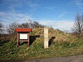
Langenstein's court west of the village


societies
- Local history and history association “An der Marke” e. V.
- Sprötau volunteer fire department
- Allotment garden association “Am Wäldchen” e. V.
- Small animal breeding association T180 Sprötau e. V.
- Lanzfreunde Sprötau
- Sprötauer Carneval Association
sports clubs
- Sprötauer Sportverein e. V.
- Rifle club "Zur Linde" e. V. Sprötau
literature
- Frank Boblenz : The Langenstein Court - a regional court near Sprötau / Schloßvippach. In: Home Thuringia. Vol. 16, Issue 3, 2009, ISSN 0946-4697 , pp. 44-48.
- Frank Boblenz: Sprötau. Sömmerda district. Langenstein's dish. In: Cultural discoveries Thuringia. Volume 3: Sparkassen-Kulturstiftung Hessen-Thüringen (ed.): State capital Erfurt, district Gotha, Ilm district, district Sömmerda, city of Weimar, district Weimarer Land. Schnell & Steiner, Regensburg 2010, ISBN 978-3-7954-2461-9 , pp. 231-232.
Individual evidence
- ^ Population of the municipalities from the Thuringian State Office for Statistics ( help on this ).
- ^ Johann Ernst Fabri : Geography for all estates. Part 1, Volume 4: Which contains the continuation and the resolution of the Upper Saxon Circle. Schwickert, Leipzig 1793, p. 82 f.
- ↑ Thuringian Association of the Persecuted of the Nazi Regime - Association of Antifascists and Study Group of German Resistance 1933–1945 (Ed.): Local history guide to sites of resistance and persecution 1933–1945. Volume 8: Thuringia. VAS - Verlag für Akademische Schriften, Frankfurt am Main 2003, ISBN 3-88864-343-0 , p. 278.
Web links
Alperstedt | Andisleben | Büchel | Buttstädt | Eckstedt | Elxleben | Gangloffsommern | Gebesee | Griefstedt | Großmölsen | Großneuhausen | Großrudestedt | Favored | Hatred life | Kindelbrück | Kleinmölsen | Kleinneuhausen | Kölleda | Markvippach | Nöda | Ollendorf | Eastern amondra | Rastenberg | Riethgen | Riethnordhausen | Ring life | Castle Vippach | Schwerstedt | Sömmerda | Sprötau | Straussfurt | Udestedt | Vogelsberg | Whale life | Weissensee | Werningshausen | Witterda | Miraculous life