West Thuringian mountain and hill country

The West Thuringian mountain and hill country is characterized by hill country, Hercynian , that is, a basin landscape that stretches from northwest to southeast in western Thuringia between the Werra near Creuzburg in the west, the edge of the Thuringian Forest between Eisenach and Ohrdruf in the southwest, the elevations between Arnstadt and the north-west of Gotha in the north-east and the Hainich in the north.
The West Thuringian mountain and hill country, which occupies a good 500 km² total area, is the main unit within the main natural unit group Thuringian Basin (with edge plates) (47/48) according to the manual of the natural spatial structure of Germany , which is also based on the Federal Agency for Nature Conservation (BfN) 481. The Thuringian State Institute for Environment and Geology in Jena (TLUG), which faithfully classifies the surrounding rocks, assigns the Keuper landscape in the interior to the Thuringian Basin ( Innerthuringian Ackerhügelland ), to which it adjoins to the southwest, and includes the semicircular shell limestone framing in the Northwest, which stretches counter-clockwise from the Hörselberge to Hainich , which is no longer included, with landscapes adjacent to the northwest, such as the Ringgau as Werrabergland-Hörselberge .
Location and limits
The West Thuringian mountain and hill country lies, from northwest to southeast, in the northeast of the Wartburg district and the city of Eisenach and, more than half of it, in the district of Gotha . A very small area in the far east between Arnstadt and the Drei Gleichen belongs to the Ilm district .
The southwest border to the Thuringian Forest and its red sandstone border Waltershäuser Vorberge follows the line Eisenach– ↑ Hörselberge– Waltershausen –Ohrdruf, whereby it only touches the Thuringian Forest directly at Eisenach and Ohrdruf. To the east of Ohrdruf, the shell limestone joins the Ohrdrufer Platte (main unit Ilm-Saale- and Ohrdrufer Platte ).
The northeast border to the Thuringian Basin runs along the Arnstadt line - ↑ Drei Gleichen - ↑ Seeberge - Gotha - ↑ Krahnberg - Reichenbach . (All mountain ranges marked with (↑) are added to the main unit.)
The border to the main unit Ringgau – Hainich – Obereichsfeld – Dün – Hainleite follows the south-western slope of Hainich from Behringen via Berka to Mihla , where the unit extends to the Werra valley, which is no longer included . Finally, up the Werra, the western border stretches from Mihla via Creuzburg to Hörschel . Immediately to the west beyond the Werra rises the Ringgau, the eastern continuation of which is the Creuzburg – Eisenacher Graben in the west of the local main unit. Noticeably, all of the larger towns are on the outskirts.
Geology and geomorphology
The West Thuringian mountain and hill country is surrounded by elevations with up to 200 meters of relief energy , but inside it rarely reaches height differences of more than 100 meters, therefore it is more of a hill than a mountain landscape. Its core is the Hörselgau – Großenlupnitzer Mulde , which stretches from the north of Eisenach via Großenlupnitz and Hörselgau east to Emleben , from where it runs out in two bays , one near Mühlberg in the east and one near Ohrdruf in the south. This landscape is similar in many respects to the Thuringian Basin to the north-east of the main unit, but its relief is somewhat more agitated and in absolute terms it is higher on average.
The hollow is divided into three small and one large loess- rich Lettenkeuper sinks, which are separated from one another in pairs by a soft shell limestone saddle in the center.
Partial landscapes of the central basin
In the far northwest the Mihlaer Mulde lies along the Lauterbach up to its confluence with the Werra in Mihla . Immediately to the south-east is the Nesse-Mulde , the main area of which is the right-hand catchment area of the Böber (confluence with the Nesse in Großenlupnitz).
To the east is the Ettenhausen – Weingarten saddle (also: Ettenhausener saddle ), which slides between the Nesse near Ettenhausen (around 240 m ) in the north-west and the Hörsel near Mechterstädt (around 270 m ), but because of its 391 m ( Hainberg south of Weingarten ) and its very flat undulating rise does not really interrupt the basin landscape.
The Hörselgau-Mulde to the southeast around Hörselgau finally takes up about half of the core basin. It mostly drains to the Hörsel, but its southeast at the bays of Ohrdruf and Mühlberg is passed by the mouth of the Ohra and the middle course of its receiving water, Apfelstädt . From a hydrological point of view, the Leinakanal and the Flößgraben , in particular, are noteworthy ; they carry water from the Hörsel and the Apfelstädt from the Thuringian Forest to Gotha, from where it is fed back to the Hörsel through the Wilder Graben via the Nesse.
The small Sonneborner Mulde , which drains to the Nesse , branches off to the northwest along the Arzbach (mouth at Sonneborn ) and the Bieberbach (mouth at Friedrichswerth ) .
South edge
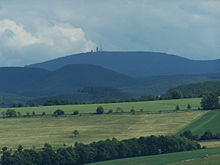
On the shell - layer rib of Hörselberge in southern West Thuringian hilly and mountainous country is evident in even steeper shape, which is also the northwestern shell-framing of the Thuringian basin by Duen and Hainleite characterized: The basin landscape rises to the rim height down more gradually, then falls but towards the outside in a steep step towards the surrounding red sandstone . From the north-eastern slope of the Großer Hörselberg, the terrain drops 484 m from 475 m to 375 m within about 850 horizontal meters (average 12% = 7 ° gradient), while the same height difference on the southwest side requires less than 150 horizontal meters (average 70% = 35 ° slope!).
In the first structure of the 6th edition of the Handbook of Natural Spatial Structure of Germany from 1959, the Hörselberge were still included in the Waltershausen foothills west to southeast of Waltershausen , with which they have little in common. Although the red sandstone of the foothills is also partially surrounded by shell limestone ridges in the area southeast of the Hörselberge (for example Burgberg Waltershausen ), these are only very narrow and do not reach the heights of the foothills immediately adjacent to the south. Accordingly, the Hörselberge were added to the local main unit a year later for the final map 1: 1,000,000, although it was also left in follow-up publications, in particular in significantly later BfN publications .
The greatest height differences and absolute heights in the area of the main unit are not to be found on the Hörsel Mountains, but in the extreme southeast, on the southern edge of the Ohrdrufer Bay; here the 400 m high landscape in the valleys of Ohra and Apfelstädt rises within a horizontal kilometer of about 300 meters and more ( Kienberg : 720 m ) to the Thuringian Forest without any significant transition zone .
Hercynian fault zones on the east and west edges
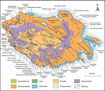
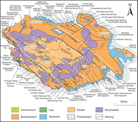
The western Thuringian mountain and hill country is characterized in particular by a high density of disturbances , especially in the eastern and western border areas. Both peripheral areas are parts of significantly larger, hercynically running fault zones. Occurrences of Rhaetian and Lias sandstones, which are rare in the Thuringian Basin, are found on the hardlings , which detach themselves with the stratified ribs of the shell limestone and partially merge with them .
Eastern edge
Along the Eichenberg – Gotha – Saalfelder fault zone , which here forms the north-eastern threshold to the Thuringian Basin, lie, from northwest to southeast, the Lohberg ( 332.6 m , immediately west of the Tüngeda dam ), the Krahnberg ( 431.3 m ) Seamounts (up to 409.2 m ) and the two mountain ranges of the Drei Gleichen (up to 420.8 m ). Here, in a sometimes very small-scale sequence, ridge-like stratified ribs of the Upper Muschelkalks ( Galberg on the Krahnberg-Südosthang, ridge from the north of the southeastern Drei Gleichen in the direction of Arnstadt ) are replaced by Härtlingen, which have been modeled by reversing the relief ( Gleichen Castle in the northwestern and Wachsenburg in the southeastern Drei Gleichen). In some places (seamounts, Schloßleite and Mühlburg in the southwest of the southeastern Drei Gleichen), both forms virtually merge.
Western edge
The extreme west of the main unit, the area of the Creuzburg – Eisenacher trench, is similarly varied . In principle, this is the south-eastern extension of the Netra – Creuzburger trench dividing the Ringgau to the right of the Werra . However, in contrast to the longer, northwest adjoining section, here it is almost completely formed as a ridge, because the flanks of the trench reach approximately the height of the shell limestone ridges bounding the trench through relief reversal and are only made through the narrow depression of the Madel between Madelungen and Krauthausen interrupted.
In the north lies the small Muschelkalk plateau of the Mihlberg ( 378 m ) east of Creuzburg, exactly in the southeastern extension of the 514.8 m high Northern Ringgau at the Rabenkuppe . Beyond its south (west) flank, the ridge dissolves - at a comparable altitude, but with a more agitated relief - in the occasionally steep individual peaks Schlierberg ( 362.6 m , Creuzburg), Hohleite ( 385.8 m , Krauthausen) and Eichelberg ( 334.9 m m , Eisenach) until the elevation on the Madel drops sharply to about 235 m .
Analogous in the south:
the narrow ridge from Hörschelberg ( 324.6 m ) to Karlskuppe ( 377.1 m ) on the south-eastern extension of the 513 m high southern ringgau at Boyneburg is only separated from the 300 m high former route north of Karlskuppe the A 4 is separated from the very steep Härtlingskuppe of the Moseberg ( 364.3 m ) to the north .
The re- routing of the A 4 , which now leads past the northern slope of the Moseberg, brought extensive geological knowledge about the course of the individual faults and the properties of the rock layers to light at the beginning of the 21st century .
All fault lines converge over the Wartenberg ( 333.2 m ) to the Petersberg ( 344.2 m ) and run out to the southeast. Its shell limestone extends both that of the northern Ringgau with Mihlberg and that of the southern one with Karlskuppe.
According to the orography , one would classify the Petersberg, which is well separated from the neighboring mountain ranges to the west by the triangular confluence of the Nesse in the Hörsel (around 215 m above sea level ), as a western spur of the Hörselberge , of which only the former route of the A 4 (around 280 m ) separates.
Clods
The West Thuringian mountain and hill country lies almost completely on the Treffurt – Plauer Scholle , which is delimited by the two above-mentioned peripheral fault zones. Only the Muschelkalk ridge of the Karlskuppe in the southern extreme west lies on the Ringgau plaice of the southern Ringgau .
External elevation profile
The immediate Randa heights of the central keuper basin of West Thüringer mountains and hills have - listed in a clockwise direction, starting at the Ohrdrufer plate in the South East - the following altitudes above mean sea level :
(at the edge heights from one kilometer distance, the approximate distance is indicated in each case to the pool edge, Elevations in the second row are indented;
if there is no shell limestone on the edge heights, the other rock is indicated)
-
Ilm-Saale- and Ohrdrufer plate
- Musketierberg ( 461 m , 1.5 km; northwest of the Ohrdrufer Platte )
- Thuringian Forest ( Basement Mountains )
- Kienberg ( 720.3 m , 1 km)
- ↓ Ohra entry between Ohrdruf and Luisenthal (approx. 410 m )
-
Brandkopf ( 672 m , 1.5 km)
- Großer Buchenberg ( 812.7 m , 8 km)
- ↓ Apfelstädt entry at Georgenthal (approx. 380 m )
-
Waltershäuser Vorberge ( red sandstone )
- Ziegelberg ( 519 m , 1 km)
- ↓ Hörsel entrance at Schönau vor dem Walde (approx. 315 m )
- Finstere Tanne ( 520 m , 1.5 km)
- Großer Inselsberg ( 916.5 m , 8 km; Thuringian Forest)
- Western edge (edge elevations belong to the local main unit)
- ↓ Hörsel exit at Sättelstädt (approx. 265 m )
- Hörselberge ( 484.2 m )
- Petersberg ( 344 m )
- ↓ Nesse estuary in Eisenach ( 215 m )
- Karlskuppe ( 377 m )
- Moseberg ( 364 m )
- ↓ Madel exit at Madelungen (approx. 240 m )
- Hohleite ( 385.8 m )
- Mihlberg ( 378 m )
- ↓ Lauterbach - confluence with the Werra near Mihla ( 184 m )
-
Ringgau-Hainich-Obereichsfeld-Duen-Hainleite
- Harsberg ( 410 m ; southwest edge of the Hainich near the mouth of the Lauterbach)
- Old Mountain ( 493.9 m , 2 km; Hainich )
-
Thuringian Basin (peripheral elevations belong to the local main unit)
- Lohberg ( 332.6 m , western edge of the Tüngeda dam )
- Nesse entry at Wangenheim (approx. 255 m )
- Krahnberg ( 431.3 m )
- Wilder Graben exit near Gotha (approx. 280 m )
- Seamounts ( 409.2 m )
- Apfelstädt exit south of Seebergen (approx. 280 m )
- Wachsenburg ( 420.8 m , three equals )
mountains
Apart from the peripheral elevations in the Thuringian Forest, Waltershäuser Vorbergen and Hainich, the elevations delimiting the Keuperbecken in the northwest and in the east are included in the main unit. Inside it has hardly any significant bumps.
The most important mountains of the West Thuringian mountain and hill country, which are roughly divided into Härtlinge with reversed relief and shell limestone ridges, partly ridge-like and stratified ribs , include:
(In brackets, the position and the height above sea level and the surrounding rock; mountains and peaks that belong to the same orographic mountain range are grouped together and, in the case of low notch heights , are subordinate to the higher neighbor.)
-
Hörselberge (Muschelkalk)
-
Great Hörselberg ( 484.2 m )
- Herrenberge ( 452 m )
-
Great Hörselberg ( 484.2 m )
- Little Hörselberg ( 436 m )
- Krahnberg ( 431.3 m , shell limestone)
- South-eastern ridge of the Three Equals
- Wachsenburg ( 420.8 m , Härtling) - castle ruins, NSG Wachsenburg
-
Schloßleite ( 400.4 m , Muschelkalk ridge with attached hardness) - west-northwest of the Wachsenburg, NSG Schloßleite
- Mühlburg ( 376.5 m , attached Härtling) - northwest of the Schloßleite main summit
- Roter Berg ( 361.5 m , Härtling) - north-north-west of the Wachsenburg in its NSG
- Northeastern shell limestone edge ridge towards Arnstadt (from there, i.e. southeast, arranged to northwest):
- Vineyard ( 337.7 m )
- Ziegenberg ( 332.6 m )
- Rückberg ( 328.9 m )
- Length ( 320.6 m )
-
Seamounts
- Großer Seeberg ( 409.2 m , Härtling) - east summit
-
Seeberg (approx. 375 m in the center of the Seeberge, Muschelkalk ridge)
- Kleiner Seeberg ( 356.4 m ) - Northwest summit
- Northwest ridge of the Three Equals ( NSG Röhrberg , Härtlinge)
-
Kaffberg ( 399.1 m )
- Röhnberg ( 383.1 m ) - west-northwest of the Kaffberg
- Kallenberg ( 331.5 m ) - northeast foothills
- Gleichen Castle ( 369.6 m ) - southeast of the Kaffberg
-
Kaffberg ( 399.1 m )
- Hainberg ( 391 m , Muschelkalk) - saddle from Ettenhausen – Weingarten south of Weingarten ; shallow elevation in the interior of the basin between Hörsel and Nesse , 7.5 km west of the Krahnberg and 5 km east of the Hörselberge
- Northern Creuzburg – Eisenacher Graben - ridge between the Madel bei Krauthausen and Madelungen in the south and south-west, the Werra near Creuzburg in the north-west and the Steingraben in the north-east
- Southern Creuzburg-Eisenacher Graben - ridge north-west of Eisenach between the Hörsel in the south and south-west, the Werra in the north-west, the Madel bei Krauthausen in the north and the Michelsbach in the south-east
-
Karlskuppe ( 377 m ) - the highest peak of a limestone ridge that tapers towards the Werra
- Stedtfelder Berg ( 348 m ) - northwest foothills
- Hörschelberg ( 325 m ) - outermost northwestern foothills
- Moseberg ( 364 m , Härtling) - north of the Karlskuppe
-
Karlskuppe ( 377 m ) - the highest peak of a limestone ridge that tapers towards the Werra
- Mihlaer Berg ( 367 m , shell limestone) - shallow hill at the southern junction of the Mihlaer Mulde to the Nesse-Mulde ; 3 km east of the Mihlberg, far north of Eisenach
- Boxberg ( 358.7 m , shell limestone) - shallow hill southwest of Gotha
-
Petersberg ( 344 m , Muschelkalk) - western spur of the Hörselberge, into which the Creuzburg – Eisenacher Graben runs to the southeast; in the triangle of the mouth of the Nesse in the Hörsel, southeast of Eisenach
- Hammelsberg ( 331 m ) - southeastern foothills
- Wartenberg ( 333.2 m , Muschelkalk) - in the square between Nesse, Hörsel and Michelsbach
- Lohberg ( 332.6 m , Härtling on Muschelkalk) - western edge of the Tüngeda dam , Eichenberg-Gotha-Saalfelder fault zone
Waters
In contrast to the Thuringian Basin, which is tributary to the Unstrut, the West Thuringian mountain and hill country mainly drains west to the Werra. The main drainage system is the Nesse , which flows into the Hörsel in Eisenach and which contributes about as much water as the Hörsel itself brings in. Of the total of 426.3 km² catchment area of the Nesse, around 250 km² lie within the local landscape, i.e. about half of its total area.
The main unit drains to the Apfelstädt and thus indirectly to the Unstrut via the Gera only to a small extent in the extreme east . Conversely, the Nesse is fed by the Flößgraben and the Leinakanal via the Wilder Graben with water from the upper reaches of Apfelstädt and Hörsel from the Thuringian Forest , which increases the effective catchment area of the Nesse.
In addition, on the way of the Hörsel through fissured shell limestone zones, especially on the Teutleben - Mechterstädt route , considerable parts of its water seep away and come to the Nesse through heavily pouring karst springs.
Also due to the rather low annual rainfall between 560 mm (interface to the Thuringian Basin) and 700 mm (roofing of the Thuringian Forest), the mean discharge rate of 3.5 to 7.7 l / km² · s is low overall and is particularly below that of the Nesse (7.4 l / km² · s).
The main rivers
In the following, the most important internal rivers of the West Thuringian mountain and hill country, especially all with more than 10 km² catchment area , arranged from north to south and within the receiving waters from east to west, are listed.
Northwest
Drain directly to the Werra in the northwest:
- Lauterbach (9.4 km, 42.4 km²; mouth in Mihla )
- Steingraben (5.9 km,> 10 km²; mouth in the west of Mihla)
- Madel (9.8 km, 23.0 km²; mouth in the south of Creuzburg )
Central part
The central main river of the local main unit is the Nesse , which runs from east to west , whose tributaries Mittagswasser (right-hand side) and Wilder Graben are the - outward - north-eastern border rivers. In Eisenach , its course is extended by the lower course of the Hörsel receiving water .
Drain from the right (= north) to the Nesse and the Hörsel lower reaches, in particular (from east to west):
- Bieberbach (8.6 km, 47.5 km²; mouth at Friedrichswerth )
- Böber (8.9 km, 29.5 km²; estuary at Großenlupnitz )
- Michelsbach (to the Hörsel - 5.0 km, 12.7 km²; confluence in Eisenach)
From the left there is only one noteworthy stream flowing to the Nesse below the Wilder Graben:
- Arzbach (3.5 km, 14.8 km², mouth near Weingarten )
To the middle Hörsel flow from the right (from southeast to northwest):
- Altenwasser (7.3 km, 8.5 km²; estuary in Leina )
- Dormbach (via Großer Kessel 4.8 km; mouth at Fröttstädt )
- Asse (6.0 km, 14.2 km²; mouth at Teutleben )
southeast

The left-hand tributaries of the Hörsel are significantly richer in water, but they only pass through the landscape in short sections of the estuary ( mainly reed water , bathing water and Laucha ); their water comes almost entirely from the Thuringian Forest .
The Ohra and Apfelstädt (confluence north of the Ohrdruf ) that drain to the Unstrut also only pass through the southeast of the landscape.
The following streams drain the far east of the landscape between Gotha and Arnstadt :
- Ratsrinne (natural spring stream of the Wild Graben ; Trennbach Krahnberg - Seeberge - 5.3 km, almost 20 km²; confluence with the Leinakanal in Gotha)
- Flax roast (from the right to the Ratsrinne - 2.5 km, a good 10 km²)
- Mühlgraben (from left to Apfelstädt -> 10 km²; mouth south of Seebergen )
- Weidbach (from the right to Apfelstädt; internal Trennbach der Drei Gleichen -> 20 km²; mouth at Neudietendorf )
- Schlammgraben (from right to Weidbach -> 10 km²; mouth above Sülzenbrückens )
Web links
Individual evidence
- ↑ In its 6th delivery, the manual specifies 495 km², which has to be supplemented by the area of the Hörselberge , which was added immediately afterwards, and its southern slope (around 11 km²).
- ↑ a b c d e E. Meynen and J. Schmithüsen : Handbook of the natural spatial structure of Germany - Federal Institute for Regional Studies, Remagen / Bad Godesberg 1953-1962 (9 deliveries in 8 books, updated map 1: 1,000,000 with main units 1960)
-
^ Walter Hiekel, Frank Fritzlar, Andreas Nöllert and Werner Westhus: The natural spaces of Thuringia . Ed .: Thuringian State Institute for Environment and Geology (TLUG), Thuringian Ministry for Agriculture, Nature Conservation and Environment . 2004, ISSN 0863-2448 . → Natural area map of Thuringia (TLUG) - PDF; 260 kB → Maps by district (TLUG)
- ↑ a b c Map services of the Federal Agency for Nature Conservation ( information )
- ↑ a b c Hydrogeological map of Thuringia from the Thuringian State Institute for Environment and Geology (PDF; 4.37 MB) ( Even finer maps are available for each district .)
- ↑ a b D. Franke: Regionalgeologie Ost - Geological online encyclopedia for East Germany
- ↑ a b Thuringian State Agency for the Environment (ed.): Area and water code index and map. Jena 1998; 26 pp.
- ↑ Calculated from 426.3 km² minus 131.4 km² upper reaches before Wildem Graben minus 28.2 km² midday water minus smaller right-hand portions of the Wilder Graben
- ↑ Map of the flowing waters of Thuringia from a catchment area of 10 km² ( Memento of the original from July 19, 2011 in the Internet Archive ) Info: The archive link was automatically inserted and not yet checked. Please check the original and archive link according to the instructions and then remove this notice. - PDF, 1.23 MB
