Schlierberg (Creuzburg)
| Schlierberg | ||
|---|---|---|
|
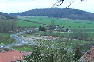
View from the Creuzburg to the southeast to the Schlierberg. |
||
| height | 362.6 m above sea level NN | |
| location | Thuringia ( Germany ) | |
| Coordinates | 51 ° 2 '2 " N , 10 ° 16' 12" E | |
|
|
||
| rock | Red sandstone | |
| particularities | Quarries | |
The mountain Schlierberg has a summit height of 362.6 m above sea level. NN and is part of the Eichsfeld-Hainich-Werratal Nature Park . It is located on the eastern edge of the Werra Valley around Creuzburg in the Wartburg district in Thuringia .
The mountain, which is completely wooded and used for forestry except for the northern edge, is part of the "Creuzburger Stadtwald". The Molkengraben , a tributary of the Madel, rises on its southeast side . There are several abandoned sandstone quarries on the north side.
Individual evidence
- ↑ Official topographic maps of Thuringia 1: 10,000. Wartburgkreis, district of Gotha, district-free city of Eisenach . In: Thuringian Land Survey Office (Hrsg.): CD-ROM series Top10 . CD 2. Erfurt 1999.

