Mühlberg (three of a kind)
|
Muhlberg
Rural Community Three Equals
|
|
|---|---|
| Coordinates: 50 ° 52 ′ 3 ″ N , 10 ° 49 ′ 27 ″ E | |
| Height : | 287 (275-300) m |
| Area : | 22.48 km² |
| Residents : | 1274 (Oct. 5, 2015) |
| Population density : | 57 inhabitants / km² |
| Incorporation : | January 1, 2009 |
| Postal code : | 99869 |
| Area code : | 036256 |
|
Location of Mühlberg in Drei Gleichen
|
|
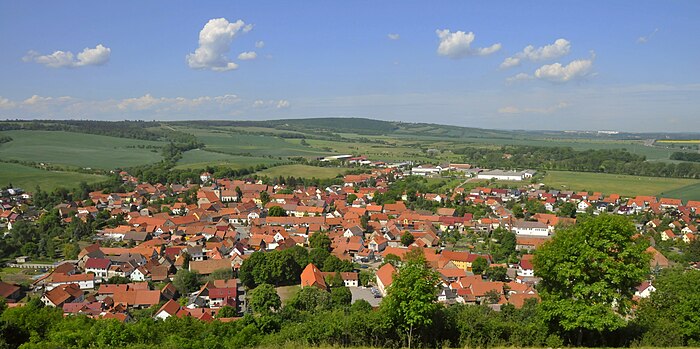
Mühlberg is a typical cluster village in the eastern district of Gotha in Thuringia . Together with Arnstadt and Großmonra , it is the oldest documented place in Thuringia. Since January 1, 2009, the formerly independent municipality has been part of the rural municipality of Drei Gleichen .
geography
Mühlberg is located in Central Thuringia on the southern edge of the Thuringian Basin in the area of the Drei Gleichen at an altitude of 290 m above sea level. NN halfway between Arnstadt and Gotha. South of the village rises the plateau of the Ohrdrufer Platte, an average of 450 meters high, which today is mainly used as a military training area. The Thuringian Basin and the foreland of the Thuringian Forest are delimited by the Eichenberg – Gotha – Saalfeld fault zone, which is visible as two ridges near Mühlberg . These are the Rhönberg and the Kaffberg with the castle hill of Gleichen Castle and the Schlossleite , on the northwestern end of which the Mühlburg was built and which ends at the fortress Wachsenburg in Holzhausen .
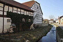
Mühlberg is traversed by the Weidbach , which in earlier centuries operated the mills of the village , reinforced by the water of the Mühlberger Spring . It is created by the union of the Saugraben and Schnepfthal streams in the Gänseweide in the southwest of the village and takes in the Burgbach in the center, which rises in the neighboring village of Röhrensee ( horse fountain ). The Weidbach flows around the Burgberg, past Sülzenbrücken and flows into the Apfelstädt in Neudietendorf .
history
On May 1, 704 Mühlberg was mentioned as Mulenberge together with Arnstadt and Großmonra in a deed of gift from Thuringian Duke Hedan II to the Anglo-Saxon Bishop Willibrord of Utrecht . 740 Boniface traveled through the place. In 1130 the Archbishop of Mainz Adalbert I acquired the location. In the 13th century, Count Meinhard founded a mint in Mühlberg . It was renewed in 1530 by the Archbishop of Mainz, Johannes I. In 1242 the place received market rights . The city of Erfurt acquired the village from Mainz property in 1357 . In 1517, just seven years after Martin Luther's theses were proclaimed , Mühlberg took over Protestant teaching. In 1525 44 Mühlbergers moved to Erfurt and demanded their rights, Hans Hayder, the peasant leader, was beheaded. The plague raged in Mühlberg from 1536 to 1538.
In the course of the following centuries the ownership changed frequently. In 1665 the people of Kurmainz became owners again. A major fire in 1709 destroyed 151 houses, 104 barns and 109 stables. Another fire in 1734 destroyed 115 houses, 97 barns and 215 stables. 1746: 53 buildings burned down. , Demonstrating the importance of Orftes that there are six in Mühlberg 1775 free farms were. In 1802 the Mühlberg exclave became Prussian in the course of the Reichsdeputationshauptschluss and between 1807 and 1813 it belonged to the French Principality of Erfurt . With the Congress of Vienna the place with the neighboring places Röhrensee, Ringhofen, Wandersleben and the castle Gleichen became part of the administrative district of Erfurt , district of Erfurt, as an exclave .
After the land consolidation in 1822, peat cutting began in Apfelstädter Ried in 1825 . In 1651, Duke Ernst the Pious from Gotha issued a fire armament regulation, according to which the places in the duchy had to provide their own fire brigades. As a result, the fire brigade was founded in Mühlberg in 1875. The town hall burned down in 1894. In 1899 the former springmill was converted into a wood goods factory. A dairy was founded in the premises of the Vorwerk in 1904. Further historical dates worth mentioning are the founding of LPG Type III (1953), the 1250th anniversary celebration and the founding of the Heimatbund (1954), inclusion of the location in the model project "Urban Renewal of Federal and State" (1990), renovation of the town hall (1993 ), Completion of the complete renovation of the Vorwerk and the culture barn (1999).
politics
Only with the reorganization of the state in 1945 Mühlberg came to the state of Thuringia and has since been part of the district of Gotha. In 1952 this became part of the newly formed Erfurt district , which lasted until the state of Thuringia was re-established in 1990. On May 21, 1992, the community merged with the neighboring communities of Grabsleben , Seebergen and Wandersleben to form the Drei Gleichen administrative community. From this merger, on January 1, 2009, the community of Drei Gleichen was created. The last mayor before the dissolution was Karsten Ullrich (CDU), who is now the mayor of the district.
Population development
Development of the population (December 31) :
|
|
|
- Data source: Thuringian State Office for Statistics
coat of arms
The coat of arms was approved on November 24, 1994.
Blazon : “In red a silver castle standing on a green mountain with a tinned tower in the middle, accompanied on the right by a silver mill wheel, on the left by a silver six-spoke wheel; the mountain is covered with a silver wave bar. "
Mühlberg is considered the oldest municipality in Thuringia and the new federal states; it was first mentioned in the year 704. The coat of arms depicts the Mühlburg, one of the three equals. The Weidbach, which flows through the town, is indicated by a wave bar. The silver six-spoke wheel, which is also an expression of the historical trade route leading through the town, indicates that Mühlberg was part of the Erfurt countryside. Finally, Mühlrad and Berg stand for the folk etymological interpretation of the place name.
The coat of arms was designed by the Erfurt heraldist Frank Diemar .
Culture and sights
See also: List of cultural monuments in Drei Gleichen (municipality)
- The panorama path of the Geopark , which touches the listed objects, leads through the village .
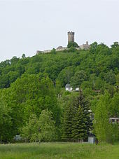
- The most important sight is the Mühlburg , one of the three equals , which rises on the eastern edge of the village .
- The Mühlberger Spring , a powerful karst spring , is also worth seeing.
- The medieval fortified church of St. Luke, first mentioned in 726, is also noteworthy .
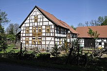
- Mühlberg had a few mills that were operated by the Weidbach , which was mainly fed by the Spring . The oldest and largest mill in town is the Steigmühle. It was first mentioned in 1249 and operated until 1970. The overshot mill wheel has a diameter of five meters. Gustav Freytag mentions the mill in his novel The Nest of the Wrens .
- Gut Ringhofen : The farm on the outskirts in the direction of Wechmar is one of the oldest mentioned individual farms in Thuringia. It was built in the 10th century as the Vorwerk of Gleichen Castle . In 1816 the Prussian king donated the estate to Karl von Müffling, an officer who was highly deserved in the wars of liberation . Here and in Erfurt he spent the last four years of his life. Today there is a riding stables and a golf resort with a restaurant and hotel on the estate .
- Witternscher Hof: The Witterda family is first mentioned in a fiefdom in 1555. In 1619 the Mühlberger line changed its name to von Wittern . 1755 is named as the owner Johann Heinrich Beck; the family's tombstone can still be seen in the Mühlberg cemetery today. From 1953 to 1990 the property was acquired by the LPG and is now used as a privately owned farm.
- Town hall on the market square: It was first mentioned in 1525, was the victim of a fire in 1894 and was rebuilt two years later. In 1992/93 it was completely renovated and modernized. Today it houses a restaurant, private apartments and club rooms. A village linden tree stood in front of the town hall as a natural monument until July 2014 , but it was struck by lightning. Since no new shoots could be found after shortening, the linden tree was felled at the end of July 2017. A replacement planting was carried out nearby in November 2017. There is also an old fountain and a Waidmühlstein on the market square .
- In the southwest of the village, accessible from the Spring via the Geopark hiking trail , through the Saugraben , on the border with the Ohrdrufer military training area, the field name Auf der Ave Maria . In the Middle Ages there was a small chapel here, but only a half-buried brick can be seen.
- About 1500 m further north-west is the Ringhofer or Bergmannsteich : In the late 18th century, a small vitriol mine was also used to mine low-grade hard coal in order to operate a brickworks, among other things. The mine went down in the history of technology in Thuringia: by the later engineer lieutenant Carl Christoph Besser , who worked for the mine from 1763 to 1774, the first functional steam engine in Thuringia was built here and kept in operation for weeks, it served as a permanent one Pumping the pit water and was kept running day and night by two stokers / machinists. However, the mine was destroyed by bad economic and financial decisions. The multi-talented Besser was later employed by Duke Ernst as an engineer and architect for the construction of the Seeberg observatory and other projects in Gotha and lost interest in mechanical engineering.
- The Heiliger-Kreuz-Graben can be found in the east of the Mühlberger district . Only the foundations of the former chapel of the Holy Cross are still preserved, which was used for prayer by the carters on the old copper road running here . After the Reformation, the chapel lost its importance and fell into disrepair.
- A little further the walker meets the sinkhole Schmallthal , a soil fall, and the formed by natural leaching of gypsum rocks in the ground the following thereupon cavities. It was built in the 19th century, but has since been backfilled.
- On September 8, 2013, the Open Monument Day 2013, a replica of a stone cross was ceremoniously erected on the outskirts in the direction of Röhrensee, commemorating a tragic accident on June 8, 1842, in which the 32-year-old miller Friederike Thiel (b. Steubert, daughter of Steigmüller) and her 10-year-old daughter Albertine were struck by lightning. The original stone cross (around 1450) disappeared without a trace in 1982 and has not yet been found despite all efforts. The replica was made on the basis of old photographs on the initiative of a Mühlberg cultural association in a stonemason in Wechmar . Originally the Mühlberg teacher Karl Heepe (1861–1951) described the stone cross in 1916 in the journal of the Thuringian Forest Association and made it widely known. In 1964 the cross was photographed intact for the last time. In 1971 it was badly damaged and demolished.
- Shortly before the Röhrensee boundary is the Neusis desert , which like the settlements Wächs and Matern (both in the local area of the nearby Grabsleben ) fell victim to the Thirty Years War .
The main Jena-Eisenach hiking trail and the Gustav-Freytag-Weg, a hiking trail that leads from Gleichen Castle via the Mühlburg to the Wachsenburg Castle, lead over the Schlossleite . In addition to the Mühlburg with the Radegundis Chapel, the Schlossleite can be found
- the viewpoint Triniusblick . At the end of the 19th century, this lookout point was built in honor of the writer August Trinius , the author of the Rennsteig song and various hiking books.
- the geotope Am Eckardtshög . Here you can get a glimpse of layers of earth and gypsum rock ( Heldburg gypsum ) with an age of around 225 million years. The gypsum was quarried in small quarries (for example the geotope on the Blumenberg and in the alabaster quarry below the Wachsenburg) and used as building material.
- the source Eymersborn. Its water feeds the peat cuttings on the north side of the Schlossleite in the Gleichental.
- Boundary stones : Already in the 16th century, borders were marked with stones bearing the emblem of the rulership, the year the stone was set and a consecutive number. Along the Gustav-Freytag-Weg and on the northern slope of the Schlossleite, the hiker discovered around 80 of these stones, which bear the Mainz wheel as a sign of Mainz sovereignty and the number 1777. The then sovereign, Archbishop and Elector of Mainz, Friedrich Karl Joseph von Erthal , visited the city of Erfurt and the Mühlburg in 1777. In his honor, boundary stones were set in the area of the Schlossleite and the Erthal obelisk was erected on Erfurt Cathedral Square .
Economy and Infrastructure
The most important economic sectors for the place are agriculture, small businesses, handicrafts and tourism. The largest farms are
- the agricultural cooperative Drei Gleichen eG as the economic successor to the former LPG . It operates with 28 employees in addition to the usual agricultural business which consists of (20,000 animals, as of 2012) and ha in crop production to around 2,500 arable land in turkey production, the trading of Agriculture Equipment and manages the estate Ringhofen with the restaurant Taubennest , a 18-hole golf course with a golf school, a guesthouse, a riding stables and a campsite.
- the Biorecycling Spezialerdenproduktion und Vertriebs GmbH
- two country slaughterhouses
- another riding stables
- a gas station.
There are also seven restaurants, pensions and private quarters available.
traffic
Mühlberg is on the L1045 road from Arnstadt via Holzhausen (here is the Wachsenburg ), Röhrensee, Wechmar , Günthersleben to Gotha . There is also a road connection to Wandersleben, 4 km to the north. The nearest train station is there. The A4 motorway with the Wandersleben junction runs right on the northern edge of the village .
There are several regular bus connections from Mühlberg , including those to Erfurt, Gotha and Arnstadt. Since April 2008, the place belongs to the area of the network tariff Central Thuringia .
Personalities
- The Müller family of pastors:
- Johann Friedrich Müller took over the Mühlberg parish in 1828 after having previously worked in Windischholzhausen . He was married to Caroline Trommsdorf, the daughter of the famous Erfurt pharmacist Johann Bartholomäus Trommsdorff . The couple had six children, two of whom were born in Mühlberg. Caroline died in 1843, and JF Müller married Karoline (1795–1861), daughter of Johann Melchior Möller , pastor in Stotternheim, two years later , and had six children with this woman.
- "Fritz" Müller , son from his first marriage, (born March 31, 1821 in Windischholzhausen; † May 21, 1897 in Blumenau , Brazil) became a well-known biologist. He emigrated to Brazil, where he worked as a teacher, farmer and naturalist. He made essential insights into the natural history of the rainforest and, like his brother Hermann, was a supporter of Darwin's theory of evolution.
- Hermann Müller , also son from his first marriage, (born September 23, 1829 in Mühlberg, † August 25, 1883 in Prad am Stilfserjoch , South Tyrol), botanist. He studied from 1848 to 1852 at the universities of Halle and Berlin and received his doctorate in Jena before he became a teacher at a natural science high school in Lippstadt, Westphalia, from 1855 to 1883 . He, too, was friends with Darwin. He is considered to be the founder of the coevolution theory.
- Wilhelm Müller, last son from his second marriage, (born February 17, 1857 in Mühlberg, † February 18, 1940 in Greifswald). After attending primary school in Mühlberg, he followed his brother Hermann to Lippstadt and attended the Ostendorf grammar school there. He then studied natural sciences in Jena, much to Hermann's delight, and stayed with his brother Fritz in Brazil from 1883 to 1885. Also a follower of Darwin, he taught from 1886 at the Ernst-Moritz-Arndt University in Greifswald as head of the zoological institute.
- Justus Menius was vicar and deacon in Mühlberg in 1523
Trivia
The Mühlbergers call themselves and are called Cameroonians by the residents of the neighboring communities . The reason is (currently) not known.
Web links
- Page about Mühlberg on the homepage of the community of Drei Gleichen
- Tourist information in the culture barn
Individual evidence
- ↑ StBA: Area changes on 01/01/2009
- ↑ Locations of the Prussian district of Erfurt in the municipal directory 1900
- ↑ Karsten Grobe: Painting is reminiscent of Müffling. Thuringian newspaper, September 1, 2012
- ↑ Max Berdig: The first steam engine in Thuringia . In: From the Coburg-Gotha lands . Booklet 3. Justus-Perthes-Verlag, Gotha 1905, p. 14-18 .
- ^ Info board from Frank Störzner, Kleinmölsen, in the Kulturscheune, Mühlberg


