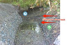
Leina Canal
|
Leina Canal upper course: Small Leina Canal |
||
|
The Leinakanal in Gotha Castle Park |
||
| Data | ||
| Water code | DE : 41682? | |
| location | District of Gotha , Thuringia | |
| River system | Weser | |
| Drain over | Wilder Graben → Nesse → Hörsel → Werra → Weser → North Sea | |
| origin | Artificial bifurcation of the Hörsel overflow Leina at the outdoor pool (above) Schönau vor dem Walde 50 ° 51 ′ 17 ″ N , 10 ° 37 ′ 14 ″ E |
|
| Source height | 381 m above sea level NN | |
| muzzle | Confluence with the Wiegwasser (from there 1.4 km canalised to the confluence with the Wilden Graben ) Coordinates: 50 ° 57 ′ 9 ″ N , 10 ° 42 ′ 23 ″ E 50 ° 57 ′ 9 ″ N , 10 ° 42 ′ 23 ″ O |
|
| Mouth height | 280 m above sea level NN | |
| Height difference | 101 m | |
| Bottom slope | 3.4 ‰ | |
| length | 29.5 km | |
| Catchment area | 29.94 km² | |
| Left tributaries | Small Leinakanal ("upper course" - 11.2 km of the total length) | |
| Right tributaries | Flößgraben (10.6 km) | |
| Medium-sized cities | Gotha | |
| Communities | Leina (community Georgenthal ) | |
The Leinakanal is a medieval artificial river that was created to supply the arid city of Gotha . The technical monument still transports water from the Thuringian Forest over almost 30 km to Gotha.
course
The Leina Canal is created by an artificial bifurcation of the Hörsel overflow Leina near Schönau in front of the forest and is therefore given its name. The tee of the Kleine Leina is approx. 100 m north of the swimming pool. The water reaches Gotha via Emleben . There it flows north of Gartenstraße and east of Remstädter Straße after 29.5 kilometers with the Wiegwasser , from where a 1.4 km long, canalized and west-parallel connecting arm leads to Wilden Graben , which is reached in the north of the city.
The raft or raft ditch was built around three centuries after the Leinakanal was built. It branches off - also as a bifurcation - above Georgenthal from the Apfelstädt . Since the apple city is divided here, this water-technical structure is called divider. In Emleben, the water of the 11.0 kilometer long raft ditch considerably strengthens the 11.4 kilometer long Leinakanal coming from Schönau. The upper part of the Leinakanal from Schönau vd Walde to Emleben has since been called the Kleiner Leinakanal .
meaning
The city of Gotha originally covered its water needs from wells . However, as the population grew, this became more and more difficult. Numerous fires made an adequate water supply more and more urgent. The canal was of fundamental importance for the development of Gotha. For centuries it served to provide drinking , industrial and extinguishing water and as a driving force for mills . With the reinforcement by the raft ditch, it also became a transport route for wood. Throughout the 18th century and the first half of the 19th century, its water was also used to operate the fountains at Friedrichsthal Castle in Gotha and in the orangery . Both systems are located directly below the Leinakanal in the palace gardens of the royal seat.
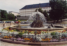
Due to the construction of dams , the importance of the Leinakanal declined sharply, but it has not been extinguished completely up to the present day. Even today, its water fills the Gotha park ponds and the water art on the Gotha main market.
In 1978 the Leinakanal was added to the list of technical monuments and is now listed as a cultural monument in the list of monuments. The coat of arms of the district of Gotha , created in 1991, contains - in the form of a silver wavy line - a stylized image of the Leinakanal.
Numbers
In order to demonstrate the technical masterpiece of medieval surveying , the Leina Canal is examined from its beginning to the former mint in the Gotha Castle Park. From here he (historically) supplied Schloss Friedenstein and Gotha with water through a branched system of pipes and ditches. The gradient in the last part of the Leinakanal was adapted to the natural conditions of the steeply sloping old town of Gotha.
The canal, which is based on the contour lines , measures 28.6 km ( just under 12 km as the crow flies ) between the two viewing points (beginning and coin ). The ratio between the course of the canal and the beeline is 1: 2.38.
The height conditions deserve special attention, as they provide essential clues for the technical masterpiece. The Leinakanal begins at 381 m above sea level. NN . The former mint is 314 m above sea level. NN. The height difference of 66.7 m over the length of 28.6 km results in an average gradient of around 2.3 ‰ ( per mille ). If you consider that the construction of the overshot mills was planned from the beginning, the actual gradient between the mills decreases even further.
If you look at the Flößgraben from the same point of view between its beginning at Georgenthaler Teiler (392 m above sea level) and the confluence with the Kleiner Leinakanal in Emleben (339 m above sea level), then there is a difference in altitude of 53 m and 11.0 km in length a gradient of 4.8 ‰. This is the greatest gradient in the entire Leina Canal system.
History of the Leinakanal
chronology
- 1369 Construction of the Leina Canal from Schönau in front of the forest to Gotha to supply Gotha with water by foreman Conradus under Landgrave Balthasar of Thuringia
- 1647–1653 construction of the raft ditch from Georgenthal to Emleben under Duke Ernst the Pious to increase the water supply of the Leinakanal (extraction of 1/8 of the apple city water )
- 1668 First instruction for the water guards on the Leina canal system
- 1697/98 Expansion of the raft ditch under Duke Friedrich II. To raft logs and firewood from the Thuringian Forest to Gotha (extraction of 1/4 of the apple city water)
- 1733 A raft patent issued under Duke Friedrich III. to promote timber rafting and to protect raft workers
- 1830 Establishment of a timber yard on Reinhardsbrunner Strasse in Gotha
- 1845 Construction of the aqueduct between Sundhausen and Leina on the Gotha- Eisenach railway line
- 1895 Demolition of the Gothaer Bergmühle on the upper main market and construction of the water art (pumping system) and water features in Gotha on the Schloßberg according to plans by Hugo Mairich
- 1910 Construction of the "Leinacanal" station on the aqueduct
- 1978 The canal is included in the "List of Technical Monuments of the GDR "
- since 1990 renovation measures on sections of the Leina Canal
- 1991 Inclusion of the Leinakanal in the coat of arms of the district of Gotha
- In 1994, as part of the new Gotha-Eisenach railway line, construction of a culvert through which the Leina Canal now crosses the railway line
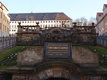
- 1995 Reconstruction of the Gothaer Wasserkunst (pumping system and water features) on the 100th anniversary of its construction in 1895
- 1997 Foundation of the working group Leinakanal at Urania KBV Gotha
- 2006 Foundation of the Leinakanal eV
- 2011 Foundation of the water maintenance association "Flößgraben / Leinakanal" (GUV)
In 2019 the 650th anniversary of the construction of the Leinakanal will be celebrated.
Construction of the canal and the rafting ditch
The Leinakanal was built under the Thuringian Landgrave Balthasar , who belongs to the Wettin family, by his foreman Conradus. Balthasar ruled from 1349 to 1406. There are no documents on the creation of the Leinakanal. It can be assumed that plans to overcome Gotha's existence-threatening water shortage emerged during the first half of the 14th century. Water was abundant in the nearby Thuringian Forest. Even before Friedrich Myconius (1490–1546; reformer ; close confidante of Martin Luther; 1st superintendent of the city of Gotha) the opinion was expressed that Balthasar had a monk pull the water-bearing ditch with a plow. This tradition has been preserved to this day in the form of the legend of the artful monk . Today the view is gaining weight that the construction of the Leinakanal was planned for the long term, that the builders around the foreman Conradus had very precise surveying equipment and methods at their disposal, and that the construction was carried out on a large scale by forced labor.
The construction of the Leinakanal was completed in 1369. The timing of the start of construction is speculative. If one compares it with the construction time of the raft ditch, which was six years, one could come to the conclusion that the construction time of the Leinakanal covered a similar period of time or even longer. On the other hand, comparisons with the construction of Roman aqueducts of a similar size allow the conclusion that much shorter construction times appear possible. The course of the Leina Canal has remained largely unchanged over the centuries and has been preserved to this day. Its water had a positive effect on the development of Gotha's economy. Such trades as the tanners and the brewers could only develop from then on. Grinding, cutting and grinding mills used the water power of the canal to drive them. With the Leina Canal it was possible to operate mills within Gotha's fortifications. As early as 1378, the mountain mill on the Gotha main market was mentioned in historical documents.
The canal's water was initially used as drinking water. However, in the 16th century, the city ordinance stipulated that rubbish could be poured into the Leina Canal. The order allowed: "To pour ashes and scum into the Lyna should not be forbidden to anyone, but to whore the same so that they flow away ...". As a result, the Gothaers had to take drinking water from deep wells and troughs.
Origin of the Leina Canal System

The supply of industrial water to Gotha via the Leina Canal remained unchanged for about three centuries. The increasing demand on the one hand and the karst subsoil in the Schönau canal section on the other hand worsened the situation considerably. In some hot summers, the mills could not be operated because the water seeped away. For this reason, Duke Ernst I of Saxe-Gotha and Altenburg, known as the Pious, initiated the construction of the raft ditch from Georgenthal to Emleben , which was built from 1647 to 1653. Forester David Schmidt provided the plans for this building. With the higher water level , short pieces of tree from the Thuringian Forest could be floated (better: washed) to Gotha.
Since the raft ditch was commissioned, we have been speaking of the Leinakanal system (colloquially still briefly: Leinakanal). Colloquially, it is also noteworthy that 'Leina' or 'Lyn' is still used to this day for some sections of the Leina Canal. Such incorrect names can even be found on maps. The section of the Leinakanal from its cut-off from the Leina to the inflow of the raft ditch has since been called the Kleiner Leinakanal. Only below the admission of the raft ditch is it still called the Leinakanal. With a factual assessment of the not entirely uniform naming, one comes to the conclusion from today's point of view that the Leinakanal system (1.) from the Kleiner Leinakanal, which starts at the tee from the Leina near Schönau in front of the forest, (2.) from the Flößgraben, which branches off at the Georgenthaler Teiler from the Apfelstädt, and (3.) consists of the Leinakanal from Emleben to the confluence with the Gothaer Wiegwasser (end of the Leinakanal).
Since the water of the Leina flows into the Weser and that of the Apfelstädt flows into the Elbe, the Flößgraben crosses a watershed at the same time . In 1697/98 the raft ditch was expanded under Duke Friedrich II of Saxe-Gotha-Altenburg in order to better transport logs and firewood from the Thuringian Forest to Gotha. In 1709/10, Duke Friedrich II even had half of the water in the Apfelstädt channeled into the raft ditch. The Baroque era (around 1600 to 1750), which began in Italy and spread across Europe, also reached the Gotha princes. The preference of baroque princes for artificial bodies of water and water features was reflected in Gotha a. a. under construction of a water art. It was a wooden pumping station that could transport water to Friedenstein Castle. Over the years a ramified system of pipelines was created that supplied ducal facilities, buildings, apartments and ponds as well as wells. Then some of the water flowed back into the Leina Canal, eventually reaching the city and spreading out in the most important streets.
During the Thirty Years' War , the eastern half of the city was cremated in 1632 and 1646. However, the additional water from the raft ditch did not prevent Gotha from being cremated again in 1665. This catastrophe hit the city during the Leinafege (regular cleaning of the entire canal, during which the weirs were closed and the water was drained off via ditches). With the construction of the Gothaer Schloss Friedrichsthal in the years 1708 to 1711, the creation of an associated large baroque palace garden as well as the so-called Ordonnanzgarten (the predecessor of today's orangery ) east below the fortifications of Schloss Friedenstein , ditches were dug, which in the following 150 years supplied the extensive gardens and their fountains with water.
Construction of the aqueduct
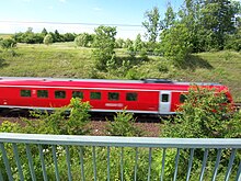
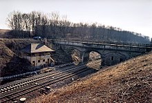
After the conclusion of a state treaty on December 20, 1841 between the Kingdom of Prussia, the Grand Duchy of Saxe-Weimar-Eisenach and the Duchy of Saxe-Coburg and Gotha, construction of the Thuringian Railway began. The planned route should also cross the Leinakanal. In order not to block it, which would have meant its end, an aqueduct was built near Sundhausen over the rail link. With the approval of the entire Thuringian Railway project in October 1844, the approval for the construction of a canal bridge to cross the Leinakanal at kilometer 141.923 was included. Incidentally, this is the highest point on the railway on this route. The earthworks began in 1845. Immediately after the cut into the Memelberg from the direction of Gotha had been made, construction of the canal bridge could begin in spring 1847. The previous course of the canal bed was originally approx. 200 m at an acute angle to today's crossing in the direction of Fröttstädt. This change in sewer routing is one of the few deviations from the original condition.
A three-part vault bridge was created on which a concrete tub for the water of the canal was placed. The main building materials used were limestone from a quarry near Teutleben and seeberg sandstone for filigree components. Originally the single-track management was planned. A block post was built next to the bridge and in 1910 the Leinacanal train station (as it was spelled at the time).
With the completion of the aqueduct in 1845, the timber rafting and thus the wood supply to Gotha on the waterway was stopped.
Other traditional functions of the Leinakanal gradually lost their importance around the turn of the century. The flow of water could be maintained by building the water bridge, but the mills lost their importance. In 1895, the mountain mill in Gotha was demolished and water features, known as Gothaer Wasserkunst , were built on the same spot . For a long time, these water features were driven by a pump that is still working today. This was powered by the Leinakanal itself and is still activated today for special celebrations.
Already at the beginning of the 20th century it was too narrow under the central arch of the aqueduct, the clear width of which was 7.54 m. With the expansion of the block to a crossing and overhaul station in 1912, the central support pillars were walled up somewhat narrower to gain space for the two tracks.
present
With the construction of the Gothaer dam (around 1900) near Tambach-Dietharz, the Ohratalsperre near Luisenthal (1967) and the narrow water dam near Tambach-Dietharz (built from 1988 to 1993) the function of the Leinakanal as a drinking water supplier for the city of Gotha ended.
In 1978 the Leinakanal was included in the Gotha district's list of monuments as a technical monument . In 1991 it found its way into the coat of arms of the district of Gotha, which has been self-governing since 1990 .
When the Eisenach – Gotha railway line was electrified and expanded in 1994 as part of the German Unity No. 7 traffic project , the old route under the aqueduct could not be retained. Above all, the curve radius had to be increased to increase the maximum speed. The railway line was therefore rebuilt immediately north of the aqueduct. The aqueduct was preserved and at the point of the new railway crossing the canal was led as a culvert under the tracks.
Despite some renovation and repair measures in recent years, the existence of the Leina canal system is threatened. Major deficiencies are particularly evident in individual areas of the Kleiner Leinakanal and the aqueduct.
Selection of important conservation measures
After 1990, essential maintenance measures were carried out on the Leina Canal system, for example in the following areas:
- 1992 - Tee off to Obermühle, Wilde Leina
- 1994 - Schönau - Gospiteroda
- 1994 - Leina - Sundhausen and Aqueduct
- 1995 - Restoration of the reconstructed water art on its 100th anniversary
- 1995/96 - Schönau vdW - Leina
- 1996/99 - Emleben - Leina - Boxberg
- 1997 - Reconstruction of the ford through the raft ditch in Emleben
- 1998/99 - Emleben - ford and weir
- 1998/99 - Rehabilitation measures on the Leina Canal from Leina to the aqueduct
- 1999 - Alte Münze area, Lucas-Cranach-Straße (expansion of the pumped storage system for water art) and in Heutal / Breite Gasse
- 2000 - Main street Schönau with the piped Kleiner Leinakanal
- 2000/02 - old coin
- 2001 - inlet at the flood ditch
- 2001 - Georgenthal - Flößgraben
- 2002 - Aqueduct - 1st renovation phase with installation of a stainless steel tub
- 2006 - Gotha-Schlosspark (renovation of 50 m with massive stone construction)
- 2013 - Schönau in front of the forest; Sealing of karst sections by injecting 16 tons of clay into the underground space; Renewal of the weir and a stretch of the canal profile
- 2013 - Refurbishment and complete dam renewal of a section between Sundhausen and the aqueduct
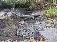
- 2013 - Aqueduct inflow: Renewal of the sedimentation basin, the service walkways, the protective grids and the hydraulic engineering paving in the bank and bed area
Necessary measures
In order to maintain the Leinakanal system, further measures are necessary, which are mainly promoted by the Leinakanal Association:
- Revival of the continuous flax hoe, which until the middle of the 20th century was regularly carried out on the Monday after St. John's Day (June 24th) and before the hay harvest,
- Realization of the next renovation phase on the aqueduct, in which u. a. the bricked-up arch of the bridge is to be exposed, the wrought-iron railing is to be restored, and growth in the masonry and on the foundation is to be removed.
The Freundeskreis Leinakanal eV and many friends of home encourage the implementation of such measures with the help of voluntary helpers, which are urgently needed. That concerns u. a. the removal of debris, floating debris and wild growth as well as the removal of the silt / sludge that has deposited in over 20 years in which no continuous flax clearing took place.
Silt and mud endanger the continued existence of the listed canal
As was clearly visible during the renovation work on the aqueduct (October 2013), around half a meter of silt and silt (probably along the entire course of the canal) has now settled. This raises the channel bottom so far that the profile cross-section is significantly reduced. There is a risk of flooding. At the same time, the water washes out the area in which the roots of the trees and bushes spread. Rotten roots leave leaks in the dam and the water can leak out on a wide front. The seeping water destroys the dam. The burrowing activity of the rodents does the rest.
Exhibition on the Leinakanal in Gotha
An exhibition on the history of the Leinakanal was set up in the Lucas-Cranach-Haus in Gotha (Oberer Hauptmarkt, "Hauptmarkt 17"). In the basement of the building is the largely original and still working water art (pump system with turbine drive and generator from 1895) to supply the Gotha water art (fountain systems and water features) with water from the Leina Canal.
literature
- Albert Doell: Gotha and its water. With a sketch map of the Leina Canal and the raft ditch. Published by the Gotha City Council. Engelhard-Reyher, Gotha 1922.
- Karl Kohlstock : Voyages of Discovery at Home. Volume 8: The main line of the Leinakanal in the city of Gotha (= voyages of discovery in the homeland. 8). 2nd, increased edition. Self-published by the author, Gotha 1926.
- Rudolf Umbreit: The development of the city of Gotha from the founding of the empire to the overthrow. - In: Kurt Schmidt (Ed.): Gotha. The book of a German city. Volume 1. Engelhard-Reyher, Gotha 1931, pp. 255–308, especially p. 261 (supply and disposal of water).
- Ingenieurbüro Kraußer Ohrdruf: The Leinakanal system. Documentation including maps and photos. 1992. - District Office Gotha.
- Helga Raschke : Gotha. The city and its citizens. 2nd, revised and expanded edition. Geiger, Horb am Neckar 1996, ISBN 3-89264-725-9 .
- Wolfgang Möller: Hike on the Leinakanal. Urania Culture and Education Association Gotha e. V., Gotha 1999.
- Helga Raschke: About water workers, millers, tanners and flax farmers. Urania Culture and Education Association Gotha e. V., Gotha 2000.
- Mario Henze: To measure the Leinakanal near Gotha in the 14th century. Dresden 2001, (Dresden, University of Technology and Economics (FH), surveying / cartography, diploma thesis, 2001).
- Wolfgang Möller: The source under the aqueduct. Urgent need for action for the second renovation phase. Train station and aqueduct on the Leinakanal. - In: Gothaer Heimatbrief. Homeland Gotha city and country. No. 46, 2005, ZDB -ID 1420600-6 , pp. 34-35.
- Günter Walter: Aqueduct and Leinakanal station. 1844-1994. 2nd, edited edition. Rockstuhl, Bad Langensalza 2005, ISBN 3-937135-50-2 .
- Hartmut Kraußer: The Leinakanal - an artificially created body of water - history and significance. 2005, (Unpublished lecture and power point presentation - DWA Landesgruppe Sachsen-Thüringen).
- Freundeskreis Leinakanal eV: Brochure "The Leinakanal - A lobby for the (very) old rascal", Gotha, 2017
Web links
- Homepage of the Freundeskreis Leinakanal eV with further information about the canal
- Map of the rivers of Thuringia (TLUG Jena) - PDF, 1.23 MB
Individual evidence
- ↑ a b c d e Technical data on the HP of the Freundeskreis Leinakanal - the specified length of 28.6 km only goes to the mint ; the "above-ground catchment area" of a total of 29.94 km² mainly includes cuts from the river basins of Leina and Apfelstädt.
- ↑ a b c River lengths according to geopaths (kmz, 150 kB)
- ↑ Map services of the Federal Agency for Nature Conservation ( information )
- ↑ History map ( Memento of the original from October 5, 2011 in the Internet Archive ) Info: The archive link was inserted automatically and has not yet been checked. Please check the original and archive link according to the instructions and then remove this notice. (Freundeskreis Leinakanal) - PDF, 1.76 MB
- ↑ Freundeskreis Leinakanal eV: Brochure "The Leinakanal - A lobby for the (old) rascal", Gotha, 2017
- ^ Andreas M. Cramer: The Gotha legends. Told in high German. Cramer and Kretzschmar, Gotha 2005, p. 17.
- ↑ The artful monk at www.echt-gothsch.de
- ^ Karl Friedrich von Strenge , Ernst Devrient : The city rights of Eisenach, Gotha and Waltershausen (= Thuringian historical sources . NF Bd. 6 = Bd. 9, ZDB -ID 548596-4 ). Gustav Fischer, Jena 1909, addendum to document 9, p. 398 .


