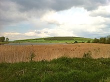
Schloßleite
Coordinates: 50 ° 51 ′ 58 ″ N , 10 ° 50 ′ 18 ″ E
The Schloßleite nature reserve is located in the Gotha district in Thuringia . It extends between the northwestern Mühlberg , a district of the municipality of Drei Gleichen , and the southeastern Holzhausen , a district of the municipality of Amt Wachsenburg in the Ilm district .
West of the area extends the country road L 2163 and L 1045. southeast the North flows Weidbach and passes the A 4 . The 222.7 ha nature reserve Röhnberg extends north and the 18.5 ha nature reserve Apfelstädter Ried extends northeast .
meaning
The 120.3 hectare area with NSG no. 333 was placed under nature protection in 1997.
See also
Web links
Commons : Schloßleite - collection of pictures, videos and audio files
- World Database on Protected Areas - Schloßleite (English)
- Nature reserves (status: 03/2018) - Gotha district on tlug-jena.de, accessed on February 14, 2019


