Spittergrund
|
Spittergrund
|
||
|
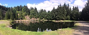
Spittergrund nature reserve (August 2016) |
||
| location | Thuringia , Germany | |
| surface | 160.4 ha | |
| Identifier | 75 | |
| WDPA ID | 319126 | |
| Geographical location | 50 ° 47 ' N , 10 ° 33' E | |
|
|
||
| Setup date | 2001 | |
The Spittergrund nature reserve is located in the Gotha district and in the Schmalkalden-Meiningen district in Thuringia . It extends west of the core town of Tambach-Dietharz along the Spitter , a tributary of the Apfelstädt . The state road L 1028 runs east of the area and flows through the Apfelstädt.
meaning
The 160.4 ha area with the NSG no. 75 was placed under nature protection in 2001.
See also
- List of nature reserves in the district of Gotha
- List of nature reserves in the district of Schmalkalden-Meiningen
Web links
Commons : Spittergrund - collection of images, videos and audio files
- World Database on Protected Areas - Spittergrund (English)
- Nature reserves (status: 03/2018) - Gotha district on tlug-jena.de, accessed on February 18, 2019


