
Wachsenburg Office
| coat of arms | Germany map | |
|---|---|---|

|
Coordinates: 50 ° 51 ' N , 10 ° 51' E |
|
| Basic data | ||
| State : | Thuringia | |
| County : | Ilm district | |
| Height : | 394 m above sea level NHN | |
| Area : | 77.75 km 2 | |
| Residents: | 8007 (Dec. 31, 2019) | |
| Population density : | 103 inhabitants per km 2 | |
| Postcodes : | 99334 (Wachsenburg Office, Kirchheim) , 99102 (Rockhausen) |
|
| Primaries : | 03628, 036202 ( Sülzenbrücken ) , 036200, 0361 (Bechstedt-Wagd, Rockhausen) | |
| License plate : | IK, ARN, IL | |
| Community key : | 16 0 70 028 | |
| LOCODE : | DE WA8 | |
| Community structure: | 13 districts | |
| Address of the municipal administration: |
Erfurter Strasse 42 99334 Wachsenburg Office |
|
| Website : | ||
| Mayor : | Uwe Möller ( CDU ) | |
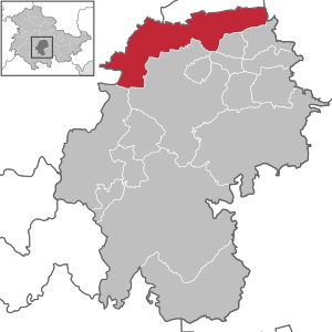
| Location of the municipality of Wachsenburg in the Ilm district | ||
  |
||

Amt Wachsenburg is a municipality in the Ilm district in Thuringia .
geography

The community is located in the extreme north of the Ilm district. The north-western border is also the border between the Ilm district and the Gotha district and thus runs along Ohrdruf , Drei Gleichen and Nesse-Apfelstädt . In the north there is a long border with the independent city of Erfurt , in the east the municipality of Klettbach in the Weimarer Land district borders on Amt Wachsenburg and in the southeast and south the municipalities of Elleben , Elxleben and Alkersleben . In the south and southwest, the municipality is bounded by the district town of Arnstadt and the municipality of Geratal .
The municipality of Wachsenburg consists of the districts Bechstedt-Wagd , Bittstädt , Eischleben , Haarhausen , Holzhausen , Ichtershausen , Kirchheim , Rehestädt , Rockhausen , Röhrensee , Sülzenbrücken , Thörey and Werningsleben . The administrative seat of the municipality is Ichtershausen.
history
The places of the parish had long historical and economic relations with each other. In the 19th century, the Wachsenburg community and the community of Ichtershausen belonged to the office of Ichtershausen and Wachsenburg of the Duchy of Saxe-Gotha and Saxe-Coburg and Gotha, respectively . In the GDR they belonged to the Ichtershausen community association. This cooperation was not continued after 1990. Instead, the city of Arnstadt took on the role of a fulfilling community for the Wachsenburg community from October 18, 1996.
On November 10, 2011, the municipal council of the Wachsenburg municipality decided to cancel the agreement between the fulfilling municipality and the city of Arnstadt. The Arnstadt city council did not make an identical resolution. In surveys of residents in Ichtershausen and the Wachsenburg community, the majority of the residents of both communities supported the merger. In Ichtershausen, with a participation of 57.2 percent, around 95.2 percent of those surveyed voted for the community merger. In the Wachsenburg community, with a participation of 60.5 percent, around 94.3 percent of those questioned were in favor of integration. In addition, the city of Arnstadt had carried out a public survey by November 1, 2011. With a participation of 39 percent, 87 percent of the participants were in favor of the city merging with the Ichtershausen community and the Wachsenburg community in the event of a future municipal reform in Thuringia.
After the approval of the Interior Committee of the Thuringian State Parliament , the State Parliament approved the incorporation on November 22, 2012.
On December 31, 2012, the Wachsenburg community was incorporated into the Ichtershausen community and the extended community was renamed the Wachsenburg district. In Thuringia, however, the term office does not describe an office in the sense of municipal law.
On January 1, 2019, the communities of Kirchheim and Rockhausen were spun off from the Riechheimer Berg administrative community . Kirchheim was incorporated into the Wachsenburg district. For Rockhausen, Amt Wachsenburg became a fulfilling municipality before Rockhausen was incorporated into it on December 31, 2019.
Population development
The population of the districts remained fairly constant for a long time, with the exception of Ichtershausen, which turned into an industrial location at the end of the 19th and 20th centuries and therefore had a relatively strong population growth. After 1990, a strong wave of suburbanization from Erfurt and Arnstadt reached many districts, so that the number of inhabitants rose. Since this wave subsided around 2000, the population has fallen slightly, although the demographic development is somewhat less dramatic than in many other rural communities in Thuringia.
|
|
|
- Data source from 1995: Thuringian State Office for Statistics
- * from 2019 enlarged municipality of Wachsenburg
politics
Municipal council
The municipal council consists of 24 members. After the local elections on May 26, 2019 , the following composition results:
| Parties and constituencies | Seats | Share of votes |
|---|---|---|
| Citizen Active Office Wachsenburg eV | 7th | 29.1% |
| CDU | 6th | 23.7% |
| Street Schools Citizens - Free Wachsenburgers | 5 | 22.5% |
| Free community of voters | 3 | 10.9% |
| The left | 2 | 9.8% |
| Green / Kirchheim citizens' electoral list | 1 | 3.9% |
| Turnout: 68.1% | ||
mayor
The full-time mayor of the Wachsenburg office and the community of Ichtershausen has been Uwe Möller (CDU) since 2010. He was last confirmed in office in a runoff election on June 19, 2016.
coat of arms
Blazon : “Divided in the Goebel cut; at the top in red a silver knight with nimbres and black boots, in his right hand a silver pennant with two black paws, and in his left hand a silver shield with a red cross; behind in green a silver ear with nine grains; below in silver on a green mountain a silver, red-roofed castle with a tower on the right. "1. Amendment to the main statute of October 17, 2014 of the municipality of Wachsenburg from January 8, 2015
flag
The municipality's flag is striped red and white (1: 1) and has the municipality's coat of arms in the center.
Local partnerships
The community of Ichtershausen has had partner relationships with Zierenberg in Hesse since 1990 .
traffic
The districts of Haarhausen and Sülzenbrücken have stops on the Neudietendorf – Arnstadt line , which are served every hour by regional trains of the Erfurt Railway and South Thuringia Railway . These travel to Neudietendorf and Erfurt in the north and to Arnstadt in the south, where the trains are separated. The front part of the train goes to Saalfeld , the rear part to Ilmenau .
Web links
Individual evidence
- ^ Population of the municipalities from the Thuringian State Office for Statistics ( help on this ).
- ^ Thuringian law on the voluntary reorganization of municipalities belonging to the district in 2012 , draft law of the state government, printed matter 5/4714
- ↑ Thuringian Law and Ordinance Gazette No. 14/2018 p. 795 ff. , Accessed on January 3, 2019
- ↑ Thuringian Law and Ordinance Gazette No. 11/2019 of October 18, 2019, p. 385 ff. , Accessed on January 1, 2020
- ^ Source for Schwarzburgische and Saxon places: Johann Friedrich Kratzsch : Lexicon of all localities of the German federal states . Naumburg, 1843. Available online from Google Books . Source for Prussian places: Handbook of the Province of Saxony. Magdeburg, 1843. Available online at Google Books
- ↑ gemeindeververzeichnis.de
- ↑ Michael Rademacher: German administrative history from the unification of the empire in 1871 to the reunification in 1990. (Online material for the dissertation, Osnabrück 2006).
- ↑ TLUG: Environment regional
- ^ Thuringian State Office for Statistics: Elections in Thuringia, City Council Election 2019 in Thuringia, Wachsenburg Office. Retrieved July 19, 2019 .
- ^ Thuringian State Office for Statistics: Elections in Thuringia, Mayoral elections in Thuringia, Wachsenburg Office. Retrieved July 19, 2019 .
Alkersleben | Wachsenburg Office | Arnstadt | Bösleben-Wüllersleben | Dornheim | Elgersburg | Elleben | Elxleben | Geratal | Großbreitenbach | Ilmenau | Martinroda | Osthausen-Wülfershausen | Plaue | Stadtilm | Joke life