
Martinroda
| coat of arms | Germany map | |
|---|---|---|

|
Coordinates: 50 ° 44 ' N , 10 ° 53' E |
|
| Basic data | ||
| State : | Thuringia | |
| County : | Ilm district | |
| Management Community : | Geratal / Plaue | |
| Height : | 400 m above sea level NHN | |
| Area : | 13.24 km 2 | |
| Residents: | 1181 (Dec. 31, 2019) | |
| Population density : | 89 inhabitants per km 2 | |
| Postcodes : | 98693, 99338 (Angelroda) |
|
| Primaries : | 03677, 036207 (Angelroda) |
|
| License plate : | IK, ARN, IL | |
| Community key : | 16 0 70 034 | |
| Community structure: | 2 districts | |
| Address of the municipal administration: |
Marienstrasse 2 98693 Martinroda |
|
| Website : | ||
| Mayor : | Günther Hedwig ( FW Martinroda ) | |
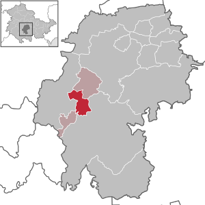
| Location of the municipality of Martinroda in the Ilm district | ||
  |
||


Martinroda is a municipality in the Ilm district in Thuringia in Germany on the Thuringian Porcelain Route .
geography
Martinroda lies between the Gehlberger Thuringian Forest in the south and the Reinsbergen in the north. The Reichenbach flows through the village, coming from the southwest , into which the Titterwind Bach flows in the center of the village and comes from the opposite direction. After taking in the Titterwind, the Reichenbach turns north, where it joins the Zahme Gera after about 8 km near Plaue . Striking in the area is the Veronikaberg with 552 m height in the NSG Veronikaberg , largely congruent with the bird sanctuary Große Luppe-Reinsberge-Veronikaberg . The Veronikaberg is the southernmost tip of the Reinsberge. It consists of shell limestone and is overgrown with beeches. Ilmenau is only 4 km south of the village .
Neighboring communities
Clockwise, starting in the north: Plaue , Ilmenau , Elgersburg , Geratal
Community structure
In addition to the core town of Martinroda, the district of Angelroda belongs to the municipality.
history
The community was first mentioned in 1219 as Mainharderode . A knight Mainhard from Arnstadt is said to have founded an estate here. The place name changed several times: Merdenroda (1500), Meinhart Rote (1559), Marterott . The village was one of the first places under the protection of the Elgersburg, which is only 4 km away . The Reformation was introduced in Martinroda, just like in the rest of the then Henneberg County , in 1544. In 1508 the place came to the office of Ilmenau in the county of Henneberg-Schleusingen and since then has belonged to the Franconian Empire . At that time, an important branch of business was the processing and trading of yew wood and the objects made from it: buckets, cutlery, scooping vessels, cans, boxes, bows and crossbows . The vine stakes were also often made of yew wood. This particularly durable wood was also used in underwater construction. The history of the place is closely linked to the Ilmenaus. Martinroda always belonged to the same state as Ilmenau. In 1583 Martinroda came to Saxony, for the longest time (from 1669 to 1920) Martinroda belonged to the office of Ilmenau and its successor in the Grand Duchy of Saxony-Weimar-Eisenach .
In the Middle Ages Martinroda was on the important trade route Erfurt - Nuremberg , the course of which was similar to today's B4 . This road was paved from 1805 to 1809 between Plaue and Ilmenau . It was named Marienstrasse after the duchess who once financed its construction, Maria Pavlovna . In the Martinrodaer local area the main street is still called Marienstraße today. The road to Heyda was paved in 1847. Martinroda received a rail connection in 1879 on the Erfurt – Ilmenau railway line . The train station is, however, a little north, outside the town ( location → ). In 1883 Martinroda got a school building, which was expanded again in 1901. The Martinrodaer formerly also mined quartz sand, which was mined in pits around the place and sold at markets in the area. This earned the residents the name sand hares . There are also numerous folk songs and poems about the Martinroda sand hares. Quartz sand was needed in glass and porcelain manufacture, among other things. There used to be a porcelain factory in Martinroda. It was founded in 1900 by Friedrich Eger. The connection to the power grid took place in Martinroda in 1911. In 1919 a post office was founded. The local LPG was founded on May 22, 1953. It was one of the larger in the district, as can be seen today in the silos and other operating facilities at the station. For example, in 1965 a dairy farm for 1000 cattle was established. From 1920 to 1952 the place belonged to the district of Arnstadt . The district was divided in 1952 and Martinroda was henceforth part of the Ilmenau district . In 1994 the Ilmenau and Arnstadt districts were reunited under the name Ilm District.
On December 31, 2019, the community of Angelroda was incorporated into Martinroda.
Population development
Development of the population:
|
Data source: from 1994 Thuringian State Office for Statistics - values from December 31st
politics
Martinroda is part of the Geratal / Plaue administrative community .
Municipal council
The council of the municipality of Martinroda consists of 8 councilors:
- Free voters Martinroda : 5 seats
- CDU : 2 seats
- Martinroda volunteer fire brigade : 1 seat
(As of: local election on May 26, 2019)
mayor
The honorary mayor Günther Hedwig was last re-elected on June 5, 2016.
Culture and sights
Buildings
- The Evangelical Church ( location → ) is located with its walled cemetery, a cemetery chapel and the former parsonage on the north-eastern edge of the village, right at the foot of the Veronika Mountain. This is a small typical regional Feldstein 's Church with verschiefertem tower and roof, which is typical for the region. It is not known when the church was built, but its design dates from the Romanesque period. The small church got its present appearance in 1720, when it was converted into an unplastered baroque hall church. The church has various historical fittings and has been a listed building since 1991 .
- The town hall Martinroda ( location → ).
The legend of the hidden barrel
In 1813 the farmers are said to have stolen a barrel of gold from the French soldiers who were passing through Martinroda and Neusiss from the heavily guarded covered wagons and hid it in the dry Gera (the confluence of Reichenbach and Titterwind ). After the soldiers withdrew, the farmers looked for the barrel, but could no longer find it. Apparently the treasure is still under a bridge today. Perhaps it is also a legend that is the Loch Ness from Martinroda might call.
Economy and Transport
Martinroda is characterized by agriculture. The facilities of the former LPG to the north of the village bear witness to this. Today a cattle farm is housed here, the smell of which can be heard from afar. Today most of Martinroda's residents are commuters who drive to Ilmenau to work. The old industrial areas at the train station are designated as a commercial area.
Martinroda is on the former B4 that connected Erfurt with Ilmenau . Roads also lead to Geraberg and Heyda . The place also has a rail connection on the Erfurt-Ilmenau line . The train station is about 2 km north of the village.
Personalities
- Peter Sengelaub (1558–1622), painter and master builder
- Paul Sauerbrey (1876–1932), politician (SPD), born in Martinroda
- Werner George Kimmerling (1913-1995), naval officer , marine engineer of the Reich, war and German Navy , last Flottillenadmiral and stage manager Marine Technology in Admiralty , was born in Martinroda on March 23, 1913
Web links
Individual evidence
- ^ Population of the municipalities from the Thuringian State Office for Statistics ( help on this ).
- ↑ a b c Ulrich Völkel: Gastliches Thüringen , Arnstadt 1993, ISBN 3-929662-00-0
- ^ Historical-topographical description of the mountain town of Ilmenau, p. 93
- ↑ Thuringian Law and Ordinance Gazette No. 11/2019 of October 18, 2019, p. 385 ff. , Accessed on December 31, 2019
- ^ Source for Schwarzburgische and Saxon places: Johann Friedrich Kratzsch : Lexicon of all localities of the German federal states . Naumburg, 1843. Available online from Google Books . Source for Prussian places: Handbook of the Province of Saxony. Magdeburg, 1843. Available online at Google Books
- ^ Michael Rademacher: German administrative history from the unification of the empire in 1871 to the reunification in 1990. Population figures. (Online material for the dissertation, Osnabrück 2006).
- ↑ Population development since 1989 (TLUG) ( Memento from October 29, 2012 in the Internet Archive ) (PDF; 18 kB)
- ^ Elections in Thuringia. Retrieved June 6, 2019 .
- ^ Elections in Thuringia. Retrieved June 6, 2019 .
- ↑ Description of the church on "Ilm-Kreis-Unterwegs.de" ( Memento from December 13, 2013 in the Internet Archive )
- ↑ Description of the church on "Ilm-Kreis.de"
Alkersleben | Wachsenburg Office | Arnstadt | Bösleben-Wüllersleben | Dornheim | Elgersburg | Elleben | Elxleben | Geratal | Großbreitenbach | Ilmenau | Martinroda | Osthausen-Wülfershausen | Plaue | Stadtilm | Joke life