
Plaue
| coat of arms | Germany map | |
|---|---|---|

|
Coordinates: 50 ° 47 ' N , 10 ° 54' E |
|
| Basic data | ||
| State : | Thuringia | |
| County : | Ilm district | |
| Management Community : | Geratal / Plaue | |
| Height : | 330 m above sea level NHN | |
| Area : | 22.69 km 2 | |
| Residents: | 1985 (Dec. 31, 2019) | |
| Population density : | 87 inhabitants per km 2 | |
| Postal code : | 99338 | |
| Area code : | 036207 | |
| License plate : | IK, ARN, IL | |
| Community key : | 16 0 70 043 | |
| City structure: | City and 3 districts | |
City administration address : |
Hauptstrasse 38 99338 Plaue |
|
| Website : | ||
| Mayor : | Jörg Thamm ( CDU ) | |
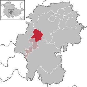
| Location of the city of Plaue in the Ilm district | ||
  |
||


_von_der_Kanzel_aus_gesehen.jpg)
Plaue is a country town in the Ilm district in Thuringia , between the district town of Arnstadt and Ilmenau .
geography
Plaue is about ten kilometers south of Arnstadt . In Plaue the Gera arises from the confluence of the Zahmer Gera and Wilder Gera . The valley slopes around Plaue consist of shell limestone . So numerous bizarre rock forms were formed. There is also a karst spring, the Spring von Plaue . The Reinsberge are to the east of the city . The Geratal is characterized by a relatively mild climate in the area around Plaue .
Neighboring communities
Clockwise, starting in the north: Arnstadt - Ilmenau - Martinroda - Geratal
In the Middle Ages, three villages in the Plaues neighborhood were abandoned. The reasons for this lay in the war events of the time, but also in the plague epidemics. Was abandoned Seigerode, a village in the then Dosdorf eingemeindeten Seiert, a side valley of the Geratals. In 1273 Quittendorf went under, a settlement in the valley of the Bettelsborn, on the Schweinsberger Flur above the village of Kleinbreitenbach, first mentioned in 1414. The village was also abandoned, a place whose name has not been passed down and which was located on the corridor of the same name between Plaue and Gossel today. In the village you can still find cellars and the cistern in the forest, which still collects water. The inhabitants of the village suffered from a lack of water, as there are no springs in this area and at that time no wells could be dug to the very deep water-bearing layers on this plateau. The villagers also did not have their own church and used the “Kirchweg” to Plaue, which is still called today, for going to church.
City structure
The three districts belong to Plaue:
- Kleinbreitenbach , one kilometer to the east
- Neusiß , four kilometers south (since 2019)
- Rippersroda , three kilometers southwest
Surname
In the 10th or 11th century, the place got its name from Wends that had penetrated far to the west . This is suggested by the originally Slavic name Plawy . Plawy or Plawe is the old Polish field name for the place where wood may have been rafted ( plav = swim, raft, flood).
history
Plaue is one of the oldest permanently settled places in Germany. The first settlements took place in the Stone Age and have been reliably proven since the Bronze Age . During the construction of the Arnstadt-Ilmenau railway line, a stool grave was found, which quickly turned out to be part of an extensive grave complex. This cemetery extended to the site of the later iron foundry, but has not yet been developed. The finds from the Stone Age were lost in April 1945 when US soldiers looted and destroyed the collection of the Plauschen school. The remains of a Celtic refugee castle were found on the Rheinsberg , which also indicates a very early settlement. The reasons for the early permanent settlement were probably the strong natural salt springs north of today's city. Very salty water came to the surface by itself. In the early Middle Ages, these salt springs led to a great wealth of the place, which probably also bought the town charter with this money. The Slavs (members of the Wends ) initially only settled on the right bank of the Gera. The site was probably chosen because of the water-rich area, the meadows and forests and probably also because of the salt springs. The name of today's town Plaue goes back to its old Slavic name "Plawe", which means "alluvial land", "flowing" or "swimming". In old records the "Wilde Gera" is called "Wendish Ger", which also explains its name and shows its Wendish origin. The river known today as "Zahme Gera" was formerly called "Alte Gera".
After the fall of the Thuringian Kingdom in 524, the rulers of Plaue often changed. Plaue belonged to the Längwitzgau, over which a landgrave ruled. The rulers often changed and in the 8th century the Hersfeld Abbey also became the owner. Around 1200 various noble families existed in the area around Plaue. The "von Witzfeld" family lived in Plaue. They ran a wagon business on the site of what would later become the porcelain factory, which was partly built on the foundations of the former Vorwerk (Vorspann) and, in particular, to help with the steep sections of the den that began behind Plaue Thuringian Forest crossing trade routes. The von Witzfeld family also owned a larger sheep farm on the parcel that is still called “behind the sheep farm” today.
In 1008 Slavic Christians built a baptistery. The fortified church of Kleinbreitenbach was built around 1200 . The first documented mention of Plaue dates back to 1273. At this time the settlement came to the Counts of Käfernburg-Schwarzburg , who were to administer the land on behalf of the Hersfeld Abbey as bailiffs. The Hersfeld Abbey had appointed the bailiffs as guardians, but they had no real control over this unrestrained noble family, which soon abused their power and harassed the peasants.
In a document from 1273 the village of Plaue is mentioned for the first time with certainty, but also the rule over it by the Kevernburg counts Günther VII. And Günther VIII., Who were enfeoffed with half the rule over Arnstadt (this also included Plaue). Günther the VIII received half of the county in 1280 because he shared the property with his older brother. He died in 1302 and left no male heirs and thus no claim to the inheritance according to the law of succession in force at the time.
From 1280 to 1302 Count Günther VIII ruled over the place and the area. Rudolf von Habsburg, together with a vigilante group from Erfurt, destroyed the Rheinsburg in 1290, which had developed into a robber baron's castle. The robber barons of the Rheinsburg threatened the important long-distance trade routes in the Geratal and Ilm valleys over the ridge of the Thuringian Forest.
Adelheid and Irmgard, the daughters and heirs of Count Günther VIII, sold the property in 1306 to Count von Schwarzburg Heinrich VII., Mr. zu Blankenburg and Günther XII., Mr. zu Schwarzburg.
Henry VII , who ruled from 1285 to 1326 (?), Was a friend of the German Emperor Ludwig IV of Bavaria . When he visited him in Arnstadt in 1323 , he persuaded him to ask the Thuringian Landgrave Friedrich von Thuringia (Ludwig's son-in-law) to allow him to build a castle in Plaue . Friedrich von Thuringia granted this permission to Heinrich VII on July 12, 1324. The document is preserved in the State Archives.
Henry VII died defending the Mark Brandenburg in 1326, possibly as early as 1324, and is buried in Berlin. It is therefore more than likely that he was no longer there when the castle was built. The land fell to his sons Heinrich X. and Günther XXI .
Due to the frequent flooding, the residents finally began to settle above the left bank at the foot of today's Hausberg and to build the Ehrenburg on the mountain.
In 1276 the foundation stone was laid for the Church of Our Lady (more precisely: the Church of the Dear Women). It was built on the walls of an older Slavic chapel. There was a monastery around them. The monks brought viticulture and woad cultivation to Plaue. With the relocation of the village to the local mountain , the area around the church, which was often hit by floods, lost its importance. After the Reformation , the church was significantly enlarged towards the west; around 1700 it was heavily rebuilt. The tower, which until now was more like that of a small fortified church , similar to that of Siegelbach , was increased significantly and doubled in height. The old church was in fact limited to the present sanctuary. According to Professor Overmann, an art historian from Erfurt , the altar shrine dates back to 1420. Two bells hung in the church tower . The larger one had a diameter of 75 cm and a height of one meter. It weighed 7.5 tons. Beneath the coat of arms of the state of Schwarzburg was "Glory to God!" And "Sounds a lot for joy, little for suffering!" Above, on the helmet , it read: "Cast by Cristian, August Maier in Rudolstadt , 1827". This bell was removed and melted down on June 22, 1917 by order of the army command, as were the organ pipes . In 1920 the bell was replaced. The height of the bell is now 75 cm, its diameter 1 m. Its inscription reads: "Glory to God on high".
The smaller bell dates from 1772. Its inscription reads: "In 1772 W. Barth poured me in Erfurth ."
The now abandoned chapel "Sankt Sigismundi" on the local mountain is younger than the main church. It was first mentioned in a Latin document on March 16, 1369. The chapel and the castle in its vicinity fell into disrepair again at the end of the Middle Ages and was rebuilt in 1730 on its old foundation walls . The date is carved in stone above the south entrance of the church. It was completely renovated around 1800, but was only used for Protestant services in the summer months . The altar shrine shows, among others, the Black Burgess noble families around 1500. The small bell, 53 cm in diameter and 600 kg in weight, was taken down on June 6, 1917 and later melted down. It bore the inscription: “I belong to the Church of St. Sigismundi. I sound - I sound, so may my call penetrate deep into your hearts. Cast by Franz Meyer in Rudolstadt 1834 ”. The new bell bears the inscription: "All that breathes, praise the Lord". Contemporary traditions from the early 20th century, such as that of Mr. Apfelstedt, tell of vaults under the altar, which would have pointed towards the castle, but which had collapsed completely. A matching collapsed corridor towards the chapel was also found in the castle cellar. However, there is no evidence of an actual connection between the church and the castle, which is approximately 100 m long. It must also be taken into account that the well-known underground escape route from the castle was in the north. The sewage pipes to the septic tank below the castle were laid in it later during the repairs in the 20th century. The tunnel was only 10 meters long. The chapel was only built over a hundred years after the castle was built, but this does not rule out a later escape tunnel. There are also reports of an escape tunnel that is even longer at 400 m, leading to the site of the later brewery, which at that time was outside the city walls. After the Second World War, the chapel was made available to the Catholic emigrants from the east and it became a Catholic for the first time until it was abandoned after German reunification.
Documents prove that on March 13, 1335, the village of Plaue was given market rights by Emperor Ludwig of Bavaria . In 1345 the city was allowed to build a castle . However, the exact date on which it was granted city rights is unknown. In 1336 Plaue received customs rights . Together with the market law, this resulted in the town law. Other interpretations, however, point to the date 1345, carved into a stone below the castle, as the date on which city rights were obtained. However, this has not been proven. A connection between this carved date and the acquisition of the town charter seems rather unlikely, especially if one considers that the year in which the construction of the castle began was carved on this stone below the castle.
The city's coat of arms was decorated with an upright golden lion on a blue background.
According to traditional documents, salt production in Plaue reached its peak in the years between 1300 and 1400. There are traditions that after the salt springs had dried up, as a remnant of the former glory of Plaue, there was still a velvet sleeve on the town hall, which the incumbent mayor wore on Sundays and presented a pipe smoking at the window.
An older depiction is cited and depicted on a Schützen disc from 1844. It shows, after a traditional inscription a) 2 salt wells, b) Kunstrad , c) Gradierhaus , d) 4 Siedhäuser , e) Housing for salt boilers, f) houses art guards and the Schmid, g) inn and stables, h) brewing, Baking and washing house, i) hut to store the artifacts.
In the Thirty Years' War Plaue was repeatedly occupied. On April 10, 1627 the population was initially able to repel a small imperial force. The next day, Plaue was conquered by a larger imperial troop, but the inhabitants were now able to get to safety in good time and fled into the woods. Shortly afterwards, Danish troops attacked the city and were able to capture and loot it.
The plague from 1346 to 1350 claimed many victims. In 1381 the Kaiser-Günther-Quelle was first mentioned, in 1414 that of Kleinbreitenbach . In 1635, the plague and other diseases again took away around a fifth of the population. Plaue had about 300 inhabitants. In 1638, 33 houses and 18 barns fell to rubble and ashes after being burnt by a disciplined soldier boy from the Electoral Saxon Army . Only two years later, the citizens had to defend themselves against the Swedish soldiers who burned down another 46 houses and 18 barns and destroyed the wooden water pipes.
After various changes within the Schwarzburg family , Plaue remained with Schwarzburg-Sondershausen ( suzerainty ) from 1599 until the state of Thuringia was formed in 1920 .
The salt springs finally dried up in the 16th century, attempts to reactivate them failed in later years. The economy was in decline , also because of the Thirty Years War . Main branches of business were agriculture, cattle breeding and handicrafts. For a while, viticulture was also carried out. After the Thirty Years War, Plaue only had 150 residents.
In the 17th century Plaue became a successful wine-growing region . In 1635, 12,000 buckets of wine were made. However, climate change at the end of the 17th and 18th centuries ( Little Ice Age ) made these branches of industry disappear again. However, the field names such as "Weintal" remained in Plaue.
In the Middle Ages, chatty citizens tried to make a profit by cultivating woad and it can be proven that they sold their woad in Arnstadt, one of the five Thuringian woad towns .
Porzellanmanufactur Plaue
The city experienced an economic boom with the "von Schierholz'schen Porzellanmanufactur Plaue " founded in 1816 . This manufactory was particularly famous for its tables, chandeliers and figurines made of porcelain, but later also for its lithophanes . It fertilized the local industry so enormously that even the city coat of arms was supplemented by the three crowns (removed again after 1945), which von Schierholz received after his elevation to the nobility as a count. The manufacture grew steadily. In the GDR, the factory remained in his possession until the death of "old" Mr. von Schierholz in 1954: Since his son refused to return to the GDR to manage the company, it was expropriated. After reunification and the return of ownership, the state-owned company had to file for bankruptcy due to the lack of competitiveness of the state-owned company during the division of Germany. The work no longer exists today. The administration wing was converted into a residential building and burned down on September 1, 2008 after a lightning strike.
Schierholz family

The von Schierholz family showed themselves to be very close to Plaue and were very socially committed to the place. The park around the now completely dilapidated spring springs and a choir shell on the site between the former waterworks at the spring spring and the von Schierholz brewery (opened in 1852, closed in the 1970s and burned down on November 24, 2001) were created at their expense opposite the castle park and the former kindergarten, which was sold after the fall of the Wall. The von Schierholz family also founded a mineral water bottling factory, the Karl-Marien-Quelle Plaue. This was expropriated in the GDR and returned to the owners after the fall of the Wall. The company was completely modernized after the reunification, after five years, the expiry of the binding period for the subsidies for modernization, but led to bankruptcy. The modern new bottling plant was expanded and transferred to the parent company in Bavaria. In the meantime, only her office complex (January 28, 2012), but also the “Massenmühle” outbuildings were burned down by arsonists on August 21, 2012.
Jews in Plaue
The first Jew in Plaue was the trader Heinemann Lang from Höchheim bei Römhild , who settled in Plaue with his family in 1819. They were accepted as " protective relatives " after they could show impeccable testimonies of their good behavior, harassed with special charges, but ultimately became valued members of the citizenry. He was followed by the cutlery dealer Hirsch Wolf, who was also harassed with some compulsory levies. He had to pay 250 Reichstaler into the city's treasury , which was paid at 4% interest when he wanted to get married, and he lost almost all of his assets in the city fire of August 12, 1828. The payment into the city treasury was not a levy, but a compulsory loan that he had to grant the city, but which was paid back to him with the agreed low interest when he left the city. The Jewish community grew to eight families, but many soon moved on. There was no unity among the Israelites ; on the contrary, the families were at odds. In their synagogue (the Brombergschen house right next to the town hall) there was frequent discord. The dispute raged primarily over the stalls in the temple and the city court had to intervene. The city government took over the supervision of the community, which soon fell apart. The city billed the Jews as annual expenses:
- 10 Reichstaler rent for the synagogue
- 10 groschen levy for the burial place (it is located outside the city walls below the castle and has been preserved)
- 2 Reichstaler for the maintenance of the bathhouse (it was in the garden of the later Gasthof Adler)
- 10 Reichstaler rent for the "school premises" (the classroom) and the teacher's apartment (in the Karl Eulenstein house on Hauptstraße)
- 10 Reichstaler for heating the rooms
- 97 Reichstaler, 20 Groschen for the salary of the teacher and the butcher
- 20 Reichstaler salary for the lead singer
The Jewish teacher also had to be fed by the Jews themselves. This happened in the form that every week he received his meal from a different Jewish family.
In 1845 there were only four Jewish families left in Plaue. Despite the move to Arnstadt, the Jews from Arnstadt continued to use the cozy Jewish cemetery, as there was no Jewish cemetery in Arnstadt. The last Jew born in Plaue was Louis Wolf, who like all other Jews left Plaue, moved to Arnstadt and died there on November 20, 1914. He was the last Jew to be buried in the Jewish cemetery in Plaue on November 22, 1914. All Jews left Plaue for economic or personal reasons. As wealthy citizens, they were all valued members of the upper class.
19th century to the present
In 1822 the town hall was demolished for 4,000 thalers and rebuilt. In 1828 another major fire destroyed 28 houses with barns. The rifle house was built in 1836. In 1852 a brewery and then several smaller industrial companies were founded. In 1871 Plaue again had 1,121 inhabitants and 154 houses. The castle was built in 1872. In 1879 the rail connection to Arnstadt and Ilmenau was established , and in 1884 to Suhl . The still existing mineral springs were taken in 1884 and since then their water has been marketed as medicinal and mineral water until the 1990s under the name Karl-Marien-Quelle .
On July 1, 1950, the previously independent municipality of Kleinbreitenbach was incorporated.
The von Schierholz family's castle was used as a cinema from the 1950s onwards, and several apartments in the castle were also partitioned off. From 1973 the castle belonged to the Erfurt shoe factory "Paul Schäfer", who wanted to convert it into a holiday home for their employees. This failed thoroughly. Ceilings were torn down, a steel girder was installed in the large hall, which was previously used as a cinema, to accommodate a new false ceiling, new ceilings were never installed. The conversion came to a standstill after a few years. The basement was rented to the LPG , which stored potatoes there. The moisture crept into the walls and by the end of the 1970s the castle was uninhabitable. The ruins were blown up in the summer of 1986. The upstream, then filled in, large well has now been restored. The large castle park with the pond and the “grotto”, a high walled swimming pool from the time of Schierholz's, and the log cabin in the park were taken over by the trust and sold after the fall of the Wall. Plauesche citizens no longer have access there today.
Plaue was included in the FDGB's holiday service from 1959 and soon developed into a spa town. In addition to the scenic location, the very good transport links to important tourist destinations in Thuringia were also responsible for this. After the fall of the Wall, the city administration relied on tourism as a source of income. A tourism company was founded and within a few years it ruined the city in a financially sustainable manner. After the insolvency of the GmbH after only a few years, the city was left with several million debts and has so far not been able to recover.
In 1994 Plaue came to the Ilm district. On January 1, 1996, the city joined the Upper Geratal administrative community based in Graefenroda .
On February 13, 2008, the city council voted for the abandonment of Plaue's independence and incorporation into the neighboring district town of Arnstadt because of the hopeless financial situation . However, the merger was not completed.
On January 1, 2019, Neusiß was incorporated into Plaue. At the same time the administrative community of Upper Geratal was dissolved, whereupon Plaue joined the administrative community of Geratal. This was then renamed the Geratal / Plaue administrative community .
Population development
In 1831 the city had 603 inhabitants. The number of inhabitants rose through the advancing industrialization to 1487 by the year 1885. In the following decades the number of inhabitants rose to over 2100. Between the world wars , just over 1,700 people lived in Plaue. Plaue reached its peak after the Second World War , when over 3,000 people lived in the city as a result of the influx of resettlers. Since then the number of inhabitants has fallen and stabilized in the GDR at around 2300 (with Rippersroda), but has fallen again slightly since 1990. In 2004 there were fewer than 2000 inhabitants for the first time.
Development of the population:
|
|
|
|
Data source: from 1994 Thuringian State Office for Statistics - values from December 31st
politics
City council
The city council of Plaue consists of 12 members. After the local elections on May 26, 2019 , the following composition results:
| Parties and constituencies | Seats | Share of votes in% |
|---|---|---|
| CDU | 5 | 45.4 |
| Citizens for Plaue | 3 | 26.7 |
| Citizens' initiative Plaue | 2 | 12.7 |
| UWG - Independent Association of Voters | 1 | 8.2 |
| Citizens' initiative Neusiss against excessive local taxes | 1 | 6.9 |
| total | 12 | 100.0 |
| voter turnout | 69.6% | |
mayor
Jörg Thamm (CDU) has been the mayor since October 2004, he was confirmed in office in 2010 and 2016.
coat of arms
Blazon : "In blue a golden lion with a red tongue and armor."
The coat of arms of Plaue shows the black castle lion. Seals from the beginning of the 15th century have the same image but vary in type. The originally crowned lion is now led uncrowned.
Culture and sights

Remarkable buildings in terms of cultural history:
- To the west above the city is the Gothic castle ruin Ehrenburg from 1324. The ruin has been prepared for residential purposes and was sold to the British by the trust establishment after the fall of the Wall .
- The Liebfrauenkirche from the 12th century with its Romanesque core is the oldest building in the town.
- The St. Sigismund Chapel near the Ehrenburg also goes back to a medieval building and was rebuilt on its foundation walls in 1730. It is believed that the original chapel was related to the castle. After the Second World War it became the Catholic Church for the resettlers, after the fall of the Wall it was desecrated and is now to be converted for residential purposes.
- The site's Jewish cemetery , which was laid out in 1826 and where the Jews who died in Arnstadt and Ilmenau were buried, extends on a slope between the local cemetery and Ehrenburg . The cemetery can only be viewed, not entered and is maintained.
- In addition to the stained glass windows donated in 1913 to the Liebfrauenkirche , the municipal celebration hall is decorated with a stained glass window that was created in 1910 in the Wilhelm Franke workshop in Naumburg .
- To the east of the city, on one of the Reinsberg mountains, are the remains of the Reinsburg , which goes back to a Celtic fortress . It was probably destroyed by Erfurt troops as a robber baron castle in the late 13th century.
- At the end of the Second World War, concentration camp prisoners were driven towards Stadtilm by SS men . Six Soviet prisoners who were murdered in the Zimmer Valley (near Plaue) were buried in the cemetery. A stele erected in Bahnhofstrasse has been a reminder of the death march of prisoners from the Buchenwald subcamp since 1984.
The spring spring

The spring spring is an extremely strong karst spring with an output of 600 to 800 liters per second. After just 100 m from the main spring, it was driving the first mill wheel . In September 1893, the government architect Bramigk and mill owner Woltersdorf from Arnstadt proved the connection between the spring and the seepage of the Zahmer Gera behind Liebenstein . Attempts previously made with dyes failed due to the filter effect of the karst rock . In the course of an hour and a half, 20 quintals (1 t) of salt were poured into the Tame Gera. The normal salinity of the spring spring is 0.6%. Four and a half hours after the introduction of the salt, the salt content rose to 1.2%, only to decrease to 0.7% after four hours. The connection was proven, but new questions were raised. The long time it took for the salt water to get from the point of introduction to the source, which is only 4 km away, and the ultimately only slight increase in the salt content, only allows one conclusion: there must be fine-pored karst rock between Liebenstein and Plaue and there must be a larger underground one Lake exist, which has not been localized to this day (although it has never been searched for). The existence of larger underground cavities is also supported by larger earth collapses between Liebenstein and Plaue, the largest of which are the Juden- und Kaisergrube and the sinkholes at the horse stables (hall designation), some of which are over 50 m in diameter and more than 10 m deep.
The Zahme Gera is also not the only underground inflow to the Springquelle, as its outflow is three to five times greater than the infiltration of the Zahmer Gera near Liebenstein.
The spring has only dried up twice in extremely dry summers since records began.
Economy and Infrastructure
The economy of Plaue is characterized by small businesses.
Water and sewage
The district of Neusiß is supplied by the water and wastewater association Arnstadt and the surrounding area . The rest of the city is served by the water and wastewater association “Obere Gera” .
traffic

Plaue is on the 3004 state road between Arnstadt and Ilmenau , which was federal road 4 until the opening of federal motorway 71 in 2003 . Furthermore, roads lead from Plaue to Gräfenroda , Rippersroda and Kleinbreitenbach .
The railway reached Plaue in 1879 when the Arnstadt – Ilmenau railway line was being built. 1883 still the route Plaue- came Gräfenroda - Suhl - Meiningen / Schweinfurt added. Since then, the Plaue (Thür) station has been a separation station . The regional express Erfurt – Würzburg ( Mainfranken-Thuringia Express ) from DB Regio Südost stops every two hours . In addition, the regional trains Erfurt – Ilmenau stop every hour and the regional trains Erfurt – Meiningen of the Süd-Thüringen-Bahn stop every hour , Monday to Friday there are also a few express trains going to Meiningen.
Personalities
- Johannes Purgold (* mid-15th century in Plaue; † 1534), also Purgoldt ; City clerk of Eisenach and lawyer
- Sidonia Hedwig Zigarunemann (born January 15, 1711 in Erfurt; † December 11, 1740 in Plaue), poet, one of the first emancipated women in Germany
- Karl Seitz (born September 4, 1869 in Vienna; † February 3, 1950 ibid), Austrian politician (SPÖ), Mayor of Vienna and Federal President , was exiled to Plaue for a few months at the end of the Second World War .
- Elly Linden (born April 25, 1895 in Plaue; † January 23, 1987 in Lübeck), German politician (SPD), member of the state parliament of Schleswig-Holstein
- Albert Stange (born January 17, 1899 in Plaue, † in the 20th century), German politician (NSDAP)
- Carl Stade (* May 2, 1900 in Plaue; † January 5, 1945 in Weimar, executed with the guillotine), resistance fighter against the Nazi regime
literature
- Felix Georgi: Chronicle of the city of Plaue . Frauendorff, Leipzig 1927.
Web links
Individual evidence
- Leaflet of the city of Plaue for the festival week “675 Years of City Law” from August 13th to 15th, 2010
- ^ Population of the municipalities from the Thuringian State Office for Statistics ( help on this ).
- ↑ a b c d Chronik der Stadt Plaue, by Felix Georgi, 1927, publisher: A. Frauendorff, p. 7
- ↑ Chronik der Stadt Plaue, by Felix Georgi, 1927, publisher: A. Frauendorff, p. 15
- ↑ a b Chronicle of the City of Plaue, by Felix Georgi, 1927, publisher: A. Frauendorff, p. 8
- ↑ Chronik der Stadt Plaue, by Felix Georgi, 1927, publisher: A. Frauendorff, p. 13
- ↑ Chronik der Stadt Plaue, by Felix Georgi, 1927, publisher: A. Frauendorff, p. 9
- ↑ Thüringer Sagen, Eugen Diederichs, 1926, Jena, p. 340
- ↑ Christopher Clark : Prussia , p. 52
- ↑ a b Chronik der Stadt Plaue, by Felix Georgi, 1927, publisher: A. Frauendorff, p. 10
- ^ A b Chronicle of the City of Plaue, by Felix Georgi, 1927, publisher: A. Frauendorff, p. 164
- ^ A b c Chronicle of the City of Plaue, by Felix Georgi, 1927, publisher: A. Frauendorff, p. 165
- ↑ Thuringian Law and Ordinance Gazette No. 14/2018 p. 795 ff. , Accessed on January 3, 2019
- ^ Source for Schwarzburgische and Saxon places: Johann Friedrich Kratzsch : Lexicon of all localities of the German federal states . Naumburg, 1843. Available online from Google Books . Source for Prussian places: Handbook of the Province of Saxony. Magdeburg, 1843. Available online at Google Books
- ^ Michael Rademacher: German administrative history from the unification of the empire in 1871 to the reunification in 1990. Population figures. (Online material for the dissertation, Osnabrück 2006).
- ↑ Population development since 1989 (TLUG) ( Memento of the original from October 29, 2012 in the Internet Archive ) Info: The archive link has been inserted automatically and has not yet been checked. Please check the original and archive link according to the instructions and then remove this notice. (PDF; 18 kB)
- ↑ Municipal council elections 2019 in Thuringia, Plaue, city. Thuringian State Office for Statistics, accessed on June 29, 2019 .
- ↑ http://arnstadt.thueringer-allgemeine.de/web/lokal/politik/detail/-/specific/Joerg-Thamm-bleibt-Plaues-erster-Mann-33181406
- ↑ New Thuringian Wappenbuch Volume 2, page 16; Publisher: Arbeitsgemeinschaft Thüringen eV 1998 ISBN 3-9804487-2-X
- ↑ Thuringian Association of the Persecuted of the Nazi Regime - Association of Antifascists and Study Group of German Resistance 1933–1945 (ed.): Heimatgeschichtlicher Wegweiser to places of resistance and persecution 1933–1945, series: Heimatgeschichtliche Wegweiser Volume 8 Thüringen, Erfurt 2003, p. 148 , ISBN 3-88864-343-0
- ↑ Chronik der Stadt Plaue, by Felix Georgi, 1927, publisher: A. Frauendorff, pp. 21-23
Alkersleben | Wachsenburg Office | Arnstadt | Bösleben-Wüllersleben | Dornheim | Elgersburg | Elleben | Elxleben | Geratal | Großbreitenbach | Ilmenau | Martinroda | Osthausen-Wülfershausen | Plaue | Stadtilm | Joke life