
District of Ilmenau
| Basic data (as of 1994) | |
|---|---|
| Existing period: | 1952-1994 |
| District : | Suhl |
| Administrative headquarters : | Ilmenau |
| Area : | 346.82 km² |
| Residents: | 67,912 (Dec 31, 1989) |
| Population density: | 196 inhabitants per km² |
| License plate : | O (1953-1990) OG, OH, OI (1974-1990) IL (1991-1995) |
| Postcodes : | 63xx (old) |
| Circle structure: | 28 municipalities (December 31, 1989) |
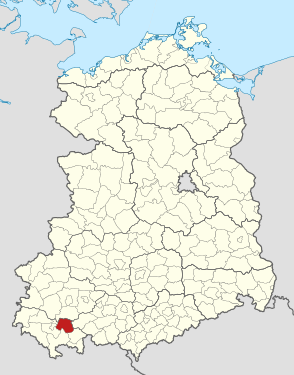
| Location of the district in the GDR | |
  |
|

The Ilmenau district was a district in the Suhl district of the GDR . From 1990 to 1994 it existed as the district of Ilmenau in the state of Thuringia . His area is now in the Ilm district in Thuringia. The seat of the district administration was in Ilmenau .
geography
location
The Ilmenau district was in the northeast of the former Suhl district and was the only district in the district that was mostly north of the Rennsteig . It bordered in the north on the Arnstadt district ( Erfurt district ), in the east on the Rudolstadt district ( Gera district ), in the southeast on the Neuhaus am Rennweg district (Suhl district), in the south on the Hildburghausen district (Suhl district) and in the southwest to the district of Suhl-Land (district of Suhl).
The Ilmenau district was one of the most densely forested in the GDR. The proportion of forest was around 70% of the total area. The district area was almost entirely in the Thuringian Forest , only the places Heyda , Bücheloh , Gräfinau-Angstedt and Wümbach were not in the forest. The highest mountains in the district were the Kickelhahn near Ilmenau (861 m), the Große Finsterberg (944 m) and the Große Eisenberg (907 m), both of them Schmiedefeld . Another distinctive mountain range was the Lange Berg (808 m) near Gehren .
The most important watercourses in the district were the Ilm , the Zahme Gera and the Wohlrose .
Most important places
According to the spatial plan, Ilmenau was a middle center and Gehren, Großbreitenbach, Gräfinau-Angstedt, Geraberg and Schmiedefeld were sub-centers or small centers .
Neighboring areas
The district of Ilmenau bordered in a clockwise direction in the north, beginning with the districts of Arnstadt , Rudolstadt , Neuhaus , Hildburghausen and Suhl-Land and the urban district of Suhl .
Dialects
Three dialects were represented in the district area. Central Thuringian was spoken in most of the district . These included the cities of Ilmenau, Langewiesen, Geraberg and Geschwenda and the villages that surrounded them. The second dialect , also belonging to the Thuringian dialect group, was Ilmthuringian in the cities of Gehren and Großbreitenbach and the surrounding places in the southeast of the former district. Hennebergisch , an East Franconian dialect , was spoken in the three villages south of the Rennsteige (Schmiedefeld, Frauenwald and Vesser) .
However, the classification only concerned the general language coloring. Due to the isolated location in the mountains, there have been major differences even between neighboring villages in terms of sentence structure, choice of words and the use of one's own vocabulary over the 500 years of settlement history. So has z. B. Geraberg local dialect has little in common with that of the neighboring village Geschwenda, although both places are in the Central Thuringian dialect area. With practiced hearing it is therefore possible to assign a resident to his home village immediately. This phenomenon is much less pronounced in the lowlands.
history
The area of the Ilmenau district was settled between the 12th and 15th centuries. The oldest places in the district are Langewiesen (1198), Elgersburg (1139) and Gehren (1105) and the youngest places in the district are on Rennsteig , z. B. Neustadt (1453), Altenfeld (1492) and Stützerbach (1506). After the district area was under the influence of the Counts of Henneberg and Schwarzburg in the Middle Ages, the Hennebergs died out in the early modern period and the Schwarzburgers divided their inheritance. In 1920 six states had possessions in the Ilmenau district, these were: Saxe-Weimar-Eisenach (Ilmenau), Saxe-Coburg and Gotha (Geraberg), Saxe-Meiningen (Neustadt), Schwarzburg-Sondershausen (Gehren, Großbreitenbach), Schwarzburg -Rudolstadt (Gräfinau, Böhlen) and Prussia (Schmiedefeld).
Administrative history since 1922
In 1922, the Arnstadt district was formed, to which most of the district area initially belonged. During the administrative reform of 1952 , 14 districts were formed in the GDR . The area of the Arnstadt district was initially planned in the Erfurt district , but this would mean that it would be too large and the neighboring district of Suhl too small. So it was decided to add parts of the Erfurt district to the Suhl district. Since Ilmenau was the closest town to Suhl, the area was integrated into the Suhl district and the Ilmenau district formed, despite its location on the north side of the Thuringian Forest. This measure met with rejection among the population, as the infrastructure towards Erfurt was well developed (federal road and railway line), while the traffic routes to Suhl were not well developed (no railway connection, unfavorable road connections). In addition, people felt more culturally, historically and geographically connected to Central Thuringia than to South Thuringia.
On May 17, 1990 the district became the district of Ilmenau. When German reunification took place on October 3, 1990 , the state of Thuringia was re-established and the districts dissolved. From then on, the district of Ilmenau belonged to this state. He was assigned the vehicle registration number IL, which replaced the O (for the Suhl district) on the license plate. In 1993 the regional reform for Thuringia was decided. Since the district of Ilmenau was relatively small, it should be merged with another. The districts of Suhl and Arnstadt were in discussion . The decision was then made for the latter variant, as it seemed more sensible to divide the district of Suhl into the districts of Hildburghausen and Meiningen. The district of Ilmenau and the district of Arnstadt merged with effect from July 1, 1994 to form the Ilm district .
Population development
| year | Residents |
|---|---|
| 1910 | 54,228 |
| 1955 | 68,300 |
| 1960 | 67,707 |
| 1975 | 68,438 |
| 1989 | 67,912 |
The number for the year 1910 refers to the area of the later GDR district of Ilmenau.
politics

The district seat was in Ilmenau. The district office or the district council and the district council were located on Wetzlarer Platz in the city center until the end of the 1960s, and later in a new building complex on Krankenhausstrasse in the south of Ilmenau. The SED district leadership and the Stasi were housed in buildings from the 1930s on the castle wall in Ilmenau. There were also some detention cells in the basement of the Stasi building.
The district council was always provided by the SED until 1990, after which Benno Kaufhold ( CDU ) was the last district administrator in the Ilmenau district (1990 to 1994).
economy
The restructuring of the economy in the Ilmenau district was planned and directed by the GDR government. The process of centralization of the economy in the district began, which was essentially complete in the mid-1970s. In the past, all towns had more or less large factories, but these have now been closed and new combines established. The plan was that the smaller villages would be de-industrialized and larger operating units were to be created in the medium-sized towns. One industry was specially promoted for each region. For Gräfinau-Angstedt (with the villages of Wümbach and Bücheloh) these were agriculture and the production of food and the processing of agricultural products. Agriculture (facilities in Martinroda) and the thermometer industry were selected for Geraberg (with Geschwenda, Martinroda and Elgersburg). The latter was concentrated in a large plant in Geraberg with 2000 employees (the Geratherm company emerged from the TWG ). The glass and porcelain industries were concentrated in Ilmenau. Around 4,000 people worked in the glass factory in Ilmenau and around 2,000 people in the Henneberg porcelain factory . For Gehren (with Langewiesen, Möhrenbach, Jesuborn and Pennewitz) the wood industry was decisive. The largest sawmill in the GDR was built at Gehrener Bahnhof. The glass industry and relay technology were concentrated in Großbreitenbach (with Neustadt, Altenfeld, Gillersdorf, Herschdorf, Willmersdorf, Allersdorf, Gillersdorf, Friedersdorf, Böhlen and Wildenspring) . For Schmiedefeld am Rennsteig (with Stützerbach, Frauenwald and Vesser) the glass industry and tourism were selected and promoted.
traffic
Three trunk roads (today's federal roads) and four railway lines ran in the district area:
- F4 / B4 : Erfurt - Arnstadt - Ilmenau - Schleusingen
- F87 / B87 : Ilmenau - Stadtilm - Weimar
- F88 / B88 : Gotha - Ohrdruf - Ilmenau - Königsee - Rudolstadt
- Railway line Plaue – Ilmenau : Plaue - Ilmenau (railway stations in the district: Martinroda, Geraberg, Elgersburg, Roda and Ilmenau )
- Ilmenau – Themar railway line : Ilmenau - Schleusingen (- Themar ) (railway stations in the district: Ilmenau , Ilmenau Bad, Manebach, Stützerbach, Rennsteig station , Schmiedefeld)
- Railway line Ilmenau – Großbreitenbach : Ilmenau - Gehren - Großbreitenbach (stations in the district: all)
- Rennsteig – Frauenwald railway line : Rennsteig - Frauenwald station (stations in the district: all; closed in the 1960s)
Communities
The municipalities of the district were reorganized with the regional reform in 1994 and again in 2018/2019 , whereby the majority of the former district belongs to its former district town Ilmenau.
| Surname | Whereabouts in 1994 | Remaining after reform 2018/2019 |
|---|---|---|
| Altenfeld | Independent, joining VG Großbreitenbach | Formation of the rural community Großbreitenbach (2019) |
| Bohlen | Independent, joining VG Großbreitenbach | Formation of the rural community Großbreitenbach (2019) |
| Bücheloh | Formation of the Wolfsberg community | Incorporation to Ilmenau (2018) |
| Elgersburg | Independent, joining VG Geratal | |
| Frauenwald | Independent, joining VG Rennsteig | Incorporation to Ilmenau (2019) |
| Friedersdorf | Independent, joining VG Großbreitenbach | Formation of the rural community Großbreitenbach (2019) |
| Miter , city | Independent, joining VG Langer Berg | Incorporation to Ilmenau (2018) |
| Geraberg | Independent, joining VG Geratal | Formation of the rural community Geratal (2019) |
| Geschwenda | Independent, joining VG Oberes Geratal | Formation of the rural community Geratal (2019) |
| Gillersdorf | Independent, joining VG Großbreitenbach | Formation of the rural community Großbreitenbach (2019) |
| Gräfinau-Angstedt | Formation of the Wolfsberg community | Incorporation to Ilmenau (2018) |
| Großbreitenbach , city | Independent, joining VG Großbreitenbach | Formation of the rural community Großbreitenbach (2019) |
| Herschdorf | Independent, joining VG Langer Berg | Accession to VG Großbreitenbach (2018), formation of the rural community Großbreitenbach (2019) |
| Heyda | Incorporation to Ilmenau | |
| Ilmenau , district town | Independent | |
| Langewiesen , city | Independent | Incorporation to Ilmenau (2018) |
| Manebach | Incorporation to Ilmenau | |
| Martinroda | Independent, joining VG Geratal | |
| Möhrenbach | Independent, joining VG Langer Berg | Incorporation according to Gehren (2013), thereby incorporation to Ilmenau (2018) |
| Neustadt am Rennsteig | Independent, joining VG Langer Berg | Accession to VG Großbreitenbach (2018), formation of the rural community Großbreitenbach (2019) |
| Oberpörlitz | Incorporation to Ilmenau | |
| Oehrenstock | Incorporation to Langewiesen | Incorporation to Ilmenau through Langewiesen (2018) |
| Pennewitz | Independent, joining VG Langer Berg | Incorporation to Ilmenau (2018) |
| Schmiedefeld am Rennsteig | Independent, joining VG Rennsteig | Incorporation to Suhl (2019) |
| Stützerbach | Independent, joining VG Rennsteig | Incorporation to Ilmenau (2019) |
| Vesser | Incorporation to Suhl | |
| Wild spring | Independent, joining VG Großbreitenbach | Formation of the rural community Großbreitenbach (2019) |
| Wumbach | Formation of the Wolfsberg community | Incorporation to Ilmenau (2018) |
More places
- Roda , incorporated into Ilmenau in 1939
- Unterpörlitz , incorporated into Ilmenau in 1981
- Jesuborn , incorporated in Gehren in 1950
- Willmersdorf , incorporated into Herschdorf in 1984
- Allersdorf , incorporated into Herschdorf in 1984
License Plate
Motor vehicles (with the exception of motorcycles) and trailers were assigned three-letter distinctive signs starting with the letter pairs OG , OH and OI from around 1974 to the end of 1990 . The last number plate series used for motorcycles was OZ 60-01 to OZ 80-00 .
At the beginning of 1991 the district received the distinctive sign IL . It was issued until January 31, 1995. It has been available in the Ilm district since November 29, 2012 .
Individual evidence
- ↑ Law on the self-administration of municipalities and districts in the GDR (municipal constitution) of May 17, 1990
- ↑ Federal Statistical Office (Ed.): Municipalities 1994 and their changes since 01.01.1948 in the new federal states . Metzler-Poeschel, Stuttgart 1995, ISBN 3-8246-0321-7 .
- ^ Norbert Moczarski et al: Thüringisches Staatsarchiv Meiningen. Department of the Regional Economic Archive South Thuringia in Suhl . A brief inventory overview. Ed .: Thuringian State Archives Meiningen. 1st edition. Druckhaus Offizin Hildburghausen, 1994, Development of traditional industrial areas in South Thuringia until 1990, p. 16-24 .
- ↑ Andreas Herzfeld: The history of the German license plate . 4th edition. German Flag Society V., Berlin 2010, ISBN 978-3-935131-11-7 , pp. 302 .
- ↑ Andreas Herzfeld: The history of the German license plate . 4th edition. German Flag Society V., Berlin 2010, ISBN 978-3-935131-11-7 , pp. 554 .
Web links
1922–1952: Altenburg | Altenburg (city) | Apolda (city) | Arnstadt | Arnstadt (city) | District Department Camburg | Eisenach | Eisenach (city) | Erfurt | Erfurt (city) | Gera | Gera (city) | Gotha | Gotha (city) | Greiz | Greiz (city) | Heiligenstadt | Hildburghausen | County of Hohenstein | Ilfeld | Jena | Jena (city) | Langensalza | Meiningen | Mulhouse | Mühlhausen (city) | Nordhausen (city) | Rudolstadt | Saalfeld | Schleiz | Schleusingen | Reign of Schmalkalden | Sondershausen | Sonneberg | Stadtroda | Weimar | Weimar (city) | Weissensee | Worbis | Zella-Mehlis (city) | Ziegenrück . 1952–1994: Altenburg | Apolda | Arnstadt | Artern | Bad Salzungen | Eisenach | Eisenberg | Erfurt-Land | Erfurt (city) | Gera-Land | Gera (city) | Gotha | Greiz | Heiligenstadt | Hildburghausen | Ilmenau | Jena-Land | Jena (city) | Langensalza | Lobenstein | Meiningen | Mulhouse | Neuhaus / Rwg. | Nordhausen | Pößneck | Rudolstadt | Saalfeld | Schleiz | Schmalkalden | Schmölln | Sömmerda | Sondershausen | Sonneberg | Stadtroda | Suhl-Land | Suhl (city) | Weimar-Land | Weimar (city) | Worbis | Zeulenroda .