Oberpörlitz
|
Oberpörlitz
City of Ilmenau
|
|
|---|---|
| Coordinates: 50 ° 42 ′ 7 ″ N , 10 ° 54 ′ 51 ″ E | |
| Height : | 565 m |
| Area : | 3.67 km² |
| Residents : | 1192 (Jan. 1, 2019) |
| Population density : | 325 inhabitants / km² |
| Incorporation : | October 16, 1993 |
| Postal code : | 98693 |
| Area code : | 03677 |
|
Location map of Oberpörlitz
|
|
Oberpörlitz is a district of the city of Ilmenau in the Ilm district ( Thuringia ).
geography
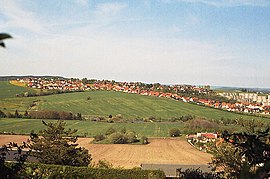
Oberpörlitz is located on the top of the Pörlitzer Höhe at about 585 meters above sea level. The old village lies in the lee of the Oberpörlitzer Höhe, while the residential area on the southern slope is unprotected from wind and weather. To the south, Oberpörlitz flows over into Ilmenau. The area of the local corridor is 3.67 km², of which about 41% is forested, 45% is arable land and pastures and about 2% is water. The remaining 12% are settlement areas. Due to the location of the place at the front of the Pörlitzer Höhe, it is usually windier there than in the surrounding area.
The Rottenbach runs south of the village .
history
Oberpörlitz was first mentioned in a document in 1351 and incorporated into the city of Ilmenau in 1993 . A close relationship had always existed between Oberpörlitz and Ilmenau. At no time did the place have its own church, so the residents attended the Ilmenau service and were buried in the Ilmenau cemetery. For example, Oberpörlitz became known as the Ilmenau kitchen village , as the people of Oberpörlitz had to pay their church tax in kind (namely wood, wool or kitchen herbs) instead of in cash. The Oberpörlitz villagers leaned in the 17th / 18th. Century against the sometimes rigidly acting Ilmenau officials. There was no freedom of trade and practically no self-administration, but reports have been made by mayors in Oberpörlitz since 1632.
Until 1559 the place belonged to Unterpörlitz , after which it was allowed to administer itself. The Thirty Years' War brought heavy devastation to the place. While it only cost about 30% of the population in Ilmenau, it was over 65% in Oberpörlitz. The Seven Years' War also brought hardship and misery to the local residents. One of Oberpörlitz's problems has always been the scarcity of water , as the village is located on a hilltop and therefore the groundwater is very deep. This was remedied in 1893 when a water pipe was laid from Roda to Oberpörlitz. The Oberpörlitzer School was not built until 1899 and closed again in 1950. Until then, the children attended the Ilmenau schools. The village was connected to the electricity network in 1913, the gas network in 1926 and the sewage network in 1928.
At the end of the Second World War (on April 10, 1945, to be precise), the US troops shelled the village and destroyed five houses. The damage amounted to 180,000 Reichsmarks . After the Second World War, many new facilities were opened in Oberpörlitz, e.g. B. the 1958 swimming pool in the Leiterbachstal, which was finally closed after 1990 (renaturation of the terrain).
In the years 1995 to 2002 a residential area was built in the southwest of the place, in which about 900 people live.
Population development
- around 1450: ~ 30 inhabitants
- 1705: ~ 70 inhabitants
- 1804: 104 inhabitants
- 1879: 147 inhabitants
- 1901: 256 inhabitants
- 1912: 356 inhabitants
- 1932: 378 inhabitants
- 1964: 353 inhabitants
- 1990: 332 inhabitants
- 1993: 408 inhabitants
- 1995: 527 inhabitants
- 1997: 694 inhabitants
- 2000: 1055 inhabitants
- December 31, 2002: 1229 inhabitants
- December 31, 2003: 1240 inhabitants
- June 30, 2004: 1234 inhabitants
- June 30, 2005: 1255 inhabitants
- June 30, 2006: 1290 inhabitants
- June 30, 2007: 1290 inhabitants
- June 30, 2012: 1339 inhabitants
politics
The local mayor is Wolfgang Heinz. The Oberpörlitz local council has eight members.
Culture
Oberpörlitz is one of the few villages in the Ilm district that does not have its own church or cemetery. The residents have always attended the Ilmenau church service.
There is a large riding stables with a riding hall in the village.
Economy and Transport
Oberpörlitz is home to the headquarters of the green heart publishing house, Thuringia's largest tourist publishing house, and the RhinoVerlag, which are regionally important publishers.
In the industrial park on the B4 west of the town, about 60 companies have settled. The village used to have important agriculture.
There are roads to Ilmenau , Unterpörlitz , Roda and Martinroda . In 1998 , the Pörlitzer Höhe stop on the Erfurt – Ilmenau railway line was laid out 1.5 km southeast of the town .
About 2 km from the village in the direction of Martinroda is the Ilmenau-West junction of the Thuringian Forest A 71 motorway .
Others
The local dialect name for Oberpörlitz is "Iberperltz".
literature
- Carola Müller: Oberpörlitz in Die Ortsteile der Stadt Ilmenau , Stadt Ilmenau (Ed.) 2001, ISBN 3-00-007916-5 .
Web links
Individual evidence
- ↑ Official Gazette of the City of Ilmenau 02/2019. City of Ilmenau, March 8, 2019, p. 10 , accessed April 23, 2019 .


