
Klettbach
| coat of arms | Germany map | |
|---|---|---|

|
Coordinates: 50 ° 55 ' N , 11 ° 9' E |
|
| Basic data | ||
| State : | Thuringia | |
| County : | Weimar Country | |
| Management Community : | Crane field | |
| Height : | 385 m above sea level NHN | |
| Area : | 15.23 km 2 | |
| Residents: | 1295 (Dec. 31, 2019) | |
| Population density : | 85 inhabitants per km 2 | |
| Postal code : | 99102 | |
| Area code : | 036209 | |
| License plate : | AP, APD | |
| Community key : | 16 0 71 043 | |
| LOCODE : | DE W2Q | |
| Association administration address: | Alexanderstraße 7 99448 Kranichfeld |
|
| Website : | ||
| Mayor : | Franziska Hildebrandt | |
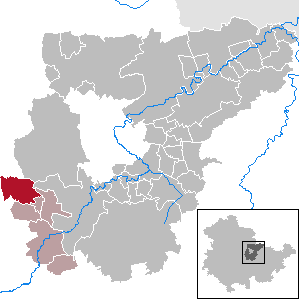
| Location of the municipality of Klettbach in the Weimarer Land district | ||
  |
||

Klettbach is a municipality in the southwest of the Weimarer Land district and part of the Kranichfeld administrative community . It consists of the districts Klettbach and Schellroda .
geography
Klettbach is located about 11 km southeast of the city center of Erfurt in a valley between the southwestern, about 410 m above sea level. NN. high valley mountain and the northeast, 438 m above sea level. NN high hill with the post mill. The valley through which a stream flows, which rises in the northeast of the village, slopes down to the southeast. The state road L 1052 runs parallel to the stream from Erfurt to Kranichfeld . At the beginning of the 1990s, a new building area with single-family houses formed on the south-eastern edge of the town. In the east of this area lies the Niederstedt desert . A few hundred meters further south the brook flows into the Tonndorfbach coming from Schellroda , which in turn flows into the Ilm after flowing through Nauendorf and Tonndorf near Munich . In the north, the A4 runs with the Erfurt-Ost junction , which means that the town has good transport links.
history
Klettbach
The first documentary mention of Klettbach was in 1370. Half of the place belonged to the dukes of Saxe-Weimar and the other half to the archbishops of Mainz (part of the Erfurt area ). From 1815 the entire place Klettbach was part of the Grand Duchy of Saxony-Weimar-Eisenach and became part of the Soviet occupation zone in 1945 and the GDR in 1949 .
Schellroda
The Rundlingsdorf is located directly on the edge of the large forest area (Aspenbusch nature reserve) south of Erfurt. It is first attested in the 11th century as Schelminrode and Schelmcherode , 1251 as Schelmenrode and even 1397 as Schelmenrade , so that this place name can be interpreted as "clearing of the Schelmes" or the "Schelme". The word “Schelm” has a long and complicated history in German, so that the current meaning of this naming can hardly be explained satisfactorily.
In the forest area west of Schellroda there was an underground army ammunition facility during World War II , which was used by the military and then by the People's Police . Since the 1990s ammunition has been disposed of there by the "Westspreng" company. This was replaced in 2008 by the Spanish company “maxam” with a “plant schellroda”. This is where industrial explosives are produced. The area is 19 hectares and is strictly secured.
In 1793 a fire brigade was mentioned in Schellroda.
Since the reunification in 1990 Klettbach has belonged to the newly founded Free State of Thuringia . The Kranichfeld administrative community was founded on January 1st, 1992.


politics
Municipal council
The municipal council in Klettbach consists of twelve council members who were elected in the local elections on May 25, 2014 in a proportional representation, and the honorary mayor as chairman.
The distribution of seats in the municipal council:
| choice | CDU | Klettbach tradition and future | total |
|---|---|---|---|
| 2014 | 5 | 7th | 12 seats |
mayor
Mayor of Klettbach is Franziska Hildebrandt, who was elected on May 26, 2019.
Attractions
Klettbach:
- St. Trinitatis Church with churchyard : the originally Gothic church was rebuilt in1721. At that time it received a rectangular church hall with a mansard roof , a choir room with corner blocks and a tower with a tail hood , open lantern , tower button , weather vane and a cross at the top, which is part ofthe church's lightning protection system . The windows are rectangular, on the west side there is a covered gallery staircase . The current appearance dates from 1724, a pointed arched sacrament niche can be discovered as the remainder of the Gothic structure on the east side of the choir. The pulpit altar dates from 1725. The church includes a circumferential double gallery, a wooden barrel vault and a wooden font from the 18th century. The church has 270 seats, with standing room there is room for around 400 visitors.
- The organ probably comes from Schröter from 1725; it was restored in 1993. The 7-tower organ front is richly decorated and flanked by angels blowing trumpets, David playing the harp can be seen in front. In 1901 the interior of the church was given its current color scheme and painting. The restoration began on the initiative of the Friends of the Klettbach Church in March 2009. In front of the church there is a memorial in honor of the fallen and missing of the two world wars.
- Several old farmsteads adorn the location
- The post mill northeast of the village (see main article → Post mill Klettbach ) is also a crowd puller.
Schellroda:
- Basically, Schellroda is worth seeing because of its layout as a round village .
- The church of St. George celebrated its 275th anniversary in 1998, which indicates that it was first mentioned in 1723, although the tower is probably much older. It was probably dedicated to Saint George. In 2008 she received the organ of the evangelical church of Bad Berka , financed by surpluses of the Thuringian state lottery in the amount of € 1700.00. Repairing the old organ would have been too expensive for the community.
Culture and sport
The social and cultural life of Klettbach and Schellroda is essentially shaped by these associations:
- After work e. V.
- Fire Brigade Association Klettbach
- Kindergartenförderverein e. V.
- Schellroda fun fair association
- Mill Association Klettbach e. V.
- Schellroda Club e. V.
- Schellrodaer rifle club
- Schützengesellschaft Klettbach e. V.
- Spielvereinigung Klettbach e. V.
The sports field in Klettbach's north also has a volleyball field and seating.
Individual evidence
- ^ Population of the municipalities from the Thuringian State Office for Statistics ( help on this ).
- ↑ Jakob Dominikus: Erfurt and the Erfurt area. According to geographical, physical, statistical, political and historical conditions. An award typeface co-crowned by the Academy of Useful Sciences in Erfurt. Part 2. Carl Wilhelm Ettinger, Gotha 1793, p. 217 .
- ↑ Michael Keller: Explosives in the middle of an idyll between a fire pond and trees. In: Thüringische Landeszeitung , August 27, 2016.
- ^ The Regional Returning Officer Thuringia: Municipal elections 2014, city and municipal council elections .
- ^ Website of the municipality .
- ↑ Press release of the MdL. Mike Mohring on his website.
Web links
At Ettersberg | Apolda | Bad Berka | Bad Sulza | Ballstedt | Blankenhain | Buchfart | Dobrich | Eberstedt | Ettersburg | Frankendorf | Grammetal | Big herring | Großschwabhausen | Hammerstedt | Hetschburg | Hohenfelden | Ilmtal Wine Route | Kapellendorf | Kiliansroda | Kleinschwabhausen | Klettbach | Crane field | Lehnstedt | Magdala | Mechelroda | Mellingen | Nauendorf | Neumark | Niedertrebra | Obertrebra | Oetter | Rannstedt | Rittersdorf | Blacksmiths | Tonndorf | Umpferstedt | Vollersroda | Wiegendorf