
Big herring
| coat of arms | Germany map | |
|---|---|---|
 Help on coat of arms |
Coordinates: 51 ° 6 ′ N , 11 ° 40 ′ E |
|
| Basic data | ||
| State : | Thuringia | |
| County : | Weimar Country | |
| Fulfilling municipality : | Bad Sulza | |
| Height : | 140 m above sea level NHN | |
| Area : | 6.04 km 2 | |
| Residents: | 656 (Dec. 31, 2019) | |
| Population density : | 109 inhabitants per km 2 | |
| Postal code : | 99518 | |
| Area code : | 036461 | |
| License plate : | AP, APD | |
| Community key : | 16 0 71 022 | |
| Address of the municipal administration: |
Kösener Str. 10 99518 Großheringen |
|
| Website : | ||
| Mayor : | Jens Baumbach | |
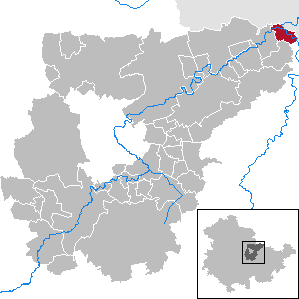
| Location of the community Großheringen in the Weimarer Land district | ||
  |
||

Großheringen is a municipality in the northeast of the Weimarer Land district . The fulfilling municipality is the city of Bad Sulza . The 128 kilometer long Ilm flows into the Saale in the village .
geography

Großheringen is located in the Weimarer Land district in northeast Thuringia on the border with Saxony-Anhalt, about 15 km northeast of the district town of Apolda. The Ilm and the Saale flow through the municipality, the confluence of the Ilm in the Saale is directly below the place Großheringen.
In addition to the place that gave it its name, the municipality also includes Unterneusulza, north of the Ilm and Thuringian Railway , as well as Kaatschen-Weichau , known for its viticulture , on the Saale, about 2 km above the mouth of the Ilm.
Neighboring communities are Bad Sulza , Schmiedehausen and Dornburg-Camburg in Thuringia and Naumburg (Saale) and Lanitz-Hassel-Tal in Saxony-Anhalt.
history

Großheringen was first mentioned in 874 under the name Heringa . The place belonged to the Schenk von Tautenburg family until it died out in 1640 . Due to this ownership history, Großheringen was a place that belonged as an exclave to the Electoral Saxon Office of Tautenburg until 1815 . With the Congress of Vienna he came to the Grand Duchy of Saxony-Weimar-Eisenach and was affiliated with the Dornburg office.
The village of Untereusulza was created in connection with the salt works in the Ilm valley (1623 construction of a salt works).
On July 1, 1950, the then independent municipality Untereusulza was incorporated. Kaatschen-Weichau was incorporated in 1974.
Culture and sights
Attractions


- Salt bridge, house bridge over the Ilm from 1753, extensively renovated in 1991
- Millstone of a woad mill at the Place of Peace, also known as the “Plan”
- Großheringen Church , hall church, built in 1723 using older components. Pulpit altar from the time of origin.
Regular events
- Mardi Gras (Mardi Gras Saturday)
- Village Festival (annually on the 2nd weekend in July)
- Weinbergfest in Kaatschener Dachsberg (September 1st weekend)
Partner municipality
Žinkovy in Plzeňský kraj , Czech Republic
Economy and Infrastructure
Established businesses

The sanitary equipment supplier Viega has been manufacturing piping systems in a large plant in Großheringen since 1992. The resulting trade tax income (gross 2008: 3.7 million euros, 2009: 3.2 million euros, 2010: 3.7 million euros, corresponds to around 5000 euros per inhabitant compared to a district average of 230 euros per inhabitant) in terms of tax revenue per capita, one of the richest communities in Thuringia.
Transport links

Due to its location at the confluence of two large rivers, Großheringen is conveniently located for a railway junction. The first railway line from Halle / Leipzig to Erfurt ( Thuringian Railway ) through the town was opened in 1874. It runs north in the Saale Valley and south in the Ilm Valley. Today it is two-pronged and electrified. Until December 2015 it was part of the ICE connection Leipzig / Frankfurt (Main) . In 1876 another important railway line was added with the Saalbahn ; it branches off the Leipzig – Erfurt railway line in Großheringen and continues south in the Saale valley via Jena , Saalfeld (Saale) , Kronach and Bamberg to Nuremberg . Today it is also two-track and electrified and was part of the ICE line Berlin - Munich until December 2017, which however used the connecting curve towards Saaleck and thus drove east past Großheringen. Another railway line that begins in Großheringen is the peppermint railway to Sömmerda , which opened in 1874 . It is a single-track, non-electrified branch line, on the eastern section of which passenger traffic was discontinued in December 2017.
Regional trains run from Großheringen in the direction of Weimar - Erfurt - Eisenach , Naumburg (Saale) - Weißenfels - Halle (Saale) and Jena - Saalfeld (Saale).
On December 24, 1935, Großheringen suffered the worst train accident in Thuringian history. 34 people died.
tourism

Important tourist routes such as the Saale-Radweg , Ilmtal-Radweg , Saale-Unstrut-Elster-Radacht and the Saale-Unstrut Wine Road run through the municipality.
Personalities
- Elvira Zahn, wine queen in Saale-Unstrut 2009/2010
Individual evidence
- ^ Population of the municipalities from the Thuringian State Office for Statistics ( help on this ).
- ^ History of large herring on the town's homepage
- ^ Karlheinz Blaschke , Uwe Ulrich Jäschke : Kursächsischer Ämteratlas 1790. Scale approx. 1: 200000. Gumnior, Chemnitz 2009, ISBN 978-3-937386-14-0 , p. 34 f.
- ↑ Geographical overview of the Saxon-Ernestine, Schwarzburg, Reussian and adjacent lands. Perthes, Gotha 1826, p. 54 .
- ↑ Tax revenue of the community Großheringen at the Thuringian State Office for Statistics
Web links
At Ettersberg | Apolda | Bad Berka | Bad Sulza | Ballstedt | Blankenhain | Buchfart | Dobrich | Eberstedt | Ettersburg | Frankendorf | Grammetal | Big herring | Großschwabhausen | Hammerstedt | Hetschburg | Hohenfelden | Ilmtal Wine Route | Kapellendorf | Kiliansroda | Kleinschwabhausen | Klettbach | Crane field | Lehnstedt | Magdala | Mechelroda | Mellingen | Nauendorf | Neumark | Niedertrebra | Obertrebra | Oetter | Rannstedt | Rittersdorf | Blacksmiths | Tonndorf | Umpferstedt | Vollersroda | Wiegendorf