
Dobrich
| coat of arms | Germany map | |
|---|---|---|

|
Coordinates: 50 ° 55 ' N , 11 ° 29' E |
|
| Basic data | ||
| State : | Thuringia | |
| County : | Weimar Country | |
| Management Community : | Mellingen | |
| Height : | 355 m above sea level NHN | |
| Area : | 8.36 km 2 | |
| Residents: | 233 (Dec. 31, 2019) | |
| Population density : | 28 inhabitants per km 2 | |
| Postal code : | 99441 | |
| Area code : | 036454 | |
| License plate : | AP, APD | |
| Community key : | 16 0 71 013 | |
| Association administration address: | Karl-Alexander-Str. 134a 99441 Mellingen |
|
| Mayoress : | Susann Hoerl | |
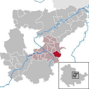
| Location of the municipality of Döbritschen in the Weimarer Land district | ||
  |
||


Döbritschen is a municipality in the south of the Weimarer Land district and part of the Mellingen administrative community in Thuringia. It consists of the places Döbritschen and Vollradisroda .
geography
Döbritschen is located at the foot of the northern roof of the stone hill , an extension of the western limestone slopes of the Saale valley around Jena in the transition to the arable plain near Mellingen and Weimar . In contrast, Vollradisroda only has free access to the Feldmark on the northern edge of the hamlet . On the other side of the forest is up to the hamlet.
history
Finds indicate a settlement of the place since the Neolithic Age. The first written mention of the place took place in 1190. In 1290 the village was owned by the family of Schenken von Döbritschen. In 1332 Döbritschen passed from the taverns of Nidda into the possession of the Counts of Weimar-Orlamünde. The former moated castle, located in the middle of the village, was a medieval manor and 45 × 80 m surrounded by a wall with a protective moat. It was destroyed in 1450. The village church has been built on the wall. The Counts of Lichtenhain followed later, later the Vitztume von Apolda and the Kapellendorf monastery. In the early 19th century, Döbritschen became a chamber property of the Grand Duchy of Saxony-Weimar-Eisenach . In 1923, Albin Gellert cultivated the 96 hectare domain.
The district Vollradisroda is first mentioned in 1311 as "Volradesrode", the name means clearing settlement of a Vollrad. The village was destroyed in the Saxon civil war and only partially settled again after 1700. It had been the Vorwerk of the Döbritschen Chamber Estate since the 19th century. Around 1900 Vollradisroda had 38 inhabitants. On October 16, 1923, Vollradisroda was incorporated into Döbritschen.
traffic
The provincial road 1060 is reached via a connecting route.
Culture and sights
- The Protestant church is a rectangular, plastered and massive hall church from 1583. It has a stately western roof tower on the mansard roof of the renovation of 1723. At the end of the 19th century a polygonal, neo-Gothic apse was added and the interior was painted. Inside there is a flat wooden barrel vault and a single-storey gallery as well as the rest of a pulpit altar from the 18th century. The bell from 1518 is from Heinrich Ziegler from Erfurt.
- Remains of the former fortifications from the 12th century

Village street in Döbritschen

Apse at the village church

View of the village from Döbritschen

War memorial in Döbritschen


Web links
Individual evidence
- ^ Population of the municipalities from the Thuringian State Office for Statistics ( help on this ).
- ↑ Thomas Bienert: Medieval castles in Thuringia. 430 castles, castle ruins and fortifications. Wartberg Verlag, Gudensberg-Gleichen 2000, ISBN 3-86134-631-1 , p. 84.
- ↑ Jürgen Gruhle: Black Book of Land Reform Thuringia. Retrieved June 25, 2011.
- ↑ Stephanie Eißing and others: Thuringia (= Handbook of German Art Monuments . ). Revision. 2nd, revised and supplemented edition. Deutscher Kunstverlag, Munich 2003, ISBN 3-422-03095-6 , p. 215.
At Ettersberg | Apolda | Bad Berka | Bad Sulza | Ballstedt | Blankenhain | Buchfart | Dobrich | Eberstedt | Ettersburg | Frankendorf | Grammetal | Big herring | Großschwabhausen | Hammerstedt | Hetschburg | Hohenfelden | Ilmtal Wine Route | Kapellendorf | Kiliansroda | Kleinschwabhausen | Klettbach | Crane field | Lehnstedt | Magdala | Mechelroda | Mellingen | Nauendorf | Neumark | Niedertrebra | Obertrebra | Oetter | Rannstedt | Rittersdorf | Blacksmiths | Tonndorf | Umpferstedt | Vollersroda | Wiegendorf