
Kiliansroda
| coat of arms | Germany map | |
|---|---|---|

|
Coordinates: 50 ° 55 ' N , 11 ° 22' E |
|
| Basic data | ||
| State : | Thuringia | |
| County : | Weimar Country | |
| Management Community : | Mellingen | |
| Height : | 335 m above sea level NHN | |
| Area : | 4 km 2 | |
| Residents: | 174 (Dec. 31, 2019) | |
| Population density : | 44 inhabitants per km 2 | |
| Postal code : | 99441 | |
| Area code : | 036453 | |
| License plate : | AP, APD | |
| Community key : | 16 0 71 038 | |
| Association administration address: | Karl-Alexander-Str. 134a 99441 Mellingen |
|
| Website : | ||
| Mayor : | Siegfried Hoffmann | |
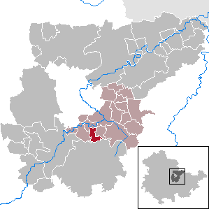
| Location of the municipality of Kiliansroda in the Weimarer Land district | ||
  |
||

Kiliansroda is a municipality in the south of the Weimarer Land district and part of the Mellingen administrative community in Thuringia.
location
The place is south of the federal motorway 4 near Mellingen and on the northern edge of the forests around Buchfart . The soils are formed from weathered shell limestone .
history

The clearing site was first mentioned in 1441 as Kiligesrode. In 1719 the estate was sold by Countess Anna Elisabeth von Gleichen and Hatzfeld and Count Franziskus Lotharius to Hans Georg Becker and his brother Hans Heinrich Becker. In 1923 Elise Becker was the owner of the 145.5 hectare manor. This was expropriated in 1945 without compensation.
From the beginning of the 19th century the place was part of the Grand Duchy of Saxony-Weimar-Eisenach , from 1920 of the Free State of Thuringia. It was occupied by US troops in April 1945 and by the Red Army from July 1945 and thus part of the Soviet zone of occupation and the new state of Thuringia, from 1949 the German Democratic Republic , from 1952 in the Erfurt district and since 1990 the place has been part of the new founded federal state, the Free State of Thuringia.
Attractions
- Kiliansroda village church , originating in the 2nd half of the 10th century, with a churchyard
- Carolinenturm (observation tower) on the Kötsch mountain ( 497 m above sea level ): The Carolinenturm is connected to two neighboring observation towers - the Paulinenturm and the Hainturm near Ehringsdorf - via the 19-kilometer three- tower hiking trail .
- Early historical refuge on the Kötsch
literature
- Hartmut Stabe: Towers in the Grand Duchy of Saxony-Weimar-Eisenach. Discover - visit - hike. Weimardruck, Weimar 2005, ISBN 3-930687-47-X , pp. 133–157: About the Carolinenturm.
Individual evidence
- ^ Population of the municipalities from the Thuringian State Office for Statistics ( help on this ).
- ↑ Jürgen Gruhle: Black Book of Land Reform Thuringia. Retrieved June 25 from the Internet
Web links
At Ettersberg | Apolda | Bad Berka | Bad Sulza | Ballstedt | Blankenhain | Buchfart | Dobrich | Eberstedt | Ettersburg | Frankendorf | Grammetal | Big herring | Großschwabhausen | Hammerstedt | Hetschburg | Hohenfelden | Ilmtal Wine Route | Kapellendorf | Kiliansroda | Kleinschwabhausen | Klettbach | Crane field | Lehnstedt | Magdala | Mechelroda | Mellingen | Nauendorf | Neumark | Niedertrebra | Obertrebra | Oetter | Rannstedt | Rittersdorf | Blacksmiths | Tonndorf | Umpferstedt | Vollersroda | Wiegendorf