
Laucha (Hörsel)
| Laucha | ||
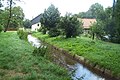
 Village washing place in Tabarz |
||
| Data | ||
| Water code | DE : 4164 | |
| location | Thuringia , Germany | |
| River system | Weser | |
| Drain over | Hörsel → Werra → Weser → North Sea | |
| source | On Forstort Tanzbuche in Rennsteig near 50 ° 50 '28 " N , 10 ° 31' 12" O |
|
| Source height | approx. 700 m above sea level NN | |
| muzzle | At Mechterstädt coordinates: 50 ° 56 ′ 30 ″ N , 10 ° 32 ′ 20 ″ E 50 ° 56 ′ 30 ″ N , 10 ° 32 ′ 20 ″ E |
|
| Mouth height | 276.6 m above sea level NN | |
| Height difference | approx. 423.4 m | |
| Bottom slope | approx. 30 ‰ | |
| length | 13.9 km | |
| Catchment area | 30.4 km² | |
| Left tributaries | Strenge (2.0 km, 2.7 km²), Mühlbach (3.5 km, 2.2 km²), Grübelbach (3.8 km, 3.1 km²) | |
| Communities | Bad Tabarz , Langenhain , Laucha | |
The Laucha is a roughly 14 km long orographic left tributary of the Hörsel in the Thuringian district of Gotha .
course
The Laucha arises on the north-western slope of the Thuringian Forest between the forest villages Kleiner Inselsberg and Tanzbuche , east of the Großer Inselsberg , from several source streams that meet in the Lauchagrund south of the locality. It emerges from the mountains between the Zimmerberg and the Datenberg . In the local area of Bad Tabarz , the Mühlbach flowing in from the Cabarzer Mühlengrund comes from the left . From the locality of Tabarz, the Laucha flows steadily northwards in a meadow. For reasons of flood protection, the river was channeled in the 19th century in the localities of Tabarz, Langenhain and Laucha.
The confluence of the Laucha in the Hörsel is about one kilometer north of the Laucha village, near the Riethmühle. The estuary has served as a marker and border point for the Mechterstädt, Laucha and Teutleben districts since ancient times .
Surname
The original name of the water body Lauchaha is said to be derived from the leek plant. The municipality of Laucha is named after the river. In a work by August Beck , the brook is called Louffa in 1868 .
history
There is evidence that the Laucha valley has been inhabited by people for thousands of years, this is proven by archaeological finds in the Langenhain and Mechterstädt districts from the Neolithic period.
In the towns of Bad Tabarz, Cabarz, Langenhain and Laucha, the hydropower of the Laucha and its tributaries were used for metal processing as early as the late Middle Ages . Several flour mills, also a tails mill and sawmills are still known.
As early as the Middle Ages, a pond was created on the western edge of the village of Laucha, in the middle of which the local noble family built a water castle. This imposing complex , known as the Weiherschloss , existed until the 1950s and was then removed, politically motivated, as evidence of the feudal era.
Impressions

The Luther fountain near Bad Tabarz in the Lauchagrund

The Laucha in Langenhain
The Riethmühle below Laucha


literature
- Wolfgang Pfauch: On the original forest cover of the Großer Inselsberg nature reserve and adjacent parts of the landscape of the Thuringian Forest. In: Gothaer Museen (Hrsg.): Treatises and reports of the Museum of Nature Gotha . No. 12. Printing house August Bebel Gotha, Gotha 1984, p. 3-30 .
- Rainer Haupt: The Große Inselsberg, a valuable nature reserve and highly frequented recreation center in the Thuringian Forest . Ed .: Council of the District of Erfurt, Forestry Department. August Bebel Gotha printing works, Erfurt 1989, p. 26 .
- Wolfgang Zimmermann: Small nature guide Thuringian Forest . In: Gothaer Museen (Hrsg.): Treatises and reports of the Museum of Nature Gotha . No. 9. Printing house August Bebel Gotha, Gotha 1990, ISBN 978-3-935782-13-5 , p. 98 .
- Christa von Schemm-Müller: Tabarz and surroundings . Ed .: Tabarzer Kneipp-Verein eV Druckerei Löhr (Ruhla), Tabarz 2004, p. 114 .
- Roland Geißler: hiking guide to Bad Liebenstein and the Inselsberg . Verlag Rockstuhl, Bad Langensalza 2007, ISBN 978-3-938997-79-6 , p. 114 .
Web links
Individual evidence
- ↑ a b Topographic map 1: 25,000
- ↑ a b River lengths according to geopaths (kmz, 150 kB)
- ^ A b Thuringian State Institute for the Environment (ed.): Area and waterway key figures (directory and map). Jena 1998. 26 pp.
- ↑ Dr. August Beck: The History of the Gothaisches Land. Volume I, History of the Regents, Gotha, 1868. P. 52/53.
- ↑ Wolfgang Pfauch: On the original forest cover in the Großer Inselsberg nature reserve and adjacent parts of the landscape of the Thuringian Forest. In: Gothaer Museen (Hrsg.): Treatises and reports of the Museum of Nature Gotha . No. 12. Printing house August Bebel Gotha, Gotha 1984, p. 4-5 .