
Frienstedt
|
Frienstedt
State capital Erfurt
Coordinates: 50 ° 57 ′ 20 ″ N , 10 ° 54 ′ 29 ″ E
|
|
|---|---|
| Height : | 291 m above sea level NN |
| Area : | 7.19 km² |
| Residents : | 1339 (December 31, 2016) |
| Population density : | 186 inhabitants / km² |
| Incorporation : | April 1, 1994 |
| Postal code : | 99092 |
| Area code : | 036208 |
 Location of Frienstedt in Erfurt
|
|
Frienstedt is a district of the Thuringian capital Erfurt .
geography
The village is located about ten kilometers west of Erfurt city center on federal highway 7 and on the edge of the Nesse valley basin on the Alach plateau in the Thuringian basin . Neighboring villages are Gamstädt in the west, Ermstedt in the northwest, Gottstedt in the north, Bindersleben in the northeast, Schmira in the east, Ingersleben in the southeast, Neudietendorf in the south and Kleinrettbach in the southwest. The fertile town hall is mainly used for agriculture. The built-up area of the Frienstedter territory is about 45 ha, the agricultural land 620 ha and the forestry area in the ONO of the locality about 11.5 ha. The northern edge of the district is formed by the Nesse , an about 1 to 2 m wide brook with a small one Depth that comes from Alach, its headwaters, and flows further west. Muschelkalk and Keuper form the subsoil of the site . The special location in a von der Nesse swamp area with once many tributaries brought earlier inhabitants a great wealth of fish as a source of food and income. There were 21 bridges in the village and its immediate vicinity.
The village is divided into two parts. The old village center is in the north and a little further away is a new building area from the period after 1990 in the south, the Erfurt-Frienstedt residential park .
history
During the Roman Empire there was an important Germanic settlement on the Nesse near Frienstedt . In addition to building remains and well shafts, numerous small finds of Roman origin were found during excavations along the route of the A 71 in 2001–2004, suggesting that this region in free Germania has close ties with the Roman Empire . The peculiarities of the settlement near Frienstedt include the oldest evidence of runic writing in Central Germany and at the same time the oldest written West Germanic word, as well as an anthropomorphic clay figure that was used as a cult object in Roman tradition. (See ridge of Frienstedt )
In the first centuries AD, warning and fishing migrated from today's Mecklenburg, Schleswig-Holstein and Denmark into the region.
The place Frienstedt was first mentioned in a document in the Hersfeld list of goods in 796. Frienstedt later came to the Reinhardsbrunn monastery . There is no document on this, but there is a document from 1286, which says that a knight Heynemann von Hain, with the consent of Landgrave Albert von Thuringia , the Marienstift in Erfurt 10½ Hufen Land u. a. also sold in Frienstedt.
The place was on the Via Regia , the most important military and trade route to Erfurt. In the 15th century, the expanding city of Erfurt, the center of the Thuringian woad towns, also acquired Frienstedt.
The Thirty Years War brought Frienstedt, like other places and cities in Germany, a lot of suffering, blood and horror. Saxon horsemen invaded the town on April 15, 1622 and plundered and mistreated the inhabitants until mid-May, followed by billeting of electoral troops until September. Because of its proximity to the via regia, strangers repeatedly invaded Frienstedt from 1626 to 1631. Even 20 years after the end of the war, the consequences of the war had not yet been overcome.
The plague also raged in Frienstedt. A plague cross on the parish gate, which is no longer there today, commemorated the epidemics of 1351, 1354, 1382, 1434 and 1472 and finally those of 1597 or 1683 .
From 1706 Frienstedt belonged to the Alach office . Until the 18th century it was surrounded by a wall and moat with four gates.
In 1793, on July 2 at around 10:00 p.m., a fire broke out in Frienstedt, which destroyed 18 houses, various barns and stables, as well as the rectory.
In 1802 he came with the Erfurt area to Prussia and between 1807 and 1813 to the French principality of Erfurt .
With the Congress of Vienna in 1815, the place came back to Prussia and in 1816 it was incorporated into the Erfurt district in the Prussian province of Saxony , to which it belonged until 1944.
In 1891 Kaiser Wilhelm II held a maneuver near Erfurt with a military parade on September 14 near Gamstädt. On the way there, the emperor and his companion were cheered at the royal court by virgins and school children. A memorial stone created by the sculptor Hugo Grabe , which stands opposite the restaurant on the roadside, reminds of this . It was inaugurated on June 16, 1913.
After the connection to the power station in Gispersleben , the street lights were switched on on November 15, 1908.
The Second World War cost the place 40 dead and missing. The greatest damage occurred in the last weeks of the war, especially between April 10 and 12, 1945.
In April 1945 Frienstedt was occupied by US troops. Eight German soldiers who died in the defensive battles in the Frienstedter Flur on April 10, 1945 are buried in the churchyard.
From 1956 to 1960 Frienstedt was "co-operative". The LPGs "Guter Wille" and "Glückiges Leben" were founded. After the formation of the KAP in 1974, the LPGs of Gamstädt, Frienstädt and Kleinrettbach merged to form the LPG "Ernst Thälmann Gamstädt" and the LPGs Ermstedt and Nottleben to form the LPG "Rosa Luxemburg". After the reunification the Agrar-GmbH Frienstedt was formed.
On April 1, 1994 Frienstedt was incorporated into the city of Erfurt. During this time, the place experienced rapid population growth due to suburbanization effects . In 1996 Frienstedt celebrated the 1200th year after it was first mentioned in a document.
Name story
The place name has changed over the centuries: Vrinstete (9th century), Friesenestat , Frinstete (1143), Freyenstete (1186), Frianstete (1243) and Vrinstede (1286). The place has had its current name since the 18th century, with occasional changes. The origin may be traced back to an old sanctuary / place of peace, in which the persecuted could not be prosecuted. The word part stedt stands for an inhabited place.
Citizen of Frienstedter
Even before 1900 the Frienstedter had a nickname: the "Margecker". These are popularly the big frogs in the "Werrchen", that is the swampy area at the end of the village towards Gottstedt , who greeted the visitors arriving from there with their concert.
coat of arms
The former coat of arms of the place shows only a linden tree.
Population development
- 1843: 434
- 1905: 400
- 1906: 412
- 1910: 433
- 1919: 433
- 1931: 455
- 1939: 468
- 1945: 648
- 1946: 689, including 225 resettlers
- 1949: 679
- 1955: 630
- 1963: 417
- 1965: 480
- 1967: 470
- 1972: 468
- 1976: 425
- 1990: 408
- 1995: 912
- 1996: 978
- 2000: 1396
- 2005: 1343
- 2010: 1343
- 2015: 1329
Attractions
Village church

The St. Laurentius Church ( location → ) was built as a fortified church in 1447. The church tower, which was included in the village fortifications, dates from this time.
On March 31, 1834, the church had to be closed because of the risk of collapse. Then the demolition took place. The rebuilding of the nave began on May 10, 1835 with the laying of the foundation stone in the presence of high-ranking personalities and 417 local residents. The nave was built in a classicist style according to plans by the grand ducal building councilor CW Condray . The pulpit altar also dates from this time.
The church, which was built in a simple and dignified manner at a cost of 3,000 thalers , was inaugurated on October 10, 1836. The tower was preserved. Two Gothic inscriptions from the previous church were preserved and walled into the east wall of the new church. They remind of the construction of the choir of the church by Curd Goetze and Günter Kolbe in 1493. There is an inscription with minuscules behind a gallery on the north side of the nave, which says that in 1469 a Gunter Koturant and a Hans Becke were the builders were.
The church tower contained three bells that had to be given in during World War II . They had a diameter of 1.13 m (1716, Neuguss 1891), 0.93 m (1797 from Apolda) and 0.71 m ( Benjamin Sorge ). A sundial from the 14th century can be seen on a corner cuboid on the south side .
The tower was renewed in 1912. The gable side and the side of the classical nave facing the town have been restored, the north side is without plaster and roof drainage. In a heavy storm with windpants on the night of July 11th to 12th, 1984, the slated, pointed spire fell into the nave (see also: Church in Töttelstädt ). After the tower button was recovered, coins and some documents from the years 1608, 1790, 1855 and 1955 were found, which were placed back in the new tower button in July 1997. The sponsor for the new tower helmet was the investor in the Frienstedt residential complex. In 1992 the church was given a chapel in the tower. In November 1997 the renovation of the outer facade began. The interior of the east-facing church has a three-sided double gallery and a pulpit altar.
In 2006 part of the church ceiling fell and the altar was damaged. In 2014 plaster detached itself from the church tower, so that a cordon had to be built around it. As a former defensive tower (observation and signal transmission function), the tower is owned by the city of Erfurt, the nave is owned by the parish.
The church is surrounded by the still-used cemetery.
The parish of Frienstedt belongs to the Evangelical Parish of Bindersleben-Frienstedt, which also includes the parishes of Alach , Ermstedt , Gottstedt , Kleinrettbach , Nottleben and Zimmersupra .
The partner church is the evangelical church of Sulzbach .
- Pictures of the church

South side

Interior
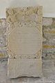
Epitaph from 1713


The Fürstenhof
The historic Gasthof Fürstenhof is located on federal road 7 . It was built in 1836 as a customs post and breakout on the via regia . After according to an oral tradition once a prince had hurt the finger, the inn was fat goose in Fürstenhof renamed. In 1891, Kaiser Wilhelm II and his wife Auguste Viktoria disembarked there on the way to a parade in the neighboring town of Gamstädt and were “greeted by virgins and school children from the localities”. A memorial stone on the B 7 opposite the Fürstenhof, which bears the inscriptions: "1813 - 1913" and "Wilhelm II. - Auguste Viktoria - September 14, 1891 - 1888, commemorates this (and perhaps another visit in 1913). June 1913 ".
Stone cross and wayside shrines
On the east side of Dietendorfer Straße, at the confluence with the B 7, opposite the Fürstenhof, there is a stone cross and a remains of a wayside shrine consisting of two stone pillars.
The stone cross is one of the most beautiful of its kind in the Thuringian-Saxon region. In seven lines with Gothic letters it tells that in June of the year 1494 the aristocratic armorer Volkmar von Gleichen died and his soul may find peace . ([ANO 1494 d | meß juni it | nobilis | armiger | volkmar | de glichen | carip]). However, the worked out coat of arms is not that of those of equals. It is believed that it can be assigned to a noble family residing in the Rudolstadt area, which served the von Gleichen as vassals.
One of the stone pillars bears the year 1460 ([Anno | d (omin) mi M || CCCCLX]), so it is 34 years older than the stone pillar, which makes a causal connection improbable.
Until 1982 the monument group stood about 500 m further east in the direction of Erfurt, where the "Ingersleber Weg" (today "Kleine Chaussee") crosses the B 7. In a Frienstedt floor plan from 1640, the group is not shown, only a "street spire" that was filled in in 1720.
additional
- A war memorial in memory of the 13 fallen or missing soldiers from the site of the First World War stands in front of the churchyard wall. In front of it there is a plaque for the victims of the Second World War .
- In the place there are stately houses, farmsteads, the rectory of the Protestant parish and the building of the local administration. See also: List of cultural monuments in Frienstedt

Stone cross

The ground monument group: 1 cross, 2 columns and a stabilizing plate on the floor for the columns, originally underground

Inscription on a pillar

Inscription on the other pillar

Kaiser Wilhelm memorial stone

War memorial


Economy and Transport
In the period from 1230 to 1680, woad cultivation and trade in the plant flourished in Thuringia. In 1597 there were 36 woad farmers in Frienstedt with a total area of 80 acres. After the end of the Thirty Years War , trade then collapsed in favor of the cheaper Indian indigo .
Frienstedt is today, as before, an agricultural place. The largest agricultural company is Agrar GmbH Frienstedt, which emerged from LPG . Many residents work in the nearby cities of Erfurt and Gotha .
The place is on the federal highway 7 , about ten kilometers from Gotha in the west and Erfurt in the east. It is connected to the state capital via a city bus line. About one kilometer east of the village runs the federal highway 71 with the junction Erfurt-Bindersleben.
The B 7 is accompanied by a cycle path as far as Erfurt.
An IKEA branch can be found in an easterly direction (at the level of the slip road to federal motorway 71) .
societies
As in many other villages, there was a large number of associations in Frienstedt in the past.
- The Agricultural Mountain District Association was founded in 1875.
- The fire brigade association was founded in 1877. In 1996 it had 56 members, including 9 women, plus a youth fire brigade group. In 1989 the new fire station was inaugurated.
- From 1918 there was the boys' association "Gemütlichkeit" made up of single men.
- The men's choir was founded in 1922 under Richard Seligmann.
- From 1926 to 1930 the gymnastics club "Gut Heil" was active.
- In 1957 a carnival club was launched.
- In December 1962 a hunting association was founded.
- In 1974 the small animal breeders came together in an association.
Particularly noteworthy among today's clubs in Frienstedt are:
- the cultural association Frienstedt e. V. , which was founded in 1991 to maintain homeland and tradition.
- the Friends of St. Laurentius Church , founded in 2005.
- the SV Fortuna Frienstedt , the local soccer club, founded in 1948.
Personalities
- Ida Koch (1840-1892), benefactress of the city of Gotha, established the city of Gotha as a universal heir in her will in 1892. (Waltershäuser Strasse 11)
Web links
Individual evidence
- ↑ CGSchmidt, R.Nedoma, K.Düwel: The runic inscription on the ridge of Frienstedt . In: The language. 49/2, 2010/2011 (2012), pp. 123-186.
- ^ Archaeological research project on the Germanic settlement near Frienstedt
- ^ Wolfgang Kahl: First mentions of Thuringian cities and villages up to 1300 . 1st edition, Erfurt 1996, p. 29, ISBN 3-931426-09-2
- ↑ a b c d e f g h i j k l m n o p q r s t u v w Anniversary publication for the 1200th anniversary of the town
- ↑ Erfurt and the Erfurt area
- ↑ Municipalities 1994 and their changes since January 1st, 1948 in the new federal states , Metzler-Poeschel publishing house, Stuttgart 1995, ISBN 3-8246-0321-7 , publisher: Federal Statistical Office
- ^ Website of the fire brigade
- ^ Handbook of the Province of Saxony. Magdeburg 1843.
- ↑ gemeindeververzeichnis.de
- ↑ Michael Rademacher: German administrative history from the unification of the empire in 1871 to the reunification in 1990. (Online material for the dissertation, Osnabrück 2006).
- ^ Thuringian State Office for Environment and Geology: Environment regional.
- ↑ population of the districts , Erfurt.de
- ↑ Hartmut Schwarz: Church tower closed . Thuringian newspaper, August 14, 2014
- ↑ Information about the stone crosses: See there under Thuringia-Erfurt-Frienstedt
Remarks
- ↑ The 1200-year anniversary publication only counts three gates for 1800: The Anger, Shepherd and Parish gates. In earlier times, however, four.
swell
- Large parts of the information on history and the history of the church come from the 1200th anniversary publication from 1996.

Districts: Old Town | Andreasvorstadt | Berliner Platz | Brühlervorstadt | Daberstedt | Herrenberg | Hohenzüge | Ilversgehofen | Johannesplatz | Johannesvorstadt | Krmpfervorstadt | Löbervorstadt | Melchendorf | Moscow Square | Rieth | Red Mountain | Meadow hill
Districts: Alach | Azmannsdorf | Bindersleben | Bischleben and Stedten | Büßleben | Dittelstedt | Egstedt | Ermstedt | Frienstedt | Gispersleben | Gottstedt | Hochheim | Hochstedt | Kerspleben | Kühnhausen | Linderbach | Marbach | Mittelhausen | Möbisburg-Rhoda | Molsdorf | Niedernissa | Rohda (Haarberg) | Salomonsborn | Schaderode | Schmira | Schwerborn | Stotternheim | Sulzer settlement | Deep valley | Töttelstädt | Killing life | Urbich | Vieselbach | Wallichen | Waltersleben | Windischholzhausen