List of the districts of Erfurt
The list of districts of Erfurt gives an overview of the 53 districts of the city of Erfurt .
The division of the city of Erfurt into 53 districts results from § 2 of the main statute of the city, whereby this division is usually based on geographical and historical circumstances. 44 districts have a district constitution according to § 45 para. 1 ThürKO, three of which two neighboring districts have introduced a common district constitution. In such so-called districts with district constitution, district mayors and district councils are elected.
development
The old town covers the area within the former fortress walls from the 14th century. After the fortress status was lifted by the Prussian government in 1873, the walls were razed and the suburbs could develop. They were essentially the focus of urban growth until the 1950s. The parts of the suburbs close to the center mostly consist of buildings from the period before the First World War and the outer parts of buildings from the interwar and early post-war periods. In 1911 Ilversgehofen was incorporated; Melchendorf followed in 1938. These are the only two villages that have been "overgrown" by the expansion of the city. The state-controlled housing construction in the GDR forced the city to expand to the south-east on the one hand and to the north on the other. This is how Erfurt's two large prefabricated building complexes, Erfurt-Nord and Erfurt-Südost, were built there . In the urban area, the majority of the buildings are apartment buildings, while there are very few main areas of home construction. New homes emerged mainly from 1990 in the villages of the Erfurt city area ( suburbanization ). The first residential areas with own homes emerged from around 1870 in the form of the villa districts in the southwest of Erfurt (Löbervorstadt, Brühlervorstadt) due to the advantageous topographical location on the slope of the Steigerwald and the Geratal. Home construction has continued there until recently. From the 1920s onwards, there was a second focus on home building: the housing estates in Erfurt , in which impoverished people built small housing estates with gardens for self-sufficiency. These settlements can be found scattered in all parts of the city. During the GDR era, the Ringelberg in the east , which was expanded after the fall of the Wall, and parts of Melchendorf in the southeast were built as single-family housing estates. Overall, however, the proportion of owner-occupied homes in the urban area remains low.
After the reunification in 1990 the settlement structure of the city changed. In the early 1990s a strong suburbanization set in , which led to almost all of Erfurt's neighboring towns recording strong population growth. This trend is slowly ebbing away. In 1994, many of these neighboring towns were incorporated into the city to strengthen the city, but also to save administrative expenses. Some places have already grown very close to the actual city of Erfurt, such as Gispersleben in the north, Marbach in the northwest, Bindersleben and Schmira in the west, Hochheim in the southwest and Windischholzhausen in the southeast.
Erfurt districts


Table labeling
- District : Official name of the district
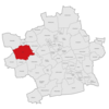
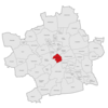
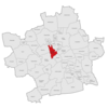
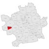
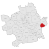
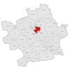
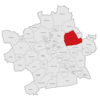
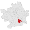
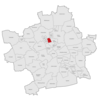
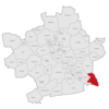
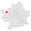
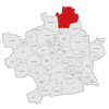
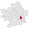
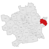
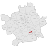
- Location in the urban area : Colored highlighting of the location of the district within the urban area
- Inhabitants : States the number of residents with main residence in the respective district as of December 31, 2012
- Area : Area of the respective district in square kilometers (km²)
- Population density : population density in inhabitants per square kilometer
-
Settlement structure : Differentiation of the individual districts according to their respective structural and area-typical features according to the municipal statistical publications in:
- urban : districts that have a highly dense, urban development structure, essentially going back to the development of apartment buildings in the 19th and first half of the 20th century
- Plattenbau : districts that emerged as closed large prefabricated housing estates between 1965 and 1990
- village-like : districts with primarily village or suburban settlement characteristics, which applies to almost all incorporated localities
- Incorporation : Year of incorporation into the city of Erfurt, provided that the district has not always belonged to the city of Erfurt
- District constitution : Indicates whether the district has its own district constitution according to § 45 Paragraph 1 ThürKO
- Residential buildings : Number of residential buildings in the respective district as of December 31, 2011
- therein apartments : number of apartments in the residential buildings in the respective district as of December 31, 2011
- Vacancy : percentage of the vacancy rate of the apartments in the respective districts as of December 31, 2011
table
| District |
Location in the city area |
Inhabitants (December 31, 2012) |
Area (km²) |
Population density (inh. / Km²) |
Settlement structure |
Einge- my dung |
District constitution |
Residential building (December 31, 2011) |
therein apartments (December 31, 2011) |
Vacancy (in%) (December 31, 2011) |
|---|---|---|---|---|---|---|---|---|---|---|
| Alach |
|
1,000 | 10.1 | 99 | village | 1994 | Yes | 270 | 361 | 2.2 |
| Old town |
|
17,980 | 2.44 | 7,369 | urban | No | 1,783 | 10,433 | 7.6 | |
| Andreasvorstadt |
|
16,020 | 2.85 | 5,621 | urban | No | 1,410 | 9,366 | 9.9 | |
| Azmannsdorf |

|
339 | 4.25 | 80 | village | 1994 | Yes | 120 | 133 | 8.3 |
| Berlin Square |

|
5,844 | 0.48 | 12,175 | Plattenbau | Yes | 161 | 3,771 | 4.3 | |
| Bindersleben |

|
1.317 | 8.06 | 163 | village | 1950 | Yes | 419 | 559 | 6.6 |
| Bischleben-Stedten |

|
1,643 | 6.61 | 249 | village | 1950 | Yes | 463 | 591 | 9.5 |
| Brühlervorstadt |

|
12,870 | 7.08 | 1,818 | urban | No | 2,052 | 6,019 | 6.0 | |
| Penitential life |

|
1,320 | 6.85 | 193 | village | 1994 | Yes | 414 | 468 | 1.7 |
| Daberstedt |

|
13,488 | 3.5 | 3,854 | urban | No | 1,641 | 7,414 | 7.3 | |
| Dittelstedt |

|
793 | 1.94 | 409 | village | 1950 | Yes | 192 | 306 | 6.9 |
| Egstedt |

|
496 | 12.57 | 39 | village | 1994 | Yes | 153 | 177 | 7.3 |
| Ermstedt |

|
449 | 5.87 | 76 | village | 1994 | Yes | 151 | 162 | 7.4 |
| Frienstedt |

|
1,343 | 7.19 | 187 | village | 1994 | Yes | 307 | 592 | 3.5 |
| Gispersleben |

|
4,107 | 10.14 | 405 | village | 1950 | Yes | 1,067 | 1,696 | 7.0 |
| Gottstedt |
|
215 | 2.1 | 102 | village | 1994 | Yes | 63 | 86 | 5.8 |
| Herrenberg |

|
7,937 | 1.69 | 4,696 | Plattenbau | Yes | 375 | 4,832 | 2.1 | |
| Hochheim |

|
2,665 | 2.84 | 938 | village | 1938 | Yes | 762 | 1,084 | 8.8 |
| Hochstedt |
|
271 | 2.97 | 91 | village | 1994 | Yes | 100 | 111 | 9.0 |
| Hohenwinds |

|
1,902 | 8.17 | 233 | urban | No | 630 | 833 | 4.8 | |
| Ilversgehofen |
|
11.202 | 2.74 | 4,088 | urban | 1911 | No | 1,356 | 6,997 | 15.1 |
| Johannesplatz |

|
5,172 | 0.43 | 12,028 | Plattenbau | Yes | 202 | 3,466 | 1.3 | |
| Johannesvorstadt |

|
6.123 | 3.30 | 1,855 | urban | No | 538 | 4.112 | 8.1 | |
| Kerspleben |
|
1,748 | 10.43 | 168 | village | 1994 | Yes | 535 | 624 | 3.2 |
| Krmpfervorstadt |

|
15,601 | 4.96 | 3,145 | urban | No | 1,783 | 8,028 | 7.3 | |
| Kuehnhausen |

|
1,165 | 3.14 | 371 | village | 1994 | Yes | 233 | 555 | 4.5 |
| Linderbach |

|
833 | 3.12 | 267 | village | 1994 | Yes | 272 | 313 | 4.8 |
| Löbervorstadt |

|
11,991 | 10.24 | 1,171 | urban | No | 1,464 | 5,752 | 7.4 | |
| Marbach |

|
3,821 | 5.14 | 743 | village | 1950 | Yes | 1,198 | 1,396 | 2.0 |
| Melchendorf |
|
10,234 | 5.63 | 1,818 | Plattenbau | 1938 | Yes | 1,021 | 5,731 | 4.0 |
| Mittelhausen |

|
1,084 | 10.47 | 104 | village | 1994 | Yes | 397 | 404 | 6.2 |
| Möbisburg-Rhoda |

|
1,098 | 8.03 | 137 | village | 1950 | Yes | 341 | 404 | 6.4 |
| Molsdorf |

|
557 | 7.17 | 78 | village | 1994 | Yes | 175 | 193 | 4.7 |
| Moscow Square |

|
7,638 | 0.88 | 8,680 | Plattenbau | Yes | 309 | 4,958 | 2.8 | |
| Niedernissa |

|
1,578 | 3.79 | 416 | village | 1994 | Yes | 341 | 732 | 4.0 |
| Rieth |
|
5,650 | 0.72 | 7,847 | Plattenbau | Yes | 171 | 3,304 | 5.3 | |
| Rohda (Haarberg) |
|
279 | 3.60 | 78 | village | 1994 | Yes | 84 | 93 | 6.5 |
| Red mountain |

|
5,691 | 0.77 | 7,391 | Plattenbau | Yes | 219 | 3,353 | 7.2 | |
| Salomonsborn |

|
1,081 | 4.68 | 231 | village | 1994 | Yes | 351 | 424 | 1.4 |
| Schaderode |
|
294 | 1.42 | 207 | village | 1994 | Yes | 107 | 109 | 0.9 |
| Schmira |

|
947 | 7.27 | 130 | village | 1950 | Yes | 314 | 346 | 8.4 |
| Schwerborn |

|
605 | 6.91 | 88 | village | 1994 | Yes | 217 | 221 | 5.0 |
| Stuttering home |
|
3,506 | 15.75 | 223 | village | 1994 | Yes | 1.014 | 1,355 | 7.4 |
| Sulzer settlement |

|
1,040 | 0.96 | 1,083 | village | Yes | 405 | 420 | 5.0 | |
| Deep valley |

|
1,086 | 5.23 | 208 | village | 1994 | Yes | 359 | 380 | 4.7 |
| Töttelstädt |

|
632 | 10.79 | 59 | village | 1994 | Yes | 197 | 229 | 6.1 |
| Killing life |

|
324 | 3.34 | 97 | village | 1994 | Yes | 100 | 123 | 5.7 |
| Urbich |
|
1.106 | 2.85 | 388 | village | 1994 | Yes | 281 | 458 | 1.3 |
| Vieselbach |
|
2,194 | 7.72 | 284 | village | 1994 | Yes | 589 | 920 | 11.6 |
| Wallichen |

|
168 | 2.37 | 71 | village | 1994 | Yes | 65 | 65 | 7.7 |
| Waltersleben |

|
433 | 4.84 | 89 | village | 1994 | Yes | 129 | 159 | 1.9 |
| Meadow hill |
|
5.112 | 0.45 | 11,360 | Plattenbau | Yes | 239 | 2,997 | 3.0 | |
| Windischholzhausen |

|
1,687 | 2.26 | 746 | village | 1994 | Yes | 506 | 642 | 2.6 |
map
Web links
References and comments
- ↑ Officially, the term local part is used for the sub-areas of district-affiliated or district-free cities / municipalities in Thuringia ( § 4 ThürKO ). However, the term district is often used synonymously in the press, in everyday language and in the city itself.
- ↑ § 2 of the main statute of November 27, 2003 in the version of the 19th statute to amend the main statute of September 16, 2015 (resolution on the printed matter 1800/15) ( PDF; 227 kB ). In: erfurt.de, accessed on November 10, 2016.
- ↑ a b § 45 Thuringian Municipal Code . In: landesrecht.thueringen.de, accessed on January 27, 2012.
- ↑ Alach with Schaderode , Kerspleben with Töttleben and Vieselbach with Wallichen .
- ↑ District information . In: erfurt.de, accessed on September 18, 2013.
- ↑ Stadtverwaltung Erfurt: Erfurt Statistics - Buildings and Housing Stock 2009 ( Memento from June 1, 2010 in the Internet Archive ) (= municipal statistics booklet 73rd edition: 07/2010 ) (PDF; 659 kB), p. 23. In: erfurt. de, accessed on November 10, 2016.
- ↑ a b c Municipal statistics booklet No. 80: Erfurt Statistics. Buildings and apartments. Update 2011 (PDF; 591 kB). P. 14 f. In: erfurt.de, accessed on November 10, 2016.


