
Deep valley
|
Deep valley
State capital Erfurt
Coordinates: 51 ° 1 ′ 20 ″ N , 10 ° 56 ′ 56 ″ E
|
|
|---|---|
| Height : | 198 (191-206) m |
| Area : | 5.23 km² |
| Residents : | 1074 (December 31, 2016) |
| Population density : | 205 inhabitants / km² |
| Postal code : | 99090 |
| Area code : | 036201 |
 Location of Tiefthal in Erfurt
|
|
Tiefthal is a district of the Thuringian capital Erfurt .
geography
Tiefthal lies in the valley of the Weißbach, a tributary of the Gera , in the Thuringian Basin , which slowly rises to the west to the Fahner Höhe . Between Tiefthal and Schaderode in the west there is a wooded area and in the north the biotope of the threshold castle , otherwise the area is not forested and is used for agriculture. Other neighboring villages are Salomonsborn in the south, Gispersleben and Kühnhausen in the east, Elxleben in the north and Friedrichsdorf in the north-west. The distance to the city center of Erfurt in a south-westerly direction is about ten kilometers.
history
In 1104, Tiefthal was first mentioned in a document. In 1361 the village came under the control of the Mainz Lieutenancy in Erfurt, which used it as a kitchen village . Like Erfurt, Tiefthal belonged to Kurmainz ( Erfurt state ) until 1802 and then from 1815 to 1945 to Prussia . On July 1, 1994, the community of Tiefthal was dissolved and incorporated into the city of Erfurt as a district. Between 1993 and 1996 a new residential area with own homes was built on the outskirts, which ensured that the population doubled.

Church of St. Peter and Paul ( location → )
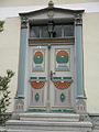
Front door in Tiefthal

Half-timbered building in Tiefthal


Population development
- 1843: 342
- 1910: 387
- 1939: 416
- 1990: 529
- 1995: 920
- 2000: 1199
- 2005: 1136
- 2010: 1101
- 2015: 1073
Economy and Transport
The area around the Tiefthal is used intensively for agriculture, especially for growing fruit and vegetables. Wine was also grown here in the Middle Ages and early modern times. Industrial and commercial areas are in the north of Erfurt, about two kilometers east of Tiefthal.
Tiefthal is on the country road from Kühnhausen to Friedrichsdorf. The federal highway 4 and the federal highway 71 run not far to the east and south of the place. With the Erfurt-Gispersleben junction just under three kilometers away , Tiefthal has a connection to the A71. A city bus connects Tiefthal with Erfurt.
Arts and Culture
Since 2002, the "Tiefthal Art Festival" has been held annually in early summer and includes concerts, theater performances, galleries and art historical tours.
Ten objects in the district are designated as cultural monuments (see list of cultural monuments in Tiefthal ).
One of the oldest clubs is the Tiefthal Liedertafel, which has existed since 1857.
Personalities
- Johann Friedrich Cramer (born November 19, 1802 - † March 29, 1859), educator
- Oswin Köhler (born October 14, 1911 - † May 2, 1996), Africanist
- Christian Paschold (* 1949 in Graefenthal), German sculptor
Individual evidence
- ↑ Municipalities 1994 and their changes since January 1, 1948 in the new federal states , Metzler-Poeschel publishing house, Stuttgart, 1995, ISBN 3-8246-0321-7 , publisher: Federal Statistical Office
- ^ Handbook of the Province of Saxony. Magdeburg, 1843.
- ↑ gemeindeververzeichnis.de
- ↑ Michael Rademacher: German administrative history from the unification of the empire in 1871 to the reunification in 1990. (Online material for the dissertation, Osnabrück 2006).
- ^ Thuringian State Office for Environment and Geology: Environment regional.
- ↑ Population of the city districts
- ^ Adolf Häckermann: Cramer, Johann Friedrich . In: Allgemeine Deutsche Biographie (ADB). Volume 4, Duncker & Humblot, Leipzig 1876, pp. 555-557.
Web links
- Tiefthal on the website of the city of Erfurt
- Ortschronik on the website of the Tiefthal clubs
- Information about Tiefthal at erfurt-web.de ( Memento from October 25, 2008 in the Internet Archive )
- privately maintained site with extensive information

Districts: Old Town | Andreasvorstadt | Berliner Platz | Brühlervorstadt | Daberstedt | Herrenberg | Hohenzüge | Ilversgehofen | Johannesplatz | Johannesvorstadt | Krmpfervorstadt | Löbervorstadt | Melchendorf | Moscow Square | Rieth | Red Mountain | Meadow hill
Districts: Alach | Azmannsdorf | Bindersleben | Bischleben and Stedten | Büßleben | Dittelstedt | Egstedt | Ermstedt | Frienstedt | Gispersleben | Gottstedt | Hochheim | Hochstedt | Kerspleben | Kühnhausen | Linderbach | Marbach | Mittelhausen | Möbisburg-Rhoda | Molsdorf | Niedernissa | Rohda (Haarberg) | Salomonsborn | Schaderode | Schmira | Schwerborn | Stotternheim | Sulzer settlement | Deep valley | Töttelstädt | Killing life | Urbich | Vieselbach | Wallichen | Waltersleben | Windischholzhausen