Sulzer settlement
|
Sulzer settlement
State capital Erfurt
Coordinates: 51 ° 1 ′ 33 ″ N , 11 ° 2 ′ 28 ″ E
|
|
|---|---|
| Height : | 177–188 m above sea level NN |
| Area : | 96 ha |
| Residents : | 998 (December 31, 2016) |
| Population density : | 1,040 inhabitants / km² |
| Postal code : | 99087 |
| Area code : | 0361 |
|
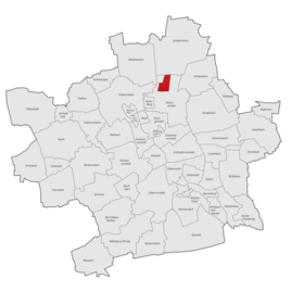
Location of Sulzer settlement in Erfurt
|
|
The Sulzer settlement (also known colloquially as Susi ) is a district of the Thuringian state capital Erfurt .
geography
The Sulzer settlement is located in the Thuringian Basin about six kilometers north of the Erfurt city center. To the west of it rises the Rote Berg , to the east lies the Sulzer See , a flooded gravel pit belonging to the Erfurt lakes . Neighboring villages are Mittelhausen in the northwest, Stotternheim in the north and Schwerborn in the northeast. To the south of the Sulzer settlement lie the Roter Berg prefabricated building area and the Hohenwind industrial area, as well as the Saline settlement and the Stollberg settlement .
history
In the Middle Ages there was a village called Sulza at the foot of the Red Mountain in the area of today's Bergrat-Voigt-Straße, which, however, was already a desert at the beginning of the modern era . The field name Sulza was retained for the area.
The Sulzer settlement emerged as a small settlement of organized group self-help after the global economic crisis of 1929. With the help of the city administration, unemployed families were able to move into land in the area east of Stotternheimer Strasse and build a house with a garden for self-sufficiency. The first houses were completed in 1932. Initially located in the middle of the fields, the city of Erfurt grew closer to the Sulzer settlement by 1990, so that today it merges directly into the Hohenwind industrial area.
In 1994 an industrial area was created north of the settlement. During the development work, the remains of the village church and the Sulza cemetery were found. It was not until 1995/1996 that the settlement was connected to the city's sewage network. In 2000 the new community center was opened, the settlement was extended to the west with 115 single-family houses and raised to a separate district.
Economy and Transport
The Sulzer settlement is located in the north of Erfurt, surrounded by numerous commercial and industrial areas that provide jobs for many settlers.
The settlement is on Stotternheimer Straße, which leads from Erfurt to Stotternheim and on to Sömmerda . The Erfurt-Stotternheim motorway junction of the federal motorway 71 is located on this street in the area of the settlement . The Sangerhausen – Erfurt railway line with the Erfurt Ost regional train station runs on the edge of the settlement near the settlement. There is also a city bus in the Sulzer settlement.

