Ermstedt
|
Ermstedt
State capital Erfurt
|
|
|---|---|
| Coordinates: 50 ° 58 ′ 6 ″ N , 10 ° 52 ′ 58 ″ E | |
| Height : | 291 m above sea level NN |
| Residents : | 448 (December 31, 2016) |
| Incorporation : | April 1, 1994 |
| Postal code : | 99092 |
| Area code : | 036208 |
|
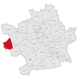
Location of Ermstedt in Erfurt
|
|

Ermstedt is a district of the city of Erfurt in Thuringia . It is the westernmost district and has been part of the state capital since 1994.
geography
Ermstedt is located on the Alacher Höhe , a plateau in the Thuringian Basin about 290 meters above sea level. The Nesse flows south of the village . The district is largely unforested and is subject to intensive agricultural use. The village itself is still characterized by its historic farmsteads. In the 1990s, as part of the wave of suburbanization in East Germany, a new single-family housing estate was built on the eastern outskirts. Neighboring places are Zimmersupra in the north, Gottstedt in the east, Frienstedt in the southeast, Gamstädt in the south and Nottleben in the west. It is ten kilometers to downtown Erfurt and about 14 kilometers to Gotha .
history
At the beginning of the 9th century, Ermstedt was first mentioned in a list of the goods lent by Archbishop Lullus († 786) of Mainz to the monastery of Hersfeld von Free as an Ermenstat . Ermstedt was closely connected to Erfurt for a long time and was part of the territory of the city of Erfurt . With this it came after the dissolution of Kurmainz in 1802 to Prussia , 1807 to the Principality of Erfurt and in 1816 to the Prussian district of Erfurt . On July 1, 1950 Gottstedt was incorporated into Ermstedt. Since 1994, both villages have belonged to the city of Erfurt as separate districts.
Population development
- 1843: 321
- 1910: 355
- 1939: 347
- 1995: 336
- 2000: 384
- 2005: 466
- 2010: 456
- 2015: 441
Attractions
The most significant building in the district in terms of art history is the Protestant St. Andrew's Church from 1613. The parish belongs to the Frienstedt parish .
Economy and Infrastructure
To this day, Ermstedt is an agricultural town with several companies in this economic sector. Otherwise, suburban living in Ermstedt dominates.
Between 1926 and 1967, Ermstedt had a connection to the Erfurt – Nottleben small railway with a connection to downtown Erfurt. Today, bus lines provide the appropriate connection to the exhibition center and the airport , where you can change to the city rail system in the direction of the city center. Another bus connection leads to Neudietendorf with a transition to rail traffic. Roads connect Ermstedt with Neudietendorf in the south, Döllstädt in the north, Bindersleben in the east and Nottleben in the west.
Individual evidence
- ^ Handbook of the Province of Saxony. Magdeburg, 1843.
- ↑ gemeindeververzeichnis.de
- ↑ Michael Rademacher: German administrative history from the unification of the empire in 1871 to the reunification in 1990. (Online material for the dissertation, Osnabrück 2006).
- ↑ Population of the city districts


