Erfurt suburbs
The Erfurt suburbs are a belt of residential areas that have been created around the city center of the Thuringian state capital.
history
Before the deconsolidation in 1873
The suburbs are laid out very regularly. There are several reasons for this: on the one hand, Erfurt, unlike Halle or Leipzig, was far away from its neighboring towns, so that with the exception of Ilversgehofens no villages grew into the city and the extensive city hall was already under the Erfurt government. In addition, it was not allowed to be built until 1873, since Erfurt was a Prussian fortress town . So the construction process initially took place within the city fortifications . Here the population rose from around 15,000 after the Napoleonic Wars in 1815 to around 45,000 in the year the fortress status was given up. As a result, the living conditions in the old town with a walled area of around three square kilometers were extremely cramped. As early as the middle of the 19th century, a first suburban area with new, classicist buildings and relatively large residential buildings arose within the walls. The focus was on Brühl and the districts on Dalbergsweg, which were previously only thinly built on with small houses and gardens. Residential quarters of this type also arose around the train station and at Johannestor in the north, but some of them were later built over again.
Between 1873 and World War I
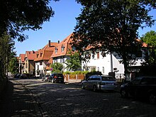
After the fortress status was lifted, the planned development of the Erfurt city hall could begin. A relatively regular street grid was created, which was gradually laid out and built on. The urban planning patterns customary at the time were followed, resulting in bourgeois villa quarters in the south and west and extensive working-class quarters in the north and east. The bourgeois quarters benefited from the main west wind direction, which always brought them fresh air from the country. They were also located in the more attractive area on the slopes of Steigerwald and Cyriaksburg as local recreation areas. In contrast, the industrial companies were located close to the working-class neighborhoods in the flat terrain of the north and east, also because there was a good connection to the rail network. Nevertheless, the workers' quarters were not as densely built up as in other large cities. Here, block perimeter development with relatively large inner courtyards with craft workshops and gardens prevailed. This was possible because Erfurt had a lot of free municipal space and thus - unlike in Berlin or Leipzig - there was no need for crowded buildings. The street grid was therefore also laid out with a relatively wide mesh. This planned urban expansion enabled the population of Erfurt to increase from 45,000 to 130,000 at the beginning of the First World War.
In 1911 Ilversgehofen was incorporated, the only village close to the city limits. By then it had grown to around 13,000 residents; before industrialization there lived just 700 people (1860). Here, too, a regular street grid was used to a large extent, but the houses were usually somewhat smaller than those in Erfurt (three instead of four storeys). Like the neighboring streets, Ilversgehofen was also a working-class district.
Interwar period
The First World War had no effects on the suburbs, but it caused an economic crisis, so that initially there was no more construction, although the population continued to grow. This led to an acute housing shortage as early as the early 1920s. To remedy this, the ideas of the Bauhaus based in the neighboring city of Weimar were taken up and residential complexes were created in the new design language in the east of the suburbs ( Hanseviertel ) and in Ilversgehofen ( Jacobsenviertel ). The construction of private homes and small apartment buildings continued in line with the zeitgeist, with a focus on Daberstedt . In the inter-war period, the street grid in the suburbs, which had not yet been completely built on, was abandoned for the first time and construction began further outside in the city corridor. Housing estates with small houses and large gardens for self-sufficiency were created here, especially in the west, but also scattered in the north and east of the city. The development of the suburbs with larger apartment buildings continued in the 1930s, but no ensembles of significant urban development were created as in the period of historicism and the Bauhaus. The population increased further to around 165,000 inhabitants by 1940, but also because some neighboring villages were incorporated.
GDR time
The suburbs also survived the Second World War, apart from a few houses, undamaged. In the 1950s and early 1960s, there was a final wave of development in the suburbs. The last of the open spaces were built on with old new buildings, such as the Borntal in the west, parts of the Hanseviertel in the east and Daberstedt in the south. The urban development in the suburbs came to an end after Erfurt already had 190,000 inhabitants in 1965, most of whom lived in the suburbs. In the meantime, a considerable need for renovation had arisen here. Due to a lack of alternatives, the renovation of older streets from the late 19th century, such as Auenstrasse in the north, began. In the process, the facades usually lost their decor, so that the houses that were renovated at the time can still be recognized today. Nevertheless, the suburbs lost their attractiveness, especially in relation to the newly built prefabricated building areas. These emerged in the 1970s and 1980s in the north and south-east of Erfurt for around 100,000 residents, while the total number of residents only rose by 30,000 to 220,000. This resulted in considerable redeployment within the city.
After 1990
After 1990 the number of inhabitants in the unrenovated old building districts dropped suddenly and vacancies became a big problem. The low point was reached around the turn of the millennium. Nevertheless, the renovation measures began shortly after reunification and the neighborhoods stabilized. In the following decade, the number of inhabitants rose again, on the one hand due to returnees from the prefabricated building areas and on the other hand due to immigration from outside. The location close to the center is perceived as particularly advantageous, and the general popularity of “Gründerzeit” apartments also contributes to this.
architecture
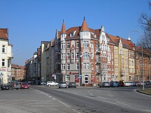
The perimeter block development with four-storey apartment buildings from the period between 1880 and 1910 on a regular street plan is dominant. It stretches in a belt from Gothaer Platz in the west over Gutenbergplatz and Rosa-Luxemburg-Platz in the north and Steinplatz and Leipziger Platz in the east as well as the Spielbergtor in the southeast to the Stadtpark at the main train station . Between the main train station, Steigerstraße and Gothaer Platz in the south and south-west of the city lies the suburban villa district with individual tenement houses and mansions of the bourgeoisie, also from the period between 1880 and 1910.
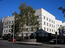
Complementary buildings from later times such as the Bauhaus-inspired residential complexes “Flensburger Block” and “Hamburger Block” in the Krämpfervorstadt are less dominant.
Districts
The districts contained in the table belong to the Erfurt suburbs. Their areas are large, as they also include undeveloped areas on the outskirts, for example the Steigerwald , which belongs to the Löbervorstadt .
| district | Area [km²] | Population 2000 |
Inhabitants 2002 |
2004 residents |
Residents 2006 |
Residents 2008 |
Residents 2010 |
|---|---|---|---|---|---|---|---|
| Andreasvorstadt | 2.84 | 13,130 | 13,234 | 14,285 | 14,911 | 15.205 | 15,556 |
| Brühlervorstadt | 7.10 | 10,879 | 11,133 | 11,464 | 11,874 | 12,089 | 12,442 |
| Johannesvorstadt | 3.29 | 5,069 | 5,241 | 5,523 | 5,752 | 5,828 | 6,040 |
| Krmpfervorstadt | 4.96 | 12,125 | 12,921 | 14,105 | 14,499 | 14,669 | 15,032 |
| Löbervorstadt | 10.22 | 11,127 | 11,185 | 11,349 | 11,426 | 11,544 | 11,623 |
| Daberstedt | 3.50 | 13,837 | 13,762 | 13,680 | 13,505 | 13,507 | 13,428 |
| Ilversgehofen | 2.76 | 9,914 | 9,928 | 10,251 | 10,221 | 10,654 | 10,823 |
| Total suburbs | 34.67 | 76,081 | 77,404 | 80,657 | 82,188 | 83,496 | 84,944 |


