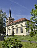
List of cultural monuments in Frienstedt
The list of cultural monuments in Frienstedt contains the cultural monuments of the Frienstedt district of the Thuringian state capital Erfurt , which were recorded by the Thuringian State Office for Monument Preservation and Archeology as architectural and art monuments in the area of the city as of March 20, 2014.
Legend
- Name: gives the name, the description or the type of the cultural monument.
- Location: States the street name and, if available, the house number of the cultural monument. The list is basically sorted according to this address. The link "Map" leads to various map displays and gives the coordinates of the cultural monument.
- Dating: indicates the date; the year of completion or the period of construction. Sorting by year is possible.
- Description: Provides structural and historical details of the cultural monument, preferably the characteristics of the monument.
- ID: If available, indicates the object ID of the cultural monument assigned by the State Office for the Preservation of Monuments.
List of cultural monuments in Frienstedt
| image | designation | location | Dating | description | ID |
|---|---|---|---|---|---|
 |
Residential building | Backhausgasse 9 (map) |
Residential building |
|
|
 |
Residential building. | Backhausgasse 21 (map) |
Residential building. The house is inhabited but in poor condition. |
|
|
 |
Stone cross | Dietendorfer Strasse (map) |
Stone cross on the B7. See also under: Information about the stone crosses: and there under Thuringia-Erfurt-Frienstedt. |
|
|
 |
Wayside shrine | Dietendorfer Strasse (map) |
Parts of a wayside shrine, on the B7: 2 stone steles and a stone slab lying on the ground between the stele on the left in the picture and the stone cross, which originally ensured the stability of the two pillars underground. See also under: Information about the stone crosses: and there under Thuringia-Erfurt-Frienstedt. |
|
|
 |
Residential building | Dietendorfer Strasse 3 (map) |
Residential building |
|
|
 |
Residential building | Dietendorfer Strasse 10 (map) |
Residential house + stable building |
|
|
 |
Wooden room | Hemp bag 20 (card) |
Wooden room |
|
|
 |
basement, cellar | Hirtenhausstrasse 1 (map) |
The building is the seat of the district mayor. Eastern cellar vault. The basement is provided with new retaining walls through building security measures. In addition, the ground is heaped up. |
|
|
 |
Homestead | Hirtenhausstrasse 21 (map) |
Homestead |
|
|
 |
Overall structural system | Hirtenhausstrasse 34 (map) |
Church + churchyard + school building + parish |
|
|
 |
Residential building | Laurentiusstrasse 9 (map) |
Residential building |
|
|
 |
Residential building | Laurentiusstrasse 15 (map) |
Residential building |
|
|
 |
church | Parish gate (map) |
Church + equipment Ev. Parish church Frienstedt |
|
|
| Overall structural system | Parish gate 2 (map) |
Church + churchyard + school building + parish |
|
||
 |
Homestead | Angle 2 (card) |
Homestead |
|
Web links
Commons : Cultural heritage monuments in Frienstedt - collection of images, videos and audio files
swell
- Erfurt Monument List ( Memento from March 29, 2014 in the Internet Archive ) (pdf), City of Erfurt, as of March 20, 2014
- List of monuments in Erfurt ( memento of August 8, 2014 in the Internet Archive ) (pdf), City of Erfurt, as of July 2, 2014