List of cultural monuments in the Andreasvorstadt
The list of cultural monuments in the Andreasvorstadt contains the cultural monuments of the Andreasvorstadt district of the Thuringian state capital Erfurt , which were recorded by the Thuringian State Office for Monument Preservation and Archeology as architectural and art monuments in the area of the city as of March 20, 2014.
Legend
- Name: gives the name, the description or the type of the cultural monument.
- Location: States the street name and, if available, the house number of the cultural monument. The list is basically sorted according to this address. The link "Map" leads to various map displays and gives the coordinates of the cultural monument.
- Dating: indicates the date; the year of completion or the period of construction. Sorting by year is possible.
- Description: Provides structural and historical details of the cultural monument, preferably the characteristics of the monument.
- ID: If available, indicates the object ID of the cultural monument assigned by the State Office for the Preservation of Monuments.
List of cultural monuments in Andreasvorstadt
| image | designation | location | Dating | description | ID |
|---|---|---|---|---|---|
| Overall structural system | Adalbertstrasse 14 (map) |
Residential district Erfurter Spar- u. Building association |
|
||
| Overall structural system | Adalbertstrasse 15 (map) |
Residential district Erfurter Spar- u. Building association |
|
||
| Overall structural system | Adalbertstrasse 16 (map) |
Residential district Erfurter Spar- u. Building association |
|
||
| Overall structural system | Adalbertstrasse 17 (map) |
Residential district Erfurter Spar- u. Building association |
|
||
| Overall structural system | Adalbertstrasse 18 (map) |
Residential district Erfurter Spar- u. Building association |
|
||
| Overall structural system | Adalbertstrasse 19 (map) |
Residential district Erfurter Spar- u. Building association |
|
||
| Overall structural system | Adalbertstrasse 20 (map) |
Residential district Erfurter Spar- u. Building association |
|
||
| Residential building | Adalbertstrasse 21 (map) |
Residential house + (overall construction) |
|
||
| Overall structural system | Adalbertstrasse 22 (map) |
Residential district Erfurter Spar- u. Building association |
|
||
| Residential building | Adalbertstrasse 23 (map) |
Residential building (+ overall construction) |
|
||
| Residential building | Adalbertstrasse 24 (map) |
Residential house + (overall construction) |
|
||
| Overall structural system | Adalbertstrasse 25 (map) |
Residential district Erfurter Spar- u. Building association |
|
||
| Overall structural system | Adalbertstrasse 26 (map) |
Residential district Erfurter Spar- u. Building association |
|
||
| Overall structural system | Adalbertstrasse 27 (map) |
Residential district Erfurter Spar- u. Building association |
|
||
| Overall structural system | Adalbertstrasse 28 (map) |
Residential district Erfurter Spar- u. Building association |
|
||
| Overall structural system | Adalbertstrasse 29 (map) |
Residential district Erfurter Spar- u. Building association |
|
||
| Overall structural system | Adalbertstrasse 30 (map) |
Residential district Erfurter Spar- u. Building association |
|
||
| Overall structural system | Adalbertstrasse 31 (map) |
Residential district Erfurter Spar- u. Building association |
|
||
| Overall structural system | Adalbertstrasse 32 (map) |
Residential district Erfurter Spar- u. Building association |
|
||
| Characteristic street and square image | Adam-Ries-Strasse 7 (map) |
Gutenbergplatz |
|
||
| Characteristic street and square image | Adam-Ries-Strasse 8 (map) |
Gutenbergplatz |
|
||
| Characteristic street and square image | Adam-Ries-Strasse 9 (map) |
Gutenbergplatz |
|
||
| Characteristic street and square image | Adam-Ries-Strasse 10 (map) |
Gutenbergplatz |
|
||
| Characteristic street and square image | Adam-Ries-Strasse 11 (map) |
Gutenbergplatz |
|
||
| Residential building | Auenstrasse 30 (map) |
Residential building |
|
||
| Residential building | Auenstrasse 31 (map) |
Residential building |
|
||
| Residential building | Auenstrasse 32 (map) |
Residential building |
|
||
| Overall structural system | Auenstrasse 39 (map) |
Residential district Erfurter Spar- u. Building association |
|
||
| Overall structural system | Auenstrasse 40 (map) |
Residential district Erfurter Spar- u. Building association |
|
||
| Overall structural system | Auenstrasse 41 (map) |
Residential district Erfurter Spar- u. Building association |
|
||
| Overall structural system | Auenstrasse 42 (map) |
Residential district Erfurter Spar- u. Building association |
|
||
| Overall structural system | Auenstrasse 43 (map) |
Residential district Erfurter Spar- u. Building association |
|
||
| Overall structural system | Auenstrasse 44 (map) |
Residential district Erfurter Spar- u. Building association |
|
||
| Overall structural system | Auenstrasse 45 (map) |
Residential district Erfurter Spar- u. Building association |
|
||
| Overall structural system | Auenstrasse 46 (map) |
Residential district Erfurter Spar- u. Building association |
|
||
| Overall structural system | Auenstrasse 47 (map) |
Residential district Erfurter Spar- u. Building association |
|
||
| Overall structural system | Auenstrasse 48 (map) |
Residential district Erfurter Spar- u. Building association |
|
||
| Overall structural system | Auenstrasse 49 (map) |
Residential district Erfurter Spar- u. Building association |
|
||
| Overall structural system | Auenstrasse 50 (map) |
Residential district Erfurter Spar- u. Building association |
|
||
| Overall structural system | Auenstrasse 51 (map) |
Residential district Erfurter Spar- u. Building association |
|
||
| Overall structural system | Auenstrasse 52 (map) |
Residential district Erfurter Spar- u. Building association |
|
||
| Overall structural system | Auenstrasse 53 (map) |
Residential district Erfurter Spar- u. Building association |
|
||
| Overall structural system | Auenstrasse 54 (map) |
Residential district Erfurter Spar- u. Building association |
|
||
| Overall structural system | Auenstrasse 55 (map) |
Residential district Erfurter Spar- u. Building association |
|
||
| Overall structural system | Auenstrasse 56 (map) |
Residential district Erfurter Spar- u. Building association |
|
||
| Overall structural system | Auenstrasse 57 (map) |
Residential district Erfurter Spar- u. Building association |
|
||
| Overall structural system | Auenstrasse 58 (map) |
Residential district Erfurter Spar- u. Building association |
|
||
| Overall structural system | Auenstrasse 59 (map) |
Residential district Erfurter Spar- u. Building association |
|
||
| Overall structural system | Auenstrasse 60 (map) |
Residential district Erfurter Spar- u. Building association |
|
||
| school-building | Auenstrasse 77 (map) |
school-building |
|
||
| Characteristic street and square image | Biereyestrasse 1 (map) |
Gutenbergplatz |
|
||
| Characteristic street and square image | Biereyestraße 2 (map) |
Gutenbergplatz |
|
||
| Characteristic street and square image | Borntalweg 7 (map) |
Gutenbergplatz |
|
||
| Characteristic street and square image | Borntalweg 8 (map) |
Gutenbergplatz |
|
||
| Characteristic street and square image | Boyneburgufer 7 (map) |
Tenement district on the western Boyneburgufer |
|
||
| Characteristic street and square image | Boyneburgufer 8 (map) |
Tenement district on the western Boyneburgufer |
|
||
| Characteristic street and square image | Boyneburgufer 9 (map) |
Tenement district on the western Boyneburgufer |
|
||
| Residential building | Froebelstrasse 1 (map) |
Residential building (+ characteristic street and square image) |
|
||
| Characteristic street and square image | Froebelstrasse 2 (map) |
Gutenbergplatz |
|
||
| Characteristic street and square image | Froebelstrasse 3 (map) |
Gutenbergplatz |
|
||
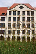 More pictures |
school-building | Gutenbergplatz 6 (map) |
School building (+ distinctive street and square image) |
|
|
| Characteristic street and square image | Gutenbergplatz 7 (map) |
Gutenbergplatz |
|
||
| Characteristic street and square image | Gutenbergplatz 8 (map) |
Gutenbergplatz |
|
||
| Characteristic street and square image | Gutenbergplatz 9 (map) |
Gutenbergplatz |
|
||
| Characteristic street and square image | Gutenbergplatz 10 (map) |
Gutenbergplatz |
|
||
| Characteristic street and square image | Gutenbergplatz 56 (map) |
Gutenbergplatz |
|
||
| Characteristic street and square image | Gutenbergplatz 57 (map) |
Gutenbergplatz |
|
||
| bridge | Karlstrasse (map) |
Bridge over the flood ditch |
|
||
 |
Overall structural system | Karlstrasse 1-20 (map) |
1897-1911 | Part of a residential complex of the Erfurt Spar- u. Building association with a total of 44 houses and 326 apartments, builder: Ferdinand Schmidt, under the clock tower a bronze plaque from 1911, sculptor: Ewald Hahn (1883–1949) |
|
 |
Luther monument | Karlstrasse 10 A (map) |
1912 | Bronze relief on a sandstone wall by Wilhelm Mues with Luther reading from the Bible. |
|
 |
school-building | Karlstrasse 10 A (map) |
1911-1912 | Luther School |
|
| Characteristic street and square image | Leopoldstrasse 7 (map) |
Tenement district on the western Boyneburgufer |
|
||
| Characteristic street and square image | Leopoldstrasse 8 (map) |
Tenement district on the western Boyneburgufer |
|
||
| Characteristic street and square image | Leopoldstrasse 9 (map) |
Tenement district on the western Boyneburgufer |
|
||
| Characteristic street and square image | Leopoldstrasse 10 (map) |
Tenement district on the western Boyneburgufer |
|
||
| Characteristic street and square image | Leopoldstrasse 11 (map) |
Tenement district on the western Boyneburgufer |
|
||
| Characteristic street and square image | Nettelbeckufer 1 (map) |
Residential area around Schobersmühlenweg |
|
||
| Characteristic street and square image | Nettelbeckufer 2 (map) |
Residential area around Schobersmühlenweg |
|
||
| Characteristic street and square image | Nettelbeckufer 3 (map) |
Residential area around Schobersmühlenweg |
|
||
| Characteristic street and square image | Nettelbeckufer 4 (map) |
Residential area around Schobersmühlenweg |
|
||
| Characteristic street and square image | Nettelbeckufer 5 (map) |
Residential area around Schobersmühlenweg |
|
||
| Characteristic street and square image | Nettelbeckufer 6 (map) |
Residential area around Schobersmühlenweg |
|
||
| Characteristic street and square image | Nettelbeckufer 7 (map) |
Residential area around Schobersmühlenweg |
|
||
| Characteristic street and square image | Nettelbeckufer 8 (map) |
Residential area around Schobersmühlenweg |
|
||
| Characteristic street and square image | Nettelbeckufer 9 (map) |
Residential area around Schobersmühlenweg |
|
||
| Characteristic street and square image | Nettelbeckufer 10 (map) |
Residential area around Schobersmühlenweg |
|
||
| Characteristic street and square image | Nettelbeckufer 11 (map) |
Residential area around Schobersmühlenweg |
|
||
| Residential building | Nettelbeckufer 12 (map) |
Residential building (+ characteristic street and square image) |
|
||
| Characteristic street and square image | Nettelbeckufer 13 (map) |
Residential area around Schobersmühlenweg |
|
||
| Characteristic street and square image | Nettelbeckufer 14 (map) |
Residential area around Schobersmühlenweg |
|
||
| Characteristic street and square image | Nettelbeckufer 15 (map) |
Residential area around Schobersmühlenweg |
|
||
| Characteristic street and square image | Nettelbeckufer 16 (map) |
Residential area around Schobersmühlenweg |
|
||
| Characteristic street and square image | Nettelbeckufer 17 (map) |
Residential area around Schobersmühlenweg |
|
||
| Characteristic street and square image | Nettelbeckufer 18 (map) |
Residential area around Schobersmühlenweg |
|
||
| Characteristic street and square image | Nettelbeckufer 19 (map) |
Residential area around Schobersmühlenweg |
|
||
| Characteristic street and square image | Nettelbeckufer 20 (map) |
Residential area around Schobersmühlenweg |
|
||
| Characteristic street and square image | Nettelbeckufer 21 (map) |
Residential area around Schobersmühlenweg |
|
||
| Characteristic street and square image | Nettelbeckufer 22 (map) |
Residential area around Schobersmühlenweg |
|
||
| Characteristic street and square image | Nettelbeckufer 23 (map) |
Residential area around Schobersmühlenweg |
|
||
| school-building | Nettelbeckufer 25 (map) |
school-building |
|
||
| Residential building | Nordhäuser Strasse 21 (map) |
Residential building |
|
||
| Residential building | Nordhäuser Strasse 22 (map) |
Residential building |
|
||
| University building | Nordhäuser Strasse 63 (map) |
University building, former college of education |
|
||
| Hospital building | Nordhäuser Strasse 74 (map) |
Clinic |
|
||
| Hospital building clinic | Nordhäuser Strasse 84 (map) |
Hospital building clinic |
|
||
| Residential building | Nordhäuser Strasse 99 (map) |
Residential building |
|
||
| Residential building | Nordhäuser Strasse 100 (map) |
Residential building |
|
||
| Residential building | Nordhäuser Strasse 101 (map) |
Residential building |
|
||
| Characteristic street and square image | Nordstrasse 14 (map) |
Residential area around Schobersmühlenweg |
|
||
| Characteristic street and square image | Papiermühlenweg 14 (map) |
Residential area around Schobersmühlenweg |
|
||
| Characteristic street and square image | Papiermühlenweg 15 (map) |
Residential area around Schobersmühlenweg |
|
||
| Characteristic street and square image | Papiermühlenweg 16 (map) |
Residential area around Schobersmühlenweg |
|
||
| Characteristic street and square image | Papiermühlenweg 17 (map) |
Residential area around Schobersmühlenweg |
|
||
| Characteristic street and square image | Papiermühlenweg 17 A (map) |
Residential area around Schobersmühlenweg |
|
||
| Characteristic street and square image | Papiermühlenweg 18 (map) |
Residential area around Schobersmühlenweg |
|
||
| Characteristic street and square image | Papiermühlenweg 18 A (map) |
Residential area around Schobersmühlenweg |
|
||
| Characteristic street and square image | Papiermühlenweg 19 (map) |
Residential area around Schobersmühlenweg |
|
||
| Characteristic street and square image | Papiermühlenweg 20 (map) |
Residential area around Schobersmühlenweg |
|
||
| Characteristic street and square image | Papiermühlenweg 21 (map) |
Residential area around Schobersmühlenweg |
|
||
| Characteristic street and square image | Papiermühlenweg 22 (map) |
Residential area around Schobersmühlenweg |
|
||
| Characteristic street and square image | Schinkelstrasse 1 (map) |
Tenement district on the western Boyneburgufer |
|
||
| Characteristic street and square image | Schinkelstrasse 2 (map) |
Tenement district on the western Boyneburgufer |
|
||
| Characteristic street and square image | Schinkelstrasse 3 (map) |
Tenement district on the western Boyneburgufer |
|
||
| Characteristic street and square image | Schinkelstrasse 4 (map) |
Tenement district on the western Boyneburgufer |
|
||
| Characteristic street and square image | Schinkelstrasse 5 (map) |
Tenement district on the western Boyneburgufer |
|
||
| Characteristic street and square image | Schinkelstrasse 6 (map) |
Tenement district on the western Boyneburgufer |
|
||
| school-building | Schlueterstrasse 1 (map) |
University of Applied Sciences (+ distinctive street and square image) |
|
||
| school-building | Schlueterstrasse 1 A (map) |
University of Applied Sciences (+ distinctive street and square image) |
|
||
| Characteristic street and square image | Schlueterstrasse 3 A (map) |
Tenement district on the southern Boyneburgufer |
|
||
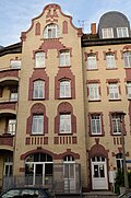 |
Characteristic street and square image | Schobersmühlenweg 1 (map) |
Residential area around Schobersmühlenweg |
|
|
 |
Characteristic street and square image | Schobersmühlenweg 2 (map) |
Residential area around Schobersmühlenweg |
|
|
 |
Characteristic street and square image | Schobersmühlenweg 3 (map) |
Residential area around Schobersmühlenweg |
|
|
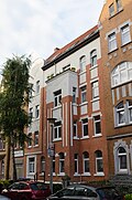 |
Characteristic street and square image | Schobersmühlenweg 4 (map) |
Residential area around Schobersmühlenweg |
|
|
 |
Characteristic street and square image | Schobersmühlenweg 5 (map) |
Residential area around Schobersmühlenweg |
|
|
 |
Characteristic street and square image | Schobersmühlenweg 6 (map) |
Residential area around Schobersmühlenweg |
|
|
 |
Characteristic street and square image | Schobersmühlenweg 7 (map) |
Residential area around Schobersmühlenweg |
|
|
 |
Characteristic street and square image | Schobersmühlenweg 8 (map) |
Residential area around Schobersmühlenweg |
|
|
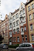 |
Characteristic street and square image | Schobersmühlenweg 9 (map) |
Residential area around Schobersmühlenweg |
|
|
 |
Characteristic street and square image | Schobersmühlenweg 10 (map) |
Residential area around Schobersmühlenweg |
|
|
 |
Characteristic street and square image | Schobersmühlenweg 11 (map) |
Residential area around Schobersmühlenweg |
|
|
 |
Characteristic street and square image | Schobersmühlenweg 12 (map) |
Residential area around Schobersmühlenweg |
|
|
 |
Characteristic street and square image | Schobersmühlenweg 13 (map) |
Residential area around Schobersmühlenweg |
|
|
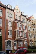 |
Characteristic street and square image | Schobersmühlenweg 14 (map) |
Residential area around Schobersmühlenweg |
|
|
 |
Characteristic street and square image | Schobersmühlenweg 15 (map) |
Residential area around Schobersmühlenweg |
|
|
 |
Characteristic street and square image | Schobersmühlenweg 16 (map) |
Residential area around Schobersmühlenweg |
|
|
 |
Characteristic street and square image | Schobersmühlenweg 17 (map) |
Residential area around Schobersmühlenweg |
|
|
| Characteristic street and square image | Schobersmühlenweg 18 (map) |
Residential area around Schobersmühlenweg |
|
||
| Characteristic street and square image | Schobersmühlenweg 18 A (map) |
Residential area around Schobersmühlenweg |
|
||
| Characteristic street and square image | Schobersmühlenweg 19 (map) |
Residential area around Schobersmühlenweg |
|
||
| Characteristic street and square image | Schobersmühlenweg 19 A (map) |
Residential area around Schobersmühlenweg |
|
||
 |
Characteristic street and square image | Schobersmühlenweg 20 (map) |
Residential area around Schobersmühlenweg |
|
|
| Characteristic street and square image | Schobersmühlenweg 21 (map) |
Residential area around Schobersmühlenweg |
|
||
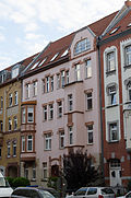 |
Characteristic street and square image | Schobersmühlenweg 22 (map) |
Residential area around Schobersmühlenweg |
|
|
 |
Characteristic street and square image | Schobersmühlenweg 23 (map) |
Residential area around Schobersmühlenweg |
|
|
 |
Characteristic street and square image | Schobersmühlenweg 24 (map) |
Residential area around Schobersmühlenweg |
|
|
| Characteristic street and square image | Schobersmühlenweg 25 (map) |
Residential area around Schobersmühlenweg |
|
||
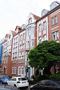 |
Characteristic street and square image | Schobersmühlenweg 26 (map) |
Residential area around Schobersmühlenweg |
|
|
 |
Characteristic street and square image | Schobersmühlenweg 27 (map) |
Residential area around Schobersmühlenweg |
|
|
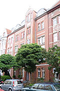 |
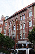
Characteristic street and square image | Schobersmühlenweg 28 (map) |
Residential area around Schobersmühlenweg |
|
|
 |
Characteristic street and square image | Schobersmühlenweg 29 (map) |
Residential area around Schobersmühlenweg |
|
|
 |
Characteristic street and square image | Schobersmühlenweg 30 (map) |
Residential area around Schobersmühlenweg |
|
|
| Characteristic street and square image | Schobersmühlenweg 31 (map) |
Residential area around Schobersmühlenweg |
|
||
| Characteristic street and square image | Schobersmühlenweg 32 (map) |
Residential area around Schobersmühlenweg |
|
||
| Characteristic street and square image | Storchmühlenweg 6 (map) |
Residential area around Schobersmühlenweg |
|
||
| Characteristic street and square image | Storchmühlenweg 7 (map) |
Residential area around Schobersmühlenweg |
|
||
| Characteristic street and square image | Storchmühlenweg 8 (map) |
Residential area around Schobersmühlenweg |
|
||
| Characteristic street and square image | Storchmühlenweg 9 (map) |
Residential area around Schobersmühlenweg |
|
||
| Characteristic street and square image | Storchmühlenweg 10 (map) |
Residential area around Schobersmühlenweg |
|
||
| Characteristic street and square image | Storchmühlenweg 11 (map) |
Residential area around Schobersmühlenweg |
|
||
| Characteristic street and square image | Storchmühlenweg 12 (map) |
Residential area around Schobersmühlenweg |
|
||
| Characteristic street and square image | Storchmühlenweg 13 (map) |
Residential area around Schobersmühlenweg |
|
||
| Characteristic street and square image | Storchmühlenweg 14 (map) |
Residential area around Schobersmühlenweg |
|
||
| Characteristic street and square image | Storchmühlenweg 15 (map) |
Residential area around Schobersmühlenweg |
|
||
| Characteristic street and square image | Storchmühlenweg 16 (map) |
Residential area around Schobersmühlenweg |
|
||
| Characteristic street and square image | Storchmühlenweg 17 (map) |
Residential area around Schobersmühlenweg |
|
||
| Characteristic street and square image | Storchmühlenweg 18 (map) |
Residential area around Schobersmühlenweg |
|
||
| school-building | Talstrasse 24 (map) |
School building + gym |
|
||
| Characteristic street and square image | Waidmühlenweg 9 (map) |
Residential area around Schobersmühlenweg |
|
||
| Characteristic street and square image | Waidmühlenweg 11 (map) |
Residential area around Schobersmühlenweg |
|
||
| Characteristic street and square image | Waidmühlenweg 12 (map) |
Residential area around Schobersmühlenweg |
|
||
| Characteristic street and square image | Waidmühlenweg 13 (map) |
Residential area around Schobersmühlenweg |
|
||
| Characteristic street and square image | Waidmühlenweg 14 (map) |
Residential area around Schobersmühlenweg |
|
||
| Characteristic street and square image | Waidmühlenweg 15 (map) |
Residential area around Schobersmühlenweg |
|
||
| Characteristic street and square image | Waidmühlenweg 16 (map) |
Residential area around Schobersmühlenweg |
|
||
| Characteristic street and square image | Waidmühlenweg 17 (map) |
Residential area around Schobersmühlenweg |
|
||
| Characteristic street and square image | Waidmühlenweg 18 (map) |
Residential area around Schobersmühlenweg |
|
||
| Characteristic street and square image | Waidmühlenweg 19 (map) |
Residential area around Schobersmühlenweg |
|
||
| Characteristic street and square image | Waidmühlenweg 20 (map) |
Residential area around Schobersmühlenweg |
|
||
| Characteristic street and square image | Waidmühlenweg 21 (map) |
Residential area around Schobersmühlenweg |
|
||
| Characteristic street and square image | Waidmühlenweg 22 (map) |
Residential area around Schobersmühlenweg |
|
||
| Characteristic street and square image | Waidmühlenweg 23 (map) |
Residential area around Schobersmühlenweg |
|
||
| Characteristic street and square image | Waidmühlenweg 24 (map) |
Residential area around Schobersmühlenweg |
|
||
| Characteristic street and square image | Waidmühlenweg 25 (map) |
Residential area around Schobersmühlenweg |
|
||
| Characteristic street and square image | Waidmühlenweg 26 (map) |
Residential area around Schobersmühlenweg |
|
||
| Characteristic street and square image | Waidmühlenweg 27 (map) |
Residential area around Schobersmühlenweg |
|
||
| Characteristic street and square image | Waidmühlenweg 28 (map) |
Residential area around Schobersmühlenweg |
|
||
| Characteristic street and square image | Waidmühlenweg 29 (map) |
Residential area around Schobersmühlenweg |
|
||
| Characteristic street and square image | Waidmühlenweg 30 (map) |
Residential area around Schobersmühlenweg |
|
||
| Characteristic street and square image | Waidmühlenweg 31 (map) |
Residential area around Schobersmühlenweg |
|
||
| Overall structural system | Waldemarstrasse 13 (map) |
Residential district Erfurter Spar- u. Building association |
|
||
| Overall structural system | Waldemarstrasse 14 (map) |
Residential district Erfurter Spar- u. Building association |
|
||
| Overall structural system | Waldemarstrasse 15 (map) |
Residential district Erfurter Spar- u. Building association |
|
||
| Overall structural system | Waldemarstrasse 16 (map) |
Residential district Erfurter Spar- u. Building association |
|
swell
- Erfurt Monument List ( Memento from March 29, 2014 in the Internet Archive ) (pdf), City of Erfurt, as of March 20, 2014
- List of monuments in Erfurt ( memento of August 8, 2014 in the Internet Archive ) (pdf), City of Erfurt, as of July 2, 2014
Individual evidence
Web links
Commons : Cultural monuments in Erfurt-Andreasvorstadt - collection of images, videos and audio files