List of cultural monuments in Huttenplatz-Johannesviertel
The list of cultural monuments in Huttenplatz-John area contains the cultural monuments of Huttenplatz-John district of Erfurt district of Old Town , by the Thuringian State Office for Heritage and Archeology were recognized as art and architectural monuments in the area of the city with state of 20 March, 2014.
Legend
- Name: gives the name, the description or the type of the cultural monument.
- Location: States the street name and, if available, the house number of the cultural monument. The list is basically sorted according to this address. The link "Map" leads to various map displays and gives the coordinates of the cultural monument.
- Dating: indicates the date; the year of completion or the period of construction. Sorting by year is possible.
- Description: Provides structural and historical details of the cultural monument, preferably the characteristics of the monument.
- ID: If available, indicates the object ID of the cultural monument assigned by the State Office for the Preservation of Monuments.
List of cultural monuments in Huttenplatz-Johannesviertel
| image | designation | location | Dating | description | ID |
|---|---|---|---|---|---|
 |
school-building | At the hill 1 (map) |
School building + enclosure + rear building (+ overall structure of the old town) |
|
|
 |
Overall structural system | At the hill 2 (map) |
Old town |
|
|
 |
Overall structural system | Am Hügel 2 A (map) |
Old town |
|
|
 |
Overall structural system | Am Hügel 4 (map) |
Old town |
|
|
 |
Overall structural system | Am Hügel 6 (map) |
Old town |
|
|
 |
Overall structural system | Am Hügel 8 (map) |
Old town |
|
|
 |
Overall structural system | Am Hügel 10 (map) |
Old town |
|
|
 |
Overall structural system | Am Hügel 10 A (map) |
Old town |
|
|
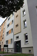 |
Overall structural system | Am Hügel 12 (map) |
Old town |
|
|
 |
Overall structural system | Am Hügel 14 (map) |
Old town |
|
|
 |
Overall structural system | Am Hügel 14 A (map) |
Old town |
|
|
 |
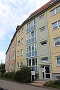
Overall structural system | Am Hügel 16 (map) |
Old town |
|
|
 |
Overall structural system | Am Hügel 18 (map) |
Old town |
|
|
 |
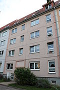
Overall structural system | Am Hügel 20 (map) |
Old town |
|
|
 |
Overall structural system | Am Hügel 22 (map) |
Old town |
|
|
 |
Overall structural system | Am Hügel 24 (map) |
Old town |
|
|
 |
Overall structural system | Am Hügel 26 (map) |
Old town |
|
|
 |
Overall structural system | Am Hügel 28 (map) |
Old town |
|
|
 |
Overall structural system | Am Hügel 30 (map) |
Old town |
|
|
| Residential and commercial building | Am Johannestor 9 (map) |
Residential and commercial building + courtyard building |
|
||
| Characteristic street and square image | Boyneburgufer 1 (map) |
Tenement district on the southern Boyneburgufer |
|
||
| Characteristic street and square image | Boyneburgufer 2 (map) |
Tenement district on the southern Boyneburgufer |
|
||
| Characteristic street and square image | Boyneburgufer 3 (map) |
Tenement district on the southern Boyneburgufer |
|
||
| Characteristic street and square image | Boyneburgufer 4 (map) |
Tenement district on the southern Boyneburgufer |
|
||
| Characteristic street and square image | Boyneburgufer 5 (map) |
Tenement district on the southern Boyneburgufer |
|
||
| Tenement district on the southern Boyneburgufer | Boyneburgufer 6 (map) |
Tenement district on the southern Boyneburgufer |
|
||
 |
Characteristic street and square image | Grünstraße 15 (map) |
Tenement district on the southern Boyneburgufer |
|
|
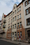 |
Characteristic street and square image | Grünstraße 15 A (map) |
Tenement district on the southern Boyneburgufer |
|
|
 |
Characteristic street and square image | Grünstraße 15 B (map) |
Tenement district on the southern Boyneburgufer |
|
|
 |
Residential building | Moritzstrasse 21 B (map) |
Residential house + enclosure of the former small Petermühle |
|
|
| Residential building | Pfeiffersgasse 15 A (map) |
Residential building (+ characteristic street and square image of the tenement district on the southern Boyneburgufer) |
|
||
 More pictures |
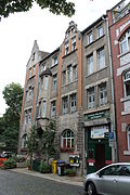
school-building | Schlueterstrasse 1 (map) |
University of Applied Sciences (+ distinctive street and square image) |
|
|
 |
Characteristic street and square image | Schlueterstrasse 3 (map) |
Tenement district on the southern Boyneburgufer |
|
|
 |
Characteristic street and square image | Schlueterstrasse 3 B (map) |
Tenement district on the southern Boyneburgufer |
|
|
 |
Characteristic street and square image | Schlueterstrasse 4 (map) |
Tenement district on the southern Boyneburgufer |
|
|
 |
Characteristic street and square image | Schlueterstrasse 5 (map) |
Tenement district on the southern Boyneburgufer |
|
|
 |
Characteristic street and square image | Schlueterstrasse 6 (map) |
Tenement district on the southern Boyneburgufer |
|
|
 |
Characteristic street and square image | Schlueterstrasse 7 (map) |
Tenement district on the southern Boyneburgufer |
|
|
 |
Characteristic street and square image | Schlueterstrasse 8 (map) |
Tenement district on the southern Boyneburgufer |
|
|
| Overall structural system | Steinstrasse 23 (map) |
Old town |
|
||
| Overall structural system | Steinstrasse 24 (map) |
Old town |
|
||
| Overall structural system | Steinstrasse 25 (map) |
Old town |
|
||
| Overall structural system | Steinstrasse 26 (map) |
Old town |
|
||
| Overall structural system | Steinstrasse 27 (map) |
Old town |
|
||
| Overall structural system | Steinstrasse 28 (map) |
Old town |
|
||
| Overall structural system | Steinstrasse 29 (map) |
Old town |
|
||
| Overall structural system | Steinstrasse 30 (map) |
Old town |
|
||
 |
Overall construction / residential building | Venice 2 (map) |
Old town / residential building, former Lohmühle |
|
|
 |
Overall structural system | Venice 2 A (map) |
Old town |
|
|
| Overall structural system | Venice 5 (map) |
Old town |
|
||
| Overall structural system | Waldenstrasse 2 (map) |
Old town |
|
||
| Overall structural system | Waldenstrasse 4 (map) |
Old town |
|
||
| Overall structural system | Waldenstrasse 6 (map) |
Old town |
|
||
 |
Overall structural system | Waldenstrasse 8 (map) |
Old town |
|
|
| Overall structural system | Waldenstrasse 11 (map) |
Old town |
|
||
| Overall structural system | Waldenstrasse 13 (map) |
Old town |
|
||
| Overall structural system | Waldenstrasse 13 A (map) |
Old town |
|
||
| Overall structural system | Waldenstrasse 15 (map) |
Old town |
|
||
| Overall structural system | Waldenstrasse 17 (map) |
Old town |
|
||
| Overall structural system | Waldenstrasse 19 (map) |
Old town |
|
||
| Overall structural system | Waldenstrasse 21 A (map) |
Old town |
|
||
| Overall structural system | Waldenstrasse 21 B (map) |
Old town |
|
||
| Overall structural system | Waldenstrasse 21 C (map) |
Old town |
|
||
| Overall structural system | Weidengasse 2 (map) |
Old town |
|
||
 |
Overall structural system | Weidengasse 3 (map) |
Old town |
|
|
| Overall structural system | Weidengasse 4 (map) |
Old town |
|
||
 More pictures |
Overall structural system | Weidengasse 8 (map) |
Old town |
|
swell
- Erfurt Monument List ( Memento from March 29, 2014 in the Internet Archive ) (pdf), City of Erfurt, as of March 20, 2014
- List of monuments in Erfurt ( memento of August 8, 2014 in the Internet Archive ) (pdf), City of Erfurt, as of July 2, 2014