Ruhrbach
| Ruhrbach | ||
|
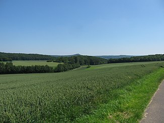
The Ruhrbach valley between Niederlistingen and Niedermeiser |
||
| Data | ||
| Water code | EN : 4466 | |
| location |
District of Kassel , Hesse , Germany |
|
| River system | Weser | |
| Drain over | Warm → Diemel → Weser → North Sea | |
| source | in Oberlistingen 51 ° 26 ′ 45 ″ N , 9 ° 14 ′ 6 ″ E |
|
| Source height | approx. 262 m above sea level NN | |
| muzzle | at Niedermeiser in the Warm Coordinates: 51 ° 27 ′ 39 " N , 9 ° 18 ′ 40" E 51 ° 27 ′ 39 " N , 9 ° 18 ′ 40" E |
|
| Mouth height | approx. 165 m above sea level NN | |
| Height difference | approx. 97 m | |
| Bottom slope | approx. 16 ‰ | |
| length | 6.2 km | |
| Catchment area | 12.564 km² | |
| Communities | Oberlistingen , Niederlistingen , Niedermeiser | |
The Ruhrbach is an approximately 6.2 km long, left-hand or west-southwest tributary of the heat in the district of Kassel , North Hesse ( Germany ).
course
The Ruhrbach rises in the northern foothills of the Habichtswälder Bergland in Oberlistingen ( near Breuna ) and flows a little north of the Habichtswald nature park between the forest areas Wolfsloh in the north and Igelsbett in the south in a predominantly east-northeast direction through the Ruhrbachtal .
Below Oberlistingen, the stream runs north past Niederlistingen (to Breuna). In the first 3.5 km of its course, where it crosses under Federal Highway 7 , it is nothing more than a channel and flows relatively flat there.
In the remainder of the flow of the Ruhrbach, which runs roughly parallel to state road 3080, there are several steps in the terrain over which its water falls. About 1 km above Niedermeiser (zu Liebenau ) there is a natural waterfall , where the water falls over two terraces about 10 m apart; the first step is about 1.5 m and the second about 0.7 m high.
After that, the Ruhrbach flows through the village of Niedermeiser, only to flow into a loop of the warm river immediately afterwards ; Opposite the mouth of the river is the Fuchsmühle, which is in operation .
Catchment area and tributaries
The catchment area of the Ruhrbach, which is fed by five small streams, is 12.564 km².
Individual evidence
- ↑ a b c d e Water map service of the Hessian Ministry for the Environment, Climate Protection, Agriculture and Consumer Protection ( information )
- ↑ a b c d Ruhrbach and waterfall with information and photos, on planetground.de
