
Marsberg
| coat of arms | Germany map | |
|---|---|---|

|
Coordinates: 51 ° 28 ' N , 8 ° 51' E |
|
| Basic data | ||
| State : | North Rhine-Westphalia | |
| Administrative region : | Arnsberg | |
| Circle : | Hochsauerlandkreis | |
| Height : | 240 m above sea level NHN | |
| Area : | 182.22 km 2 | |
| Residents: | 19,540 (Dec. 31, 2019) | |
| Population density : | 107 inhabitants per km 2 | |
| Postal code : | 34431 | |
| Primaries : | 02991, 02992, 02993, 02994 | |
| License plate : | HSK | |
| Community key : | 05 9 58 024 | |
| LOCODE : | DE MSG | |
| City structure: | 17 boroughs | |
City administration address : |
Lillers-Strasse 8 34431 Marsberg |
|
| Website : | ||
| Mayor : | Klaus Hülsenbeck ( CDU ) | |
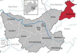
| Location of the city of Marsberg in the Hochsauerlandkreis | ||
  |
||


Marsberg is a small town in the northeastern part of the Sauerland , Hochsauerlandkreis ( North Rhine-Westphalia , Germany). It was created in its current form in 1975 as part of the municipal reorganization of North Rhine-Westphalia from Obermarsberg (earlier, especially in the 17th and 18th centuries: Stadtberge , still used in Low German) and Niedermarsberg (formerly Horhusen ) and other previously independent communities.
In Obermarsberg the most important sanctuary of the Saxons is said to have stood with the Irminsul on the Eresburg . After its destruction by Charlemagne, one of the oldest monasteries in Westphalia was built at this point , which later fell to the Corvey monastery . Niedermarsberg developed into a trading place, but was politically dependent on Obermarsberg. Mining and processing of ores have been important in the area since the early Middle Ages. In the 19th century, with the LWL-Klinik Marsberg, the health system gained importance as an economic factor.
geography
location
Marsberg is located around 29 km south of Paderborn and 3 km (both as the crow flies ) from the Hessian border in the valley of the Diemel , into which the Glinde flows in the city center . It is located between the Brilon Heights in the west, the Sintfeld in the north, the Red Land in the east and south and the Diemelsee Nature Park in the southwest. The Teutoburg Forest / Eggegebirge nature park borders north of Marsberg .
While the city center is about 250 to 255 m above sea level. NN with the Marsberg train station at 249.8 m above sea level. NN , the urban area extends between 206 m in the Diemel valley east of Westheim and 594.6 m altitude on the Eisenberg east of the dam of the Diemelsee .
Expansion of the urban area
The city covers an area of 182 km² (as of 2002). Of these 18,201.3 ha, 838.4 ha are buildings and open spaces, 42.6 ha are farms, 9086 ha are agricultural land, 7135 ha are forest and 166.8 ha are water.
Neighboring communities
The neighboring communities of Marsberg are:
City structure
Marsberg is divided into the 17 city districts
Geology and geological history


Marsberg lies at the triple point between the Rhenish Slate Mountains, the Hessian Basin and the Münsterland Basin. This creates a complex tectonic and geological situation. The oldest rocks in the Marsberg area come from the Devonian . The Devonian deposits consist of red, gray and green shale claystones. They are overlaid by sub-carbon black clay slates (lying alum slates ), to which a large part of the copper mineralization in the Marsberg area is bound. In the higher part of the lower carboniferous dominate silicified limestone and clays (Kulmbach Kieselkalke and Kulmbach chert ). In the younger rocks that followed, the degree of silicification increasingly decreased and dark gray, schisty claystones (Kulm claystones ) were sedimented, which in individual layers contained masses of mussels ( Posidonia becheri ). Due to a gradual increase in sand pouring, the rocks of the higher Lower and Upper Carboniferous are characterized by an alternating layer of gray clay slate and light, fine-grain sandstones. The entire series of rocks in the Kilianstollen visitor mine is exemplary open.
In the higher Upper Carboniferous, the entire area of today's Rhenish Slate Mountains was lifted and unfolded during the Variscan Orogeny .
After the elevation of the Variscan Mountains, leveling began in the Rotliegend under arid climatic conditions. In the Zechstein , the area around Marsberg at the edge was flooded by a sea advancing from the north and shallow marine limestone was deposited. As a result of the arid climatic conditions, the edge areas of the Zechstein Sea increasingly dried up. Sulphate rocks ( gypsum and anhydrite ) as well as fine-grained, terrestrial deposits indicate the changing sedimentation conditions. In the Zechstein, at least 4 sea advances into the Marsberg area are known. In the red sandstone period that followed, clastic sediments (sandstones and mudstones) were deposited in an increasingly humid climate. These are widespread today in the area of the Hessian Depression east of Marsberg.
Until the beginning of the Upper Cretaceous the area around Marsberg was mainland. About 100 million years ago, the Chalk Sea advanced from the North Sea to the edge of the Rhenish Slate Mountains. In the process, mainly flat marine carbonate rocks ( marl and limestone) were deposited, which can be found north of the Essentho - Wünnenberg line today. In the highest Upper Cretaceous, tectonic movements started again in this area, which led to a displacement of the rock layers. Since that time the Rhenish Slate Mountains began to rise again, the river valleys cut into the mountain rump. During the Tertiary the rocks were weathered profoundly under the influence of a warm, humid climate . The limestones in particular were heavily karstified in some cases - numerous streams were created , for example the so-called duck caves near Essentho. When the limestone and marl stones were decalcified, so-called Hotten stones were created .
During the Quaternary , the ice masses from Scandinavia do not reach the Marsberg area. The area was in front of the glacier front, which was in the Münsterland Basin . The rivers cut deeper into the mountains, especially during the warm periods, and formed pronounced gravel terraces during the cold periods.
Soil-forming processes, erosion and sediment rearrangement continue to this day. The most recent deposits in the Marsberg area are the Holocene spring limestone , for example at the Paulinenquelle, fens in the Diemelaue and the man-made mine dumps, especially the copper slate mining near Marsberg.
history
Early history
The area of today's Obermarsberg lies on an easily defendable mountain plateau. Easy access is only possible via a southern saddle. The first indications of human presence can be traced back to around 14,000 BC. Date Christ. From the time around the 4th / 3rd Ceramic finds from the Michelsberg culture date back to a thousand years before Christ . At that time there was probably already a Neolithic settlement on the mountain . Other finds come from defenses from the pre-Roman Iron Age .
Early Middle Ages

The written tradition of the history of the place goes back to the Saxon time . The Franconian Reichsannalen called the place Eresburg . This complex was one of the most important ramparts of the Saxons and, according to Thietmar von Merseburg, is said to have housed the most important (pre-Christian) sanctuary of this tribe, the Irminsul , for which there is no archaeological evidence yet. The Irminsul was probably also the reason why this place was one of the first targets during the Saxon Wars of Charlemagne . In 772 the complex was conquered and the column destroyed. Afterwards, the castle was conquered back by the Saxons and only remained in the hands of the Franks in 776 after a third conquest. In 785, Karl probably had the castle renovated in a smaller size. In the north-east of the castle district, one of the first churches was built with St. Peter's Church and one of the first monasteries in Westphalia, the Obermarsberg monastery. From this monastery, the area was Christianized. According to a contemporary tradition, the church of Pope Leo III. consecrated in connection with his trip to the Reichstag in Paderborn. At times the Eresburg was also an imperial palace. Karl lived there with his family for several months in 785.
Louis the Pious has transferred the monastery and the associated properties to the Corvey monastery . Instead of the independent monastery there was a provost's office. The Obermarsberg settlement developed below the castle. The provost was later also pastor of Obermarsberg.
Before 915 the castle was owned by Duke Heinrich von Sachsen . During this time the Saxons, who probably had their base at the castle, defeated Eberhard von Franken in the immediate vicinity . In the Marsberg collegiate church, the dispute between King Otto I and his half-brother Thankmar ended in 938 when the latter was killed at the altar by a spear thrown through a side window of the church.
Since 1036 the deposed Duke Adalbero of Carinthia was held captive at the castle for three years.
The area was important because of its ore deposits and the nearby intersecting long-distance trade routes, the via Regia and the Roman route. A settlement called Horhusen (today Niedermarsberg) developed at this point. In 900, Ludwig the Child gave Corvey the right to hold a market in Horhusen, to raise customs duties and the right to mint . A certificate allegedly issued in 962 by Otto I guaranteed the town of Dortmund merchant law and Corvey sole ownership. In fact, it is likely to be an 11th century forgery.
High and late Middle Ages

Marsberg Castle must have passed into the possession of a noble family. In any case, in the turmoil after the end of the Counts of Padberg in 1113, at the request of Abbot von Corvey, it was destroyed by Count Friedrich von Arnsberg . After 1144, the Abbot of Corvey had the castle rebuilt. The residents of Obermarsberg rose up against the abbot and called the Count of Arnsberg for help. With the help of the Counts of Schwalenberg, however, the Corveyers maintained their position. Ownership was confirmed to Corvey by a royal charter in 1150. However, the castle was destroyed by the Arnsbergers in 1145.
A Corveyer list of goods from the first quarter of the 12th century makes the relatively great importance of Horhusen clear. The place had two parish churches, two chapels and three mills. The oldest church was a Dionysius church, which later fell into disrepair. The second church, the St. Magnus Church, was consecrated between 1036/46. The population was estimated to be between 750 and 900 people. The representative of the Abbot of Corvey was a town count from the Horhusen family . There was no development of an urban constitution. In addition to trade, the inhabitants lived from textile manufacture, metal production and processing. Corvey secured the rights to the ore deposits on the nearby Erzberg from the king as early as 1150.
After the fall of Henry the Lion and the emergence of the Archbishopric of Cologne belonging Duchy of Westphalia to 1180 was largely surround the belonging to Corvey Mars mountain of eau de Cologne areas. Corvey himself placed himself under Cologne protection in 1196.
In Horhusen there was a dispute with the Bishop of Paderborn, who instead of the Abbot of Corvey now provided the city count. Since Corvey finally achieved the exemption of Paderborn in 1208 , it has also claimed this independence for the provost office in Obermarsberg. Supported by the Archbishop of Cologne and probably also by the Abbot of Corvey, many especially wealthy citizens moved from Niedermarsberg to Obermarsberg around 1220. During this time a city wall was built in Obermarsberg , and construction of the Nikolaikirche began next to the old monastery church. Corvey gave the new town the right to self-government. A city court had existed since 1222 and already before 1229 there was a magistrate of twelve members ("consules") and the mayor ("proconsul"). In addition to commoners, the council also included knights by birth. A city seal has been handed down since 1231.
The Archbishop of Cologne Engelbert I, in his capacity as Duke of Westphalia , had apparently made the city subject to himself. After the bishop's death, Corvey denied possession of the Cologne residents. However, in 1230 it had to cede half of the city of Obermarsberg to Archbishop Heinrich I von Müllenark from Cologne . The right to coin was also divided. As a result, Corvey and the Archbishopric of Cologne became dual rule over Ober- and Niedermarsberg. In the longer term, Cologne's influence increased. The city increasingly developed into an important base for the Cologne residents opposite the neighboring Waldeck. A town castle was built around 1322. However, their importance soon waned again with the construction of Canstein Castle around 1342. In 1507, the entire city, with the exception of the Benedictine provosty, fell to Kurköln. In terms of church law, however, the area, with the exception of the provost district, still belonged to the diocese of Paderborn .
Although Niedermarsberg was a separate municipality, it was fortified by a wall and has been called a town since the 14th century, but was subordinate to Obermarsberg. Hardly any tradespeople were allowed to settle in the lower town and its residents had hardly any political say. On the northwestern edge of the settlement was a Corveyer castle seat.
Early modern age


The Reformation found its way into Marsberg probably as early as the 1540s, supported by the nearby Protestant Waldeck . In connection with the Reformation, the guilds revolted against the leadership of the city in 1539. This led to a temporary ban on guilds and guilds under Elector Hermann V. von Wied . Corvey did not succeed for a long time in appointing Catholic pastors. After the defeat of Archbishop Gebhard I von Waldburg , who had tried in vain to introduce the Reformation in the Electoral Cologne area , the Counter-Reformation began under Ernst of Bavaria , and later reinforced under Ferdinand of Bavaria . Recatholization dragged on over a longer period of time. In 1615, the majority Lutheran magistrate was ousted, and by 1630 there were only a few Protestant families in the city. The emigration of numerous Lutheran-minded, often wealthy, residents had significant negative economic consequences.

Marsberg was badly affected by a local plague epidemic in 1612/13, which is said to have killed 1200 people within five months.
During the Thirty Years' War Obermarsberg became a permanent base for imperial troops. Since 1632, Hessian troops tried to conquer the city several times without success. However, the walls and numerous buildings were badly damaged. Many ironworks and hammer mills in the area were destroyed.
In 1646 Marsberg was shelled, captured and looted for ten days by the troops of the Swedish General Wrangel . The city was later set on fire and the collegiate church blown up. As a result of this destruction, the importance of Obermarsberg declined significantly. Many residents moved to Niedermarsberg. For this reason, the old town of Obermarsberg has largely been preserved in its old form. The population center shifted more and more into the valley of the Diemel to Niedermarsberg.
In 1781 Marsberg was one of the largest cities in the Duchy of Westphalia with around 400 houses. For comparison, the residential town of Arnsberg only had 252 houses. Inside, political participation was limited to a small group. Council elections were no longer held, instead the new council was appointed every year by the old council.
But the inhabitants of the lower town did not succeed in breaking away from the claim to power of the upper town magistrate. At the beginning of the 19th century the old Benedictine provosty was abolished. In 1808, during the time of the Hessian rule, Niedermarsberg achieved complete separation from the upper town. In 1827, now as part of the Prussian province of Westphalia, the judicial office was moved from the upper to the lower town.
Witch hunt

As in other parts of the Duchy of Westphalia, there has been a considerable number of witch hunts in the area of what is now Marsberg . In Padberg alone there were nine charges between 1588 and 1590 and another four between 1592 and 1602. In 1648-1650, Cunne Cordes and one other person from Essentho were caught in a witch hunt. In the witch trials in Canstein in 1656 and 1658 nine women were executed in witch trials. The outcome of a further eleven processes is unknown. For the height of the persecutions between 1628 and 1630 in the Duchy of Westphalia, corresponding processes can be proven in Marsberg, but not quantified with certainty. There are references to six people from Marsberg who got into witch trials from 1598 to 1630 :
- 1598 mother of Josef Ehebrecht
- 1629 daughter of Hammerschmidt Curt Pickhard
- 1629 A woman who died as a result of torture
- 1630 Reiniken Johann
- 1656 A girl
- o. J. A hut maker
In the museum of the city Marsberg there is a memorial to the victims of the witch trials.
19th and 20th centuries
Niedermarsberg was particularly important because of its early commercial development (see Economy). In addition to glass production, mining and copper processing were particularly important. This had significant consequences for the social structure. In the villages in particular, in the vicinity of factories or pits, mixed agricultural and commercial existences dominated. Numerous workers lived there, but they also had small farms. In the more distant villages, on the other hand, the purely agricultural livelihoods predominated.
In Giershagen in 1882 over 38% of all working people were miners. The total working population was 44%. In contrast, only 29% lived full-time from agriculture. According to records from 1892, of 119 people examined, 30% had so much land that they could have lived on it if necessary. Most of the remainder owned a house and an acre or two of land, kept goats or a cow. Only seven were single and without possessions. As a result of structural and economic crises (see below), earning opportunities decreased. It was similar in the commuter community of Padberg.
In 1889, the great miners' strike in the Ruhr area also led to work stoppages in the Marsberg district. Labor disputes broke out again a year later, and in 1892 a strike in Giershagen and the surrounding area lasted several weeks. Most of the miners joined the Christian miners' association , especially after the turn of the century .
In 1906 there was a coordinated wage movement in the districts of Brilon and Meschede. At the same time there was a several month strike in the copper industry in Marsberg. Although these took place without the union's control, anti-union measures by the management made the situation even worse at times.
Politically, Marsberg, as a city with a predominantly Catholic population, was dominated by the Center Party during the German Empire and until the beginning of the Weimar Republic . In the republic's first Reichstag election in 1920 , almost 75% voted for the Center Party. The “Marxist parties” together came to only almost 14% ( SPD 7.76%, USPD 6.17%). The bourgeois parties ( DNVP , DVP and DDP ) came together to 11.17%. Until the Reichstag election in 1928 , the binding force of the center decreased somewhat. This party got 60.79%. However, neither the left-wing parties ( KPD and SPD together 7.33%) nor the bourgeois parties (11.46%) were able to benefit from this. Various splinter and interest parties were particularly strong (together 20.42%). In particular, the voters of the splinter parties apparently went over to the NSDAP at the end of the republic . This came to 26.31% in the Reichstag election in March 1933 . The center came to 60.72%. The Left (SPD, KPD) only got 7.76%. The bourgeois parties came in at 4.9%.
At the time of National Socialism , Marsberg became a crime scene for the euthanasia program . The St. Johannes Stift became a “children's department” of the “Reich Committee for the Scientific Recording of Serious Hereditary and Constitutional Ailments.” In the following months, around 50 children and young people were killed there. Due to unrest in the population, this “specialist department” in Niedermarsberg was closed in 1941 and moved to the clinic in Aplerbeck .
Second World War
Allied bombers dropped several individual bombs in the area of the community of Niedermarsberg from 1940. These attacks were practically without consequences. On October 13, 1944, twelve Lightning fighter-bombers attacked the local railway systems with 20 bombs. This attack was also without major damage, five of the bombs were duds. Further attacks by low-flying aircraft took place on February 4th and 22nd, 1945. On March 14th, railway systems, industrial plants and houses were hit in a heavy air raid. The railway's Diemel Bridge was also badly damaged. The railway line was now impassable. The next attack on March 19 finally destroyed the railway's Diemel Bridge. During the last major air raid on March 21, around 120 bombs, including 23 duds, were dropped. The station and the surrounding area were badly hit. A Wehrmacht flak train was also badly hit. Three soldiers died and seven were wounded. In the air raids on Niedermarsberg, a 14-year-old boy was killed and several people, mostly foreign workers, injured.
On March 28, 1945 a unit of the Waffen-SS moved in to defend Niedermarsberg from the advancing US Army . On the orders of the Gauleiter, the Volkssturm erected road blocks on the arterial roads. On March 29, the head of the US troops came down from Obermarsberg, where no roadblock had been set up. White towels were hung out in many houses. Many residents had sought refuge in the tunnel of the copper works or in the forest. From the Amthaus, a Unterscharfuhrer of the Waffen SS shot the jeep at the head of the US column with a bazooka . Four US soldiers were killed. When the US soldiers began to bombard the area around the Diemel Bridge, the men of the Waffen SS fled Marsberg. The next day, large columns of tanks rolled on eastwards. A small group of Volkssturm men from Westheim allowed themselves to be captured. Many of the houses had to be cleared for soldiers and former prisoners.
In the Second World War , 258 men from the Niedermarsberg community were killed, most of them as soldiers on the Eastern Front or in captivity.
Religions

The Obermarsberg monastery from the late 8th century was one of the oldest monasteries in Westphalia and made a major contribution to the Christianization of the region.
In the 12th century, the Bredelar monastery was added in today's urban area .
In the 13th century there was a beguinage community in Marsberg .
The Reformation was able to gain a firm foothold in Marsberg in the 16th century, benefiting from the nearby Waldeck. Only as a result of the Counter Reformation did the area become predominantly Catholic again. The Marsberg Capuchin Monastery was founded in the 18th century . The monasteries were dissolved in the course of secularization.
Today there is a pastoral association Marsberg-Mitte, to which, in addition to the Propsteigemeinde St. Magnus in Niedermarsberg, the parish of St. Peter and Paul in Obermarsberg and St. Vitus in Erlinghausen belong. The association belongs to the Dean's Office Hochsauerland-Ost.
In the area of today's city there used to be a not insignificant Jewish minority. In 1844, there were 107 Jewish residents in Niedermarsberg, and 13 children attended the Jewish school. In 1849 the synagogue in Niedermarsberg burned down, which the Oppenheimer family had built on their own account. A new building was carried out elsewhere until 1856. There have been state-recognized synagogue communities in Padberg and Niedermarsberg since the middle of the 19th century. These took care of the Jewish residents in the surrounding villages. In the area of the community of Niedermarsberg there were synagogues in Niedermarsberg, Obermarsberg and Heddinghausen. The former synagogue in Padberg and the Jewish cemeteries in Beringhausen, Niedermarsberg, Essentho , Heddinghausen and Obermarsberg still bear witness to Jewish life . The synagogue in Niedermarsberg, which was devastated and desecrated during the November pogroms in 1938 , was used as a cinema and discotheque after the Second World War. In 2009 the artist Gunter Demnig laid stumbling blocks to commemorate murdered Jewish citizens .
In the 19th century the number of Protestant Christians increased again. Efforts to found a community go back to the 1840s, since the 1860s Marsberg was a branch of the municipality of Brilon before it became independent in 1878. A considerable increase in Protestant Christians took place with the immigration of refugees after the Second World War.
In the 2000s, 70% of the population were Catholic, 19% are Protestant and 11% belong to another faith or were non-denominational.
For the Catholics there is a pastoral association Marsberg-Mitte, to which, in addition to the Propsteigemeinde St. Magnus in Niedermarsberg, the parishes of St. Peter and Paul in Obermarsberg and St. Vitus in Erlinghausen belong. The association belongs to the Dean's Office Hochsauerland-Ost.
There is a Yeni mosque owned by the DITIB .
Incorporations
On 1 January 1975, the city Marsberg in the course of municipal restructuring than was cities merger of the previously independent cities Niedermarsberg and Obermarsberg and the communities Beringhausen , Borntosten , Bredelar , Canstein , Erlinghausen , Giershagen , Heddinghausen , Helminghausen , Leitmar , Padberg , and Udorf formed . In addition, there were the communities of Essentho , Meerhof , Oesdorf and Westheim from the former Wünnenberg office in the Büren district.
Development of the population
Municipalities of Nieder- and Obermarsberg
| date | Nieder- Marsberg |
Upper marsberg |
Marsberg |
|---|---|---|---|
| June 6, 1961 | 8962 | 1849 | 10,811 |
| May 27, 1970 | 8968 | 1809 | 10,777 |
| June 30, 1974 | 8826 | 1777 | 10,603 |
Sources: State Office for Data Processing and Statistics North Rhine-Westphalia : 1961 and 1970: Results of the population censuses, 1974: Determination of the number of inhabitants on the occasion of the upcoming regional reform
City of Marsberg
|
|
|
|
Sources: State Office for Data Processing and Statistics North Rhine-Westphalia: 1975: new area layout, information from June 30, 1974, from 1990: always on December 31, of which from 2011: based on the 2011 census
The prognosis of the demographic development assumes a population loss of 1–2% for the near future. Marsberg is thus roughly in the average of the Hochsauerlandkreis.
politics
City Council
Composition of the city council after the local elections on May 25, 2014 :
| Party / group | Share of votes in 2014 |
Seats 2014 |
Seats | ||
|---|---|---|---|---|---|
| 2009 | 2004 | ||||
| CDU | 43.84% | 15th | 16 | 18th | |
| SPD | 36.19% | 13 | 14th | 13 | |
| Civic community | 9.22% | 3 | 4th | 4th | |
| Green | 6.49% | 2 | 3 | 2 | |
| LEFT | 4.25% | 1 | - | - | |
| We for Marsberg | - | - | - | 1 | |
Coat of arms, seal and banner
The city of Marsberg was granted the right to use coats of arms, seals and banners by a certificate issued by the District President in Arnsberg on March 24, 1977.
- "In red the golden letter A."
- meaning
- As a legal successor, the city of Marsberg continues the coat of arms awarded to the city of Obermarsberg by the King of Prussia on December 20, 1909. It goes back to coins minted in the city since the 13th century, which showed the letter A next to the patron saint Peter.
- Description of the seal
- "It shows the capital letter A and has the inscription above STADT below MARSBERG in the seal."
- Description of the banner
- "In yellow, shifted a little towards the bar, the city's coat of arms, on the long sides 3 stripes of equal width alternating between red, yellow and red."
Town twinning
The French commune of Lillers in the Pas-de-Calais department has been twin town of Marsberg since 1967 . Based on a partnership between two sports clubs in Essentho and Ettelgem in Belgium, an official partnership between Marsberg and Oudenburg came about in 1978 .
Culture and sights
.jpg)

Museums
There is a local history museum in Marsberg, which is dedicated to geology, prehistory and early history and the history of Ober- and Niedermarsberg. In addition, works from the Papen and Larenz sculptor's workshops as well as sacred objects and objects from everyday culture can be seen there.
The Kilianstollen visitor mine gives an overview of the geology and copper mining.
Buildings
In the old town of Obermarsberg there are a number of architectural monuments, including the former monastery area with the collegiate church of St. Peter and Paul and the St. Nikolaikirche .
The historic town hall in Obermarsberg originally dates from the 13th century and was renewed after the Thirty Years' War. In front of it is a historical pillory. You can also see the remains of the old curtain wall with the Buttenturm .
Other buildings are:
- Bilstein Tower
- catholic provost church St. Magnus
- Padberg synagogue
- Jewish cemetery Obermarsberg
- Bredelar Monastery
- Canstein Castle
- St. Maria Magdalena in Padberg
- St. Johannes Stift for Child and Adolescent Psychiatry
- Marsberg fiber optic clinic
Natural monuments and nature reserves
- The Glockengrund nature reserve near Udorf is an example of old forms of agriculture and offers space for numerous animal and plant species. The basis is the limestone grassland. The state of North Rhine-Westphalia and the North Rhine-Westphalia Foundation have acquired around 80 hectares of this area in order to preserve the landscape. The nature reserve is looked after by the Association for Nature and Bird Protection in the Hochsauerlandkreis (VNV). Around 800 sheep of an old breed ensure that the species-rich grasslands are preserved.
- Diemelsee
- Bleikuhlen (between Meerhof and Blankenrode)
- Höling, Kalkhöhle (on Arolser Straße)
- Hagedorn natural monument
Deserted areas around Marsberg
In this list of desolations near Marsberg, desolate fallen places are recorded, which were in the area of the present-day city of Marsberg. The list does not claim to be complete. In the Middle Ages there were a large number of small villages and settlements in the area, they were scattered over the landscape without order. Wherever there was water and the soil appeared sufficiently fertile, people settled.
The places listed here fell victim to the great desolation process in the Middle Ages . Not all of them were villages in today's sense, some were also individual farms . It must have been a creeping, slow process. This began around 1300 and reached its peak in the late Middle Ages. About 70% of the localities founded before 1200 were abandoned. There are different theories about the reasons for leaving the place. For example, the attraction of the city of Marsberg is being considered. Farmers and tenants sought a better livelihood and a more secure life in the city. Outside the city walls, farmers were often plundered and pillaged in feuds. Another reason was plague epidemics and residents' need to seek shelter in fortified cities . The number of submerged places was not small; they were scattered loosely over the landscape where agricultural use was possible. Some of these desertions have been repopulated in modern times.
| Surname | description | image |
|---|---|---|
| Schmeddehagen | The location of the village between Erlinghausen and Kohlgrund can still be recognized today by the field name Schmiedehagen. The name shows that iron was worked there. There is a documentary mention of 1324. The owners, the Dickelbier brothers, sold their property there to the Knights of Canstein in 1363 . The place was still inhabited in 1532, after 1541 the name no longer appeared. | |
| Dorpede | During excavations in the former Dorpede, archaeologists from the LWL found the remains of the church and the settlement around it. The desert was built in the ninth century at the latest, ceramics from the ninth century were excavated under the floor of the church from the second half of the 12th century. The church was a small vaulted hall church with a rectangular end . The way to the building was paved. Over 30 graves have been found in the churchyard surrounding the building. Some of the residential buildings came from the time the church was built. Dark discoloration of the posts of the wooden structures was found. Some foundations and the foundation walls of a smaller storage facility are evidence of other stone buildings. The village was abandoned around 1400, the name and the location are preserved in the field name Dbodeder Mark. The area is listed, but has been designated as a commercial area by the city of Marsberg. Ceramics from the late 15th century were found in a large building west of the church, although the village had not been inhabited since the early 15th century. One thesis of the LWL scientists is: It is possible that the Dalheim monastery, which owned parts of the village, tried for a while to reopen a business here . Because of the size of the plastered stone building, which had a sewer, it is believed that no farmers lived here. Since large parts of the excavated parts of the settlement were covered by alluvial layers, one end of the village is assumed due to flooding, possibly through the nearby Diemel. | |
| Eilenhuson | The place was also called Eylighusen, Eligenhusen or similar. Today the Eilhausen estate is located there near Kohlgrund. There is a documentary mention of 880 as Heylcanhusen; at that time the Corvey monastery was wealthy there. The place was later mentioned several times in documents. A parish church , to which the Udorf branch belonged, is attested for 1243 . The village had fallen in desolation since 1506 at the latest. In 1537 there was an enclosed castle belonging to the Counts of Waldeck at this point . It was later inhabited by the bailiff von Eilhausen and demolished in 1816. | |
| Ostem | Also called Oestheim, it was a desert near Borntosten | |
| Reckelinghausen | The place was just across the border in the Neudorfer Felde. Today the corridor is called Rikkelingsen. Obviously the place had not been inhabited for a long time in 1537. | |
| Siek | Lies in a depression northeast of Erlinghausen . Today the street is called Im Siek. The village no longer existed in 1537 and was a branch of the parish in Hesperinghausen . Corvey Abbey was wealthy here | |
| Sillinghausen | Was also called Siltzinghausen and was on the way from Niedermarsberg to Erlinghausen. Today the corridor is called Grund Sillingsen. The dean Caspari from Niedermarsberg reported that he had seen traces of houses in the 19th century. The place was mentioned in 1040 in an inauguration document of the St. Magnus Church in Niedermarsberg . There are documentary mentions from later years, for example in a document from Abbot Erkenbert . The last documented mention comes from the year 1427. It is possible that the village was destroyed during the Soest feud and the residents moved to Erlinghausen. | |
| Downstairs | The place was at the end of a side valley of the Diemel , where Giershagen is today. It was mentioned in a document in 948 and fell in the 16th century. | |
| Lo | The place was mentioned in the register of Abbot Erkenbert as the manor of the Curia of Corvey in Niedermarsberg. The farm was therefore located near Marsberg, the exact coordinates are not known. In a document from 1423 a Lohhof was mentioned in the gorge that goes from the Bauernscheid . This gorge is probably the valley through which the road ran. The Lo was mentioned again in 1416 in a document about a property. | |
| Glindingere | The place was also called Glindengere, Glindeger or Glindege. In the Glindetal at Glindeplatz, a road branches off to Heddinghausen, where the village was located. At the beginning of the 12th century it was mentioned in a register of the abbot Erkenbert, Corvey owned a tithing of six shillings a year here. This amount went to the Magnus Church in Niedermarsberg. The Corveyer fiefdoms came to the Obermarsberg monastery in 1328 and 1334. | |
| Gellinghausen | This small settlement was in the valley of the Glinde, the exact location is not known. A documented mention as Gelighusen can be found in the Corveyer Traditions from 963 to 1037. Corvey Abbey owned land here. Around 1500 the place was called a desert, probably it was abandoned long before. | |
| Flessinghausen | Also known as Wlessengere or Flessenger. The location was between Leitmar and Marsberg in the Glindetal. The corridor is now called Flessingen. Corvey Abbey was entitled to tithe here around 1200. Marsberg Abbey later owned this place. | |
| Höringhausen | The field name south of Erlinghausen Im Born zu Höringhausen is likely to be a possible location . In 948 the place was mentioned in a document as Hirgisinchusen, in which King Otto I handed over some goods to Count Hahold. Höringhusen was named in 1040 in a certificate of dedication to the Church of St. Magnus in Niedermarsberg. Bishop Rotho gave the church his tithe. | |
| Dannenbrucke | The village was mentioned in a document in 1101 as the property of the Flechtdorf Monastery. Archbishop Friedrich of Cologne confirmed to Erpo and Dietmar von Padberg that they had handed over five courtyards and an outbuilding to the monastery. The exact location of the settlement is not known, the current field name Dannenbrauk is probably an indication of the location. | |
| Gerwelinghausen | A document from the Gogericht Münster from 1546 mentions the place, but it is not certain whether it was still inhabited at that time. Presumably the settlement went back to a manor house, which was mentioned shortly after 1100 in a register of the abbot Erkenbert. The income from this property of the Corvey monastery went to the church in Obermarsberg. | |
| Albertinghausen | was on the outskirts of Niedermarsberg | |
| Albrachtinghausen | The place was on the western outskirts of Niedermarsberg, today the street is called Im Albast. |
Sports

In the urban area of Marsberg there are, among other things, a triple gymnasium, two artificial turf pitches as well as three ash pitches and twelve natural grass pitches. There is also an indoor swimming pool, tennis courts, a badminton and tennis center, a riding arena, an archery range and a miniature golf course in Niedermarsberg and a miniature golf course in Helminghausen. There is also a golf course (18-hole course and 6-hole short course) in the Westheim district. The city is the start and end point of the Eggeweg main hiking trail run by the Eggegebirgsverein and the Sauerland forest route .
Regular events
The rifle festivals are celebrations in almost every district . Changing organizers organize the town rifle festival once a year. Marsberg is the town in the Hochsauerland district that was the first to hold an annual town rifle festival. There is also the All Saints Market on the third weekend in October with a historic parade on Sunday. Carnival parades take place annually on Carnival days in Beringhausen (Bud Sunday ), Erlinghausen (Bud Sunday), Essentho (Bud Sunday), Giershagen (Violet Tuesday), Meerhof (Rose Monday) and Obermarsberg (Rose Monday).
Economy and Infrastructure
Economic history
Middle Ages and Early Modern Times

The mining and processing industries were of central importance for the economic and general development of the city. Slag remains prove that copper was mined and smelted in the area of today's city of Marsberg as early as the 8th century. Bredelar Monastery already became a center of mining in the Middle Ages. Giershagen was created as a monastery village to exploit the iron mines. In the late Middle Ages merchants from Marsberg took part in long-distance trade and the city belonged to the Hanseatic League . The products of the Marsberg tank forge were important export goods. The basis was iron production in the vicinity.
Around the 16th century, iron mining and iron processing increased in importance compared to copper production. In the 16th century, in addition to pig iron, guns, cannon balls, stoves and firebacks were produced in the Marsberg area. Around 1612 there were six huts on the Diemel and Glinde rivers near Marsberg. Trade relations existed as far as the Netherlands. Merchants from Amsterdam received an electoral privilege in 1618 to manufacture cast goods, especially weapons. The distribution took place over the Weser. This commitment ended when the Weser was closed during the Thirty Years' War. The mining industry began to decline in the Duchy of Westphalia in the middle of the 17th century. The mining industry in the Marsberg area was able to hold its own comparatively well. These were even targeted by Dutch industrial espionage. There was a revival in the 18th century. After the copper mines were closed in the late Middle Ages, they were opened up again in and around Marsberg during this time. Numerous residents of Giershagen, Rösenbeck and Messinghausen found employment in the iron mines of Bredelar Monastery. The production of the smelting works in Bredelar and Marsberg, the iron fresh hammers in Beringhausen and Siedlinghausen exceeded the iron ore extraction, so that raw materials from Waldeck and the Dill area also had to be imported.
The hop cultivation operated by the Marsberg Propstei was important as the basis for beer brewing. The mill system was also important. The city of Marsberg controlled a "mill valley" with numerous mills, one of which already existed in the 12th century.
19./20. century

In the 19th century, the traditional mining industry had to adapt to new industrial developments. In addition, there were new branches of industry with paper and glass production. A company from Hemer Ebbinghausen, Ulrich & Co. founded a modern paper mill in Niedermarsberg on the site of a disused hammer mill in the 1830s. In 1856 it employed 170 people and achieved a turnover of 100,000 thalers per year. The company later specialized and, before the First World War, was one of the leading manufacturers of fine stationery in northwest Germany.
Marsberg remained next to Ramsbeck a center of mining on non-ferrous metals. The Stadtberger union , which had existed for a long time, was converted into a stock corporation in 1872. This now included all copper mines in the area. After a low point around 1870, production increased again in the following years. While the ore production was only 20,000 tons in 1870, it was 42,000 tons in 1880. The production of copper in 1890 was 735 t. Because the exploitation of the ores close to the ground had been exhausted, civil engineering had to be started. The company employed more than 200 miners and 300 ironworkers, making it the largest company in the Marsberg area.
In addition, the area around Marsberg experienced a considerable boom until 1880, not least due to the construction of the railway in the field of iron ore extraction. As a result, ore mining fell dramatically for economic and structural reasons. A first significant mine had to close in 1897, the others followed in the following years.
After the First World War, the importance of the copper industry decreased more and more. First, the mining areas were set up during the Great Depression and the smelting was abandoned. In the course of the self-sufficiency efforts during the Nazi era , copper mining was resumed in Marsberg. It was finally given up after the end of World War II. To extract the copper from the lean ores, a special roasting process was used at relatively low temperatures with the addition of salt. The resulting red slag (Marsberger Kieselrot ) was processed after the war and used as a surface for sports fields until it was found in 1991 that this slag contained extremely high dioxin TEQ values.
Today's economic structure


After the end of mining, the manufacturing industry is now predominantly medium-sized. The glass, metal, textile, plastics, paper and wood industries are important. The tertiary sector in the broadest sense is of considerable importance. The Marsberg LWL Clinic for Psychiatry is located in Marsberg . Today this is the largest employer in the area. Tourism is also important. Of the 6523 employees subject to social security contributions (2002), 2477 were employed in manufacturing. In the tertiary sector (excluding public administration) there were 2069 people, 649 in commerce and 626 in construction. Well-known national companies include the Ritzenhoff AG glass factory , WEPA Hygieneprodukte GmbH and the Graeflich zu Stolberg'sche Brewery Westheim .
traffic
Marsberg is located on the B7 , which runs across Germany from the Polish border in the east to the Dutch border in the west. Marsberg can also be reached via the A 44 , junction 63 (Marsberg) or junction 62 (Lichtenau).
On the Upper Ruhr Valley Railway from Hagen to Warburg (every two hours to Kassel-Wilhelmshöhe) there are train stations in Bredelar, Marsberg and Westheim. The Beringhausen stop is also on the route.
The long-distance bus company Flixbus offers regular services from Marsberg to Winterberg and Göttingen.
media
Public facilities
The city is the seat of the Marsberg District Court .
Education
Municipal kindergartens:
- Kindergarten "Wirbelwind" Meerhof
- Municipal family center "Pfiffikus" Erlinghausen
- Municipal movement kindergarten Giershagen
Church kindergartens:
- Evangelical Jona Kindergarten in Niedermarsberg
- Catholic family center "Casa Magnus" Niedermarsberg
- Catholic kindergarten "Haus Bethlehem" Westheim
- "Christkönig" day care center in Bredelar
- "Sankt Markus - The kindergarten in the country" Beringhausen
Independent kindergartens
- DRK family center and day care center Obermarsberg
- Kindergarten "Grabenstrolche" Essentho
- Kindergarten "Regenbogen" Oesdorf
- Day care center and family center "Rennufer" Obermarsberg
Primary schools:
- "Egge-Diemel Primary School" Westheim
- "Nature Park Primary School" Giershagen
- "School at the Burghof" Niedermarsberg
Further training:
- Carolus-Magnus-Gymnasium Marsberg ( European School North Rhine-Westphalia )
- Marsberg municipal secondary school
- Marsberg municipal secondary school
- Marsberg Secondary School
Other schools:
- School on Bomberg: LWL school in the Marsberg Clinic
Personalities
Honorary citizen
- Johann Wilhelm Fischer (1812–1896), judge and local history researcher, honorary citizen of Obermarsberg
- Karl F. Hein, founder of the Schützenhalle Obermarsberg, honorary citizen of Obermarsberg
sons and daughters of the town
- Heinrich von Marsberg (* around 1200 in Mühlhausen near Marsberg, which has now fallen into desolation, † 1229 in Cologne) was one of the first brothers of the Dominican Order in Germany with Jordan of Saxony .
- Heinrich Papen (* 1644 or 1645 in Giershagen ; † December 12, 1719) was a Baroque carver.
- Christoph Papen (born January 1, 1678 in Giershagen , † 1735) was a baroque picture carver and sculptor
- Franz Wilhelm von Spiegel zum Desenberg (born January 30, 1752 at Canstein Castle (near Marsberg), † August 6, 1815), Landdrost and Minister.
- Ferdinand August von Spiegel zum Desenberg and Canstein (born December 25, 1764 at Canstein Castle near Marsberg in Westphalia, † August 2, 1835 in Cologne), from 1824 to 1835 Archbishop of the Archdiocese of Cologne
- Hugo von Ritgen (born March 3, 1811 in Stadtberge; † July 31, 1889 in Gießen), architect and university professor.
- Heinrich Heide (born December 24, 1846 in Obermarsberg, † December 13, 1931 in New York) was a German-American entrepreneur.
- Friedrich Gerlach (born April 29, 1856 in Giershagen, † September 30, 1938 in Wiesbaden), secret building officer, university professor and member of the Prussian state parliament.
- Rosa Buchthal (born July 31, 1874 in Marsberg, † December 31, 1958 in Amsterdam), politician (DDP) and women's rights activist
- Augustinus Philipp Baumann (born December 9, 1881 in Niedermarsberg; † February 20, 1953), auxiliary bishop in Paderborn
- Hermann Köhler (born January 12, 1950 in Niedermarsberg), track and field athlete and Olympic participant
- Karl Peter Brendel (born January 23, 1955 in Niedermarsberg), was Member of the State Parliament in North Rhine-Westphalia, 2005 to 2010 State Secretary in the North Rhine-Westphalian Ministry of the Interior
- Hubertus Klenner (* 1959 in Marsberg), Mayor of Marsberg 2004-2014
- Hans-Joachim Watzke (born June 21, 1959 in Marsberg-Erlinghausen), Managing Director of Borussia Dortmund GmbH & Co. KGaA
- Ferdinand M. Gerlach (born February 8, 1961 in Marsberg), scientist and doctor, President of DEGAM .
- Peter Lohmeyer (born January 22, 1962 in Niedermarsberg ), actor.
- Burkhard Lischka (born February 1, 1965 in Marsberg), politician (SPD)
- Peter Alois Kuhlmann (born May 24, 1965 in Marsberg), classical philologist
- Lissy Ishag (born January 22, 1979), TV presenter
- Fabian Lamotte (born February 25, 1983 in Marsberg), football player
- Claudia Kalin (born September 7, 1992 in Marsberg), soccer player
literature
- Gerhard Brökel : Erlinghausen. A village story. Published by the Catholic parish of St. Vitus Erlinghausen, Benedict-Press, Münsterschwarzach 1984.
- Hugo Cramer: The district of Brilon in the Second World War 1939–1945 - reports from many employees from all over the district. Josefs-Druckerei, Bigge 1955.
- Dehio, Georg , under the scientific direction of Ursula Quednau: Handbook of German art monuments. North Rhine-Westphalia II Westphalia . Deutscher Kunstverlag , Berlin / Munich 2011, ISBN 978-3-422-03114-2 .
- Harm Klueting (ed.): The Duchy of Westphalia. Volume 1: The Duchy of Westphalia in Cologne from the beginnings of Cologne rule in southern Westphalia to secularization in 1803 . Münster 2009, ISBN 978-3-402-12827-5 .
- Marsberger Heimatbund (Ed.): Marsberg, Horhusen. City history from 11 centuries . Marsberg, 2000.
- Hermann Runte: On the history of Marsberg In: Sauerland 2/2010, pp. 60–68, [1]
- Hans-Georg Stephan: Marsberg-Horhusen. An important early mining region on the eastern edge of the Rhenish Slate Mountains: model and special case . in: Yves Hoffmann, Uwe Richter (ed.): The early history of Freiberg in a national comparison. Urban early history - mining - early house building . Mitteldeutscher Verlag, Halle / Saale 2013, pp. 243-294, ISBN 978-3-95462-132-3 .
- Heinz Stoob : The city of Marsberg until the late Middle Ages . In: Cologne, Westphalia 1180 - 1980. Regional history between the Rhine and Weser. Volume 1. Münster, 1981 pp. 233-236.
Web links
- City of Marsberg
- Marsberg Tourism
- City Marketing Marsberg
- Marsberg in the Westphalia Culture Atlas
Individual evidence
- ↑ Population of the municipalities of North Rhine-Westphalia on December 31, 2019 - update of the population based on the census of May 9, 2011. State Office for Information and Technology North Rhine-Westphalia (IT.NRW), accessed on June 17, 2020 . ( Help on this )
- ↑ a b Topographical Information Management, Cologne District Government, Department GEObasis NRW ( Notes )
- ^ Peter Kracht: Sauerland, Siegerland and Wittgensteiner Land . Münster, ISBN 3-402-05497-3 , p. 14, p. 146
- ↑ Main statutes of the city of Marsberg (PDF; 29 kB)
- ↑ Jochen Farrenschon, Béatrice Oesterreich, Sven Blumenstein and Michael Holzinger: Geological map of North Rhine-Westphalia, 1: 25,000, sheet 4519 Marsberg , Krefeld 2008, pp. 23–60
- ↑ Jochen Farrenschon, Béatrice Oesterreich, Sven Blumenstein and Michael Holzinger: Geological map of North Rhine-Westphalia, 1: 25,000, sheet 4519 Marsberg , Krefeld 2008, pp. 62–98
- ^ Hermann Runte: On Marsberg's History In: Sauerland 2/2010 S. 60
- ↑ a b c Handbook of Historic Places in Germany . North Rhine-Westphalia. Stuttgart, 1970, p. 495
- ^ Hermann Runte: On the history of Marsberg In: Sauerland 2/2010, S. 60. Handbook of the historical sites of Germany . North Rhine-Westphalia. Stuttgart, 1970, p. 496
- ↑ Cornelia Kneppe: Castles and cities as focal points of rule between 1100 and 1300 . In: Harm Klueting (Ed.): The Duchy of Westphalia. Vol. 1: The Cologne Duchy of Westphalia from the beginnings of Cologne rule in southern Westphalia to the secularization of 1803 . Münster 2009, ISBN 978-3-402-12827-5 , p. 225. Handbook of the historical sites of Germany . North Rhine-Westphalia. Stuttgart, 1970 p. 495f.
- ↑ Cornelia Kneppe: Castles and cities as focal points of rule between 1100 and 1300 . In: Harm Klueting (Ed.): The Duchy of Westphalia . Vol. 1: The Cologne Duchy of Westphalia from the beginnings of Cologne rule in southern Westphalia to the secularization of 1803 . Münster 2009, ISBN 978-3-402-12827-5 , p. 224.
- ↑ Handbook of Historic Places in Germany . North Rhine-Westphalia. Stuttgart 1970, p. 497.
- ↑ Jens Foken: Solidified Middle Ages. The cities and freedoms of the Duchy of Westphalia in the early modern period . In: Harm Klueting (Ed.): The Duchy of Westphalia . Vol. 1: The Duchy of Westphalia: Westphalia from the Electorate of Cologne from the beginnings of Cologne rule in southern Westphalia up to secularization in 1803 . Münster 2009, ISBN 978-3-402-12827-5 , p. 399
- ↑ Hermann Runte: On Marsberg's History In: Sauerland 2/2010 P. 62
- ↑ Jens Foken: Solidified Middle Ages. The cities and freedoms of the Duchy of Westphalia in the early modern period . In: Harm Klueting (Ed.): The Duchy of Westphalia . Vol. 1: The Duchy of Westphalia: Westphalia from the Electorate of Cologne from the beginnings of Cologne rule in southern Westphalia up to secularization in 1803 . Münster 2009, ISBN 978-3-402-12827-5 , p. 415
- ↑ Jens Foken: Solidified Middle Ages. The cities and freedoms of the Duchy of Westphalia in the early modern period . In: Harm Klueting (Ed.): The Duchy of Westphalia . Vol. 1: The Duchy of Westphalia: Westphalia from the Electorate of Cologne from the beginnings of Cologne rule in southern Westphalia up to secularization in 1803 . Münster 2009, ISBN 978-3-402-12827-5 , p. 391
- ↑ Jens Foken: Solidified Middle Ages. The cities and freedoms of the Duchy of Westphalia in the early modern period . In: Harm Klueting (Ed.): The Duchy of Westphalia . Vol. 1: The Duchy of Westphalia: Westphalia from the Electorate of Cologne from the beginnings of Cologne rule in southern Westphalia up to secularization in 1803 . Münster 2009, ISBN 978-3-402-12827-5 , p. 396
- ↑ Hermann Runte: On the history of Marsberg In: Sauerland 2/2010, p. 63. See: Siegfried Stolz: The Thirty Years War in Marsberg . In: The Thirty Years War in the Duchy of Westphalia . Published by the Schmallenberg-Holthausen Slate Mining and Local History Museum. Balve 1998, pp. 117-156.
- ↑ Rainer Decker: The witch hunts in the Hochstift Paderborn. In: Westfälische Zeitschrift, journal for patriotic history and antiquity , Volume 128, Münster 1978, pp. 315–356.
- ↑ a b Alexander von Elverfeldt : From the shameful vice of magic. Witch trials in the Canstein patrimonial court in the second half of the 17th century. Canstein 2006.
- ↑ Tanja Gawlich: The witch commissioner Heinrich von Schultheiss and the witch persecution in the Duchy of Westphalia . In: Harm Klueting (Ed.): The Duchy of Westphalia . Vol. 1: The Duchy of Westphalia: Westphalia from the Electorate of Cologne from the beginnings of Cologne rule in southern Westphalia up to secularization in 1803 . Münster 2009, ISBN 978-3-402-12827-5 , p. 308.
- ^ Heinrich Klüppel, Hubert Schmidt (editor): Contributions to the history of Marsberg by Father Rupert Stadelmaier. Niedermarsberg 1972.
- ↑ a b c Ludwig Hagemann: From the history of the Catholic parishes of Marsberg. 2nd Edition. 1937, p. 270.
- ^ Zacharias Wahl: in the Index rerum memorabilium , in a copy by Reinhard Brand from October 15, 1961
- ↑ Historisches Obermarsberg eV: Secretly turned your neck at night ( page no longer available , search in web archives ) Info: The link was automatically marked as defective. Please check the link according to the instructions and then remove this notice.
- ↑ Jens Hahnwald: Black Brothers in Red Underwear… Workers and the labor movement in the Arnsberg, Brilon and Meschede districts . In: Karl Peter Ellerbrock, Tanja Bessler-Worbs (Hrsg.): Economy and society in south-eastern Westphalia . Society for Westphalian Economic History, Dortmund 2001, p. 236, p. 242f., P. 246, p. 253.
- ↑ Statistics of the German Empire, Vol. 291.1: Elections to the Reichstag on June 6, 1920. Berlin, 1920. P. 47
- ^ Statistics of the German Reich, Vol. 372: The elections to the Reichstag on May 20, 1928. Berlin, 1931.
- ^ Statistics of the German Reich, Vol. 434: The elections to the Reichstag on July 31 and November 6, 1932 and on March 5, 1933. Berlin, 1935
- ↑ Bernd Walter: The Nazi "child euthanasia" campaign in the province of Westphalia . In: Praxis der Kinderpsychologie und Kinderpsychiatrie , 3/01, S. 222 and 215
- ^ Hugo Cramer: The district of Brilon in the Second World War 1939-1945 . 1955, honor roll section, community Niedermarsberg, pp. 225–230.
- ^ Overview of the deanery structure in the Meschede community association
- ↑ Peter Hees: The former new synagogue of the Jews . Niedermarsberg, Weist 18. In: Jewish life in the Sauerland . Fredeburg, 1994 p. 464ff., Cf. also: Johannes Bödger: The elementary schools of the Israelites in Niedermarsberg . In: Ibid. P. 129ff.
- ^ Chronicle of Stumbling Blocks
- ↑ Parish conception of the evangelical church ( page no longer available , search in web archives ) Info: The link was automatically marked as defective. Please check the link according to the instructions and then remove this notice.
- ^ Peter Kracht: Sauerland, Siegerland and Wittgensteiner Land . Münster, 2005, ISBN 3-402-05497-3 , pp. 146 .
- ^ Overview of the deanery structure in the Meschede community association
- ↑ a b Federal Statistical Office (ed.): Historical municipality register for the Federal Republic of Germany. Name, border and key number changes in municipalities, counties and administrative districts from May 27, 1970 to December 31, 1982 . W. Kohlhammer, Stuttgart / Mainz 1983, ISBN 3-17-003263-1 , p. 332 .
- ↑ a b Martin Bünermann, Heinz Köstering: The communities and districts after the local government reform in North Rhine-Westphalia . Deutscher Gemeindeverlag, Cologne 1975, ISBN 3-555-30092-X , p. 129 f .
- ↑ Demographic report HSK ( Memento of the original from April 2, 2015 in the Internet Archive ) Info: The archive link was automatically inserted and not yet checked. Please check the original and archive link according to the instructions and then remove this notice. (PDF; 486 kB)
- ↑ http://wahlen.citkomm.de/EUKW2014/05958024/index.htm
- ↑ § 2 of the main statute of the city of Marsberg (PDF)
- ^ Eduard Belke, Alfred Bruns, Helmut Müller: Communal coats of arms of the Duchy of Westphalia . Arnsberg 1986, ISBN 3-87793-017-4 , p. 56
- ↑ partnership with Lillier
- ^ Partnership with Oudenburg
- ↑ Marsberg Local History Museum
- ↑ Kilian Stollen
- ↑ Overview of monuments in Obermarsberg (PDF; 760 kB), Historisches Obermarsberg
- ^ Project Glockengrund of the Foundation NRW
- ^ Gerhard Brökel Erlinghausen. A village story. Published by the Catholic parish of St. Vitus Erlinghausen, Benedict-Press, Münsterschwarzach 1984 page 52
- ^ Gerhard Brökel Erlinghausen. A village story. Edited by the Catholic parish of St. Vitus Erlinghausen, Benedict-Press, Münsterschwarzach 1984 pages 52 to 54
- ^ Gerhard Brökel Erlinghausen. A village story. Published by the Catholic parish of St. Vitus Erlinghausen, Benedict-Press, Münsterschwarzach 1984 p. 55.
- ↑ Dörpede industrial area ( Memento of the original from October 6, 2014 in the Internet Archive ) Info: The archive link was inserted automatically and has not yet been checked. Please check the original and archive link according to the instructions and then remove this notice. (PDF; 12.0 MB)
- ↑ Dorpede
- ^ Gerhard Brökel Erlinghausen. A village story. Published by the Catholic parish of St. Vitus Erlinghausen, Benedict-Press, Münsterschwarzach 1984, page 55
- ↑ Ostem
- ^ Gerhard Brökel Erlinghausen. A village story. Published by the Catholic parish of St. Vitus Erlinghausen, Benedict-Press, Münsterschwarzach 1984 page 56
- ^ Gerhard Brökel Erlinghausen. A village story. Published by the Catholic parish of St. Vitus Erlinghausen, Benedict-Press, Münsterschwarzach 1984 page 56
- ^ Gerhard Brökel Erlinghausen. A village story. Published by the Catholic parish of St. Vitus Erlinghausen, Benedict-Press, Münsterschwarzach 1984 page 56
- ↑ Niederupsrunge ( Memento of the original of July 27, 2009 in the Internet Archive ) Info: The archive link was automatically inserted and not yet checked. Please check the original and archive link according to the instructions and then remove this notice.
- ^ Gerhard Brökel Erlinghausen. A village story. Published by the Catholic parish of St. Vitus Erlinghausen, Benedict-Press, Münsterschwarzach 1984 page 56
- ^ Gerhard Brökel Erlinghausen. A village story. Edited by the Catholic parish of St. Vitus Erlinghausen, Benedict-Press, Münsterschwarzach 1984 page 57
- ^ Gerhard Brökel Erlinghausen. A village story. Edited by the Catholic parish of St. Vitus Erlinghausen, Benedict-Press, Münsterschwarzach 1984 page 57
- ^ Gerhard Brökel Erlinghausen. A village story. Edited by the Catholic parish of St. Vitus Erlinghausen, Benedict-Press, Münsterschwarzach 1984 page 57
- ^ Gerhard Brökel Erlinghausen. A village story. Edited by the Catholic parish of St. Vitus Erlinghausen, Benedict-Press, Münsterschwarzach 1984 pages 57 and 58
- ^ Gerhard Brökel Erlinghausen. A village story. Published by the Catholic parish of St. Vitus Erlinghausen, Benedict-Press, Münsterschwarzach 1984 page 58
- ^ Gerhard Brökel Erlinghausen. A village story. Published by the Catholic parish of St. Vitus Erlinghausen, Benedict-Press, Münsterschwarzach 1984 pages 58 and 59
- ^ City rifle festival - St. Magnus Niedermarsberg rifle brotherhood . In: Schützenbruderschaft St. Magnus Niedermarsberg . ( stmagnus-niedermarsberg.de [accessed April 10, 2018]).
- ^ Wilfried Reininghaus: Salt pans, mines and smelting works, trade and commerce in the Duchy of Westphalia . In: Harm Klueting (Ed.): The Duchy of Westphalia . Vol. 1: The Duchy of Westphalia: Westphalia from the Electorate of Cologne from the beginnings of Cologne rule in southern Westphalia up to secularization in 1803 . Münster 2009, ISBN 978-3-402-12827-5 , p. 721
- ^ Wilfried Reininghaus: Salt pans, mines and smelting works, trade and commerce in the Duchy of Westphalia . In: Harm Klueting (Ed.): The Duchy of Westphalia . Vol. 1: The Duchy of Westphalia: Westphalia from the Electorate of Cologne from the beginnings of Cologne rule in southern Westphalia up to secularization in 1803 . Münster 2009, ISBN 978-3-402-12827-5 , p. 722
- ^ Hermann Runte: On Marsberg's History In: Sauerland 2/2010, p. 61
- ↑ Jens Foken: Solidified Middle Ages. The cities and freedoms of the Duchy of Westphalia in the early modern period . In: Harm Klueting (Ed.): The Duchy of Westphalia . Vol. 1: The Duchy of Westphalia: Westphalia from the Electorate of Cologne from the beginnings of Cologne rule in southern Westphalia up to secularization in 1803 . Münster 2009, ISBN 978-3-402-12827-5 , p. 373f., Wilfried Reininghaus: Salt pans, mines and ironworks, trade and commerce in the Duchy of Westphalia . In: Harm Klueting (Ed.): The Duchy of Westphalia . Vol. 1: The Duchy of Westphalia: Westphalia from the Electorate of Cologne from the beginnings of Cologne rule in southern Westphalia up to secularization in 1803 . Münster 2009, ISBN 978-3-402-12827-5 , p. 728, Stefan Gorißen: A forgotten area. Iron ore mining and metallurgy in the Duchy of Westphalia in the 18th century. In: Karl Peter Ellerbrock, Tanja Bessler-Worbs (Hrsg.): Economy and society in south-eastern Westphalia. Society for Westphalian Economic History, Dortmund 2001, ISBN 3-925227-42-3 , p. 31
- ^ Wilfried Reininghaus: Salt pans, mines and smelting works, trade and commerce in the Duchy of Westphalia . In: Harm Klueting (Ed.): The Duchy of Westphalia . Vol. 1: The Duchy of Westphalia: Westphalia from the Electorate of Cologne from the beginnings of Cologne rule in southern Westphalia up to secularization in 1803 . Münster 2009, ISBN 978-3-402-12827-5 , p. 726
- ^ Wilfried Reininghaus: Salt pans, mines and smelting works, trade and commerce in the Duchy of Westphalia . In: Harm Klueting (Ed.): The Duchy of Westphalia . Vol. 1: The Duchy of Westphalia: Westphalia from the Electorate of Cologne from the beginnings of Cologne rule in southern Westphalia up to secularization in 1803 . Münster 2009, ISBN 978-3-402-12827-5 , p. 724
- ↑ Stefan Gorißen: A forgotten area. Iron ore mining and metallurgy in the Duchy of Westphalia in the 18th century . In: Karl Peter Ellerbrock, Tanja Bessler-Worbs (Hrsg.): Economy and society in south-eastern Westphalia . Society for Westphalian Economic History, Dortmund 2001, ISBN 3-925227-42-3 , p. 42
- ^ Wilfried Reininghaus: Salt pans, mines and smelting works, trade and commerce in the Duchy of Westphalia . In: Harm Klueting (Ed.): The Duchy of Westphalia . Vol. 1: The Duchy of Westphalia: Westphalia from the Electorate of Cologne from the beginnings of Cologne rule in southern Westphalia up to secularization in 1803 . Münster 2009, ISBN 978-3-402-12827-5 , p. 737, p. 739
- ^ Wilfried Reininghaus, Georg Korte: Commerce and trade in the districts of Arnsberg, Meschede, Brilon, Soest and Lippstadt (1800-1914) . In: Karl Peter Ellerbrock, Tanja Bessler-Worbs (Hrsg.): Economy and society in south-eastern Westphalia . Society for Westphalian Economic History, Dortmund 2001, ISBN 3-925227-42-3 , p. 147, p. 165
- ^ Wilfried Reininghaus, Georg Korte: Commerce and trade in the districts of Arnsberg, Meschede, Brilon, Soest and Lippstadt (1800-1914). In: Karl Peter Ellerbrock, Tanja Bessler-Worbs (Hrsg.): Economy and society in south-eastern Westphalia . Society for Westphalian Economic History, Dortmund 2001, ISBN 3-925227-42-3 , p. 156f.
- ↑ Jens Hahnwald: Black Brothers in Red Underwear… Workers and the labor movement in the Arnsberg, Brilon and Meschede districts. In: Karl Peter Ellerbrock, Tanja Bessler-Worbs (Hrsg.): Economy and society in south-eastern Westphalia . Society for Westphalian Economic History, Dortmund 2001, ISBN 3-925227-42-3 , p. 231
- ^ Peter Kracht: Sauerland, Siegerland and Wittgensteiner Land . Münster, ISBN 3-402-05497-3 , p. 148
- ↑ Marsberg as a business location. City of Marsberg, accessed on July 30, 2019 .
Arnsberg | Bestwig | Brilon | Eslohe (Sauerland) | Hallenberg | Marsberg | Medebach | Meschede | Olsberg | Schmallenberg | Sundern (Sauerland) | Winterberg