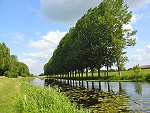
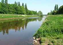
Bocholter Aa
|
Bocholt Aa Aa strand |
||
|
Pleystrang of the Bocholter Aa at the Bocholter Aasee |
||
| Data | ||
| Water code | DE : 9282 | |
| location | Germany | |
| River system | Rhine | |
| Drain over | Oude IJssel → IJssel → IJsselmeer | |
| River basin district | IJssel | |
| origin | Confluence of the Schwarzer Bach (4.3 km) and the Weißer Vennbach (5.4 km) at Velen 51 ° 52 ′ 59 ″ N , 6 ° 59 ′ 28 ″ E |
|
| Source height | 55.5 m above sea level NN | |
| muzzle | near Ulft in the Oude IJssel Coordinates: 51 ° 53 '4 " N , 6 ° 23' 17" E 51 ° 53 '4 " N , 6 ° 23' 17" E |
|
| Mouth height | 15 m NAP | |
| Height difference | 40.5 m | |
| Bottom slope | 0.73 ‰ | |
| length | 55.8 km (including 5.4 km of the White Vennbach) | |
| Catchment area | 536.372 km² | |
| Drainage at the Rhedebrugge gauge |
MQ |
2.72 m³ / s |
| Left tributaries | u. a. Borkener Aa , Seegraben | |
| Right tributaries | u. a. Knüstingbach , Rheder Bach | |
| Flowing lakes | Aasee | |
| Medium-sized cities | Borken , Bocholt | |
| Small towns | Velen , roadstead | |
The Bocholter Aa ( Aa-Strang on the Dutch side ) is an approximately 51 km long tributary of the Issel , which flows from the Borken district into the Dutch Achterhoek .
course
The small river is created in Velen in the western Münsterland between Borken and Coesfeld through the confluence of the short Thesingbach , Vennbach and Black Bach .
From there the Bocholter Aa flows in a westerly direction, leaving the ridge of the mountains to the left. Via Borken , past the Pröbstingsee and Rhede , it reaches Bocholt , where it flows past the Aasee on the eastern edge of the city . In the center of Bocholt, the New Town Hall is located on an artificial island in the river, which was included in the historical city fortifications until the 19th century. In a north-westerly direction, the Aa reaches the German-Dutch border at Suderwick. For about two kilometers it is a border river and then finally reaches the Netherlands, where after only another five kilometers it flows into the much smaller Issel , called Oude IJssel , as the Aa-strand near Ulft .
A 58-kilometer cycle path known as the aa route leads near the river from Velen via Ramsdorf , Gemen , Borken, Rhede, Bocholt, Isselburg to Anholt . The aa route is part of a cross-border cycle route network , which also includes the berkel , slinge and ijssel routes . The cycle paths offer six round trips and can be combined with each other.
See also
Web links
Individual evidence
- ^ German basic map 1: 5,000
- ↑ Topographic map 1: 25,000
- ↑ a b Topographical Information Management, Cologne District Government, Department GEObasis NRW
- ↑ Rhine river basin district / Issel catchment area ( Memento of the original from March 4, 2016 in the Internet Archive ) Info: The archive link was inserted automatically and has not yet been checked. Please check the original and archive link according to the instructions and then remove this notice.
- ↑ See Achterhoek and Westmünsterland rivers .
- ↑ Bocholter Aa. (PDF; 2.8 MB) 58 km bike path in the region. European Agricultural Fund for Rural Development, accessed on May 21, 2011 (German, Dutch).
- ↑ river landscape rivierenlandschap achterhoek · westmünsterland. (PDF; 5.3 MB) Four beautiful bike tours. Retrieved November 3, 2011 .


