Hohe Tauern
The Hohe Tauern are a high mountain region in the central Alps in Austria . The approximately 120 km long and up to 3798 m above sea level. A. high main ridge represents the geographical center of the Eastern Alps . Here - in addition to the Ötztal Alps - are the highest mountains in Austria. In the Hafner Group (part of the Ankogel Group) are the easternmost three-thousand-meter peaks in the Alps .
For the etymology of the name Tauern , as well as related terms, see the main article Tauern .
Hohe Tauern (Glockner and Venediger group) from the north-west, view from Tristkopf
Location and mountain groups
The Hohe Tauern are located in the Austrian federal states of Salzburg , Carinthia and Tyrol ( East Tyrol ). The 150 km long main ridge marks the border between Salzburg and the other two countries; its southwestern edge belongs to the Italian province of South Tyrol .
The northern boundary forms the valley of the Salzach , the southern the valley of the Drau . In the west, the Hohe Tauern is bounded by the Krimmler Ache and Ahrntal , in the east by Grossarltal , Murtörl ( 2260 m above sea level ), Murwinkel and Katschberg Pass ( 1642 m above sea level ). To the west of the Birnlücke ( 2667 m above sea level , Krimmler Tauern) join the Zillertal Alps , to the northeast of the Murtörl ( 2260 m above sea level ) the peaks of the Radstädter Tauern (see also Niedere Tauern ).
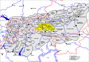
According to the orographic division of the Eastern Alps (AVE) by the German and Austrian Alpine Association , the Hohe Tauern is divided into the following mountain groups (from west to east):
- Venediger group (highest peak Großvenediger 3657 m above sea level ) with Durreck group , Panargen ridge and Lasörling group
- Granatspitzgruppe ( Großer Muntanitz 3232 m above sea level )
- Glockner group ( Grossglockner 3798 m above sea level )
- Goldberg Group ( Hocharn 3254 m above sea level )
- Ankogel group ( Hochalmspitze 3360 m above sea level ) with Hafner and Reisseck groups .
In the south of the main Tauern ridge are:
- Rieserferner Group ( Hochgall 3436 m above sea level )
- Villgraten Mountains or Defereggen Mountains ( White Peak, 2962 m above sea level )
- Schobergruppe ( Petzeck 3283 m above sea level )
- Kreuzeck group ( Polinik 2784 m above sea level ).
National Park and Geology
In the center of the region lies the Hohe Tauern National Park , in which the Austrian Alpine Association and landowners in the three federal states of Tyrol, Salzburg and Carinthia have contributed important areas of land. With 1836 km² it is the largest of the six Austrian national parks and therefore also the largest in the Alps. The protected area is divided into a core zone (nature zone according to IUCN ) and an outer zone (edge zone) with forest and alpine farming .
The tourism has only increased slightly since the establishment of the National Park and focus on high-quality "green tourism" and natural gentle mountaineering laid. The environmental protection and the preservation of original branches of industry will receive specific attention. Some reservoirs play an important role in the energy industry ( Kapruner , Stubach and Maltatal ). The tungsten ore scheelite is mined in the Felbertal ; mining here alone makes Austria the fourth largest producer of tungsten in the world.
The geology of the Hohe Tauern is shaped by crystalline rocks, but the structure of the mountains is unusually complicated. From Paleozoic gneisses and mica schists to phyllites and quartzites to Mesozoic limestone there is a great variety, which is reinforced by the tectonics of the " Tauern window ". This is what makes the landscape so appealing: from vertical rock faces and sharp-edged ridges you can find all the transitions to gentle grassy peaks and raised bogs . Steep cirques and glaciers alternate with karst plateaus and whole groups of mountain lakes, popular peaks with those that are never climbed. The ice border of the Hohe Tauern runs between 2700 and 2900 m.
The valleys leading north to the Salzach have stepped construction (glacial trough valleys ) with waterfalls and huge gorges (Gasteiner and Liechtenstein gorges , Kitzloch gorges , etc.), which have safe footbridges for visitors. Important traffic connections over / through the Hohe Tauern are the Felbertauern tunnel , the picturesque Großglockner high alpine road , the Tauern tunnel (railway) and the Katschberg tunnel ( Tauern motorway ).
Web links
- Hohe Tauern National Park
- Entry on Hohe Tauern in the Austria Forum (in the AEIOU Austria Lexicon )
- Geology of the Hohe Tauern
- Hohe Tauern on www.summitpost.org (English)
- Hiking portal: Tauernhöhenwege • Huts & trails • Long-distance hiking trails
Coordinates: 47 ° 4 ' N , 12 ° 42' E


