Panargen Ridge
| Panargen Ridge | ||
|---|---|---|
|
The Panagenkamm covered by the Finsterkarspitze : with Keeseck in the background on the left, the summit of the Panargenspitze in the middle right , Totenkarspitze and Rotenmanntörl on the far right |
||
| Highest peak | Keeseck ( 3173 m above sea level ) | |
| location | East Tyrol , Tyrol , Austria | |
| part of | Venediger group | |
|
|
||
| Coordinates | 46 ° 58 ' N , 12 ° 14' E | |
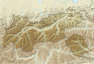
The Panargenkamm is a mountain ridge of the Venediger group in East Tyrol. It borders the rear part of the Defereggental to the north and is separated from the Lasörling group by the Trojeralm valley, which is directly northeast of the Panargen ridge . The highest peak of the Panargenkamm is the Keesegg ( 3173 m above sea level ). The Panargenkamm lies almost entirely in the Hohe Tauern National Park .
location
The Panargenkamm lies in the southwest of the Venediger group and includes the Hutnerspitze, the southernmost part of this mountain group. In the west and south, the Schwarzach forms the border with the Rieserferner group , in the east and north-east the Trojer Almbach separates the Panargenkamm from the Lasörling group in the west and the Rosenspitz group in the north-west. In the north the Rotenmanntörl forms the border to the Umbalkamm .
The main strand of the Panargenkamm runs from the Weißen Beil in the southeast to the northwest to the Rotenmanntörl. Starting from the Weißen Beil, the Panargenkamm rises over the Kauschkahorn and the Seespitze as well as the Erlsbacher Spitzen to the Alplesspitze. Followed by the Panargenscharte, the Panargen ridge continues to Keesegg, the highest peak of the mountain ridge. Then the Keeseggscharte is followed by the Panargenspitzem, the Keeslenke and the Totenkarspitze before the Rotenmanntörl. In addition, the Seespitz and the Alplesspitz have formed long southern ridges. The south ridge runs from the Seespitze to the Weitstrahl, from the Alplespitze the south ridge stretches over the Panargenlenke and Hutnerscharte to the Hutnerspitze.
In the Panargen ridge there is only a named glacier remnant on the north side of the Keesegg with the Daberkees. Small residual glaciers have also formed on the north side of Panargenspitze and Totenkarspitze. On the south side of the mountain ridge there are several mountain lakes with Eggsee, Großbachsee, Alplesseen and Oberseitsee.
summit
|
|

