White hatchet
| White hatchet | ||
|---|---|---|
|
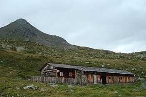
White ax above the Oberseitealm |
||
| height | 2767 m above sea level A. | |
| location | St. Jakob in Defereggen , East Tyrol , Tyrol , Austria | |
| Mountains | Panargenkamm , Venediger Group , Hohe Tauern | |
| Dominance | 1.1 km → Kauschkahorn | |
| Notch height | 92 m ↓ Scharte to the Kauschkahorn | |
| Coordinates | 46 ° 56 '11 " N , 12 ° 18' 32" E | |
|
|
||
| Normal way | Ascent from Trogach or through the Trojeralmtal via the high path Blumenweg upper side (medium-difficult mountain tour) | |
The White Ax , a mountain with a height of 2767 m above sea level. A. , is located in the Hohe Tauern in Austria and is the easternmost peak of the Panargenkamm of the Venediger group .
rise
From St. Jakob in Defereggen through the Trojeralmtal to the beginning of the panorama trail Blumenweg upper side, now through the forest partly steeply to the uncultivated Oberseitalm. Alternatively, this can also be reached from Trogach via the Reggnalm. Now the marked ascent to the northwest, finally over blocks to the summit with a cross. (Walking time approx. 4–5 hours)
Web links
Commons : Weißes Beil - collection of images, videos and audio files

