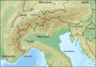
Edge mountains east of the Mur
| Edge mountains east of the Mur | ||
|---|---|---|
| Highest peak | Stuhleck ( 1783 m above sea level ) | |
| location | Lower Austria , Styria | |
| part of | Austrian Central Alps , Alpine Foreland | |
| Classification according to | AVE 47 | |
|
|
||
| Coordinates | 47 ° 35 ' N , 15 ° 48' E | |
The marginal mountain range east of the Mur is a mountain group in the Eastern Alps .
It includes the eastern foothills of the central Eastern Alps and the foothills of the eastern and southeastern foreland .
Boundary and adjacent mountain groups
The boundary of the mountain range east of the Mur is formed:
- in the northeast it touches the Vienna Woods
- to the Gutenstein Alps along the Steinfeld - Neunkirchen - Ternitz
- Rax-Schneeberg-Gruppe : the line from Ternitz- Gloggnitz - Schottwien over the Semmering Pass to Mürzzuschlag in the Mürz Valley
- of Mürzzuschlag to Bruck limit the mürzsteg alps to
- the Lavanttaler Alps separates the Mur to Spielfeld
- the eastern border runs unspecifically along the Hungarian Plain , Lake Neusiedl and via Bruck an der Leitha into the Vienna Basin
structure
The mountain group is generally divided into the following mountains:
- Fischbacher Alps ( Stuhleck 1782 m above sea level )
- Wechsel (Hochwechsel 1743 m above sea level )
- Grazer Bergland ( Hochlantsch 1720 m above sea level )
It also includes the eastern and south-eastern foothills of the Alps:
- Leithagebirge (Sonnenberg 484 m above sea level )
- Rosaliengebirge (Heuberg 748 m above sea level )
- Ödenburger Gebirge (Brentenriegel 606 m above sea level )
- the Bucklige Welt ( Eselberg 974 m above sea level )
- the Joglland ( high change 1743 m above sea level )
- Günser Bergland , even Günsergebirge ( Geschriebenstein 884 m above sea level. A. )
Web links
Commons : Edge mountains east of the Mur - collection of images, videos and audio files
Individual evidence
- ↑ Eastern Alps. In: bergalbum.de. (Alpine club division of the Eastern Alps).
